Vermont’s most notable underwater ghost town is Ricker Basin, a farming community of 50 families submerged beneath Waterbury Reservoir when the U.S. Army Corps of Engineers completed a dam in 1938. You’ll find stone foundations, cellars, and an iron bridge preserved underwater following the devastating 1927 flood that killed 84 people and prompted federal intervention. During low water levels, these ruins become visible, revealing roads, mill foundations, and cemetery plots from the settlement Joseph Ricker established in 1816. The reservoir’s depths conceal extensive archaeological evidence of Vermont’s response to natural disaster.
Key Takeaways
- Ricker Basin, a 19th-century settlement of 50 families, was submerged beneath the Waterbury Reservoir after the devastating 1927 Vermont flood.
- The Waterbury Dam, constructed 1935-1938 by the Army Corps of Engineers, permanently flooded Ricker Basin’s homes, roads, and infrastructure.
- Submerged relics include stone foundations, iron bridges, mills, schoolhouses, and cemetery plots visible during low water levels.
- The 1927 flood killed up to 111 people and caused $50 million in damage, leading to Ricker Basin’s abandonment.
- Glastenbury, once a thriving resort town, became wilderness after disasters and resource depletion, disincorporating in 1937.
The Great Flood of 1927 and Its Devastating Impact
When nearly 9 inches of rain fell across Vermont between November 2 and November 4, 1927, the state experienced what remains its deadliest natural disaster. You’ll find that 84 people died—some estimates reach 111—with Lieutenant Governor Samuel Hollister Jackson among the casualties.
The deluge destroyed 1,285 bridges and caused damage exceeding $50 million, equivalent to half Vermont’s total assessed property value. What’s striking: per capita damages reached $86.35, tripling Mississippi’s concurrent flood losses.
The catastrophe fundamentally altered governance structures, forcing towns to relinquish their traditional autonomy as federal intervention became necessary. The state government assumed responsibility for rebuilding bridges that had previously been maintained by individual towns. The flood also wrecked miles of roads and rails, severely impacting the food supply, transportation, and daily life across a largely rural, dirt-road dependent Vermont. This historical precedent demonstrates why you need robust flood insurance and climate adaptation strategies today—the alternative isn’t independence, but devastation that strips away your actual freedom to rebuild on your own terms.
Ricker Basin: A Thriving Farming Community Lost to Progress
You’ll find Ricker Basin’s history documented through three distinct phases that transformed it from a settlement of 50 families across 4,000 acres into submerged ruins.
Joseph Ricker established the community in 1816, where subsistence farming and timber operations sustained residents until soil depletion and rocky terrain forced most families to abandon their homesteads by the late 1800s. The settlement developed essential amenities including a schoolhouse, trading post, and several sawmills that served the growing population after the railroad’s arrival.
The 1927 flood dealt the initial catastrophic blow, though the community’s final erasure came when the Waterbury Dam‘s construction deliberately submerged the remaining structures and artifacts beneath reservoir waters. Today, remnants of an iron bridge become visible when water levels drop low enough to expose the former main entrance to the settlement.
Settlement and Early Prosperity
During the early 1800s, Joseph Ricker established a settlement on the southeastern slopes of Ricker Mountain, initiating what would become a community of approximately 50 families spanning 4,000 acres. You’ll find this location connected valleys through ancient trade routes, where pioneers carved homesteads from unforgiving terrain.
They selected higher elevations strategically, avoiding flood-prone valleys while accessing timber resources and underground caves for storage. The settlers faced the arduous task of clearing rocks and stumps to create viable farmland and fields from the mountain’s challenging landscape.
The railroad’s mid-1800s arrival in Waterbury catalyzed economic integration, transforming isolated homesteads into Ricker Mills. Three sawmills became operational hubs, harnessing stream power to process abundant timber.
However, “prosperity” proves misleading—steep slopes and rocky soil constrained agricultural output to subsistence levels. Multiple generations occupied structures dating to the late 1700s, maintaining autonomy through resourcefulness rather than wealth accumulation. The community’s identity was reinforced by families primarily bearing the same last name, reflecting the close-knit nature of this isolated settlement.
The Devastating 1927 Flood
The precarious prosperity Ricker Basin’s residents had built came to an abrupt end on November 3, 1927, when persistent heavy rains began falling across Vermont. Torrential rainfall on frozen ground sent the Winooski River surging at 4 feet per hour, reaching 13 feet above normal by November 4.
Houses nearest the river were completely destroyed. Roads washed out, isolating the settlement from Waterbury as Little River’s waters drove residents to their roofs.
Statewide, 84 Vermonters perished, with 55 deaths in the Winooski basin alone. The flooding also devastated Waterbury, Stockbridge, and Johnson, claiming lives across multiple communities. Property damage reached $30 million—nearly half a billion in today’s dollars. This disaster exposed Vermont’s vulnerability and catalyzed flood control initiatives.
The community was abandoned after the disaster, becoming a ghost town as survivors recognized the destruction’s severity and moved away. When another flood struck in 1934, it prompted permanent road closures and inspired the Waterbury Dam‘s construction, establishing essential flood preparedness infrastructure.
Submerged by Waterbury Dam
Long before Waterbury Dam submerged its hillsides, Ricker Basin sustained approximately 50 families across 4,000 acres on Ricker Mountain’s southeastern slopes. You’ll find historical photography documenting three sawmills that powered the economy from 1916-1922, including Waterbury Last Block Co.‘s operation employing 35 men and 44 horse teams producing WWI munitions components.
Local folklore from elderly residents confirms the community’s struggles with steep terrain and rocky soil that forced subsistence farming over profitable agriculture.
In April 1935, 5,000 U.S. Army Corps of Engineers and Civilian Conservation Corps workers began dam construction. The state acquired land and closed roads before 1938’s completion flooded Ricker Basin permanently. The dam was built in response to the devastating 1927 flood that killed 55 people in the Wooki River Basin alone.
What remained of this self-reliant settlement now lies beneath Waterbury Reservoir—a community erased by engineered flood control.
Construction of the Waterbury Dam and the Birth of a Reservoir
The catastrophic flooding of November 1927, which killed over 55 people and caused up to $22,000,000 in damage across Vermont, prompted the Corps of Engineers to develop an extensive flood control plan featuring seven reservoirs.
Construction of the Waterbury Dam commenced in 1935 under New Deal funding, employing approximately 2,000 workers—including World War I veterans and Civilian Conservation Corps laborers—who hand-placed rocks to form the structure’s walls over a three-year period. The dam was constructed on Little River, approximately 2.5 miles above its confluence with the Winooski River.
The dam’s completion in 1938 created a reservoir that permanently submerged Ricker Basin, transforming the farming community into an underwater ghost town.
Dam Construction Timeline
Following federal authorization in June 1933, construction of the Waterbury Dam commenced in 1935 under the oversight of the United States Army Corps of Engineers.
You’ll find that approximately 2,000 workers assembled at the site, establishing a temporary settlement to execute this three-year project completed in 1938.
The engineering specifications required 2,200,000 cubic yards of rolled earth fill material, with workers hand-placing rocks along the dam’s 1,845-foot length.
This massive undertaking utilized Civilian Conservation Corps labor and contract services funded through Roosevelt’s New Deal legislation.
The project’s environmental implications included potential aquifer contamination risks and altered river sedimentation patterns downstream.
The completed structure featured an outlet control house, three Tainter gates, and an unlined rock channel spillway designed to manage flood control operations.
Ricker Basin Submersion
Behind this monumental engineering achievement lay a human cost rarely documented in federal project reports.
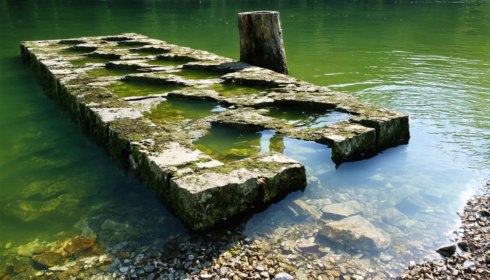
When the Waterbury Dam project commenced, state acquisition permanently closed access roads into Ricker Basin. You’ll find the reservoir now covers foundations, home outlines, and roadways beneath accumulating silt layers.
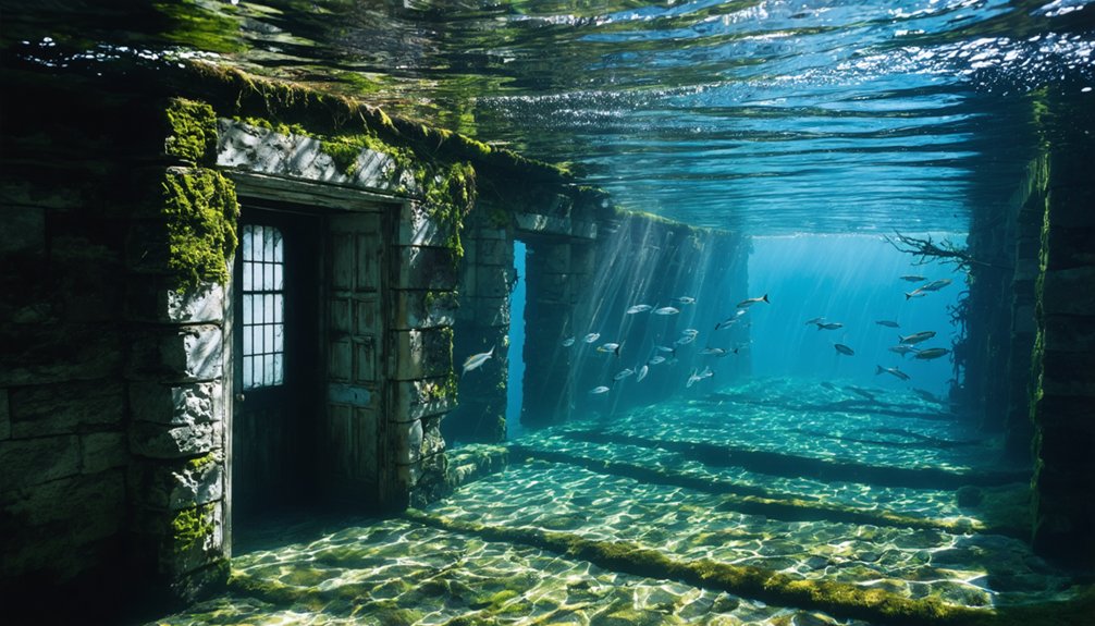
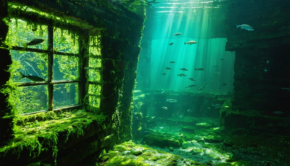
Underwater archeology reveals an eerie landscape where stone foundations mark former residences in precise grid patterns. The project effectively created Vermont’s only submerged ghost town, preserving relics in cold freshwater conditions.
Above the waterline, you’ll discover cellar holes, cemetery plots, and deteriorating structures.
Local anglers guard fishing secrets near these underwater ruins, where bass congregate around century-old foundations.
The settlement’s physical traces remain—quiet woods concealing a vanished community’s skeletal remains beneath reservoir depths.
What Lies Beneath: Submerged Ruins in Little River State Park
When reservoir levels drop at Little River State Park, visitors encounter the corroded iron framework of a bridge that once served as Ricker Basin’s primary entrance—a tangible artifact of flood control engineering that permanently altered Vermont’s landscape.
The 1935 dam construction deliberately submerged these settlement remnants, transforming ancient artifacts into hidden relics beneath Waterbury Reservoir’s surface.
You’ll discover evidence of this drowned community through:
- Structural remains: Rusted bridge components emerge during low water periods, marking the former town access point.
- Engineered flood control: U.S. Army Corps of Engineers deployed 5,000 workers to create this reservoir following catastrophic 1934 flooding.
- Accessible exploration: Trail systems now traverse former settlement areas, connecting surface ruins with submerged features below.
The reservoir serves dual purposes—flood prevention and recreational access to Vermont’s submerged history.
Glastenbury: From Bustling Resort to Abandoned Settlement
While Waterbury Reservoir conceals Ricker Basin beneath permanent waters, Vermont’s mountainous regions preserve a different category of abandonment—settlements that collapsed above ground yet remain accessible to contemporary exploration. Glastenbury‘s documented decline mirrors principles observable in underwater ecosystems: resource depletion triggers systematic collapse.
You’ll find evidence of this charcoal-driven settlement that peaked at 210 residents in 1880 before exhausting its timber resources. The 1898 flood—amplified by deforestation’s removal of root-stabilization systems—destroyed railway infrastructure critical to resort operations.
This methodological destruction demonstrates how environmental degradation accelerates abandonment patterns similar to aquatic archaeology findings in submerged sites. Vermont disorganized the town in 1937 when population reached three residents.
Today’s eight inhabitants occupy terrain where wilderness reclaimed built structures through documented ecological succession processes.
The Bennington Triangle and Its Dark History
You’ll encounter claims that Glastenbury Mountain sits at the center of Vermont’s “Bennington Triangle,” a term coined by author Joseph A. Citro to describe a series of disappearances between 1945 and 1950.
The evidence linking these cases remains circumstantial—while Middie Rivers, Paula Welden, Paul Jepson, and others genuinely vanished during this period, no physical evidence connects the incidents beyond their temporal proximity.
Local folklore attributes supernatural causes to the region’s dark history, though investigators documented no verifiable patterns that distinguish these disappearances from typical missing persons cases in remote wilderness areas.
Glastenbury’s Violent Past
Long before Glastenbury became synonymous with mysterious disappearances, the settlement earned its dark reputation through documented acts of violence that foreshadowed its eventual abandonment.
The town’s violent logging era transformed pristine wilderness into a lawless frontier where brutality eclipsed prosperity:
- 1892 McDowell-Crowley Murder: Henry McDowell bludgeoned coworker John Crowley to death, claiming voices commanded the killing. He escaped the mental facility and vanished—much like ancient artifacts disappearing beneath shifting earth.
- 1897 Harbour Shooting: John Harbour died from unknown assailant’s bullet despite carrying his own loaded weapon, creating an enduring unsolved case.
- Systematic Decline: The 1898 flood destroyed infrastructure, gutting the resort and railroad. By 1937, Vermont disincorporated the town—wilderness reclaiming the settlement like underwater flora consuming submerged structures.
This documented violence, not supernatural curse, catalyzed Glastenbury’s transformation into Vermont’s most notorious ghost town.
As tales of despair and fear spread, the region became a hotspot for urban legends, attracting those intrigued by ghost tales from Braintree Center. Visitors flock to the area, eager to explore its haunted history and the stories that linger in the shadows. Each encounter adds a new layer to the mythos, ensuring that the past continues to shape the present.
Mysterious Disappearances and Legends
Between 1945 and 1950, five people vanished within a 36-square-mile zone of southwestern Vermont’s Glastenbury Mountain region—an area paranormal author Joseph A. Citro dubbed the “Bennington Triangle.”
You’ll find documented cases ranging from 74-year-old hunting guide Middie Rivers to 18-year-old college student Paula Welden, all disappearing without trace despite massive search operations involving over 1,000 participants and FBI resources.
The pattern’s unsettling: minimal physical evidence, no recoverable remains in four cases, and Frieda Langer’s body appearing seven months later in previously searched terrain.
While folklore legends suggest cryptid sightings and supernatural phenomena, concrete explanations point toward Vermont’s harsh mountain weather, abandoned mine shafts, and dense wilderness.
All five cases remain officially unsolved, with death causes undetermined.
Other Forgotten Communities Across Vermont
Vermont’s landscape harbors numerous abandoned settlements beyond its submerged villages, each documenting distinct economic collapses and environmental pressures that shaped the state’s demographic patterns.
Three Notable Inland Ghost Towns:
1. Plymouth Five Corners – You’ll find only stone foundations where Salt Ash’s 1850s gold rush created mills and hotels. This four-year boom collapsed when Civil War tensions redirected economic focus, leaving hidden artifacts beneath forest regrowth.
2. Glastenbury – Bennington County’s disincorporated town peaked at 250 residents before murders and mysterious disappearances emptied logging camps.
Ancient artifacts from blacksmith operations remain scattered across this remote terrain.
3. Somerset – Windham County’s 1898 flood destroyed railroad infrastructure, ending its lumber transport hub status. State officials unincorporated it in 1937, preserving only cellar holes as evidence of former settlement patterns.
Civil War Era Artifacts Emerging From the Depths
While terrestrial ghost towns reveal settlement patterns through surface foundations, Lake Champlain’s depths preserve a different category of historical evidence.
You’ll find Revolutionary War artifacts—not Civil War—emerging from Arnold’s Bay, where Benedict Arnold’s fleet engaged British forces in 1776.
Underwater archaeology teams have documented hundreds of objects from scuttled vessels: buttons, coins, shoe fragments.
The 54-foot Spitfire gunboat remains intact at 400 feet, its bow gun visible through 3D rendering.
Lake Champlain Maritime Museum’s preservation techniques involve high-pressure water jets and specialized lifting equipment.
Cold freshwater and thick sediment layers protect wooden structures that’d disintegrate elsewhere.
Though invading mussels now threaten these sites, the proposed $45 million recovery plan demonstrates commitment to extracting knowledge buried beneath centuries of lake mud.
When Low Water Reveals Hidden History
When Waterbury Reservoir’s water levels drop sufficiently, the rusted iron framework of Ricker Basin’s main bridge emerges from the depths—a stark reminder of Vermont’s most catastrophic natural disaster. You’ll find this submerged landscape functions as an accidental laboratory for maritime archaeology, where underwater ecosystems have preserved structural remnants since 1938.
The reservoir’s fluctuating levels reveal:
- Foundation structures from mills, schoolhouses, and residential buildings that withstood partial submersion
- Cemetery markers documenting families who perished in the 1927 flood that claimed over 50 lives
- Agricultural infrastructure including barn foundations where livestock once grazed before disaster struck
Unlike drought-dependent exposures elsewhere, you’ll access these artifacts through deliberate reservoir management.
Little River State Park’s trails lead you directly to ruins—tangible evidence of communities sacrificed for flood prevention.
Exploring Vermont’s Submerged Past Today
How do you systematically explore archaeological sites that spend most of the year underwater? Little River State Park maintains year-round trails providing unrestricted access to Ricker Basin’s cellar holes, foundations, and cemetery.
Little River State Park offers year-round trail access to submerged archaeological remnants of Vermont’s abandoned Ricker Basin settlement.
You’ll document sawmill ruins, schoolhouse remnants, and a cow barn foundation using standard archaeological techniques—photographic surveys, structural measurements, and artifact cataloging during ideal visibility periods.
Historical preservation here operates through controlled access rather than excavation. The state’s ownership since 1938 protects these ruins from development while permitting independent exploration.
When reservoir levels drop, you can examine the submerged iron bridge entrance—though rusted and waterlogged. The 1927 and 1934 floods that drove out fifty families inadvertently created this preservation environment.
You’re free to traverse maintained paths documenting evidence of Vermont’s resourceful mountain settlers who worked impossible terrain until nature reclaimed it.
Frequently Asked Questions
Can You Scuba Dive to See the Underwater Ruins in the Reservoir?
You’re free to dive Vermont’s reservoir ruins if you enjoy zero underwater visibility, hypothermia risk, and trespassing charges. Seriously though: prioritize diving safety by checking local regulations first, obtaining proper certifications, and diving only in legally accessible historic preserve sites.
Were Residents Compensated When Their Land Was Taken for the Dam?
Historical records don’t document compensation policies for Ricker Basin residents whose land Vermont acquired after devastating 1927 and 1934 floods. You’ll find no evidence of financial settlements in available sources, leaving historical land disputes regarding property valuations unresolved.
Are There Any Surviving Photographs of Ricker Basin Before the Flood?
You’ll find no confirmed pre-flood photographs in available historical preservation records—researchers rely instead on archaeological discoveries like foundation maps and artifact documentation. The visual record apparently vanished with the community itself beneath Waterbury Reservoir’s waters.
What Happens to Artifacts Found by Visitors Exploring the Exposed Ruins?
You’re required to report artifacts to park rangers immediately rather than removing them. Artifact recovery by visitors is prohibited—preservation challenges demand items remain in situ for historical context. Unauthorized removal results in fines and potential criminal charges.
How Often Does the Reservoir Water Level Drop Low Enough to Reveal Foundations?
Like buried secrets awaiting liberation, the reservoir rarely reveals foundations—only during emergency interventions. Hydroelectric projects prioritize operational stability over exposure events. Environmental impacts from structural concerns, not scheduled drawdowns, determined the early 2000s revelation. You’ll find no predictable access pattern documented.
References
- https://ournewenglandlegends.com/podcast-409-the-ghost-town-of-ricker-basin/
- https://happyvermont.com/2014/10/23/glastenbury-ghost-town/
- https://obscurevermont.com/tag/flood-of-1927/
- https://en.wikipedia.org/wiki/List_of_ghost_towns_in_Vermont
- https://www.youtube.com/watch?v=CWhR02kOIkE
- https://www.onlyinyourstate.com/nature/vermont/creepiest-hike-vt
- https://en.wikipedia.org/wiki/Great_Vermont_Flood_of_1927
- https://digitalcommons.longwood.edu/cgi/viewcontent.cgi?article=1023&context=senior_theses
- https://pubs.usgs.gov/wsp/0636c/report.pdf
- https://benningtonmuseum.org/wp-content/uploads/27-the-flood-worse-than-irene.pdf


