Wisconsin’s Lake Michigan coastline holds submerged remnants of over a dozen 19th-century port settlements that collapsed after the logging boom depleted timber resources. You’ll find underwater evidence at sites like Clay Banks and Little Sturgeon, where 2,000-foot piers, dock systems, and sawmill foundations now rest beneath the waves. The state’s Underwater Archaeology Program documents these submerged cultural resources alongside 700+ shipwrecks using sonar and ROVs. Cold freshwater preserves pier pilings, cribbing structures, and settlement foundations as tangible archaeological records. The article ahead explores specific documentation of these vanished maritime communities.
Key Takeaways
- Wisconsin has multiple ghost port settlements along Lake Michigan with submerged remnants from the post-Civil War logging boom era.
- Over 42 ships sank along an 18-mile coastline between 1851-1901, creating extensive underwater archaeological sites in cold freshwater.
- Former communities like Clay Banks left underwater infrastructure including pier foundations, pilings, sawmills, and warehouses after economic collapse.
- The Wisconsin Shipwreck Coast National Marine Sanctuary protects 36 wrecks at depths of 130-480 feet for research and heritage tourism.
- State archaeologists use scuba, sonar, and ROVs to document submerged cultural resources spanning five millennia, including shipwrecks and settlement ruins.
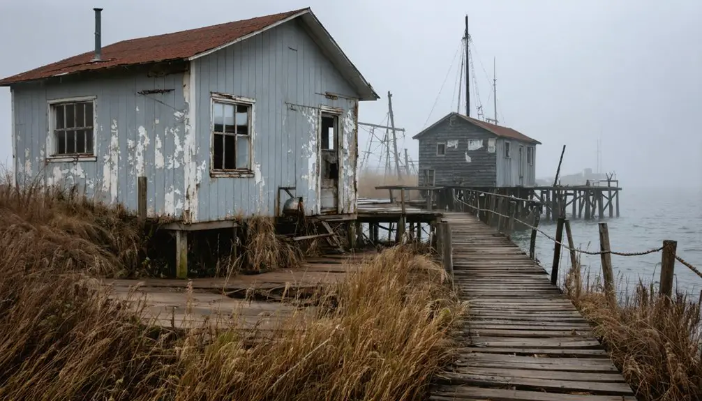
Door County’s Vanished Lake Ports
Along the windswept shores of Door County’s Clay Banks Township, four ghost port settlements once thrived as critical maritime hubs for Wisconsin’s post-Civil War logging boom.
Four ghost ports once dominated Clay Banks Township’s shoreline as vital shipping centers during Wisconsin’s lumber era.
You’ll find evidence of over a dozen vanished sites across the peninsula, where piers extended up to 2,000 feet through rocky shoals to reach Lake Michigan’s deeper waters. These structures enabled schooners to export lumber, stone, and agricultural products that built Midwest cities like Chicago.
When logging declined, settlements disappeared—leaving only underwater remnants. The Wisconsin Underwater Archeological Association documented these submerged ghost town legends through decade-long surveys using metal detecting, ground-penetrating radar, and historic plat maps. These studies preserve stories of the hardships and complexities faced by small sawmill businesses that depended entirely on maritime commerce.
Between 1851 and 1901, 42 ships sank along this 18-mile coastline, their wrecks preserved in cold freshwater alongside pier foundations that once welcomed vessels past Nelson’s Lighthouse. Baileys Harbor’s rocky outer reef alone claimed 20 shipwrecks and strandings, making it one of the deadliest stretches for maritime navigation.
The Rise and Fall of Clay Banks Settlements
You’ll find Clay Banks’ transformation from thriving lumber ports to underwater ruins occurred within a single generation following the Civil War.
The settlements’ sawmill-dependent economies required massive pier infrastructure—some extending hundreds of feet into Lake Michigan—to sustain wood-fueled steamship traffic.
This traffic consumed timber from 20 acres per voyage.
Archaeological evidence now documents how deforestation’s rapid depletion of local timber reserves triggered systematic abandonment, leaving pier remnants and settlement foundations submerged along the shoreline.
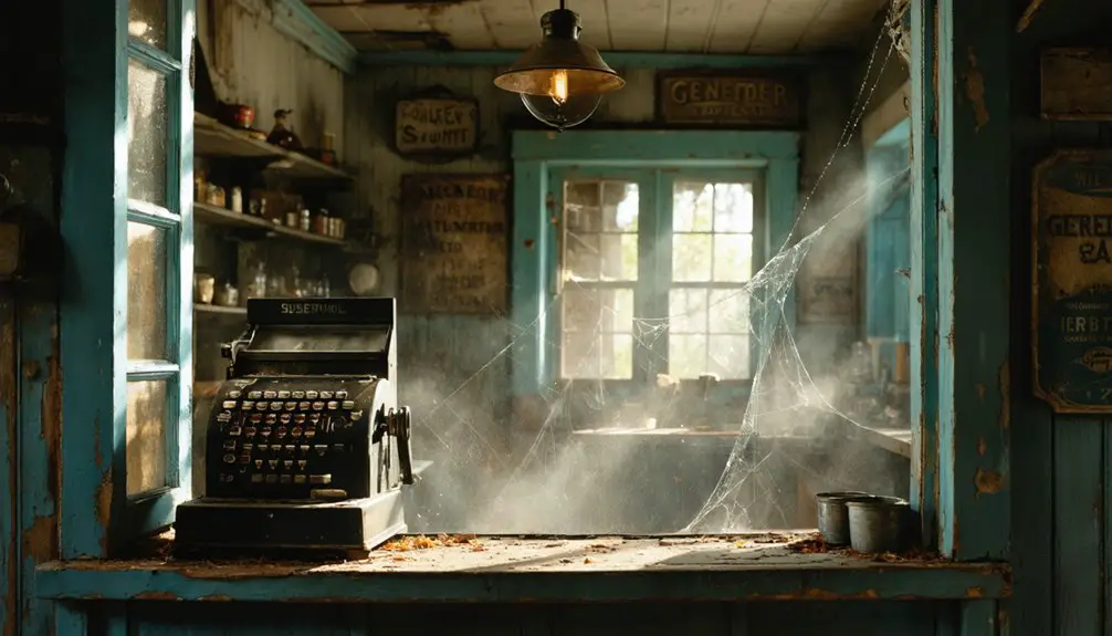
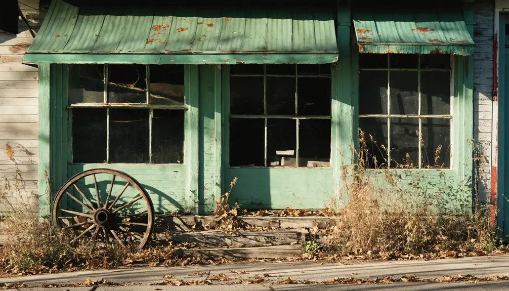
These ports functioned as 19th-century truck stops, supporting industries with local stores, breweries, and brick yards that supplied lumberjacks and sailors before vanishing with the timber trade.
Volunteer divers have played crucial roles in documenting these submerged sites, with organizations conducting multi-season underwater archaeology projects to preserve Great Lakes maritime history.
Lumber Industry Boom Era
When W. H. Horn established his shingle mill, pier, and support facilities in Clay Banks‘ northeast corner in 1870, you witnessed the transformation of ancient freshwater reefs and prehistoric sediment layers into Wisconsin’s lumber manufacturing frontier.
By 1874, Clay Banks outshipped every Door County port, processing timber from over 40,000 acres of standing forest.
The 1868 Little Sturgeon mill alone produced 80,000 shingles daily, while ships hauled 700,000 board feet weekly to Milwaukee and Chicago.
Chicago’s 1871 fire ignited unprecedented demand—one account noted available timber could plank to the moon “with thousands of miles to spare.” Little Sturgeon lime kilns burned 160 barrels daily atop a 70-foot cliff, shipping materials from their pier directly to Chicago’s reconstruction sites.
Yet freedom from eastern lumber monopolies proved fleeting. The 1875 panic rendered timber unsalable, collapsing operations and forcing ownership transfers throughout Door County’s nascent lumber network. Forestville’s operations joined smaller mills focused on shingle manufacturing, processing logs transported across water from Green Bay due to the absence of rafting-suitable streams.
Pioneer Communities and Infrastructure
Clay Banks township’s four ghost port settlements materialized along a treacherous six-mile Lake Michigan coastline where rocky shoals and submerged reefs necessitated construction of massive pier systems extending hundreds of feet into navigable waters.
Urban planning centered on sawmill operations, with communities developing infrastructure between 1863-1877:
- Warren House (1877) – Log structure functioning as family residence and postal facility
- Commercial establishments – HITT Sawmill, Eagle Hotel, PAARMANN Mercantile creating economic networks
- Maritime infrastructure – Extensive docking systems, cliffside lime kilns supporting lumber transport
The October 1871 fire devastated these waterfront communities, destroying critical infrastructure including Horns Pier and forcing settlement name changes that reflected the transformed landscape.
You’ll find ecological impacts remain visible underwater today.
Wisconsin Underwater Archeological Association documented these vanished settlements through archival research and field studies.
Door County Historical Society established Heritage Village at Big Creek (1998) to preserve remaining structures, creating tangible connections to communities that disappeared when logging declined. French explorer Robert de LaSalle landed along this coastline in 1679, centuries before the lumber settlements emerged.
Decline Into Ghost Towns
The lumber industry’s economic dominance proved short-lived across Door County’s smallest township.
You’ll find that environmental depletion directly triggered Clay Banks’ collapse—forest cutting dropped water tables, forcing mill closures when operators couldn’t convert to steam power.
Supply chain logistics that once connected these settlements to Milwaukee and Chicago became obsolete as timber reserves vanished.
The 1900s grasshopper plague compounded economic devastation, while rural mail routes eliminated the need for local post offices.
Piers crumbled into Lake Michigan, creating today’s shipwreck exploration sites documented by the Wisconsin Underwater Archaeological Association since 2016.
The Hitt and Davidson mill had once dominated the landscape, producing 100,000 shingles daily at its 1872 peak before the resource collapse.
What remains of these four ghost port settlements now lies submerged or buried, offering tangible evidence of how resource exhaustion transforms thriving maritime communities into archaeological sites beneath the waves.
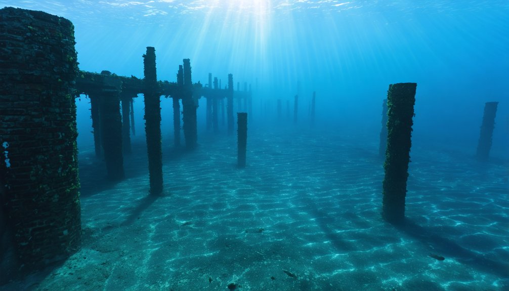
When Piers Crumbled Into the Lake
Lake Michigan’s relentless forces destroyed most piers within a single season of their construction, leaving scattered remnants protruding from the lake bottom today. You’ll find evidence of their destruction through multiple mechanisms:
Lake Michigan’s brutal forces demolished newly built piers in a single season, scattering their broken remains across the lake floor.
- Winter ice heaving physically displaced pier sections hundreds of feet from their original positions.
- Ship collisions broke through weakened structures during navigation attempts.
- Storm damage required constant pier reconstruction, ultimately proving economically unsustainable.
Lake erosion continually undermined these structures, whittling shorelines and compromising foundations.
Archaeological surveys using metal detecting and ground-penetrating radar now reveal anomalies aligned with historical property boundaries. Items submerged for a century disintegrate rapidly when exposed to air, making underwater documentation essential.
The crumbling piers themselves contribute to ongoing lake erosion, creating feedback loops that accelerated their disappearance and transformed thriving ports into ghost towns. Researchers estimate that over 100 ghost port complexes may exist along Wisconsin’s Lake Michigan shoreline.
Wisconsin’s Underwater Archaeology Program
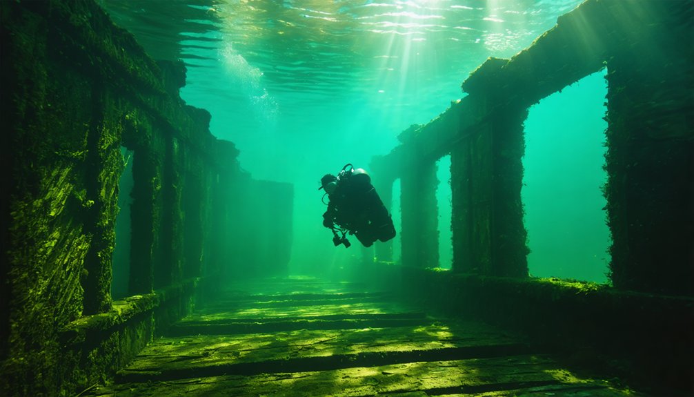
Beneath Wisconsin’s waterways, the state’s Underwater Archaeology Program systematically documents submerged cultural resources spanning five millennia of human activity. You’ll find state underwater archaeologist Tamara Thomsen leading investigations into ancient canoes, shipwrecks, and fur trade materials protected under Wisconsin law.
The program’s Lake Mendota discoveries revealed fourteen dugout canoes—one dating to 3000 B.C., the oldest in the Great Lakes region. Underwater preservation in twenty-five feet maintains these artifacts where shoreline erosion exposes them from ancient village sites.
Teams employ scuba diving, ground-penetrating radar, acoustic surveys, and remotely operated vehicles to map submerged prehistory sites. They’ve documented the L.W. Crane steamer wreck and conducted extensive Fox River surveys.
The program collaborates with First Nations historians while restricting unauthorized disturbance, ensuring you can explore maritime heritage through research rather than physical access.
Maritime Trails: Documenting Submerged History
The Mid-Lake Michigan region demonstrates this program’s impact:
- 875 square miles containing 14 intact shipwrecks with the highest density and national significance potential.
- 15 of 39 known wrecks listed on the National Register of Historic Places.
- 65-mile stretch proposed for National Marine Sanctuary designation since 2010.
Cold freshwater preserves vessels like the Westmoreland, remaining intact after 155 years underwater—creating accessible historical records you can explore.
Lost Coastal Communities of Eastern Wisconsin
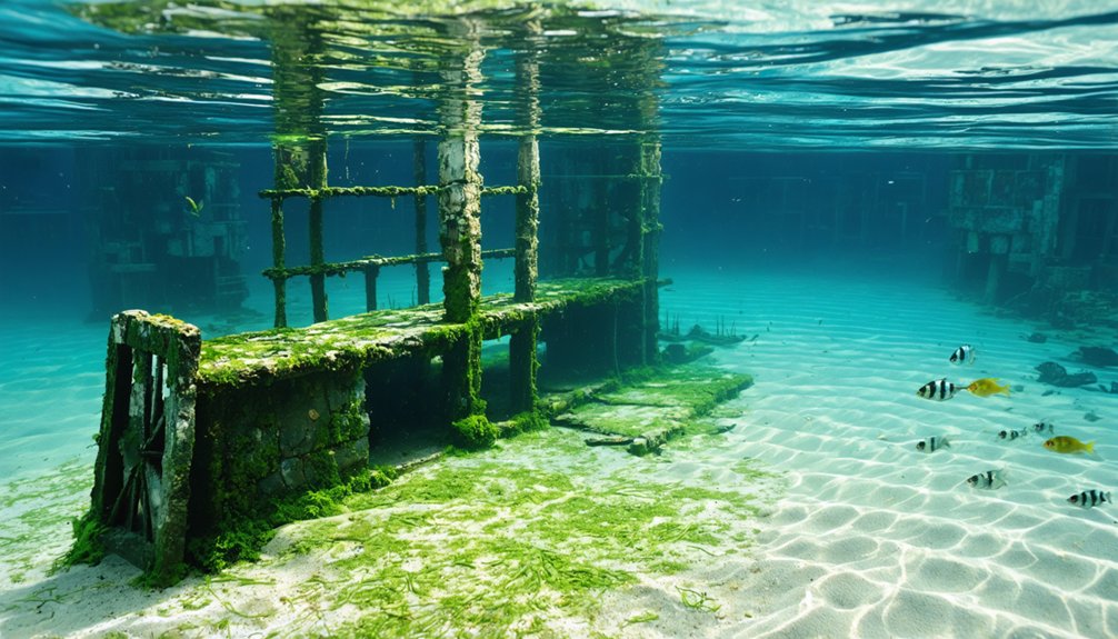
You’ll find dozens of small communities that emerged along eastern Wisconsin’s Lake Michigan shores during the mid to late 19th centuries. Each was anchored by wooden piers extending into the water for shipping forest and farm products to Chicago. These boom towns depended entirely on pier-based commerce until catastrophic fires, dangerous shoals, and shipwrecks—including the Thomas Spear tug that sank during Newport’s shutdown—contributed to their systematic decline.
Today, archaeological evidence reveals their economic collapse through submerged pier pilings, scattered dock remains from 1875, and closed post offices like Quincy’s, which ceased operations in June 1915.
Boom Towns and Piers
During the mid to late 19th centuries, dozens of small communities emerged along eastern Wisconsin’s shoreline, each anchored by a lake pier and general store that served as essential nodes in regional trade networks.
You’ll find these settlements thrived on commercial shipping, moving products between Chicago and Milwaukee markets.
Primary commodities shipped included:
- Cordwood and lumber trade products from northern forests
- Agricultural goods—grain, fish oil, and farm produce
- Manufactured items—beer, flour, and brickyard materials
Archival research has identified eight lost communities in Kewaunee County alone, including Sprague’s Pier, Sandy Bay, and Grimm’s Pier.
Henry Grimm’s operation exemplifies these ventures—short-lived but crucial.
When railroads arrived offering cheaper transportation, owners abandoned their piers rapidly.
Today, these once-bustling commercial shipping hubs stand silent, their maritime origins largely forgotten.
Shipwrecks and Maritime Hazards
Lake Michigan’s treacherous waters claimed over 700 vessels along Wisconsin’s coastline, transforming these same shipping routes that sustained pier communities into graveyards for commercial ships.
You’ll find shipwreck mysteries concentrated in Mid-Lake Michigan’s 875 square-mile zone, where 14 intact vessels rest undisturbed.
The Gallinipper (1833) and Home (1843) represent Wisconsin’s oldest discovered wrecks, both preserved in deep water.
Maritime archaeology reveals sudden storms as primary causes—tornado-like winds capsized the Alvin Clark, while the extended Gallinipper couldn’t handle 1854 gale conditions.
Wisconsin Shipwreck Coast National Marine Sanctuary now protects 36 documented wrecks from depths of 130 to 480 feet.
Modern preservation laws replaced “finders keepers” practices after the 1969 Alvin Clark raising, protecting these underwater archaeological sites for unrestricted exploration.
Economic Decline and Abandonment
While maritime commerce breathed life into Wisconsin’s coastal settlements, the same economic dependencies that fostered their growth ultimately sealed their fate. You’ll find three primary collapse triggers that transformed thriving ports into underwater remnants:
- Resource Depletion – Post-Civil War logging exhausted plateau timber reserves, shuttering sawmills and eliminating the backbone of pier-dependent economies.
- Transportation Evolution – Railroad expansion northward in 1888 rendered maritime shipping obsolete, particularly devastating ports like Dunnville.
- Infrastructure Decay – Abandoned piers crumbled into lakebeds as communities dispersed.
Maritime climatology and shifting underwater agriculture patterns accelerated abandonment. Door County Peninsula now hosts over a dozen ghost town sites. Clay Banks township alone lost four port settlements.
Today’s Wisconsin Historical Society documents these vanished communities where only submerged pier remnants mark once-prosperous commercial centers.
Grimm’s Pier: A Graveyard of Ships
North of Kewaunee, where a small stream enters Lake Michigan, maritime and terrestrial investigations have confirmed the remnants of Grimm’s Pier—one of the lesser ghost ports along Wisconsin’s coast.
Maritime archaeologists have identified Grimm’s Pier remains where a creek meets Lake Michigan north of Kewaunee, marking another forgotten Wisconsin shipping port.
You’ll find ten documented shipwrecks associated with this 19th-century shipping point, spanning from the Mount Vernon and Octavia in 1849 to the Buccaneer in 1943.
Underwater detection methods have revealed vessels like the Ellen Pike (1855), America (1873), and Thomas Spear (1880) resting in these waters.
The pier’s operational history includes an 1868 vessel loss and a fore-and-after schooner grounding in 1869 while loading posts.
Today, shipwreck preservation efforts document this site alongside Dean’s Pier and Sandy Bay, forming Wisconsin’s underwater graveyard.
Site plans and 1876 photographic evidence provide essential archaeological documentation.
Ulao’s Dramatic Wooden Pier and Bluff Chute
You’ll find Ulao’s most remarkable engineering achievement in its 1000-foot wooden pier that extended from the Lake Michigan beach into deeper waters for direct vessel loading.
The operation relied on a wooden chute system descending the site’s 200-foot clay bluff, allowing cut wood to slide efficiently from the plateau processing area to the beach below.
This integrated infrastructure moved massive quantities of cordwood—each steamer required 600 cords from ten acres of forest—from farmers’ wagons at the bluff top to waiting ships at the pier.
Engineering the 1000-Foot Pier
How did engineers in the 1880s construct a thousand-foot wooden pier extending from a 200-foot bluff into Lake Michigan’s turbulent waters?
Historical records documenting Ulao’s engineering specifications remain submerged with the town itself, leaving researchers without verified construction data.
What we can verify requires additional primary sources:
- Pier Foundation Systems – Wooden cribbing methods used in Great Lakes construction during the 1880s
- Bluff Chute Mechanisms – Gravity-fed cargo transport systems connecting elevation to waterline
- Structural Longevity – How timber piers withstood ice floes and wave action
You’ll need archaeological surveys and historical engineering documents to understand how this infrastructure now affects aquatic ecosystems.
The submerged wooden structures potentially create artificial reef systems, though they lack the energy generation capacity of modern hydroelectric turbines.
Wood Delivery System Operations
When Gifford’s crews completed the wooden trough-shaped chute from bluff top to beach, they’d engineered a gravity-fed transport system that transformed Ulao’s wood fuel operation from small-scale to industrial capacity.
Local farmers clearing land for cultivation sold timber directly to the operation, where workers cut lengths to steamer specifications. The wood harvesting process yielded impressive quantities—600 cords from just ten wooded acres.
Processed wood slid down the steep chute directly to the pier area, eliminating manual hauling down the bluff.
Horse and oxen-drawn wagons delivered materials from inland villages within four miles via established roads, creating robust transportation infrastructure.
Fish Creek and Juddville operations supplemented supply during winter cutting seasons.
Wood-burning steamers docked at the 1000-foot pier to purchase fuel banked along the shoreline, destined for Milwaukee, Chicago, and Green Bay markets.
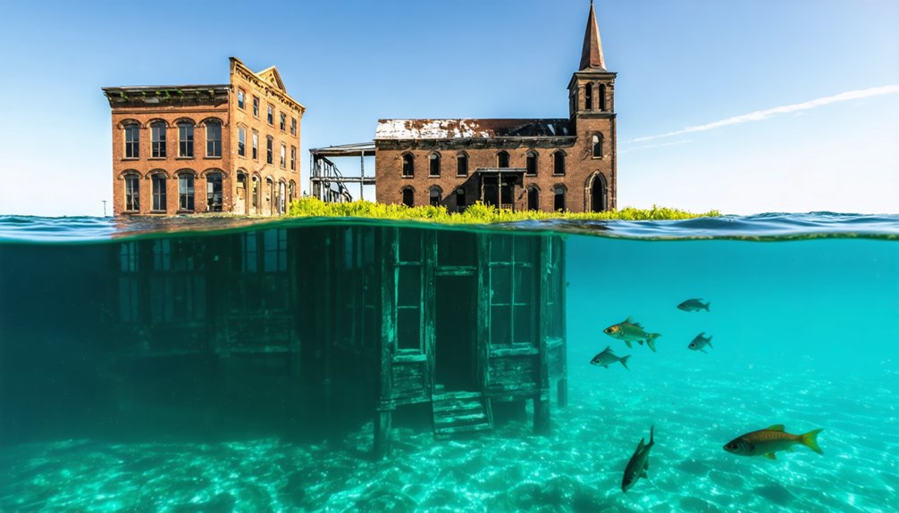
Quincy: The Town Beneath Castle Rock Lake
Beneath Castle Rock Lake’s 16,640 acres lies the submerged remnants of Quincy, a community deliberately flooded during the mid-20th century to create Wisconsin’s fourth-largest inland body of water.
You’ll find the Wisconsin River Power Company constructed Castle Rock Dam after World War II, transforming farmlands and prairie into an artificial flowage.
While haunted legends and submerged sculptures don’t characterize this site, the documented remains tell their own story.
Pre-flood infrastructure included:
- Dellwood Hotel and Pavilion – operated until 1957 before dismantling
- Community parks – Dellwood Park along Little Roche-A-Cri Creek
- Model homes – promotional structures near the Community House
You can access the area via Castle Rock Park’s east dike for bank fishing and exploration.
Report navigation hazards to 1-800-53-WATCH.
Pioneer Villages That Withered Away
While Wisconsin’s underwater ghost towns rest beneath lake surfaces, numerous pioneer villages across the state withered on dry land, leaving behind scattered graves, relocated structures, and historical markers as their only evidence.
You’ll find these settlements’ fates tied to natural resources and railroad routes between 1836-1865.
Gratiot’s Grove vanished when lead supplies dwindled, though Henry Gratiot’s house survives as Wisconsin’s second-oldest home.
Pleasant Ridge harbored African-American populations escaping the 1850 Fugitive Slave Act, while Cheyenne Valley operated integrated schools decades before federal mandates.
Argon’s cemetery preserves Polish settlers’ names—Yesis, Boruskis, Grabowskis—alongside World War I veterans.
These abandoned communities share characteristics with historical fishing villages and maritime folklore settlements: resource depletion, shifting transportation networks, and economic collapse determined which towns survived Wisconsin’s frontier era.
Frequently Asked Questions
Can Divers Legally Explore Underwater Ghost Town Sites in Wisconsin?
You can legally dive Wisconsin’s underwater ghost towns like Quincy, as no explicit prohibitions exist. However, you’ll need to take into account environmental impact on these archaeological sites and follow proper documentation practices when exploring submerged historical remnants.
Exploring abandoned towns in Kentucky lakes can provide a unique glimpse into the past, just as divers experience in Wisconsin. Each submerged site tells a story of what once was, inviting adventurers to uncover hidden histories. Careful exploration is essential to preserve these delicate environments and to honor the legacy of the communities that once thrived there.
What Types of Artifacts Have Been Recovered From Submerged Piers?
You’ll find logging hardware, pier structural elements, shipwreck debris, and fur trade materials through underwater archaeology at submerged Wisconsin piers. Artifact preservation depends on lake conditions, with wooden remnants, metal fasteners, and stone foundations documenting historical port activities.
Are There Maps Showing Locations of All Wisconsin Underwater Ghost Towns?
No extensive map exists—you’ll find the same frustration researchers face. Historical preservation efforts and underwater archaeology documentation remain incomplete statewide. You can access regional maps through Wisconsin Historical Society, though many submerged community locations aren’t publicly cataloged.
How Deep Underwater Are Most of These Ghost Town Remains?
Most remains sit in shallow water—pilings just below the surface at Lake Michigan ghost ports, while Fish Lake’s structures submerge 12-15 feet deep. You’ll find underwater archaeology and historical preservation challenges vary considerably by site documentation and flooding conditions.
Were Any Deaths Recorded During the Frequent Shipwrecks at These Ports?
Yes, you’ll find documented deaths in historical maritime safety records. The Niagara’s 1856 burning killed 60 passengers near Port Washington. However, shipwreck archaeological discoveries show Trinidad and F.J. King crews survived through proper evacuation procedures and rescue coordination.
References
- https://wuaa.org/index.php/publications/ghost-port-settlements-and-shipwrecks-in-door-countys-clay-banks
- https://www.wisconsinhistory.org/records/article/CS4070
- https://www.youtube.com/watch?v=RxFxQOInreo
- https://pbswisconsin.org/video-stub-for-wisconsin-s-lost-coastal-communities/
- https://townofgraftonwi.gov/town-history/
- https://en.wikipedia.org/wiki/Quincy_(ghost_town)
- https://www.youtube.com/watch?v=wonDmYBfuFE
- http://www.baillod.com/wuaa/claybanks.html
- https://doorcountypulse.com/where-underwater-treasures-lie/
- https://www.doorcounty.com/experience/shipwrecks