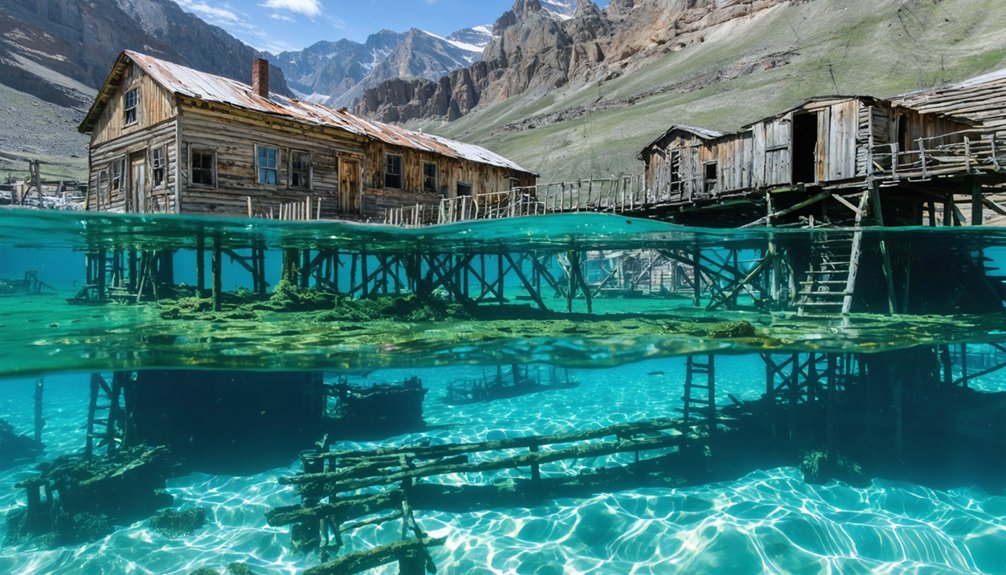
Wyoming has exactly one documented underwater ghost town: Marquette, submerged beneath 100 feet of water in Buffalo Bill Reservoir since 1910. You’ll find this settlement was established around 1878-1881 at the Shoshone River confluence and featured typical frontier infrastructure—general store, schoolhouse, and saloon. When construction of the 325-foot Buffalo Bill Dam began in 1904, federal authorities purchased the land and relocated most structures to Cody before flooding commenced. The reservoir now conceals what few remnants weren’t moved, preserved in silt-filled depths that reveal Wyoming’s transformation from frontier settlement to engineered agricultural landscape.
Key Takeaways
- Marquette, founded in 1878 near Shoshone River, is Wyoming’s only known underwater ghost town submerged beneath Buffalo Bill Reservoir.
- Buffalo Bill Dam construction (1904-1910) flooded Marquette after federal land purchase and mandatory evacuation of all settlers by 1910.
- Most structures were relocated to Cody before flooding; remaining buildings now lie submerged under 100 feet of water and sediment.
- Underwater archaeology is extremely limited due to poor visibility, heavy silt deposits, and significant water depth obscuring physical remains.
- The town exemplifies how infrastructure projects and resource extraction economics created then erased Wyoming’s industrial-era settlements.
The Story of Marquette: A Town Lost to Progress
When George Marquette established his homestead at the confluence of the Shoshone River in Bighorn Basin—sources cite either 1878 or 1881—he couldn’t have anticipated his settlement would become Wyoming’s only underwater ghost town.
By 1897, he’d secured official ownership and operated the post office from 1891.
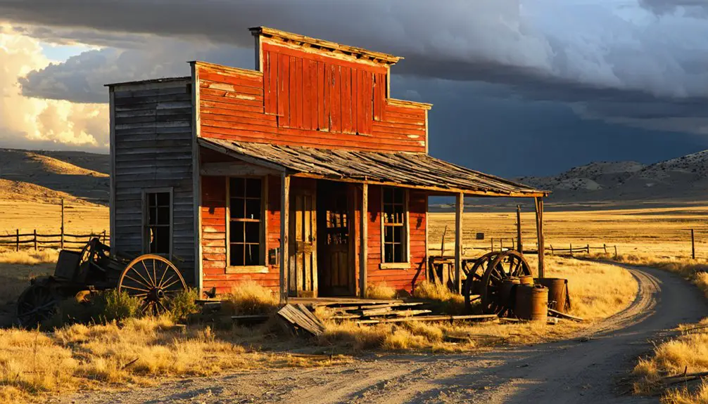
The community expanded to include a general store, schoolhouse, barbershop, dancehall, and saloon by 1906.
Marquette himself served as justice of the peace, coroner, and postmaster, playing multiple vital roles in the fledgling settlement.
The government purchased the land for the Shoshone Dam site, allowing settlers to remain until 1910 when reservoir filling commenced.
Residents systematically relocated most structures, leaving minimal submerged artifacts beneath what’s now Buffalo Bill Reservoir.
The dam, which began construction in 1904 and was completed in 1910, would go on to irrigate approximately 12,500 acres of surrounding land.
Despite cultural rediscovery efforts and occasional low water levels—like 2018’s exposure of wooly mammoth remains—Marquette’s remnants remain submerged, Wyoming’s Atlantis preserved underwater.
Building the Buffalo Bill Dam and Its Impact on Settlement
After Buffalo Bill Cody and his investors formed the Shoshone Land and Irrigation Company to transform 60,000 acres of Bighorn Basin desert, they acquired water rights from the Shoshone River in 1897 and 1899 for 169,000 acres.
When costs exceeded private capabilities, the federal government assumed control in 1904.
Engineer Daniel Webster Cole’s engineering innovation produced one of America’s first concrete arch dams, rising 325 feet from bedrock.
The construction demanded extreme sacrifice: seven workers died building it between 1905-1910, while laborers secured Wyoming’s first successful strike for wages exceeding $3 per shift.
Workers manually poured 82,900 cubic yards of concrete using rudimentary tools in dangerous conditions within the deep granite canyon.
The environmental impact proved transformative.
You’ll find 90,000-100,000 acres of once-barren sagebrush converted to productive farmland.
The dam initially stood as the world’s highest, surpassing New York’s Croton Dam.
The reservoir ultimately submerged settlements, creating underwater ghost towns while delivering irrigation, hydroelectric power, and agricultural prosperity throughout the Bighorn Basin.
How Marquette Disappeared Beneath the Waters
George Marquette arrived in the Bighorn Basin in 1878 as one of the region’s first white settlers, establishing his homestead at the Shoshone River confluence where he’d develop both farming and ranching operations.
George Marquette pioneered the Bighorn Basin in 1878, carving out his homestead where the Shoshone River converged into ranching territory.
By 1891, he’d founded the town’s post office and served as postmaster. The settlement peaked in 1906 with essential infrastructure: general store, schoolhouse, saloon, and cold storage facilities serving surrounding ranches.
When dam construction began, federal agents purchased Marquette’s land alongside neighboring properties. You’ll find documented evidence that Buffalo Bill Cody received $3,900 for his 80-acre tract—roughly $86,000 in today’s currency.
Settlers evacuated by 1910 before reservoir filling commenced. Salvageable structures relocated to Cody; remaining buildings vanished beneath 100 feet of water. The town’s post office had operated from the Irrigation District Office, according to research conducted by Old Trail Town historians.
What’s left now exists only in folklore legends—Wyoming’s submerged Atlantis, buried under silt at the reservoir’s 157-foot depths. Even during recent low water periods, the reservoir holds just over 405,000 acre-feet, making exposure of these historic remnants highly unlikely.
Life After Submersion: What Remains of Marquette Today
Since reservoir waters rose over the settlement in 1910, Marquette’s physical remains have rested at depths reaching 100 feet beneath Buffalo Bill Reservoir’s surface.
You’ll find that underwater archaeology efforts face severe preservation challenges here—thick silt layers blanket the site, poor visibility prevents thorough documentation, and the town’s unlikely to resurface even during low water periods.
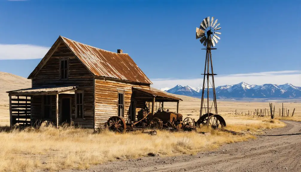
Most structures you’d want to examine were relocated before flooding, leaving only outbuildings and older homesteads submerged.
What survives above water tells Marquette’s story: Old Trail Town’s entrance cabin was salvaged pre-submersion, though high relocation costs and limited space restrict such preservation efforts.
The settlement had established itself along the confluence of the Shoshone River, where George Marquette founded the community in 1878.
The town served as a local hub with a post office, general stores, and saloons surrounded by farms and ranches.
As industries changed and people migrated, many communities fell into disrepair, transforming into ghost towns of New Mexico. Each deserted building tells a story of a vibrant past, inviting adventurous souls to explore their remnants. Today, these sites serve as poignant reminders of the rich history that once flourished in the Southwest.
You’re left with pre-1910 photographs and family records as primary documentation, while official underwater exploration records don’t exist.
Wyoming’s Submerged Heritage in National Context
While Marquette represents Wyoming’s only submerged settlement, it stands apart from its national counterparts through the thoroughness of its pre-flooding relocation. You’ll find that unlike Rockport, Utah—where drought conditions in 2021 exposed foundations via drone footage—Marquette’s buildings were systematically removed before the 1910 reservoir filling.
This strategic evacuation eliminated the cultural significance typically associated with submerged ghost towns that periodically resurface during low water events.
The preservation challenges you encounter with underwater heritage sites create a paradox: submersion protects artifacts from surface decay while simultaneously restricting public access. Buffalo Bill Reservoir’s 2018 low-water event revealed wooly mammoth bones rather than structural remnants, confirming the Bureau of Reclamation’s complete site clearance.
You’re left with documented history instead of physical evidence—a distinctly different archaeological footprint than comparable national sites. Similarly, Kirwin’s physical remnants gradually deteriorated as natural forces reclaimed the abandoned mining town, transforming machinery and structures into scattered artifacts within a wilderness landscape. Just as Gebo transitioned from a prosperous coal mining community to ruins by the mid-1900s, these submerged sites reflect the impermanence of industrial settlements shaped by shifting economic demands.
Frequently Asked Questions
Can Divers Legally Explore the Submerged Remains of Marquette Today?
You’ll face legal restrictions diving at Marquette since the Bureau of Reclamation controls the reservoir. Marine archaeology rules prohibit unauthorized artifact removal from federal waters, and you’d need explicit permission before exploring the submerged town site.
Are There Underwater Photographs or Video Footage of Marquette’s Ruins?
No underwater exploration has documented Marquette’s submerged ruins through photography or video. You’ll only find pre-flood photographic archives from 1899-1910, as the 157-foot depth prevents practical imaging of structures lying 100 feet below the reservoir’s surface.
Did Anyone Refuse to Leave Marquette Before the Flooding Occurred?
No historical evidence shows anyone refused to leave Marquette. You’ll find documentation confirms residents voluntarily relocated during government acquisition, prioritizing historical preservation of structures while minimizing wildlife impact before the 1910 reservoir flooding began.
What Happened to the Cemetery Graves Before the Town Was Submerged?
Like shadows erased before dawn, the cemetery’s fate remains undocumented. You’ll find no records of grave relocations, suggesting historical preservation wasn’t prioritized. The ecological impact of submersion likely buried any evidence of proper removal beneath Buffalo Bill Reservoir’s waters.
Could the Dam Ever Be Removed to Restore the Original Town Site?
Dam removal remains technically improbable due to Buffalo Bill Dam’s massive 325-foot structure irrigating 12,500 acres. You’d face extraordinary engineering costs, agricultural disruption, and environmental impact assessments—with minimal historical artifacts remaining to justify such unprecedented federal intervention.
References
- https://wakeupwyo.com/vanished-true-story-of-a-wyoming-ghost-town/
- https://mycountry955.com/have-you-heard-of-the-wyoming-ghost-town-entirely-hidden-by-water/
- https://www.mapquest.com/travel/underwater-ghost-town/
- https://cedarbayoumarina.com/four-ghost-towns-under-lake-texoma/
- https://www.youtube.com/watch?v=bGIHllVn8uE
- https://www.youtube.com/watch?v=wIJFx2wxjkg
- https://www.visitkeweenaw.com/listing/wyoming-the-ghost-town/519/
- https://cowboystatedaily.com/2021/10/11/buffalo-bill-reservoir-conceals-submerged-history-of-ghost-town/
- https://cowboystatedaily.com/2024/10/27/cody-couple-selling-historic-cabin-that-may-have-been-part-of-wyoming-atlantis/
- https://sheridanmedia.com/news/88186/although-buffalo-bill-reservoir-is-low-long-submerged-ghost-town-unlikely-to-reappear/