You’ll find numerous ghost towns submerged beneath Pacific Northwest reservoirs, deliberately flooded during 1940s-1960s federal dam construction. Detroit, Oregon lies beneath Detroit Lake since 1953, while Grand Coulee Dam submerged eleven communities and displaced 2,250 Native Americans in 1942. Klamath Junction’s 20th-century infrastructure remains visible during droughts in Emigrant Lake, and Lookout Point Reservoir covers six former settlements. These sites reveal foundations, artifacts, and cultural remnants when seasonal water levels drop, offering archaeological insights into communities sacrificed for hydroelectric development and the broader human costs of infrastructure projects.
Key Takeaways
- Detroit, Oregon, founded in 1889, was submerged beneath Detroit Lake in 1953 after dam construction displaced 200 residents.
- Grand Coulee Dam flooded 21,100 acres in 1942, submerging eleven communities and displacing thousands of Native Americans.
- Drought conditions periodically expose underwater artifacts like foundations, wagon remnants, and infrastructure from submerged Pacific Northwest towns.
- Klamath Junction and Robinette are preserved underwater settlements containing 20th-century structures visible during low water levels.
- Lookout Point Dam flooded six Oregon communities in 1954, creating archaeological sites that emerge during seasonal water drawdowns.
Detroit Oregon: A Town Drowned by Dam Construction
When the Oregon Pacific Railroad extended its tracks through the Cascade Mountains in 1889, construction crews established a work camp that would evolve into the town of Detroit, Oregon.
Named for Michigan residents in the area, the settlement received its post office in 1891 with Vanness G. Danforth serving as the initial postmaker.
You’ll find this settlement flourished through lumber operations until A.B. Hammond’s 1934 death coincided with economic collapse.
The U.S. Army Corps of Engineers acquired land in 1946 for hydroelectric development, forcing relocation by 1952.
Detroit Dam’s June 1953 completion submerged the original townsite beneath what became Detroit Lake.
The 200 residents who called Old Detroit home were displaced when Congress approved the dam construction that would flood their community.
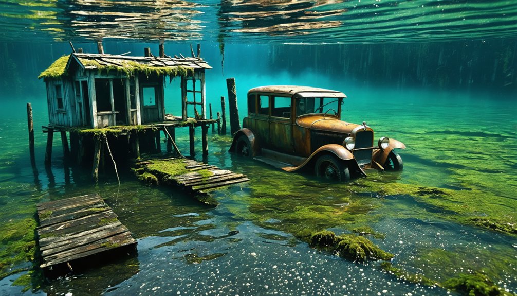
When October 2015’s drought dropped water levels 143 feet below capacity, remnants emerged including an 1870s wagon and cement structures.
Low oxygen conditions in these underwater ecosystems preserved artifacts better than atmospheric exposure would’ve allowed, though authorities restricted access to prevent looting.
Mongold Camp: The Visible Remnants at Low Water
When Detroit Lake’s water levels drop during drawdown periods, you can observe concrete foundations west of Piety Island that mark Mongold’s former location.
Unlike Detroit proper—a complete town with commercial buildings and permanent residences—Mongold functioned exclusively as temporary worker housing for logging and railroad construction crews.
The camp’s cement foundations, which sheltered over 50 families at peak occupancy, represent a distinct settlement type that preceded both the dam construction era and the reservoir that now obscures it. Similar to how the CCC developed infrastructure at Ainsworth State Park in the 1930s with stone work and facilities, workers at Mongold constructed the camp’s basic structures during the same era of regional development. The camp’s construction paralleled Depression-era projects like Booth Wayside, created during 1928–1944, when work camps and public infrastructure development proliferated across the Pacific Northwest.
Low Water Level Access
As drought conditions persisted across the West Coast for four consecutive years, Detroit Lake’s water levels plummeted to historic lows. They dropped 143 feet below capacity and reached an elevation of 1,427 feet.
You’ll find these extreme conditions create unprecedented access to submerged historical sites through Mongold Camp’s facilities. The public boat launch and swimming area provide entry points to explore exposed remnants.
However, you must exercise caution with unsupervised water recreation amid cold temperatures, debris, and unpredictable currents.
Low oxygen levels at the lake bottom enabled artifact preservation for over six decades, keeping wooden structures pristine underwater.
However, brief land exposure after 2015 inflicted more damage than the previous 60 years submerged.
The dam operations include winter spillways opened annually to accommodate spring snowmelt, which influence the seasonal fluctuations that determine artifact visibility.
You’re advised to use flotation devices, partner systems, and protective footwear when accessing these archaeological zones. Before launching any watercraft, consult the Oregon State Marine Boards alerts page to identify reported obstructions and hazards in the water.
Worker Camp Vs Town
Unlike Old Detroit’s organic development as a permanent settlement, Camp Mongold originated as a purpose-built temporary worker installation during the late 1940s-1950s era. It was specifically constructed to house railroad builders and logging crews before shifting to dam construction personnel.
You’ll observe this distinction through the solid cement foundations—evidence of industrial-grade construction designed for transient occupation rather than community permanence.
The camp housed over 50 families at peak capacity, with federal relocation programs establishing entire immigrant communities.
The archaeological significance lies in documenting labor camp infrastructure versus town development patterns.
Environmental impacts differ substantially: Mongold’s concentrated footprint minimized landscape disruption, while Old Detroit’s sprawling residential layout created broader ecological disturbance.
Today’s visible remnants reveal engineered efficiency—foundations positioned strategically along river bottomlands that ultimately succumbed to reservoir inundation.
Grand Coulee Dam and the Eleven Lost Communities
When you examine the Grand Coulee Dam’s completion in 1942, you’ll find it permanently displaced 3,000 to 4,000 residents from eleven communities—Keller, Lincoln, Gifford, Daisy, Kettle Falls, Marcus, Boyds, Inchelium, Rice, Peach, and Jerome.
The flooding inundated 21,100 acres of Colville and Spokane reservation lands, with Inchelium’s 250 Colville Indian residents losing their entire town to the rising waters.
You’re looking at a project that submerged not just infrastructure but 1,388 documented Native graves and destroyed 9,000 years of cultural history at sites like Kettle Falls, which disappeared under 90 feet of water by July 1941.
The displacement of approximately 2,250 Native Americans from the Colville and Spokane tribes erased entire villages, traditional fishing spots, and sacred burial grounds that had sustained indigenous communities for millennia.
The dam, constructed between 1933 to 1942, transformed from initial low dam plans to the high dam design that ultimately created the reservoir responsible for this massive inundation.
Towns Submerged by Construction
During the 1930s, the Grand Coulee Dam‘s construction on Washington State’s Columbia River initiated one of the largest forced relocations in Pacific Northwest history.
You’ll find that hydroelectric evolution demanded the sacrifice of eleven communities to create the massive reservoir. The engineering challenges extended beyond concrete and turbines—clearing operations beginning around 1936 required systematic removal of buildings, brush, and even graves from doomed townships.
Workers flooded the region seeking Depression-era employment, ironically dismantling the very communities some called home. Authorities granted residents extensions to secure alternative housing, while others continued dam work after displacement. Among the submerged settlements, Kettle Falls lost not only its town but also the geographical waterfall that gave it its name, now resting beneath Lake Roosevelt. The U.S. Army Corps of Engineers would later demonstrate similar infrastructure intervention when they built a breakwater in 1956 to protect bay industries in other Pacific Northwest locations.
Colville Reservation Community Impacts
The Grand Coulee Dam‘s infrastructure costs extended far beyond the eleven settler towns documented in reservoir clearing operations. You’ll find that twelve aboriginal tribes of the Colville Reservation lost their entire salmon fishery when construction blocked anadromous fish passage in 1941.
Federal engineers built no fish ladders—a decision that eliminated the cornerstone of Indigenous traditions overnight. Over 5,000 residents faced immediate cultural and economic devastation as seasonal waterway harvesting ceased.
The Colville, Nespelem, Sanpoil, Lakes, and eight other tribes had practiced nomadic lifestyles centered on Columbia River resources for millennia.
Today’s restoration efforts—reintroducing salmon, bighorn sheep, and buffalo—demonstrate cultural resilience against colonization’s compounding traumas. Recent federal agreements finally acknowledge these systematic erasures, though fish populations remain absent from upstream territories.
Kettle Falls: Where a Waterfall Vanished Beneath Lake Roosevelt
For over 10,000 years, Shonitkwu—”loud waters” in the Salish language—thundered through quartzite rocks along the Columbia River. Its cascades dropping nearly 50 feet over angled slabs where salmon concentrated in such abundance that indigenous peoples from across the Columbia Plateau gathered annually to harvest them.
Waterfall erosion carved by prehistoric Missoula floods created this geological formation, establishing North America’s most productive fishing location.
Indigenous history records permanent fishing stations here until Grand Coulee Dam‘s completion in 1942 submerged the falls beneath 380 feet of Lake Roosevelt. You’ll find only remnants now—crumbling foundations visible during drawdowns, testimony to government authority that displaced up to 3,000 residents, relocated native burial grounds, and permanently blocked salmon migrations upriver.
The thunderous waters that carried for miles fell silent beneath hydroelectric ambitions.
Bayocean: The Resort Town Claimed by the Pacific Ocean
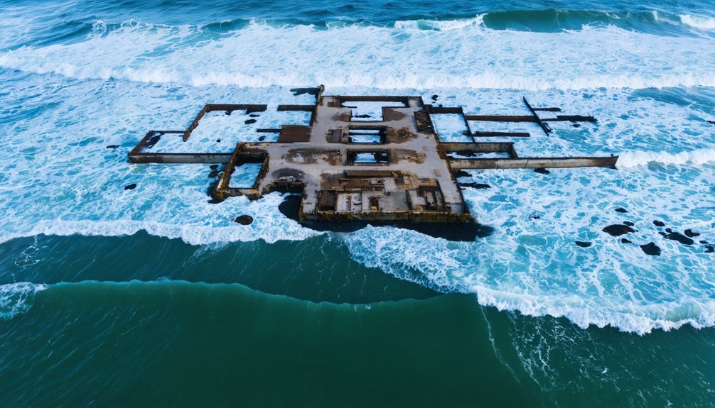
While Grand Coulee Dam drowned Kettle Falls through federal mandate, Bayocean‘s destruction came from unintended engineering consequences—a cautionary tale demonstrating how human modifications to coastal dynamics can obliterate entire communities.
You’ll find Bayocean’s remains buried beneath vegetation on Tillamook Bay’s western edge. Developers built this “Atlantic City of the West” in 1906 on a sand dune spit, constructing elaborate amenities including a natatorium, theater, and golf links. By 1914, they’d sold over 1,600 sites.
The 1914-1917 north jetty construction altered the marine ecosystem’s wave patterns, triggering relentless coastal erosion. Despite protective measures, the beach vanished by 1928.
Storms breached the spit in 1952, and by 1960, the Pacific consumed the final residence. Engineering interventions inadvertently transformed a thriving resort into Oregon’s “Atlantis.”
Klamath Junction: Oregon’s Diveable Underwater Ruins
Where Emigrant Creek once carved its path through southern Oregon’s valleys, Klamath Junction now rests beneath the expanded waters of Emigrant Lake. This area offers recreational divers access to remarkably preserved early twentieth-century infrastructure.
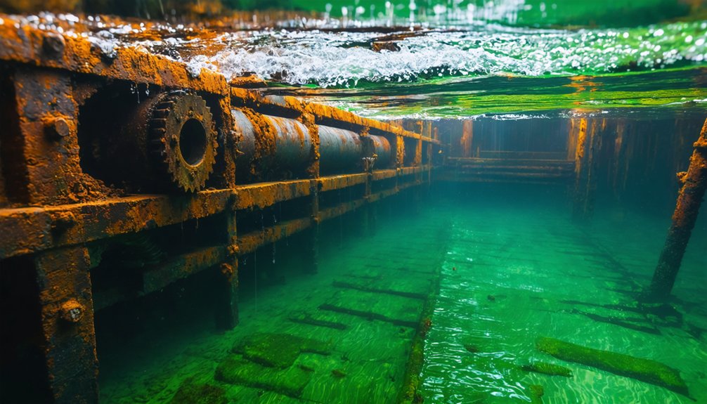
You’ll find foundations from gas stations, a café, and a dance hall submerged since 1960, when the Bureau of Reclamation’s 204-foot dam doubled the reservoir’s capacity.
The environmental impact displaced residents and forced cemetery relocations in 1958, erasing this stopover between Ashland and Klamath Falls.
During 2014’s drought, urban decay emerged from receding waters—archaeologists documented mud-caked ruins revealing ordinary debris rather than treasures.
Today’s snorkelers explore silt-covered structures where the original highway enters and exits the lake, providing tangible evidence of infrastructure sacrificed for agricultural irrigation systems serving Rogue Valley’s orchards.
Robinette: Snake River’s Vanished Industrial Settlement
Along the basalt walls of Hells Canyon near the Powder River’s confluence with the Snake River, Robinette served as Baker County’s northernmost industrial outpost until Brownlee Dam’s 420-foot earth-fill structure sent reservoir waters rising 100 feet above the townsite in May 1958.
You’ll find this settlement’s history preserved through Pete Basche’s photographs documenting agricultural operations, rail infrastructure, and timber facilities from 1913 onward. The Union Pacific Railroad terminus supported 46 residents by 1940, facilitating agricultural distribution from Pine Valley and Eagle Valley orchards.
Idaho Power Company’s dam closure forced complete evacuation, though historical preservation efforts relocated structures like Robinette Store to Richland.
Unlike modern wetlands restoration projects prioritizing ecosystem recovery, Brownlee Reservoir permanently transformed this industrial corridor into submerged archaeological territory, accessible only through archival documentation at Baker County Library’s digital collections.
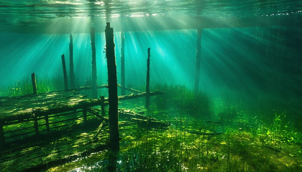
Lookout Point Reservoir: Six Hamlets Lost to the Willamette
The U.S. Army Corps of Engineers completed Lookout Point Dam in 1954, flooding six Middle Fork Willamette River communities—Landax, Eula, Lawler, Signal, Reserve, and Carter—beneath what became Lookout Point Lake.
Located 360.3 km upstream from the Pacific Ocean in Lane County, this reservoir serves flood control, power generation, recreation, and irrigation functions.
You’ll find cement structures remain submerged, likely covered in silt, creating submerged ecosystems that may harbor ancient artifacts from the early 1950s settlements.
The dam contributes to generating electricity for approximately 300,000 homes while maintaining strategic water levels: minimal capacity during winter months to capture Cascade snowmelt, then releasing stored water downstream during summer to support wildlife and water quality.
These archaeological sites rest beneath heavy recreational boating traffic.
The Human Cost: Relocated Communities and Tribal Lands
When federal dam projects transformed American river valleys during the mid-twentieth century, engineers prioritized infrastructure over the communities that would vanish beneath reservoir waters.
You’ll find stark contrasts between relocation approaches: Butler, Tennessee received systematic assistance relocating buildings and graves in 1948, while Celilo Village’s Indigenous population faced cultural erasure when the Army Corps constructed minimal replacement housing directly over their ancestral lands.
The MHA Nation at Elbowoods experienced profound disruption when Garrison Dam displaced 325 families in 1954. External contractors were hired for grave removal after tribal members refused work, violating cultural prohibitions.
Environmental impacts compounded these injustices—Native Tillamook warnings about erosion risks were dismissed due to prevailing racial attitudes, demonstrating how infrastructure development systematically devalued Indigenous knowledge and autonomy.
Frequently Asked Questions
Can You Legally Remove Artifacts From Underwater Ghost Towns in Oregon?
You can’t legally remove artifacts without explicit permission from property owners and appropriate archaeological permits. Legal restrictions protect underwater sites, while artifact preservation requires professional expertise. Unauthorized removal constitutes theft and damages irreplaceable historical resources regardless of your intentions.
What Water Levels Are Safest for Visiting Partially Submerged Town Remains?
You’ll find safest access when water levels drop 10-15 feet below normal pool elevation, exposing structures while maintaining diving safety protocols. Consider marine ecology impacts and secure proper permits before exploring—autonomous decision-making requires understanding environmental consequences and legal frameworks.
Are There Guided Diving Tours Available to Explore Klamath Junction Ruins?
No guided diving tours exist for Klamath Junction ruins. You’ll need independent dive safety knowledge and marine ecology awareness to explore unregulated sites. Federal jurisdiction and hazardous conditions prevent commercial operators from offering organized expeditions at this location.
How Much Compensation Did Displaced Residents Receive From Dam Construction Projects?
Compensation disputes plagued dam projects, with displaced residents often receiving little to nothing initially. You’ll find relocation assistance varied dramatically—from zero compensation in the 1930s-40s to millions awarded decades later through legal settlements and negotiations.
What Happens to Cemeteries When Towns Are Intentionally Flooded for Reservoirs?
Cemeteries face complete obliteration when reservoirs flood towns. You’ll find graves relocated before inundation when possible, though historical preservation efforts often fail. Environmental impacts include erosion exposing remains, while low-oxygen conditions ironically preserve submerged artifacts exceptionally well.
References
- https://pnwphotoblog.com/detroit-oregons-underwater-ghost-town-coe/
- https://www.traceyourpast.com/newsletters/ghost-towns
- https://www.opb.org/news/article/oregon-bayocean-ghost-town-resort-tillamook-bay/
- https://thatoregonlife.com/2016/07/4-underwater-lost-cities-oregon-people-dont-know/
- https://www.youtube.com/watch?v=nEnuMUhhwFA
- https://en.wikipedia.org/wiki/List_of_flooded_towns_in_the_United_States
- https://www.smithsonianmag.com/smart-news/west-coast-drought-uncovers-remnants-long-sunken-oregon-town-180957691/
- https://www.popularmechanics.com/science/a18817/dried-up-lake-reveals-sunken-oregon-town/
- https://www.youtube.com/watch?v=1TzFRVg-Rb4
- https://www.outdoorrevival.com/instant-articles/perfectly-preserved-remains-19th-century-wagon-discovered-detroit-lake-lowest-level-46-years.html


