You’ll find Nebraska’s most photogenic ghost towns wrapped in autumn color from early to mid-October, when golden cottonwoods and crimson sumac frame weathered storefronts along abandoned rail corridors. St. Deroin at Indian Cave State Park offers reconstructed buildings amid fall foliage and Missouri River bluffs, while railroad ghost towns like Belmont showcase crumbling grain elevators against vibrant prairie grasses. Keystone’s single-sided Main Street and Minetare’s brick facades glow beneath October’s light, creating haunting scenes where natural reclamation meets frontier history—and there’s considerably more to explore across the state’s forgotten settlements.
Key Takeaways
- St. Deroin Ghost Town at Indian Cave State Park features reconstructed storefronts, historic schoolhouse, and vibrant fall colors along Missouri River bluffs.
- Belmont’s hand-carved railroad tunnel, abandoned since 1982, is framed by golden cottonwoods and prairie grasses reclaiming station platforms.
- Mid-October brings yellow aspens, red maples, and vibrant cottonwoods contrasting against deteriorating buildings in abandoned railroad towns.
- Ponca State Park offers 22 miles of hiking trails with yellows from cottonwoods and reds from sumac, peaking early-to-mid October.
- Railroad ghost towns like Harrison, Glen, and Andrews feature crumbling platforms and rusted rail beds amid scenic autumn corridors.
St. Deroin Ghost Town at Indian Cave State Park
Where the Nemaha River surrenders to the Missouri, the skeletal remains of St. Deroin pierce autumn’s canvas at Indian Cave State Park. You’ll wander among reconstructed storefronts and a relocated brick schoolhouse perched on river bluffs, where oak and maple ignite the valley below.
Founded in 1853 on Native heritage land, this trading post thrived until floods drowned its future. Today, nearly 300,000 visitors explore where Joseph Deroin—son of French-Canadian trader and Otoe woman—built his frontier empire.
Hike to the ancient sandstone cave harboring 1,500-year-old petroglyphs; their petroglyph symbolism whispers stories Lewis and Clark heard in 1804. The ghost town’s elevated cemetery and general store offer prime vantage points where history and fall colors collide against Missouri River currents. The Nebraska Game and Parks Commission acquired the abandoned townsite in 1962, transforming 1,300 acres into a state park that later expanded by an additional 2,700 acres. Watch for over 140 bird species that now inhabit the grounds where steamboats once docked and frontier commerce flourished.
Ponca State Park’s Autumn Color Display
Along northeastern Nebraska’s Missouri River bluffs, Ponca State Park unfolds 22 miles of hiking trails through what locals consider the state’s most dramatic fall foliage display.
You’ll find yellows dominating the landscape—cottonwoods, green ash, elms, and black walnuts creating golden canopies overhead. Smooth sumac punctuates the scene with brilliant reds throughout the winding bluffs.
Early-to-mid October delivers peak color along these seasonal hiking routes, best experienced on clear, cool days when scenic viewpoints reveal layers of autumn hues stretching toward the Missouri River.
Cool temperatures above freezing intensify the reds, while overcast conditions deepen overall color saturation. Wind and frost can prematurely cause leaves to fall before reaching their full color potential.
You’ll need an entry permit from OutdoorNebraska.gov, but the park offers overnight stays in mini lodges and cabins if you’re planning extended exploration of these wooded trails. The park accommodates groups with 15 mini lodges alongside cottages, rustic cabins, and strawbale green cabins for varied overnight experiences.
Railroad Ghost Towns Along Historic Routes
Northwestern Nebraska’s high plains tell stories through crumbling station platforms and rusted rail beds where autumn grasses now sway between forgotten towns.
You’ll discover railroad relics along the White River route, where Glen and Andrews once thrived on the “Cowboy Line’s” promise.
Near Crawford, Belmont’s hand-carved tunnel—Nebraska’s first—pierces bluffs abandoned since 1982, its entrance framed by golden cottonwoods each fall.
Marsland and Orella mark the Chicago, Burlington and Quincy Railroad‘s ambitious expansion across these windswept plains.
Harrison, Nebraska’s highest town at 4,876 feet, began as a railroad camp called Summit before serving as a gateway to ranching country and fossil beds.
Your autumn discoveries reveal more than decaying wood and stone; they expose how quickly prosperity vanishes when iron rails fall silent.
The Belmont Tunnel closed in 1980, marking the end of an era when freight movement and arriving populations once sustained these waystation communities.
Drive these scenic corridors when September’s light illuminates prairie grasses reclaiming station foundations, and you’ll understand freedom’s double edge—the liberation of endless horizons and isolation’s harsh consequences.
River Settlement Ruins and Their Stories
Nebraska’s river corridors hold settlement stories that autumn’s lower waters help reveal—from territorial-era Rockport, buried beneath Missouri River silt on the floodplain where bluffs cast afternoon shadows, to the stone-and-timber ruins of Cowles Mill near Walnut Creek, where fall’s golden light catches remnants of dams and mill races operational through the 1920s.
Riverbank stories emerge where archaeology meets accessible terrain. You’ll find Brownville’s Exoduster settlement evidence along the Missouri, where former slaves built communities during territorial days. Cuming City’s 1855 town company planned 180 blocks with stores and hotels before the railroad bypassed it for neighboring Blair, leaving only foundation traces by 1900.
The 1775 Yutan Oto-Missouria village near Papillion Creek—named for Chief Ietan—offers over 100 excavated pits from its protohistoric occupation. Excavations revealed circular earth lodges with central hearths, grass-covered walls, and distinctive tunnel-like entrances facing east or south.
Floodplain history writes itself in layers: DeWitty’s peaceful black-white coexistence from 1906 forward proves Nebraska’s river settlements embraced independence over convention.
Keystone’s Abandoned Main Street
Where cattle once grazed across 150,000 acres of North Platte River bottomland, Keystone’s single-sided main street now stands as autumn *confirmation* to the collapse of free-range ranching.
You’ll find abandoned Main Street relics lining just one side of the dusty thoroughfare, their weathered facades glowing amber beneath October cottonwoods.
The Keystone history you’re witnessing began in 1906, when the railroad’s promise drew settlers who’d already pushed the great cattle operations north to Wyoming.
That house with the post office still stands, where the Feltz family once sold fresh milk for five cents per quart to Union Pacific workers.
The frame school building, which replaced the original sod schoolhouse and offered eight grades plus two years of high school, served as the community’s social hub until the town’s decline.
Seven miles east along the Lincoln Highway, Roscoe tells a similar story of railway station prosperity that faded when steam locomotives no longer needed water refilling stops.
Today, only the village library occupies this ghost street, serving sixty-two residents who remain among the prairie grass and golden aspens.
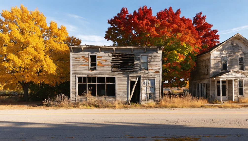
Minetare’s Vacant Building Row
Along the dusty stretch of Minatare’s Main Street, a row of two-story brick buildings stands frozen in 1960s decline, their arched windows and corbelled cornices catching the slanted October light beneath a canopy of golden cottonwoods.
You’ll discover urban decay intertwined with architectural history here—weathered ghost signs advertising long-defunct merchants, ornate tin ceilings glimpsed through broken glass, and sagging wooden boardwalks that creak beneath your boots.
The structures, built during the 1910s railroad boom, were abandoned when Union Pacific rerouted operations, leaving this commercial strip to the elements.
Mid-October transforms the scene. Yellow aspens and red maples from nearby Lake Minatare frame the deteriorating facades, creating compelling contrasts between nature’s renewal and man’s abandonment.
You can photograph freely from Main Street, capturing autumn’s vibrant persistence against brick walls that once served railroad workers’ needs.
Identifying Ghost Town Locations Through Historic Maps
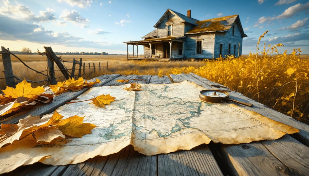
When autumn light filters through the yellowing cottonwoods of Nebraska’s backcountry, historic maps become your most valuable tool for discovering forgotten settlements hidden beneath waves of prairie grass. Your archival research should focus on three essential map types:
- Railroad maps from the 1870s-1890s document branch line development and reveal systematic settlement patterns with communities spaced six to ten miles apart along defunct rights-of-way.
- County plat books show section numbers, post offices, and isolated structures marking speculative town sites that vanished before Nebraska’s agricultural collapse.
- Township section maps display ford crossings, cemetery locations, and grove patterns indicating where settlers briefly attempted civilization.
Compare these documents against modern aerial photographs to spot graded streets now lined with rust-colored trees—permanent markers of dreams abandoned generations ago.
Best Trails for Fall Foliage Viewing Near Ghost Towns
You’ll find some of Nebraska’s most vivid autumn displays along trails that weave through historic ghost town territories, where abandoned settlements meet seasonal transformation.
The St. Deroin hiking routes and nearby Ponca State Park trails offer elevated bluff views where crimson sumac and golden cottonwoods frame Missouri River valleys that once bustled with frontier commerce.
These river valley scenic paths let you trace the footsteps of early settlers while witnessing the same fall colors that marked their harvests and winters over a century ago.
St. Deroin Hiking Routes
Hidden within Indian Cave State Park‘s 3,052 rugged acres, St. Deroin’s trail network delivers 22 miles of freedom through hardwood forests ablaze with autumn color.
You’ll discover ridge-top panoramas where red oak, maple, and ash create a spectacular show along Missouri River bluffs.
Top routes for fall foliage photography:
- Trail 11 climbs near Indian Cave grotto, offering expansive westward views and varied color displays perfect for capturing sunset shots with trail safety in mind.
- North Ridge and East Ridge trails twist through dense hardwood canopies where golden light filters through yellow and orange leaves.
- Rock Bluff Trail provides dramatic elevation changes, descending from colorful bluffs back to the river.
Adirondack shelters positioned along routes let you rest while bright red sumac and purple maples frame your wilderness escape.
Ponca State Park Trails
Northeast of Nebraska’s forgotten settlements, Ponca State Park spreads 22 miles of trails across Missouri River bluffs where autumn transforms the hardwood canopy into a kaleidoscope of russet, gold, and crimson. You’ll find smooth sumac, cottonwood, and black walnut blazing against October skies.
The Education Center Nature Trail offers an easy 0.17-mile introduction for foliage photography among bur oaks and eastern red cedars.
Old Oak Trail, built by the Civilian Conservation Corps in the 1930s, winds one mile through remnant ridge-top prairies showcasing trail conservation history.
Bloodroot Trail’s 1.6-mile loop delivers prime deer-spotting amid woodland wildflowers.
For adventurous souls, the Tri-State Overlook Trail climbs 1.28 miles to sweeping Missouri River vistas. You’ll traverse historic CCC staircases while paper birch and quaking aspens shimmer overhead.
River Valley Scenic Paths
Where Nebraska’s river valleys carve through ancient grasslands, fall foliage explodes along scenic pathways that connect you to the state’s ghost town heritage.
Prime River Valley Routes:
- Fort Robinson’s White River Trail – You’ll discover accessible hiking along old railroad grades with scenic overlooks where autumn colors blanket the White River and Soldier Creek valleys below.
- Fort Kearny Hike-Bike Trail – This 13.2-mile paved route crosses both Platte River channels, delivering unobstructed river landscapes as cottonwoods transform into golden corridors from April through November.
- Niobrara River Valley Paths – Six converging ecosystems create Nebraska’s most diverse fall display, where eastern deciduous forests meet western conifers along spring-fed waters.
These trails offer unrestricted exploration through territories where abandoned settlements once thrived.
Notable Abandoned Settlements Across Nebraska Counties
Nebraska’s abandoned settlements cluster into distinct patterns you’ll notice while exploring autumn landscapes.
Railroad-era towns from the 1870s-1890s boom line forgotten tracks where maple and ash trees now shade crumbling grain elevators and foundation stones.
River valley communities like those along the Missouri and forgotten prairie crossroads reveal their histories through weathered structures framed by October’s golden cottonwoods and rust-colored switchgrass.
Railroad Era Ghost Towns
When railroad speculators organized towns throughout Nebraska Territory in 1857, they couldn’t have predicted how many of their settlements would vanish within decades.
You’ll discover these railroad-era ghost towns scattered across the state’s prairies, where vintage locomotives once hauled freight and passengers through now-silent corridors.
Three Railroad Ghost Towns Worth Exploring:
- Belmont in Dawes County – Features Nebraska’s first railroad tunnel carved beneath a bluff, a symbol of ambitious engineering.
- Steele City – Developed in the 1870s near the Oregon Trail as a critical railroad stop.
- Glen and Andrews – Vanished completely when rail operations ceased.
Ghost town preservation efforts maintain structures like Orella’s relocated train station and section foreman’s house.
You’ll find autumn colors framing these weathered remnants, where railroad schedules once dictated daily life before economic realities forced residents elsewhere.
River Settlement Remains
Beyond the railway corridors, Nebraska’s rivers carved natural pathways where settlers established communities that have since returned to prairie and woodland.
You’ll discover DeWitty’s ruins along the North Loup River in Cherry County, where forty-three Black homesteader heritage sites tell stories of independence claimed under the 1904 Kinkaid Act.
Autumn transforms these forgotten settlements into golden landscapes, where limestone foundations peek through native grasses turned amber and rust.
The Missouri River’s Brownville reveals archaeological evidence of Black families who escaped Southern persecution, their underground dwellings now protected through settlement preservation efforts.
Fall foliage frames the Blue River valley‘s 1862 homesteads and Lower Loup village sites, where descendants’ organizations honor those who sought freedom on Nebraska’s open plains before drought and economic collapse reclaimed the land.
Western Nebraska Fading Communities
Where the Sandhills meet the High Plains, western Nebraska’s fading communities cling to existence along former transportation corridors that once promised prosperity. You’ll discover authentic local community histories in these windswept settlements where autumn transforms sparse cottonwoods into golden beacons against endless horizons.
Essential Western Nebraska ghost town experiences:
- Whitney’s railroad junction legacy – Stone storefronts frame empty track beds below Pine Ridge, where St. Agnes Catholic Church’s annual soup supper preserves imagery and folklore from cattle-ranching days.
- Lisco’s 1928 concrete arch bridge – This Lincoln Highway monument attracts photographers seeking prairie sunset imagery beneath minimal light pollution.
- Arthur’s county seat isolation – Windmills punctuate wide horizons in one of America’s least-populated counties, where fading settlements embody pure frontier independence.
Each location offers unmediated connection to Nebraska’s vanishing rural heritage.
Frequently Asked Questions
What Safety Precautions Should Visitors Take When Exploring Ghost Town Sites?
Watch where you wander—crumbling structures conceal serious dangers. You’ll need sturdy boots, awareness of wildlife encounters, and respect for historical preservation. Stay alert to unstable floors, rusty nails, and territorial creatures claiming these autumn-draped ruins as their domain.
Are Overnight Camping Options Available Near Nebraska’s Ghost Town Locations?
You’ll find excellent camping at Indian Cave State Park near St. Deroin ghost town, where historical preservation meets adventure. Pitch your tent among 22 trail miles, explore authentic structures, and hear local ghost stories beneath autumn’s golden canopy.
When Is the Peak Time for Fall Foliage in Nebraska?
Timing is everything—you’ll catch Nebraska’s peak fall foliage from mid- to late October. Historical preservation sites transform into autumn photography techniques goldmines, where abandoned buildings frame brilliant cottonwoods and maples in untamed, vibrant displays of nature’s reclaimed freedom.
Do Any Ghost Towns Require Special Permits or Permission to Visit?
Most Nebraska ghost towns don’t require permits if they’re on public land like Indian Cave State Park. However, you’ll need permission for sites on private property. Always respect historical preservation efforts and landowners’ rights when exploring these autumn-touched ruins.
What Photography Equipment Works Best for Capturing Abandoned Buildings and Autumn Colors?
You’ll want a wide-angle lens (16-35mm f/2.8) to capture weathered barn frames against crimson oaks, plus essential camera accessories like a sturdy tripod for those golden-hour shots and graduated ND filters to balance Nebraska’s dramatic autumn skies.
References
- https://www.nebraskalife.com/blog/post/saint-deroin-ghost-town
- https://nebraskapassport.com/trip-idea/see-our-state-fall-attractions-nebraska
- https://history.nebraska.gov/finding-nebraskas-ghost-towns/
- https://www.youtube.com/watch?v=q1Bww945Vhc
- https://nebraskarules.tripod.com/id6.html
- https://visitnebraska.com/trip-idea/explore-7-authentic-ghost-towns-nebraska
- https://en.wikipedia.org/wiki/List_of_ghost_towns_in_Nebraska
- https://theplanninglady.com/2020/07/12/history-of-indian-cave-state-park/
- https://www.nebraskalife.com/printpage/post/index/id/95
- https://theclio.com/entry/89970


