You’ll find the Giles ghost town at mile marker 110 along State Route 24 in Utah’s Blue Valley, where Mormon pioneers established a farming settlement in the 1880s. The community peaked at 200 residents by 1900, thriving on irrigation from the Fremont River through canals built by settlers like Hite Burgess. Today, only scattered artifacts and historical markers remain amid the blue-gray soil derived from Bentonite clay. The site’s compelling story of pioneer ambition and agricultural innovation awaits your discovery.
Key Takeaways
- Giles ghost town is located at mile marker 110 on State Route 24 in Utah at coordinates 38°21’17″N, 110°51’14″W.
- Mormon pioneers established Giles in the 1880s, reaching its peak population of 200 residents by 1900 before becoming abandoned.
- The settlement sits in Blue Valley, named for its distinctive blue-gray soil from Bentonite clay and Mancos shale deposits.
- Hite Burgess built the first dam and three-mile irrigation canal in 1884, enabling agricultural development in the area.
- Few physical remains exist today, with only scattered artifacts, broken glass, and rusted metal marking the former settlement’s location.
A Pioneer Settlement in Blue Valley
While the area was initially known as Blue Valley due to its distinctive blue-gray soil from Bentonite clay and Mancos shale, Mormon pioneers began establishing the settlement that would become Giles in the early 1880s.
You’ll find that Hyrum Burgess led the way as the first settler on the north side of the river, with his family playing an essential role in the community’s foundation.
The pioneer lifestyle took root quickly, with early agriculture becoming possible after Hite Burgess surveyed and constructed the first dam and three-mile irrigation canal in 1884.
Using basic tools like a wooden tripod and plumb bob, these early settlers transformed the harsh landscape into farmable land.
The town reached its peak when 200 residents lived in the community by 1900.
Located east of Capitol Reef Park, the settlement would eventually become a ghost town marked by mystic sadness.
The Rise and Fall of Desert Farming
Despite the harsh desert conditions, indigenous peoples pioneered sustainable farming practices in Utah’s Great Salt Lake Basin long before Mormon settlement, establishing a rich agricultural heritage that would influence later developments in Giles.
Early Native Americans found ways to farm Utah’s arid basin, creating agricultural methods that shaped the region’s future development.
The Shoshone, Goshute, Ute, and Fremont peoples mastered agricultural techniques that combined irrigation with dry-farming methods to grow corn, squash, and beans.
You’ll find that Mormon settlers later expanded these irrigation challenges, constructing over 1,000 miles of canals by 1865.
By 1890, they’d transformed 265,000 acres into irrigated farmland.
However, the agricultural success wouldn’t last.
For technical assistance with irrigation systems and water access, farmers would need to contact system administrators through established support channels.
The Bear River Massacre of 1863 resulted in the deaths of 350 Shoshone people and marked a devastating turning point for indigenous agriculture in the region.
Between AD 1300 and 1500, severe climate changes brought prolonged droughts that devastated farming communities.
These environmental pressures ultimately contributed to population declines and the abandonment of many farming settlements in the region.
In the heart of Utah’s Blue Valley, Giles ghost town sits at mile marker 110 along State Route 24, approximately 15 miles between Caineville and Hanksville.
As you explore the area, you’ll come across abandoned buildings in Jackson, Utah, remnants of a bygone era that offer a glimpse into the town’s history. These structures stand silently against the backdrop of the mountains, inviting curiosity and exploration. Visitors often find themselves captivated by the stories these forgotten places hold, making it a perfect stop for history enthusiasts and photographers alike.
You’ll find it at coordinates 38°21’17″N, 110°51’14″W, with an elevation of roughly 4,440 feet above sea level.
For effective route planning, use Steamboat Point on USGS maps as your primary reference.
While the paved highway provides straightforward access, you’ll need to prepare for remote desert travel.
Essential travel tips include carrying adequate fuel, water, and emergency supplies, as you won’t find services nearby.
Unlike the precision engineering found in U.S. aircraft manufacturing, navigation here relies on natural landmarks and basic tools.
It’s best to navigate during daylight hours, using both GPS and physical maps since cell service is unreliable.
Remember to check current road conditions before departing, as desert weather can impact accessibility.
The Blue Valley Cemetery serves as a distinctive landmark to confirm you’re on the right path.
Natural Wonders and Landscape
The stark landscape of Giles ghost town emerges from Utah’s Blue Valley, where distinctive blue clay deposits paint the barren terrain at 4,446 feet elevation. The site’s historic Mormon settlers experienced devastating floods that ultimately led to the town’s abandonment.
The history of Gold Hill, Utah, is steeped in tales of resilience and struggle. As the harsh conditions took their toll, many families were forced to seek better opportunities elsewhere, leaving behind remnants of their once-thriving community. Today, the ghost town serves as a poignant reminder of the human spirit’s ability to endure even in the most challenging environments.
You’ll discover dramatic natural formations of exposed sedimentary rock, cliffs, and canyons typical of Capitol Reef country. The population of 200 made this remote area their home by 1900, despite its challenging environment. The nearby Fremont River creates an ecological significance where riparian habitats contrast with the surrounding desert environment.
- Desert-adapted wildlife thrives here, with coyotes leaving tracks near the abandoned settlement.
- Xeric vegetation dots the landscape, showcasing nature’s resilience in harsh conditions.
- Flash floods have carved the rugged scenery, shaping both the land and human settlement patterns.
This wild terrain supports a unique ecosystem where the harsh desert plateaus meet life-sustaining river corridors, creating a striking backdrop for the ghost town’s remains.
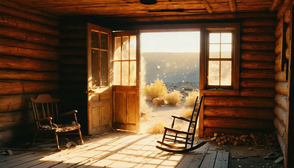
What Remains Today
Modern visitors to Giles will find scant physical evidence of this once-thriving settlement, with only fragments of broken glass and rusted metal scattered across the stark landscape.
The remnant artifacts from the late 1800s continue to deteriorate under harsh desert conditions, while nature steadily reclaims the site.
You’ll notice historical markers indicating “Front Street” and “Main Street,” though these ghostly echoes of civilization exist primarily in name only – no actual street surfaces or clear building foundations remain visible.
Unlike some preserved Utah ghost towns, Giles lacks standing structures or restored buildings.
Instead, you’ll encounter an environment dominated by wildlife, where coyote tracks replace human footprints and the blue clay soil of the valley slowly absorbs the last traces of the town’s existence.
Like many Utah ghost towns, the site fell victim to natural disasters and flooding that forced residents to abandon their homes.
Unlike Silver Reef, which houses the Wells Fargo Building as a museum, Giles has no preserved structures for visitors to explore.
Preserving Giles’ Legacy
You’ll find extensive documentation efforts underway through meticulous archaeological excavations conducted by BLM, Utah State Historic Preservation Office, and volunteers at the Giles site.
The uncovered artifacts, including glass shards, ceramics, and building materials, help fill critical gaps in the historical record where written documentation falls short.
To protect these irreplaceable resources, state programs now focus on public education about vandalism prevention and responsible site visitation while maintaining interpretive signage that preserves the spatial layout of the former town.
Historical Documentation Efforts
Extensive documentation efforts since 1895 have preserved Giles’ historical legacy through diverse archival records, maps, and photographs.
You’ll find the town’s historical significance captured in original documents, including the 1895 townsite layout with 50 parcels and detailed street plans housed in Wayne County archives.
Modern technology has enhanced these archival challenges through GPS mapping and digital preservation at coordinates 38° 21′ 17.21″ N, 110° 51′ 13.96″ W.
- Utah Ghost Town Project coordinates with local historical societies to maintain thorough records of structures and artifacts
- Collaborative research initiatives combine community-sourced narratives with official documentation
- Digital forums and online archives provide public access to genealogical records, photos, and historical maps
The integration of traditional records with modern documentation methods guarantees Giles’ story remains accessible for future generations.
Physical Site Protection
Despite its remote location, Giles faces significant preservation challenges that require extensive protection measures.
You’ll find fencing installed around sensitive areas to combat persistent vandalism and looting issues that have plagued the site since the 1940s. Site security efforts now include educational signage warning against artifact removal and explaining legal consequences for damaging the historic remains.
Environmental threats pose additional preservation challenges, with wildfires and flash flooding having already destroyed original structures and railroad relics.
To counter these risks, you’ll see active management of invasive cheatgrass to reduce wildfire susceptibility. Conservation teams use non-invasive survey techniques like GPS mapping to document artifact locations, while volunteers and professionals work together to clean and stabilize remaining structures, ensuring their survival for future generations.
Frequently Asked Questions
Were Any Notable Crimes or Deaths Reported in Giles During Its Existence?
You won’t find any documented crimes or deaths in historical records, despite ghostly encounters some claim. The town’s brief existence was marked by natural challenges rather than unsolved mysteries.
What Happened to the Original Burgess Family After Leaving Giles?
You’ll find the Burgess legacy continued as family descendants relocated to Alpine, Highland, and other Utah communities, working in sawmills, farming, and religious service while establishing permanent settlements throughout the region.
Are There Any Surviving Photographs of Giles When It Was Inhabited?
You won’t find verifiable historical documentation of inhabited Giles – surviving photographic evidence is extremely limited. While modern images show abandoned structures, no confirmed photographs exist from when families called this place home.
What Was the Peak Population of Giles During Its Most Prosperous Years?
You’ll find that during peak prosperity around 1900, the population growth in this settlement reached approximately 200 residents, remaining stable until destructive flooding events began impacting the community in the early 1900s.
Did Native American Tribes Interact With the Giles Settlement Historically?
Like scattered fragments of an incomplete puzzle, you won’t find direct evidence of Native American relations with Giles settlers. Historical interactions weren’t documented, though tribes inhabited the broader Wayne County region beforehand.
References
- https://images2.loopnet.com/d2/mNtUjVpqdKF6biniUqExR8hpRdqEnKJQZfis5EFk1Mo/document.pdf
- https://mapcarta.com/N3229765485
- https://travelwitht.wordpress.com/2009/06/16/a-ghost-town/
- https://commons.wikimedia.org/wiki/Category:Giles
- https://www.youtube.com/watch?v=IOB5MDXSkmc
- https://en.wikipedia.org/wiki/Blue_Valley_(Wayne_County
- https://www.onlineutah.com/gileshistoryb.shtml
- https://www.mormonpioneerheritage.org/for-sale-one-historical-utah-town-1-per-person-press-release-10232004/
- https://www.usbr.gov/lc/phoenix/AZ100/1940/AZ_irrigation_history.html
- https://growtheflowutah.org/2023/12/23/farmers-history-and-future-in-the-great-salt-lake-basin/


