You’ll find Glenville’s ghostly remains along Delaware’s Red Clay Creek, where a once-thriving 1950s suburb met its fate through devastating floods. After Hurricane Floyd struck in 1999, followed by Hurricane Isabel in 2004, persistent flooding forced officials to launch a $15 million buyout program, relocating 172 families. Today, abandoned street layouts and scattered foundations peek through overgrown grass, while the area’s transformation into parkland tells a compelling story of nature’s power.
Key Takeaways
- Glenville, Delaware transformed from a thriving suburban community to a ghost town due to devastating floods, particularly Hurricane Floyd in 1999.
- The area, located on Bread and Cheese Island near Red Clay Creek, faced repeated flooding that made residential living unsustainable.
- A $15 million government buyout program relocated 172 homes from the floodplain, leading to widespread abandonment by 2004.
- Most houses were demolished between 2005-2009, leaving only scattered foundations, abandoned streets, and a few structures on higher ground.
- The former residential area has been converted into parkland and restored wetlands to help manage future flooding naturally.
The Rise of a Suburban Dream
While many Delaware communities trace their roots to colonial times, Glenville’s story as a suburban development began in the mid-20th century on Bread and Cheese Island, a low-lying floodplain along Red Clay Creek.
You’ll find its origins tied to America’s post-war suburban boom, when developers transformed this 20-foot elevation site into what seemed like an idyllic neighborhood near Stanton. The area required careful link disambiguation to distinguish it from other Glenville locations across the country.
Despite the area’s documented flood risks, suburban nostalgia drew families to Glenville’s peaceful setting. The community thrived until Hurricane Floyd in 1999 triggered devastating floods that would begin its decline. They built single-family homes and formed a close-knit community, all while overlooking the environmental oversight that would later prove fatal.
The neighborhood’s appeal rested on its accessibility and perceived tranquility, embodying the classic American dream of suburban living – even as nature quietly reminded residents of their precarious location.
Life Along Red Clay Creek
In the 1950s, you’d find local families gathering along Red Clay Creek‘s shaded banks for weekend picnics and swimming near the old mill site.
You could spot children casting their lines for catfish and sunfish in the deeper pools, while their parents set up elaborate creek-side spreads on checkered blankets.
The creek’s clear waters provided a natural swimming hole until the late 1960s, when increased industrial runoff began to affect water quality and gradually diminished these cherished recreational activities.
This area had a rich history of water-powered industry, as Stanton Mills operated here for over 200 years before its destruction.
The area suffered devastating damage when Hurricane Floyd caused severe flooding along Red Clay Creek in 1999.
Fishing and Swimming Activities
Red Clay Creek offered both local residents and visitors three prime trout species for angling – rainbow, brook, and brown trout – as part of Delaware’s put-and-take fishing program.
You’d need a trout stamp and fishing license if you were 16 or older, while youngsters aged 12-15 could fish with a young angler stamp. Trout fishing activities were closely managed by DNREC with weekly stockings during April. The daily catch limit was six trout, though fly-fishing sections limited you to four.
If you preferred traditional fishing, you could use live minnows and small spoons for browns, or spinners and worms for rainbows. In designated fly-fishing areas, you’d be restricted to artificial flies with single hooks. The stretch from Yorklyn Road to Auburn was designated exclusively for fly fishing enthusiasts.
The creek wasn’t just for trout – you could also catch bass, sunfish, and catfish while enjoying the surrounding trails and picnic spots.
Creek-Side Family Gatherings
During the late 18th and early 19th centuries, life along Red Clay Creek centered on close-knit communities where families gathered for both work and leisure.
You’d find families sharing creek stories and passing down family traditions at mill sites, which served as natural meeting spots for neighboring homesteaders. Settlers often visited the area known as Red Clay Island, which had previously been called Rodhlers Uno.
Here’s what you might’ve experienced at these creek-side gatherings:
- Barn raisings where communities joined forces to help their neighbors
- Trading of handcrafted goods made by local craftspeople
- Storytelling sessions featuring local lore like the tale of maiden Kiamensi
- Seasonal festivities centered around harvest times and mill operations
- Communal work activities that strengthened family bonds while completing essential tasks
These gatherings fostered deep connections among scattered farmstead families, creating lasting social ties that defined creek-side life.
Natural Forces Reshape Destiny
While humans attempted to tame the floodplain along Red Clay Creek, nature ultimately reclaimed Glenville through persistent flooding that intensified in the early 2000s.
Despite human engineering, Red Clay Creek’s floodplain proved untameable, forcing Glenville to surrender to nature’s persistent waters.
You’ll find that even non-hurricane rain events repeatedly inundated the area, making floodplain management increasingly impossible as water eroded infrastructure and damaged homes year after year.
The community’s resilience eventually gave way to environmental realities as county officials initiated a buyout program, converting residential areas to parkland. Like heated discussions in the Politics, Economics and News forum, the decision sparked intense local debate.
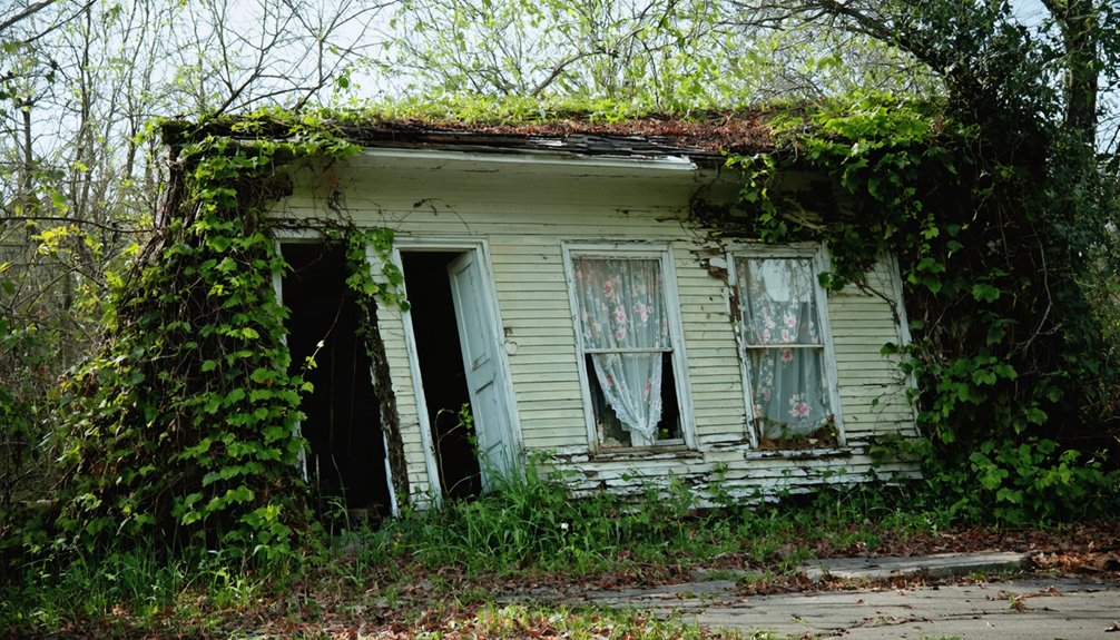
Today, you can still trace Glenville’s ghostly remains through abandoned street layouts and scattered house foundations.
The devastating impacts of Hurricane Floyd in 2000 marked the beginning of the area’s inevitable abandonment.
Nature has steadily reasserted its dominance, transforming the once-vibrant neighborhood into green space.
The town’s fate serves as a stark reminder that sometimes, the wisest response to environmental challenges is a planned retreat.
Hurricane Floyd’s Devastating Impact
Hurricane Floyd released its fury on Delaware in September 1999, delivering a devastating blow to Glenville with record-breaking rainfall that would reshape the community’s future.
Category 4 strength hurricane conditions intensified the destruction as Floyd approached the East Coast.
As floodwaters rose, you’d have witnessed these devastating scenes:
- Raging waters submerging homes under 12 feet of water, forcing residents to flee
- Powerful currents tearing through roads and railroad tracks, isolating the community
- Trees crashing down onto houses as saturated soil gave way
- Emergency responders battling through rising waters to rescue stranded motorists
- Power lines snapping, leaving thousands in darkness for days
The flood recovery efforts revealed the true scale of destruction: 194 damaged homes in Glenville alone, with repair costs soaring past $8.42 million statewide.
Despite showing remarkable community resilience, this “1-in-500-year event” marked a turning point in Glenville’s history.
The Decision to Abandon
After Hurricane Floyd’s devastation in 2000, you’d see Delaware officials begin an extensive buyout program for Glenville’s flood-prone areas near Red Clay Creek.
You’ll notice the relocation process wasn’t immediate but gained momentum between 2000 and 2004, as county and state authorities worked to acquire properties from willing homeowners.
When Hurricane Isabel struck in 2004, you’d find the evacuation process accelerating until officials finalized the complete abandonment of Glenville’s flood zone.
Relocation Process Begins
Due to increasingly severe flooding that plagued Glenville throughout the early 2000s, county and state officials initiated an extensive relocation plan in 2004. The decision demonstrated community resilience and flood preparedness as residents faced difficult choices about leaving their homes behind.
- Fencing went up around abandoned sections to restrict access
- Some houses remained standing while awaiting demolition
- Original street layouts and foundations stayed intact temporarily
- Portions of the neighborhood remained inhabited during change
- Officials designated the area for conversion to parkland
You’ll find that this relocation process marked a turning point for Glenville’s identity, as the once-vibrant residential community began its transformation into a ghost town.
As this change unfolded, it mirrored the broader trends affecting many of the ghost towns of Illinois history, where thriving hubs became shadows of their former selves. Economic shifts and declining populations left behind remnants of what once was, creating a landscape filled with decaying structures and forgotten stories. Exploring these sites offers a glimpse into the lives and legacies that shaped these communities.
The buyout program offered residents a chance to escape the flood-prone area while officials worked to repurpose the land for safer public use.
Government Buyout Program
When tropical storms and severe flooding repeatedly battered Glenville in the early 2000s, local and state officials launched an ambitious $15 million buyout program to permanently relocate the community’s residents.
After Tropical Storm Henri’s devastating impact in 2003, which followed the destructive Hurricane Floyd of 1999, you’ll find that government officials determined the buyout implications outweighed costly flood mitigation alternatives.
The program targeted approximately 172 homes in the Red Clay Creek floodplain, with funding secured through FEMA and state resources.
While the decision tested community resilience, you’ll see it reflected a practical approach to public safety and fiscal responsibility.
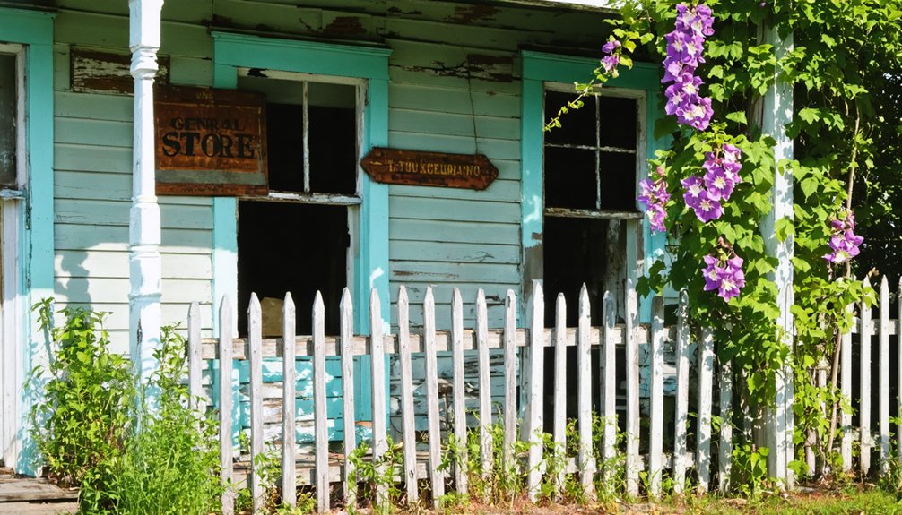
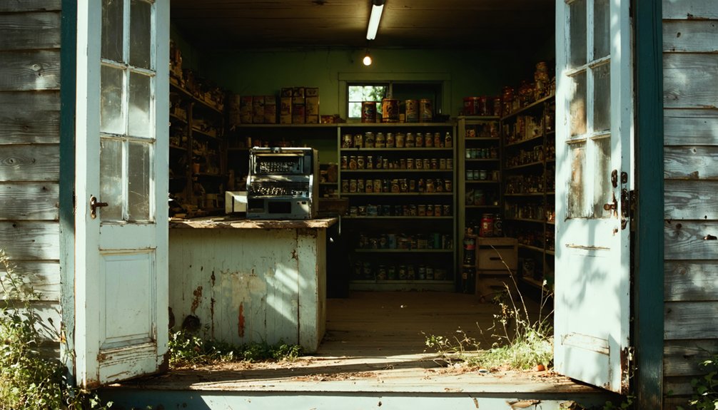
Traces of Former Glory
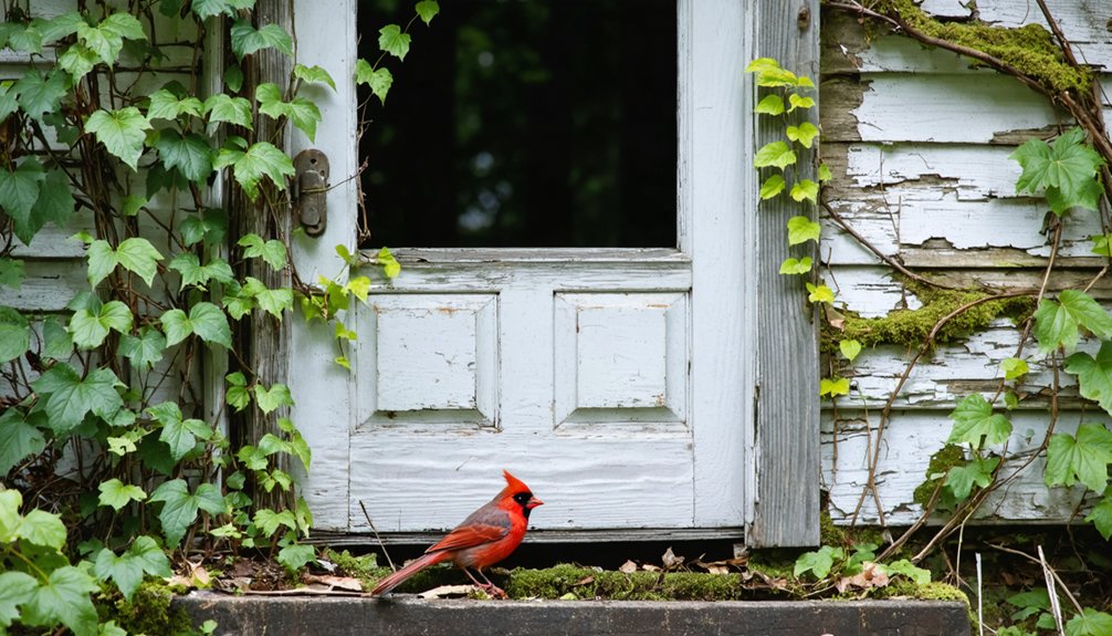
The remains of Glenville’s once-thriving neighborhood tell a poignant story through its abandoned structures and crumbling foundations.
As you explore the ghost town today, you’ll find traces of architectural decay that stand as silent witnesses to the community memories forged along Red Clay Creek.
- Streets that once buzzed with neighborhood activity now lead to empty lots
- House foundations peek through overgrown grass, marking where families once lived
- A few stubborn structures still stand, defying nature’s reclamation
- Weathered building materials scatter the landscape, telling tales of Hurricane Floyd and Isabel
- Former driveways end abruptly at missing garages, hinting at hasty departures
From Neighborhood to Nature Park
After devastating floods repeatedly ravaged Glenville’s residential areas, New Castle County and Delaware State officials launched an ambitious $15 million buyout program in the early 2000s to transform this flood-prone neighborhood into protected parkland.
The initiative marked a turning point in urban redevelopment, as you’ll now find most houses demolished between 2005 and 2009, except for a few remaining structures on E. Netherfield Road’s higher ground.
By 2009, the neighborhood’s transformation was nearly complete, with demolitions clearing the way for a safer, flood-resistant future.
The land’s conversion from residential to public space demonstrates remarkable community resilience, with officials prioritizing safety over maintaining the status quo.
Today, you can witness nature reclaiming the former subdivision, as restored wetlands and open spaces help absorb floodwaters from Red Clay Creek. This transformation protects surrounding areas while creating valuable ecosystem services for the region.
Preserving Glenville’s Legacy
Despite Glenville’s physical transformation into parkland, preservation efforts since 2004 have guaranteed its legacy endures through thorough documentation and community engagement.
Local historians and former residents have shared firsthand accounts of life in this flood-prone community, creating a valuable historical record of its rise and eventual evacuation.
- Detailed online forums capture residents’ experiences during the 1999 and 2003 floods
- YouTube videos showcase the town’s remaining structures before demolition
- Photographic collections document the $15 million buyout process
- Community posts preserve memories of daily life on Bread and Cheese Island
- Educational materials highlight Glenville’s historical significance in shaping regional flood management
You’ll find Glenville’s story continues to influence policy decisions and serves as a powerful reminder about sustainable development in flood-prone areas.
Walking Through History Today
Wandering through Glenville’s remnants today offers visitors a haunting glimpse into Delaware’s not-so-distant past.
You’ll find architectural remnants scattered throughout: broken foundations peek through overgrown grass, while partially demolished homes stand as silent witnesses to nature’s power over human ambition.
Access the site via Route 4 west of Newport, where you can explore the grid-like streets that once bustled with suburban life.
Take Route 4 westward from Newport to discover Glenville’s abandoned streets, where suburban dreams once thrived.
Community memories linger in the scattered artifacts – pottery shards and old bottles tell stories of daily life before the floods came.
While there aren’t any formal tours, you’re free to discover the site’s mysteries on your own.
But don’t wait too long – ongoing demolition means these physical connections to Glenville’s history are disappearing fast.
Frequently Asked Questions
Are There Any Paranormal Activities Reported in Abandoned Glenville Buildings?
You won’t find documented ghost sightings or eerie encounters in Glenville’s abandoned buildings. Since its 2004 flood-related abandonment, no official paranormal investigations or credible reports have emerged from this fenced-off area.
What Happened to the Local Businesses That Served Glenville Residents?
You won’t find records of specific business closures since Glenville had minimal local commerce. Most residents relied on neighboring towns like Stanton and Newport for services before the community’s abandonment.
Did Any Original Residents Refuse to Leave During the Buyout?
While resident testimonies indicate most accepted the buyout, you’ll find a few families demonstrated buyout resistance, staying in their homes on higher ground along E. Netherfield Road until today.
Can Visitors Still Access the Island During Flood Seasons?
You can’t access the island during flood seasons – it’s completely off-limits with active monitoring, fencing, and no-trespassing signs. The area becomes extremely dangerous when Red Clay Creek rises rapidly.
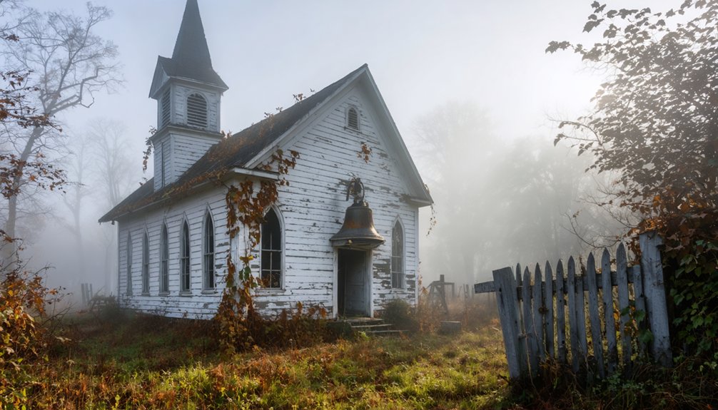
Were There Any Schools or Churches in Glenville Before Abandonment?
Despite exploring records of over 100 residential properties, there’s no evidence of ghostly schools or abandoned churches in the area. You’d have found residents traveling to Newport for these services.
References
- https://www.youtube.com/watch?v=ex8Hld_imPU
- https://www.phillybite.com/index.php/travel/7398-ghost-towns-in-delaware-that-you-can-visit
- https://www.ghosttowns.com/states/de/glenville.html
- https://commons.wikimedia.org/wiki/File:Abandoned_house_in_Glenville_Delaware.jpg
- https://fullcontactpoker.com/poker-forum/index.php
- https://www.visitkeweenaw.com/listing/delaware-the-ghost-town/515/
- https://kids.kiddle.co/Glenville
- https://en.wikipedia.org/wiki/Glenville
- https://www.townofglenville.gov/sites/g/files/vyhlif3161/f/uploads/updated_plan_10-23-17.pdf
- https://pubs.usgs.gov/bul/1245/report.pdf