You’ll find Gunsight’s weathered ruins scattered across the Tohono O’odham Nation Reservation in Pima County, Arizona—a ghost town that rose around silver deposits discovered in 1878 near a distinctive gunsight-shaped mountain. Operations began in 1881, extracting silver, lead, and copper from depths reaching 460 feet, with the community peaking between 1892-1896 when about 300 residents worked the mines. After ore bodies depleted by the early 1900s, this once-thriving camp faded into desert silence, leaving behind collapsed tunnels and foundations that tell a deeper story of Arizona’s volatile mining frontier.
Key Takeaways
- Gunsight was a silver mining settlement established in 1892 near a mountain resembling a gunsight in Pima County, Arizona.
- Mining operations from 1881 to 1977 extracted silver, lead, gold, and copper from underground shafts reaching 460 feet deep.
- The community peaked at 300 residents between 1892-1896 before ore depletion caused abandonment by the early 1900s.
- Today, scattered ruins, mining equipment, and one standing building remain at the remote desert site.
- The ghost town is located within Tohono O’odham Nation Reservation, requiring tribal permission and 4WD vehicles for access.
Origins and Discovery of Gunsight
In 1878, prospectors discovered silver deposits in a remote corner of Pima County, Arizona, near a mountain whose distinctive profile resembled a gunsight. You’ll find this location marked as T14S, R4W, where the mountain feature remained visible from the emerging settlement.
The site’s name directly reflects this prominent landmark, capturing what early miners saw daily against the horizon.
Local legends suggest these first prospectors recognized the silver potential immediately, though they’d need fourteen more years before establishing formal infrastructure.
The initial community grew to about fifty residents who depended on a nearby ranch for vegetables and dairy products.
Historic photographs from this era show the raw, isolated conditions these pioneers endured.
The discovery didn’t just mark a mining claim—it launched a settlement that would briefly flourish before vanishing into Arizona’s desert landscape. By June 27, 1892, the town had established a post office, which served the growing mining community until January 6, 1896. Native American tribes had inhabited the area for centuries before the prospectors arrived, establishing a long human presence in this remote desert region.
Silver Mining Operations and Development
You’ll find Gunsight’s silver mining operations began in 1881 when prospectors established underground workings to extract lead and silver deposits from the desert terrain.
Baker’s shaft expansion followed as miners pursued the spotty, oxidized ore bodies that characterized the district’s mineralization patterns.
The mine’s relatively small output ultimately led to depletion by the early 1920s, when the Ajo Gunsight Mining Company ceased production operations between 1919 and 1922.
Located at an elevation of 2,041 feet in Pima County, the Gunsight Mine operated as a past producer classified with a small deposit size.
The operation’s high-grade ore required shipping to Swansea, Wales for smelting, following the common practice established by copper mines along the Colorado River during the Civil War era.
Discovery and Early Operations
Gunsight Mine’s operational history began in 1881 when prospectors initiated underground silver mining operations in what would become known as the Gunsight Mining District, situated 16 miles southeast of Ajo in Pima County, Arizona.
You’ll find this lead-silver deposit yielded secondary commodities including gold, copper, zinc, and barium-barite at 2,041 feet elevation.
Mining technology of the era required underground extraction methods, though specific techniques remain undocumented in available records.
Early operators Carthage Silver Mining Co. and Fernald & Scott established workings that would continue intermittently through 1965.
The mine employed shafts and tunnels to access ore bodies, similar to contemporary operations throughout Arizona’s mining districts that utilized vertical shafts for material extraction and horizontal tunnels for ore transport.
The ore bodies were emplaced along intersecting fissure zones within the granitic host rocks, with structural features controlling the mineralization patterns.
The environmental impact stayed relatively contained given the small deposit size and limited production scale.
S.B. Keith’s 1974 Arizona Bureau of Mines documentation confirms the mine’s classification as a past producer with modest overall output.
Baker’s Shaft Expansion
Among the documented underground workings at Gunsight Mine, Baker’s Shaft represented the most significant vertical development within the district’s silver-bearing veins.
You’ll find that miners initially sank this shaft to 250 feet during early operations, establishing access to mineral veins within the volcanic host rock. The expansion phase pushed deeper into the earth, extending the shaft to 400 feet before operations ceased around 1873.
This engineering achievement reflected adaptations in mining technology necessary for extracting silver from increasingly deep deposits in the harsh desert terrain. Miners also excavated a glory hole within the shaft system, a distinctive excavation method used to access particularly rich ore deposits.
The shaft’s rock structures remain visible today, weathered monuments to the ambitious underground development that characterized southeastern Arizona‘s peak silver mining era within Pima County’s rugged landscape. The site lies within the Basin And Range Province, a physiographic region marked by distinctive geological formations that influenced mineral deposition and mining accessibility throughout the Intermontane Plateaus.
Mine Depletion and Closure
Following decades of intermittent extraction, the Gunsight Mine’s commercial viability collapsed under the weight of depleted ore bodies and economic constraints that plagued small-scale operations throughout southeastern Arizona.
You’ll find the last recorded production occurred in 1977, yielding modest grades of 22% lead and 5 ounces of silver per ton—insufficient returns for sustained operations.
The mine’s sporadic output from 1918 onward reflected exhausted veins and shallow workings that couldn’t compete with larger regional producers.
Economic impacts rippled through the settlement as operators abandoned unprofitable shafts by the early 1980s.
Multiple historical operators including Graham & Dickey, Fisher Mining Co, and Fernald & Scott attempted to revive the workings across different periods, though none achieved long-term success.
Today’s environmental legacy includes scattered tailings, collapsed adits, and remnant infrastructure across the 2,080-foot elevation site—physical testaments to extraction’s unsustainable *testament* on Pima County’s mineralized landscape.
Life in the Mining Camp
You’d have witnessed a stark existence in Gunsight’s mining camp during the early 1860s, where crews of five to ten men worked tunnel operations and managed basic smelting equipment.
The camp’s social structure centered around shared labor in the shafts and communal survival in the harsh Panamint Mountain environment, with populations occasionally swelling to 300 inhabitants during productive periods.
Your daily routine would have revolved around mining operations, maintaining fuel oil-powered equipment, and steering the constant threats posed by both the unforgiving desert conditions and tensions with displaced Native American populations. The southern Panamint Range location placed miners near massive deposits of black sulphurets of silver, though the extreme summer heat could cause rapid dehydration and death even with water available.
Daily Operations and Work
When miners descended into Gunsight’s underground workings between 1919 and 1922, they confronted a complex operation targeting spotty oxidized copper mineralization alongside more reliable lead and silver deposits.
The Ajo Gunsight Mining Co. employed 5 to 10 men who explored geological formations through shafts, drifts, tunnels, winzes, and stopes extending to considerable depths.
Your daily operations included:
- Extracting high-grade ore from gold and silver ledges using period mining technology
- Processing lead and silver as primary commodities, with gold, copper, and zinc as secondary targets
- Traveling inclined shafts reaching 460 feet depth
- Managing spotty mineralization requiring careful near-surface enrichment handling
- Shipping ore intermittently—370 tons of lead, silver, and copper left the site
The operation ultimately produced large quantities before closure, leaving behind extensive underground infrastructure at 2,041 feet elevation.
Community and Social Structure
Beyond the mechanical rhythms of drilling and blasting, Gunsight’s workforce of 5 to 10 men formed a sparse social framework typical of small-scale Arizona mining ventures. You’d find minimal social hierarchy in this remote outpost, where survival and shared labor created practical equality among miners.
The camp’s isolation meant community interactions centered on essential activities: exchanging supplies, sharing news from distant towns, and pooling resources during equipment failures.
Unlike larger mining districts with established saloons, stores, and residential neighborhoods, Gunsight remained a functional work camp. You wouldn’t encounter the ethnic enclaves or family structures that characterized boom towns.
Instead, this lean operation attracted transient prospectors and wage workers who endured harsh desert conditions for modest returns, their temporary presence leaving little architectural or social legacy.
The Rise and Fall of Gunsight
Silver’s discovery in 1878 transformed a remote stretch of Pima County into Gunsight, a mining settlement named for the distinctive profile of its neighboring mountain.
You’ll find this community peaked between 1892 and 1896, when its post office operated and roughly 50 residents called it home.
The town’s trajectory followed a predictable pattern:
- Silver extraction drove initial prosperity and population growth
- Local ranches supplied vegetables and dairy to support operations
- Mining activity disrupted local flora and wildlife habitats throughout the area
- Economic decline accelerated as ore deposits played out after 1896
- Complete abandonment occurred by the early 1900s
Post office closure in 1896 marked Gunsight’s death knell. Without viable silver deposits, residents abandoned the settlement, leaving scattered ruins and mining equipment across the desert landscape where you can still explore today.
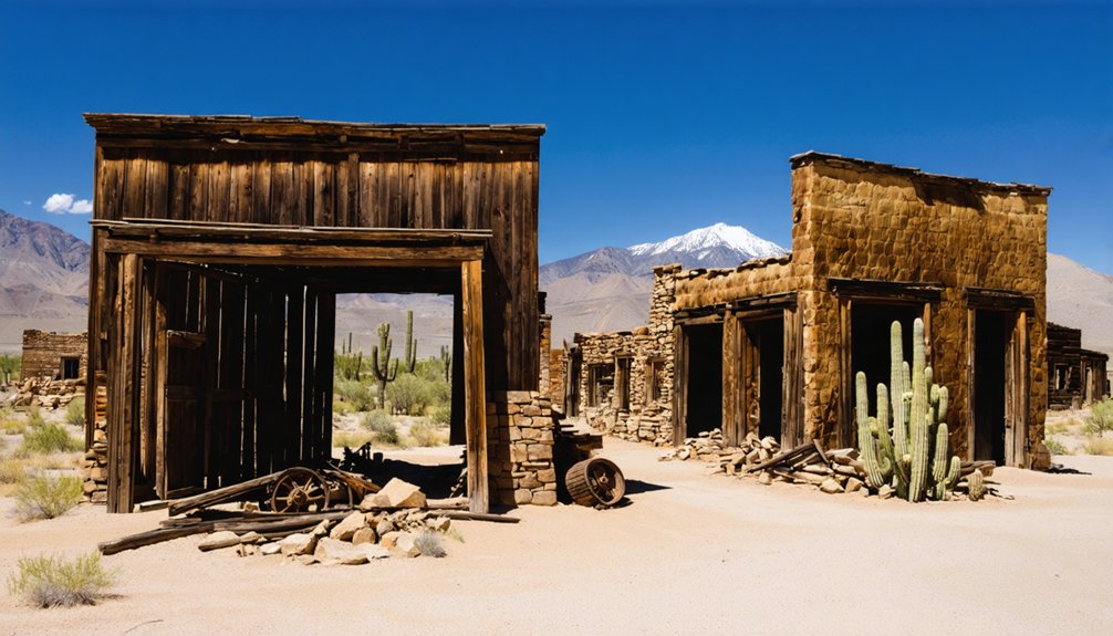
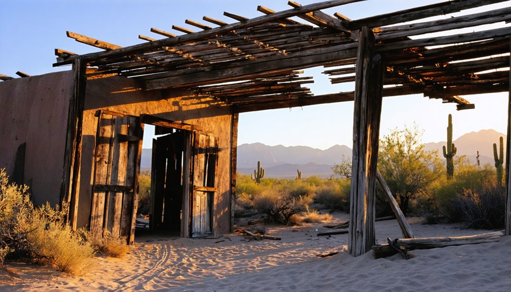
What Remains Today
A century after Gunsight’s abandonment, only fragments of its mining past survive in the Pima County desert. You’ll find one standing building amid scattered ruins and concrete foundations that mark where fifty residents once lived.
Mining equipment remnants and pipes lie dispersed across the landscape, testimony to the played-out silver veins that sealed the town’s fate.
Scattered metal remnants and rusted pipes mark the final chapter of exhausted silver deposits that doomed this desert settlement.
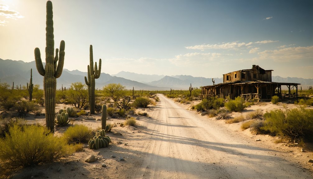
Accessing the site requires 4WD vehicles over rough roads in T14S R4W, though mild winters make exploration feasible.
The fragile ruins receive no modern conservation efforts, leaving them vulnerable to time and elements.
What was once human enterprise has now reverted to wildlife habitat beneath the distinctive gunsight-shaped mountain.
Danger signs warn of hidden pits where miners once extracted their fortunes.
Getting to Gunsight
Reaching Gunsight requires maneuvering the complexities of its location within the Tohono O’odham Nation Reservation in Pima County’s Sonoran Desert.
You’ll need permission from tribal authorities before accessing this ghost town near Sells, AZ 85634.
The site sits approximately 10 miles from Ajo in rugged terrain featuring desert washes and distant hills.
Key Access Considerations:
- Historical artifacts remain protected under tribal jurisdiction
- Wildlife observation opportunities exist throughout the Sonoran Desert landscape
- The former mining town, established around 1880, lies within restricted reservation boundaries
- Gunsight Wash coordinates (32.238105, -112.751037) provide reference points
- Nearby Why, AZ offers the closest public road access via Highway 85
Unlike freely accessible BLM lands, Gunsight demands respect for tribal sovereignty and cultural heritage.
Exploring the Surrounding Area
While Gunsight itself remains restricted within reservation boundaries, the surrounding Sonoran Desert region offers extensive exploration opportunities through established ghost towns and mining sites.
You’ll find Goldfield Ghost Town in Apache Junction, featuring accessible Main Street shops, underground mine tours, and weekend gunfight reenactments. The Mammoth Gold Mine offers professional-guided exploration, while Prospector’s Palace provides hands-on gold panning experiences.
Venture further to Vulture Mine, Arizona’s richest 1863-established gold and silver operation, or explore Jerome’s mountain-surrounded mining town with its preserved structures and scenic walks.
Desert adventures depart from Gunsight Butte, offering UTV and ATV tours ranging from two-hour guided excursions ($108) to three-hour ancient ruins explorations ($150).
Wildflower blooms transform the landscape seasonally, while stellar night skies reveal unobstructed constellations across the desert expanse.
Frequently Asked Questions
What Wildlife Can Be Encountered When Visiting Gunsight Ghost Town?
You’ll encounter diverse wildlife including black-tailed jackrabbits, coyotes, and rattlesnakes. Desert species like Gambel’s quail, bobcats, and chuckwallas thrive here. Watch for red-tailed hawks overhead while exploring this remote wilderness area freely.
Are There Any Camping Facilities Available Near Gunsight?
Yes, you’ll find free BLM dispersed camping at Gunsight Wash requiring no campsite reservations—just bring your camping gear. Alternatively, Hickiwan Trails RV Park sits 1.5 miles away, while Shadow Ridge Resort offers full hookups twelve miles north in Ajo.
What Safety Precautions Should Visitors Take When Exploring the Ruins?
You’ll need sturdy footwear for trail navigation through unstable terrain, shouldn’t enter fire-damaged structures, and must respect historical preservation laws prohibiting artifact removal. Always carry ample water, monitor weather conditions, and travel with others for safety.
Can Artifacts Be Legally Collected From the Gunsight Site?
No, you can’t legally collect artifacts. Legal restrictions under the 1906 Antiquities Act and artifact regulations enforced by the Bureau of Land Management prohibit removing any mining relics or historical items from public lands without permits.
How Far Is Gunsight From the Nearest Town With Services?
You’ll find services about 30-40 miles away in Ajo or Why. Despite its historical significance and ongoing preservation efforts, Gunsight remains remote. You’ll need proper planning before visiting this authentic ghost town location in Arizona’s desert.
Exploring the history of abandoned mines near Oracle Arizona can provide additional insight into the region’s mining past. Many of these sites are untouched and offer a glimpse into a once-thriving industry that shaped the local community. Make sure to bring proper gear and plenty of water as you venture through the rugged landscapes surrounding these fascinating remnants.
References
- https://www.ghosttowns.com/states/az/gunsight.html
- https://en.wikipedia.org/wiki/List_of_ghost_towns_in_Arizona
- https://azdot.gov/adot-blog/two-guns-sordid-history-i-40
- https://www.youtube.com/watch?v=jVg-HePwOyU
- https://www.youtube.com/watch?v=kFtntN6FLV4
- https://digital-desert.com/death-valley-trails/loafing-along/chapter-22.html
- https://pubs.usgs.gov/circ/1992/1082/report.pdf
- https://westernmininghistory.com/mine-detail/10283558/
- https://mojavedesert.net/mining-history/overview/03.html
- http://www.azbackcountryadventures.com/rita.htm


