You’ll discover Harper’s remains between Argyle and Nine Mile Canyons in Utah, where Buffalo Soldiers established an essential stagecoach route in 1886. Originally known as Lee Station, this frontier town peaked with nearly 200 residents between 1905-1910, featuring a post office, telegraph office, and hotel. The town’s decline began in the early 1900s as motor vehicles replaced stagecoaches, leaving behind scattered log cabins and steel telegraph poles that whisper tales of frontier life.
Key Takeaways
- Harper was established in 1886 as a stagecoach town by Buffalo Soldiers, originally named Lee Station at the intersection of Argyle and Nine Mile Canyons.
- The town peaked between 1905-1910 with up to 190 residents, featuring a post office, telegraph office, hotel, and schoolhouse.
- Military presence shaped Harper’s development through road construction and telegraph infrastructure, supporting supplies to Fort Duchesne.
- Harper became a ghost town by the 1930s when motor vehicles made stagecoach stops unnecessary and economic challenges forced residents away.
- Today, scattered log cabins and Civil War-era steel telegraph poles remain as evidence of Harper’s frontier past.
The Birth of a Stagecoach Town
When the Buffalo Soldiers of the 9th Cavalry Regiment constructed the road through Nine Mile Canyon in 1886, they set the stage for Harper’s emergence as an important stagecoach stop.
Originally known as Lee Station after Ed Lee, who purchased the land from homesteader Tom Taylor, the site became a critical hub in Utah’s stagecoach culture. The community worked together to build a log schoolhouse to serve local children.
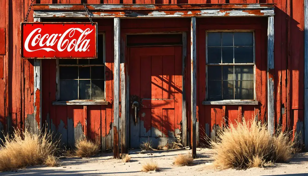
You’ll find Harper’s strategic location at the intersection of Argyle and Nine Mile Canyons perfectly positioned it to serve travelers between Fort Duchesne and Price. The stop offered rest for weary horses and passengers, while supporting mail, telegraph, and freight operations. By 1910, Harper had grown into a bustling community with a log post office, telegraph office, hotel, store, and saloon.
Despite the frontier challenges of establishing a remote outpost, Harper grew to provide essential services along this bustling route. The installation of telegraph lines using Civil War surplus iron poles further cemented Harper’s role in connecting Utah’s isolated communities.
Life Along Nine Mile Canyon
Life along Nine Mile Canyon centered around a vibrant community of 130-190 residents who called Harper home during its peak years between 1905-1910.
You’d find a diverse mix of ranchers, farmers, and workers spread across the settlement patterns that stretched for about a mile along the canyon. The community’s resilience showed in their determination to establish essential services, including a schoolhouse near Argyle Canyon and an unofficial post office.
Daily life revolved around the steady flow of stagecoaches, freight wagons, and telegraph communications passing through town. The road through Harper was originally built by Buffalo Soldiers in 1886. Much like Harper Adams University, the town placed great importance on agricultural development.
You could’ve spotted horses being changed at Lee Station’s barn, or locals gathering at the hotel and store.
Despite the harsh rural conditions, Harper’s residents maintained a self-sufficient lifestyle until shifting transportation routes led to the town’s eventual decline.
Military Influence and Development
You’ll find evidence of essential military infrastructure in Harper’s history through the buffalo soldiers’ construction of a significant supply road connecting Fort Duchesne to Price in 1886.
The road, which traversed Nine Mile and Gate Canyons, served as the primary route for supplying the fort’s growing population of 300 to 600 soldiers throughout the 1890s.
The military’s influence extended beyond transportation, as they installed steel telegraph poles along the route, establishing the region’s first telecommunications network and transforming Harper into a strategic hub for army operations in northeast Utah. The area’s military significance mirrored broader patterns seen during the Utah War era, when one-third of the U.S. Army was deployed to the territory. Like the earlier Utah War period, the lack of direct telegraphic communication had previously hindered military operations in the region.
Buffalo Soldiers’ Road Construction
In 1886, Buffalo Soldiers undertook a critical infrastructure project by constructing the essential road through Nine Mile Canyon, connecting Fort Duchesne to the railroad in Carbon County, Utah.
You’ll find their engineering legacy in the roads they built through challenging terrain like Gate Canyon, creating crucial supply routes between Price, Helper, and Fort Duchesne.
These dedicated soldiers didn’t just build roads – they maintained them rigorously while protecting travelers and supply convoys from outlaws.
They established road stations along their routes to shelter travelers during harsh weather. Their construction efforts proved instrumental in connecting isolated military outposts with expanding western territories.
The 9th Cavalry Regiment established telegraph lines alongside their roads to improve communication across the region. A vital part of their duties included policing and patrolling the areas where they constructed infrastructure. Even today, you can trace their remarkable achievements along the Buffalo Soldier Heritage Trail, where their road-building expertise helped shape Utah’s early development.
Military Telegraph Installation History
While the transcontinental telegraph line first crossed Utah in 1861, Harper’s military telegraph installation emerged as part of Fort Duchesne’s strategic communication network in 1886. The military’s telegraph technology transformed this remote outpost, utilizing Civil War surplus steel poles and high-quality galvanized wire to guarantee reliable communication. Young operators were recruited to staff these critical installations. The installation’s messages cost seven dollars per telegram, making it a more economical option than previous methods.
You’ll find three key aspects of military logistics that shaped Harper’s telegraph development:
- Army personnel constructed essential roads and installed telegraph lines every 20 miles to accommodate battery power limitations.
- Military operations provided security and maintenance for the lines, protecting critical communication routes.
- The infrastructure supported both military and civilian needs, later evolving to telephone service by the early 1900s.
These installations remained essential to Harper’s connectivity until 1917, serving as a significant link between isolated frontier communities.
Fort Duchesne Supply Route
Located between Price and Fort Duchesne, the critical military supply route established in 1886 became a lifeline for Utah’s eastern frontier development.
You’ll find this engineering marvel was carved through eastern Utah’s canyons by the Buffalo Soldiers of the 9th Cavalry, revolutionizing supply logistics to the region’s military operations.
The road’s significance extended far beyond its military purpose. While it transported over 2 million pounds of government supplies annually to Fort Duchesne’s 300 soldiers, it also enabled the export of valuable gilsonite discovered in 1888.
The route proved essential for maintaining control over the Uintah Basin, allowing rapid troop movements and facilitating peacekeeping efforts with the Ute population.
Though later replaced by Highway 191, this historic pathway continues serving ranchers and tourists today.
Historic Buildings and Infrastructure
Built in 1886 by Buffalo soldiers, an essential road through Nine Mile and Gate Canyons connected Fort Duchesne to Price, transforming Harper into a bustling stagecoach stop.
The historic architecture included structures crucial to frontier life, while infrastructure significance centered on military communications and transportation needs.
You’ll find these remnants of Harper’s vibrant past:
- Telegraph poles made from repurposed Civil War steel, carrying crucial communication lines between settlements until 1917
- Lee Station’s stage stop complex, featuring a large horse barn and traveler facilities
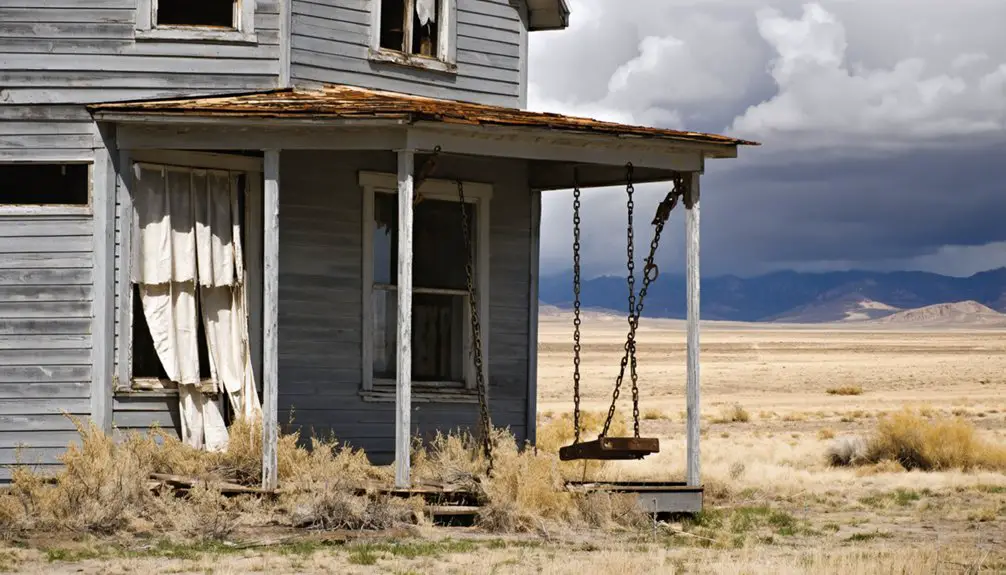
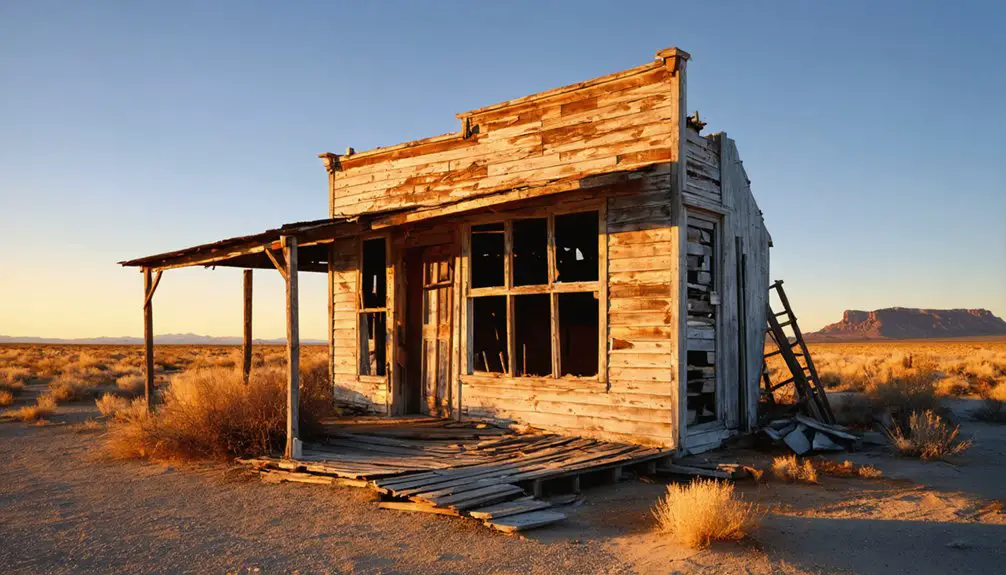
- Scattered log cabins and deteriorating buildings spanning a mile of canyon, including former sites of the saloon, hotel, store, and post office
Today, these aging structures stand on private land, silent witnesses to Harper’s frontier heritage.
Native American Heritage
The lands surrounding Harper hold deep Indigenous roots stretching back thousands of years before the town’s frontier era.
You’ll find this area was home to several Native American groups, including the Paiutes, Utes, and Navajos, who maintained complex social networks and traditional subsistence patterns across the region.
These tribes faced significant challenges as Mormon settlers moved into their territories during the mid-1800s. The Walker War and Black Hawk War erupted as Indigenous peoples defended their ancestral lands.
Despite forced relocations and restrictive federal policies, tribal sovereignty endures. Today’s Native communities continue their Indigenous traditions through cultural events, language preservation, and educational programs.
Their descendants maintain strong connections to this landscape, preserving oral histories and religious practices that honor their enduring relationship with the Harper area.
Daily Life in Harper’s Peak Years
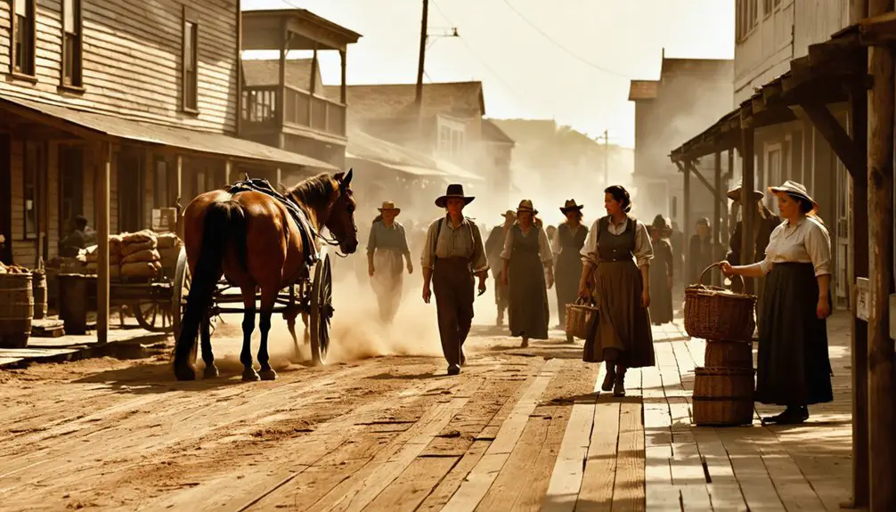
You’d have found Harper’s bustling stagecoach stop serving as the heart of local commerce and social life, where residents gathered to collect mail, exchange news, and trade goods.
Travelers passing through on the military supply route between Fort Duchesne and Price created steady traffic that kept Harper’s businesses viable during its peak years.
The telegraph line installed by Buffalo soldiers along the canyon modernized communication for Harper’s residents, connecting them to the broader region while the local post office handled their correspondence and packages.
Commerce and Social Activities
During Harper’s peak years as a stagecoach stop between Fort Duchesne and Price, life centered around “Lee Station,” where Ed Lee’s homestead served as an essential hub for commerce, communication, and social gatherings.
Trade interactions flourished as ranchers, travelers, and locals converged at this crucial waypoint, where you’d find fresh horses, mail service, and telegraph communications installed by the army in 1886.
Key features of Harper’s community gatherings included:
- Voting activities in local log buildings
- School sessions near Argyle Canyon
- Mail collection and distribution at central meeting points
You’d find the daily rhythm marked by stagecoach arrivals, cattle operations, and informal social connections.
The town’s layout, spreading a mile along the canyon, created natural opportunities for neighbors to interact while conducting business or tending to ranch duties.
Transportation and Mail Services
As buffalo soldiers carved out an essential road through Nine Mile and Gate Canyons in 1886, Harper’s transportation infrastructure began to take shape, connecting Fort Duchesne to Price via a rugged but crucial route.
You’d find stagecoaches regularly stopping at Harper’s hotel and saloon, where travelers and mail carriers would rest while horses were changed for the challenging journey ahead.
The town’s post office served as a significant hub for mail delivery throughout the region, while steel telegraph poles carried messages between Harper and Fort Duchesne.
You couldn’t miss the constant flow of stagecoach routes through the narrow canyon trails, where drivers navigated weather delays and rough terrain.
Military escorts and buffalo soldiers maintained the roads, ensuring safe passage for mail, passengers, and freight between frontier settlements and larger towns.
Transportation and Communication Hub
Located at the intersection of Argyle and Nine Mile Canyons, Harper emerged as an essential transportation and communication nexus in late 19th century Utah.
The town’s evolution from a remote outpost to a critical hub showcases the remarkable transportation evolution and communication advancements of the American West.
You’ll find evidence of Harper’s strategic importance through:
- The Buffalo Soldiers’ road construction in 1886, connecting Fort Duchesne to Price’s railhead
- Steel telegraph poles that carried messages between settlements, later converted to telephone lines in 1907
- Lee Station’s stagecoach facilities, including a large barn and rest area for horses
As you explore Harper’s ruins today, you’re walking through a site that once served as the lifeline for military logistics, civilian transport, and regional communication in this rugged frontier territory.
The Path to Abandonment
Harper’s decline began in the early 1900s, transforming from a bustling transportation hub into an empty ghost town by the 1930s.
You’ll find that multiple factors converged to seal the town’s fate: the rise of motor vehicles made stagecoach stops obsolete, while economic challenges hit the small sheep ranching community hard.
The population dynamics shifted dramatically as families sought better opportunities elsewhere.
The town’s isolation in Nine Mile and Argyle Canyons, combined with harsh winters and limited farmland, made modern living increasingly difficult.
Services disappeared one by one – the telegraph line was discontinued by 1917, the post office closed, and even the schoolhouse was relocated to Wellington in the 1930s.
Without infrastructure modernization or economic diversity, Harper couldn’t compete with nearby developing towns, leading to its ultimate abandonment.
Exploring Harper’s Remnants Today
Standing at the intersection of Argyle and Nine Mile Canyons, the remnants of Harper stretch for roughly a mile along Utah’s rugged terrain.
Nestled where two historic canyons meet, Harper’s weathered remains trace a mile-long path through Utah’s wilderness.
As you commence ghost town exploration, you’ll need to secure permission from private landowners before accessing these historical structures that once served as a crucial stagecoach stop.
One fascinating example of this is the history of Clarion, Utah ghost town, which has intrigued many adventurers and historians alike. As you wander through its remnants, tales of past inhabitants and their struggles come to life, offering a glimpse into a bygone era. Each building tells a story, begging to be uncovered by those brave enough to explore its eerie surroundings.
For successful historical preservation and safe exploration, remember these essential points:
- Navigate to the site using coordinates 39°48′10″N 110°21′15″W, with Wellington serving as your nearest supply point.
- Document the deteriorating structures through photography while maintaining a safe distance from unstable buildings.
- Pack adequate supplies and emergency gear, as you’ll be venturing into a remote area with limited services.
The surrounding canyon environment offers glimpses of pioneer life through scattered ruins, telegraph poles, and stone foundations that tell Harper’s story.
Frequently Asked Questions
Are There Any Documented Deaths or Burials in Harper’s Town Limits?
You won’t find any official death certificates or burial records within Harper’s town limits. Existing documentation shows no evidence of deaths occurring there or dedicated burial grounds being established.
What Was the Highest Recorded Population During Harper’s Peak Years?
Like a tiny Facebook community, Harper’s population timeline peaked at 130 residents around 1910. You’d have found this frontier settlement humming with essential services during its heyday as a stagecoach town.
Did Any Famous Outlaws or Notable Figures Visit Harper?
While famous outlaws likely passed through the area along the Outlaw Trail, there’s no concrete evidence of notable figures or outlaws specifically visiting Harper’s stage station or settlement.
What Natural Disasters or Extreme Weather Events Affected Harper?
You’ll find Harper’s biggest threats came from flash floods in its narrow canyons, where flood risks were amplified by the terrain. Drought impacts made survival tough without natural springs for water.
Were There Any Mines or Mineral Deposits Discovered Near Harper?
You won’t find evidence of significant mining techniques or mineral resources near Harper. Historical records focus on its role as a stagecoach stop rather than any documented mines or deposits.
References
- https://www.legendsofamerica.com/harper-utah/
- https://en.wikipedia.org/wiki/Harper
- https://www.ghosttowns.com/states/ut/harper.html
- https://www.utahoutdooractivities.com/ninemileharper.html
- https://www.onlineutah.com/harperhistory.shtml
- https://en.wikipedia.org/wiki/Ninemile_Canyon_(Utah)
- https://www.roadtripryan.com/go/t/utah/carbon-county/nine-mile-canyon
- https://rsc.byu.edu/civil-war-saints/prelude-civil-war-utah-wars-impact-legacy
- https://historytogo.utah.gov/utah-war/
- https://wchsutah.org/documents/utah-world-war-book1.pdf


