You’ll find Hatton’s ghost town remains near Corn Creek, Utah, where it began as Petersburg in 1859. The settlement thrived as a critical stage stop along the Mormon Road, serving travelers between Salt Lake City and Southern California. While Hatton prospered through agriculture and transportation in the 1870s-1890s, a combination of floods, isolation during the Black Hawk War, and the Hurricane Canal’s completion in 1904 led to its eventual abandonment. Its silent ruins hold fascinating stories of pioneer life.
Key Takeaways
- Originally established as Petersburg in 1859, the settlement was renamed Hatton in 1877 near Corn Creek, Utah.
- Served as a significant stop for the Gilmer and Salisbury Stage Company and freight route between Salt Lake City and California.
- Agricultural community faced repeated challenges from floods, Native American conflicts, and geographic isolation during its existence.
- Development of the Hurricane Canal in 1904 contributed significantly to the town’s eventual decline and abandonment.
- Complete abandonment occurred by 1921 when the local church branch closed, marking the end of the settlement.
From Petersburg to Hatton: The Origins of a Lost Settlement
While Utah’s territorial expansion was in full swing, the settlement of Petersburg emerged in 1859 through the efforts of Peter Robison and Peter Boyce, who ventured from Fillmore to establish a community where Mormon Road intersected with Corn Creek.
Settler motivations aligned with broader territorial goals, as Peter Boyce took over as Indian agent from Anson Call at the nearby Corn Creek Indian Farm, following Brigham Young’s appointment. The town would later be renamed to Hatton in 1877.
The town’s infrastructure developed strategically around its position near a Pahvant village, with Robison serving as the first postmaster. The original Petersburg schoolhouse would later be dismantled and rebuilt in Kanosh in 1869.
You’ll find that Petersburg’s early success stemmed from its role as an essential stop along major transportation routes, particularly after becoming a significant station for the Gilmer and Salisbury Stage Company in 1864, connecting Utah’s southern railroad to Nevada’s mining regions.
Life Along the Mormon Road: Transportation and Trade
Three major developments shaped transportation along the Mormon Road after its 1847 establishment: government investment, commercial freight operations, and handcart migration.
The U.S. government’s $25,000 investment in 1854 transformed this route into a crucial military and commercial artery linking Salt Lake City to Southern California.
Mormon leadership recognized the route’s importance as a vital freight corridor between Los Angeles and Salt Lake City.
The route evolved from early pack horse trails to support wagon transportation routes, requiring significant modifications to accommodate larger vehicles and increased traffic volumes.
Native American Relations and Early Settler Stories
Before Mormon settlers established communities in the Upper Virgin River valley, Southern Paiute peoples had long inhabited these lands, setting the stage for complex interactions and eventual conflicts.
As settlers moved into Hatton near Corn Creek in 1859, they encountered the Pahvant tribe and established an Indian Farm to manage native interactions.
Settlement tensions reached a breaking point in 1866 when two ranchers were killed at Pipe Spring, leading to retaliatory violence and the deaths of the Berry family.
You’ll find evidence of these troubled times in Grafton Cemetery, where both settlers and Native Americans were buried. The cemetery contains an estimated 74 to 84 graves from this tumultuous period. One notable grave belongs to Joseph Berry, who was killed by raiders in 1866.
Brigham Young responded by ordering Mormon villages to consolidate into larger towns of at least 150 men, temporarily abandoning smaller settlements like Grafton for more defensible locations.
Agricultural Heritage and Community Development
The agricultural roots of Hatton took shape when settlers from Fillmore established a farming community near Corn Creek in the mid-1800s.
Pioneers from Fillmore carved out a new farming settlement along Corn Creek, sowing the early seeds of Hatton’s history.
You’ll find that these pioneering farmers developed irrigation techniques to harness the creek’s water, ensuring crop diversity could thrive in Utah’s arid climate. While specific details about their farming methods aren’t well documented, the settlement’s agricultural focus supported its role as a rest stop along the Gilmer and Salisbury Stage Company route. Similar to the challenges faced in ghost towns, Hatton’s eventual decline reflected the broader pattern of economic shifts in rural Utah. The community faced water management difficulties reminiscent of Grafton’s flooding that plagued early Utah settlements.
- Water management strategies included irrigation systems similar to other Utah settlements
- Post office establishment in 1877 marked the community’s growth and independence
- Farming operations sustained the town’s economy for over six decades
- Community infrastructure supported both agricultural and transportation needs
- Settlement patterns shifted when many residents moved upstream to Kanosh in the late 1860s
The Path to Abandonment: Why Hatton Disappeared
Despite initial promise as a farming settlement and stage stop, Hatton’s path to abandonment began with a series of natural and economic challenges that progressively undermined its viability.
You’ll find that recurring floods from the Virgin River devastated crops, homes, and irrigation systems, making agriculture increasingly difficult to sustain. Much like Thistle’s catastrophic flooding, the power of water proved unstoppable in reshaping the town’s destiny. The town’s geographic isolation left settlers vulnerable to raids during the Black Hawk War, forcing a complete evacuation in 1866. Brigham Young’s policy of feeding rather than fighting Indians helped restore peace in the region.
The final blow came with the development of Hurricane Canal in 1904 and the founding of Hurricane City in 1906.
These new opportunities, combined with Hatton’s persistent flooding and economic decline, drew residents away to more secure locations. By 1921, the local church branch had closed, and the remaining families gradually departed until the town’s complete abandonment.
Frequently Asked Questions
Are There Any Remaining Structures or Ruins Still Visible in Hatton Today?
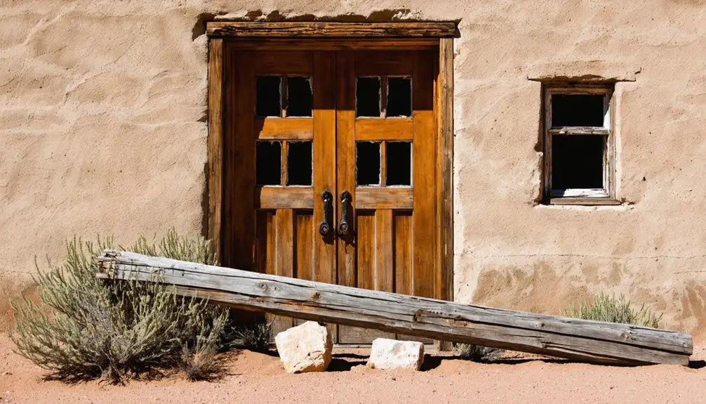
You won’t find any remaining structures or visible ruins in the area today, as historical records indicate the town’s buildings have deteriorated or been removed since its abandonment.
What Was the Peak Population of Hatton During Its Most Prosperous Years?
You won’t find exact historic population trends documented, but analyzing ghost town demographics suggests Hatton likely peaked at several hundred residents during its 1860s stagecoach stop heyday.
Did Any Famous Historical Figures Ever Pass Through Hatton’s Stage Station?
While thousands traveled the Gilmer and Salisbury line, you won’t find records of any famous travelers at Hatton’s stage station. Despite its historical significance, no documented evidence shows notable figures stopping there.
What Happened to the Original Land Titles After Hatton Was Abandoned?
You’ll find that land ownership remained recorded in county archives, though title transfers became complicated after abandonment. Without federal oversight pre-1869, original territorial claims stayed valid but largely inactive.
Were There Any Significant Natural Disasters That Contributed to Hatton’s Decline?
Unlike other ghost towns, you won’t find evidence of natural disasters contributing to Hatton’s decline. Historical records show the town’s fate was sealed by economic decline and population shifts to nearby Kanosh.
Exploring Loseeville’s haunted history reveals tales of restless spirits that linger in abandoned homes and forgotten streets. Many who visit report strange occurrences, as if the past is reaching out to share its stories. As the sun sets, the eerie ambiance draws in thrill-seekers eager to uncover the mysteries that shaped this once-thriving community.
The history of Black Rock, Utah, adds to the allure of exploring ghost towns in the region. Its past tells a story of ambition and resilience, with settlers drawn to the promise of prosperity in a harsh landscape. Now, as remnants stand in silence, they beckon adventurers to piece together the lives that once filled the area with hope and dreams.
References
- https://inspiredimperfection.com/adventures/grafton-ghost-town/
- https://www.utahlifemag.com/blog/post/4-ghost-towns
- https://jacobbarlow.com/2017/01/19/hatton-utah/
- https://www.valleyjournals.com/2024/10/02/507818/exploring-utah-s-ghost-towns-seven-abandoned-settlements-with-fascinating-histories
- https://www.ksl.com/article/51308628/restored-utah-ghost-towns-that-should-be-on-your-summer-travel-bucket-list
- https://jacobbarlow.com/tag/hatton/
- https://www.youtube.com/watch?v=dCg_xiclHxA
- https://expeditionutah.com/ghosttowns/
- https://www.visitutah.com/things-to-do/history-culture/ghost-towns
- https://en.wikipedia.org/wiki/Mormon_Road


