Louisiana’s ghost town count remains frustratingly imprecise—official sources cite anywhere from 17 to nearly 100, though archival evidence suggests you’re looking at 500 or more vanished settlements when you include undocumented sawmill camps, railroad stops, and coastal villages. The discrepancy stems from inconsistent criteria and catastrophic record loss through hurricanes, fires, and flooding that erased entire communities before anyone catalogued them. Different parishes harbor distinct abandonment patterns—timber exhaustion inland, hurricane devastation along the coast, and transportation shifts throughout—revealing how geography shaped these disappearances.
Key Takeaways
- Louisiana has between 70 to 100 documented ghost towns, though official counts vary from 17 to nearly 100 depending on criteria.
- The true number exceeds 500 vanished communities, but fragmented records and documentation gaps make precise counts impossible.
- Resource exhaustion from sawmill closures and timber depletion caused many Louisiana settlements to disappear permanently.
- Hurricanes, coastal erosion, and flooding destroyed numerous towns, including Cheniere Caminada and Isle de Jean Charles.
- Railroad abandonment and transportation route changes accelerated community decline, leaving many former settlements deserted.
Counting Louisiana’s Abandoned Settlements
Determining exactly how many ghost towns exist in Louisiana depends largely on which definition you apply and what sources you consult. Geotab data identifies seventeen abandoned settlements statewide, placing Louisiana 17th among U.S. states.
However, online sources list nearly 100 locations, while seventy documented sites suggest the actual count falls somewhere between. You’ll find Wikipedia’s inventory incomplete, missing numerous sawmill communities and former rail stops.
The discrepancy stems from varying criteria—some counts include sites experiencing urban decay and economic decline, while stricter definitions require complete abandonment. Former mining towns and resource-exhausted communities once flourished before depletion led to their desertion.
Hurricane-devastated communities like Cheniere Caminada and Ruddock represent clear-cut cases, but places like Taft—with zero population yet maintaining a church cemetery—blur the boundaries.
Historical records reveal Louisiana’s ghost towns resulted from resource exhaustion, natural disasters, and industrial transformation. Among current Louisiana cities, both Baton Rouge and New Orleans rank among potential future ghost towns due to high vacancy rates and population decline indicators.
Official Records and Documentation Challenges
You’ll find no single authoritative count of Louisiana’s ghost towns because state agencies never established a centralized registry for abandoned settlements. The Division of Archaeology tracks burial sites and archaeological remains, while the State Archives preserve colonial-era land grants and crucial records—neither system documents when communities simply emptied out.
This archival gap means you’re left piecing together estimates from informal sources like regional historians and proximity-based maps, with counts ranging wildly depending on whether someone’s counting vanished railroad stops, flooded river landings, or mill towns reclaimed by swamp. The Bureau of Land Management maintains extensive records including general correspondence from 1796-1909 and letters received from 1803-1965, though these federal documents primarily track land disposal rather than settlement abandonment. Across the country, researchers have identified over 3,800 ghost towns, though the actual number depends heavily on how each state defines an abandoned settlement.
Conflicting Count Estimates
When you examine official sources for Louisiana’s ghost town count, you’ll encounter wildly divergent figures that reveal the state’s archival challenges. Source1Count lists just 17 documented sites, ranking Louisiana 17th nationally—dramatically lower than Texas’s 511 or California’s 346.
Yet Wikipedia’s incomplete catalog enumerates dozens of vanished communities, while Bayou Insider claims hundreds disappeared during the 20th century alone. This discrepancy stems from Louisiana’s unique destruction patterns: hurricanes obliterated coastal settlements like Ruddock in 1915, while flood control projects deliberately submerged towns like Bayou Chene. Among the most tragic examples is Cheniere Caminada, which faced hurricane destruction in 1893, though some residents courageously attempted to rebuild the devastated community.
The documentation challenges intensify when considering Vernon Parish sawmill towns, where communities like Barham, Alco, and Neame vanished after lumber operations ceased, leaving few official records. Modern preservation efforts struggle to catalog waterlogged remnants and undocumented sawmill camps. Without standardized criteria distinguishing authentic ghost towns from abandoned sites, you’re left steering through conflicting estimates that obscure genuine tourism opportunities across Louisiana’s haunted landscape.
Limited Historical Record Keeping
Louisiana’s archival gaps run deeper than conflicting numbers—the state’s official record-keeping systems have systematically failed to document vanishing communities.
Historical documentation exists primarily as byproducts of government duties, leaving disappeared towns like Frenier and Bayou Chene barely traceable. You’ll find NOAA’s historical map tool comparing 1965 and 2012 shorelines for Buras, but most vanished settlements lack such records.
When official archives fail, oral history becomes your primary source. Boat tour guides preserve stories of Revilletown’s colored water and Pointe-aux-Chenes’ drowned schoolhouses. Local descendants maintain these narratives where bureaucracy abandoned documentation. Resources like Louisiana Ghost Town Directory and GhostTowns.com help fill these documentation voids by cataloging locations and details that official records overlooked.
Limited media coverage compounds the problem—without systematic recording, you’re left piecing together Louisiana’s ghost towns through fragmented cemetery records, handwritten deeds, and the memories of those who refuse to let erasure complete its work. Courts have even invalidated original deeds due to missing supporting records and witnesses, demonstrating how inadequate documentation can erase communities from legal existence entirely.
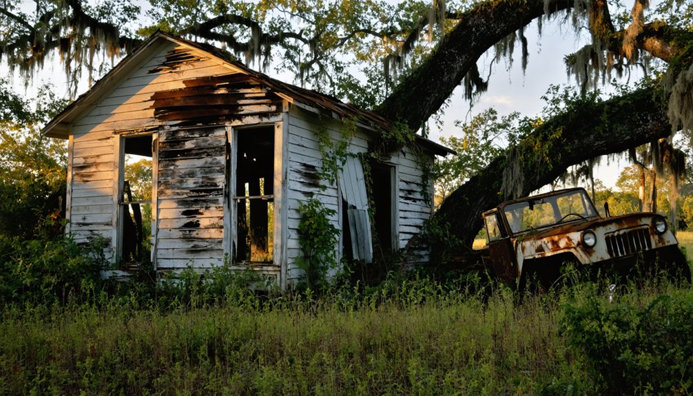
Sawmill Communities That Vanished
During Louisiana’s timber boom a century ago, up to 1,300 sawmill towns dotted the state’s piney woods and cypress swamps. Lumber companies built entire villages around their mills, creating a sawmill economy where they owned everything—homes, schools, even cemeteries.
You’ll find these communities demonstrated remarkable community resilience, yet their fate was sealed by “cut out and get out” logging practices that exhausted timber supplies. Unlike Old West ghost towns with their wooden storefronts and tumbleweeds, these settlements faded gradually, leaving behind abandoned structures and quiet cemeteries as their only markers. The deforestation was so complete that the 60-mile stretch between Alexandria and Leesville had no trees remaining.
Consider these vanished settlements:
- Alco – Alexandria Lumber Company’s town housed over 1,000 workers before its 1945 closure; only a cemetery remains near LA Hwy 465
- Morley – Established in 1907, abandoned by 1927 after depleting cypress within twenty years
- Saline – Once bustling with cotton and timber, the sawmill closed in the 1940s
When mills shut down, workers scattered, leaving ghost towns reclaimed by forests.
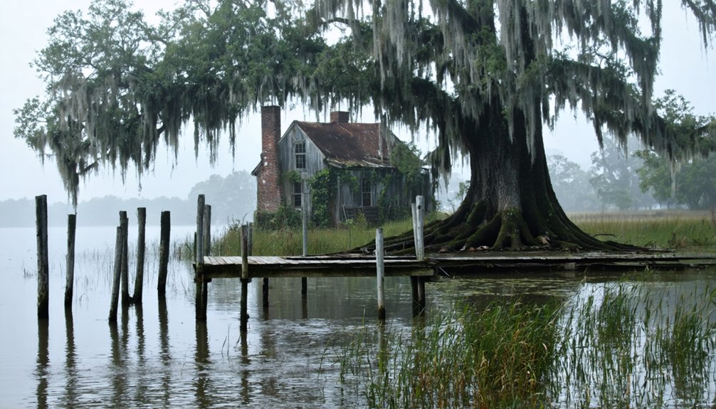
Coastal Ghost Towns Lost to Hurricanes and Erosion
Louisiana’s coastline harbors a different breed of ghost town—communities erased not by economic collapse but by the relentless Gulf itself.
You’ll find the most haunting examples in Cheniere Caminada, where an 1893 hurricane killed over 1,100 residents and left the thriving fishing village in ruins.
And on Isle de Jean Charles, the Biloxi-Chitimacha-Choctaw tribe watched their ancestral home shrink from five miles wide to a sliver of vanishing marsh.
Plaquemines Parish tells the same story repeatedly: settlements like Burrwood and Port Eads gradually surrendered to subsidence and storm surge.
Their cemeteries are now washing into open water as Louisiana loses a football field of land every hour.
Cheniere Caminada Hurricane Devastation
On October 1, 1893, a Category 4 hurricane slammed into the fishing village of Cheniere Caminada with an 18-foot storm surge that killed 779 of its 1,471 residents—nearly half the population.
This multi-ethnic community of French-speaking Catholics, Creoles, Acadians, and Italians supplied New Orleans with seafood before nature erased it from Louisiana’s coast. The devastation was absolute:
- 300 homes destroyed with only one structure left standing
- Entire fishing fleet demolished, ending the village’s economic lifeline
- Cemetery decimated, creating suspected mass graves west of the original site
Today, you’ll find little evidence of this cultural heritage along Highway 1 near Grand Isle.
Historical preservation efforts commemorate the site where family surnames vanished overnight, leaving only sinking ground and oral traditions warning of divine judgment.
Isle De Jean Charles
A 98% land loss since 1955 transformed Isle de Jean Charles from a 22,000-acre refuge into a 320-acre remnant, marking one of Louisiana’s most dramatic coastal disappearances.
Your ancestors of the Biloxi-Chitimacha-Choctaw tribe established this sanctuary in the 1830s, escaping the Trail of Tears onto what authorities deemed worthless swampland. Cultural heritage thrived here through palmetto-roofed mud houses, fishing traditions, and self-sufficient communities that grew from 16 families to 77 by 1910.
Ecological impacts from saltwater intrusion, hurricanes, and oil industry canals accelerated destruction after Hurricane Carmen in 1974. By 2016, only 70 residents remained when the federal government awarded $48 million—the first climate refugee resettlement grant—relocating survivors 40 miles north, leaving behind a ghost town where freedom once flourished.
Plaquemines Parish Disappearing Settlements
Where the Mississippi River surrenders to the Gulf of Mexico, Plaquemines Parish witnessed three essential settlements vanish beneath waves and time. You’ll find no standing structures in these locations—only archival records prove they existed:
- Burrwood – Once home to 1,000 residents serving shipping operations, now fully submerged by coastal erosion.
- La Balize – A vital pilot station repeatedly destroyed by hurricanes until storm surges eroded the site completely.
- Pilottown – River pilots’ settlement abandoned after relentless hurricane damage accelerated its disappearance.
These coastal ghost towns represent more than failed historical preservation—they’re warnings. Subsidence, sea level rise, and hurricanes displaced entire communities before environmental recovery became priority.
The delta’s erosion patterns suggest more settlements face similar fates, making documentation imperative before Louisiana’s maritime heritage dissolves entirely into the Gulf.
River Towns Forgotten by Time
Louisiana’s relationship with the Mississippi River created prosperity and destruction in equal measure for settlements clinging to its banks.
The Mississippi River gave life to Louisiana’s riverside towns with one hand while taking it away with the other.
You’ll find Bayou Sara’s story particularly haunting—once the most important port between Natchez and New Orleans, it faced relentless devastation. The USS Essex shelled it to ruins in 1862. Floods in 1844, 1851, 1912, and 1927 progressively erased what remained.
The Great Flood of 1927 reduced its population from 630 to fewer than 100. Officially unincorporated in 1926, the town couldn’t sustain another blow when 1937’s waters forced final abandonment.
Today, archaeological excavations reveal traces of its commercial past, though preservation efforts face challenges from the very river that once promised fortune but ultimately delivered oblivion.
Railroad Settlements Left Behind
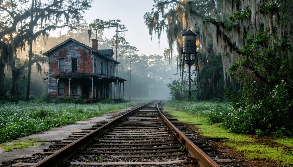
While rivers shaped Louisiana’s earliest settlements, the railroad boom of the late 19th century wielded even more brutal power over which towns survived and which disappeared.
Rail history reveals corporations deliberately bypassed established communities, building entirely new towns through subsidiaries to control land sales and freight monopolies. Settlement patterns shifted dramatically as residents abandoned their homes en masse.
Consider three northern Louisiana examples:
- Rocky Mount, Fillmore, and Bellevue — bypassed by the Shreveport, Vicksburg and Pacific Railroad
- Haughton — received the rail line in 1884, absorbing displaced populations
- Ruddock — thrived with daily New Orleans service until a 1915 hurricane killed 58 residents
Even county seat status couldn’t guarantee survival.
The Louisiana Midland Railway’s 77-mile span between Packton and Vidalia eventually joined hundreds of abandoned agricultural and logging branches, their towns vanishing into Louisiana’s forests.
Regional Distribution Across Louisiana Parishes
The geographic scatter of Louisiana’s ghost towns tells a story of environmental vulnerability and economic specialization. You’ll find concentrations in parishes where single industries once dominated—Pointe Coupee’s abandoned sugar mill communities, St. John the Baptist’s vanished cypress lumber operations at Ruddock, and DeSoto’s railroad settlements along the KCS line.
These cultural heritage sites reveal regional patterns: river parishes lost towns to floods and hurricanes, while inland Vernon and Beauregard parishes witnessed logging camp abandonment.
Louisiana’s ghost towns map the state’s vulnerabilities: river parishes drowned by storms, inland forests stripped by loggers’ camps.
East Carroll Parish’s cluster along US 65 marks agricultural decline, and Plaquemines Parish’s submerged Burrwood demonstrates coastal erosion‘s devastating impact.
You’re exploring archaeological sites that stretch from Caddo Parish’s Albany to lakeside Frenier, each location preserving evidence of Louisiana’s extractive economy and nature’s reclamation rights.
Notable Abandoned Plantation Communities

Among abandoned settlements, plantation-based communities reveal Louisiana’s most profound economic and social transformations. You’ll find these ghost towns emerged from distinct pressures that challenged floodplain resilience and historical preservation:
- Morley (1907-1927): Cypress lumber operations exhausted timber resources within twenty years, leaving behind a complete industrial settlement west of Brusly.
- Sunnyside (1871-1918): Railroad depot relocation and devastating fire displaced this river commerce hub toward Port Allen.
- Lobdell Area (1930s): Levee construction forced entire community dismantling, with only one plantation home surviving relocation.
Woodland Plantation’s 2026 acquisition by the Descendants Project marks a significant shift—returning the 1811 slave revolt site to descendant control after two centuries.
These communities demonstrate how infrastructure priorities, resource depletion, and natural disasters continually reshape Louisiana’s settlement patterns.
Estimating the True Number of Lost Towns
Counting Louisiana’s ghost towns reveals more about archival gaps than actual losses. You’ll find official counts ranging from 17 to nearly 100, but historical archaeology suggests thousands more settlements vanished without documentation.
Sawmill closures, railroad abandonments, and coastal erosion erased entire communities before anyone recorded their existence.
The problem? Preservation efforts focus on documented sites, leaving undocumented settlements lost forever. Louisiana’s wetlands swallow evidence, while corporate timber records burned or disappeared.
You’re left estimating from fragmentary census data, scattered land deeds, and oral histories. The true number likely exceeds 500 communities when you count every disappeared railroad stop, lumber camp, and riverside landing.
Without systematic archaeological surveys and archival digitization, Louisiana’s ghost town count remains educated guesswork at best.
Frequently Asked Questions
Can You Legally Visit and Explore Louisiana’s Ghost Towns?
You’ll find most of Louisiana’s nearly 100 ghost towns sit on private property, demanding owner permission before you explore. However, some locations like Sherburne’s wildlife management area offer legal access, letting you freely discover these abandoned cultural landmarks.
What Caused Most Louisiana Ghost Towns to Be Abandoned?
You’ll find most Louisiana ghost towns emerged from economic decline—sawmill industries shutting down, railroads abandoning stops, and resource depletion. Historical causes also include devastating hurricanes and environmental changes that forced entire communities to relocate or disappear completely.
Are Any Louisiana Ghost Towns Considered Haunted or Have Paranormal Activity?
You’ll find Louisiana’s most haunted history at Frenier, where voodoo priestess Julia Brown’s 1915 supernatural legend persists. Ruddock and Cheniere Caminada also carry documented paranormal reputations following their hurricane devastations that killed thousands of residents.
Which Louisiana Ghost Town Is Best Preserved for Tourists to Visit?
You’ll find Ruddock best preserved among Louisiana’s ghost towns, offering abandoned infrastructure like railroad remnants and historic architecture fragments. Its documented 1915 hurricane narrative and accessible location make it ideal for exploring authentic, unrestricted glimpses into vanished communities.
How Do Ghost Towns Differ From Ruins of Native American Settlements?
Ghost towns reflect recent Euro-American settlement decline from industrial or economic causes, while Native American ruins represent indigenous sites with far deeper native origins, requiring archaeological interpretation and cultural context that archival records alone can’t provide you.
References
- https://www.ezhomesearch.com/blog/ghost-towns-in-louisiana/
- https://www.youtube.com/watch?v=yMatGshCNDY
- https://en.wikipedia.org/wiki/List_of_ghost_towns_in_Louisiana
- https://710keel.com/discover-70-ghost-towns-from-across-louisiana/
- https://www.loveexploring.com/gallerylist/188219/the-us-state-with-the-most-ghost-towns-revealed
- https://www.geotab.com/ghost-towns/
- https://joybird.com/blog/top-ghost-towns-in-america/
- https://themortgagepoint.com/2024/10/25/americas-new-ghost-towns/
- https://talkradio960.com/louisianas-most-deserted-ghost-towns/
- https://www.archives.gov/research/guide-fed-records/groups/049.html