Maryland contains approximately 15 to 20 documented ghost towns, though you’ll find the exact count varies based on classification criteria—whether sites are fully abandoned, partially inhabited, or reduced to archaeological ruins. Nearly half cluster in Garrett County‘s Appalachian region, where coal mining and logging communities like Kempton and Vindex once thrived. Colonial-era settlements along Chesapeake Bay, including St. Mary’s City and London Town, add historical depth to this inventory. The state’s relatively modest count reflects its stable agricultural economy compared to resource-extraction states, yet each site reveals distinct chapters of Maryland’s industrial and colonial past.
Key Takeaways
- Maryland has approximately 15 to 20 documented ghost towns, placing it in the lower third of U.S. states nationally.
- Nearly half of Maryland’s ghost towns are concentrated in Garrett County along the West Virginia border in Appalachian regions.
- Count disparities exist due to differing classification criteria, with some sources listing 10 sites while total documented communities exceed 43.
- Ghost towns are classified into five tiers based on remaining structures and habitation levels, from barren to historic communities.
- Maryland’s lower count reflects its stable agricultural economy and geography, not a lack of historically significant abandoned communities.
Counting Maryland’s Forgotten Settlements: The Numbers Vary
When you attempt to catalog Maryland’s ghost towns, you’ll encounter conflicting tallies that reveal as much about definitional ambiguities as about the settlements themselves. Ghosttowns.com documents 10 haunted or abandoned sites, while national rankings credit Maryland with 15 distinct locations—a modest figure against the nationwide total exceeding 3,800 settlements.
These disparities stem from classification challenges: does Fort Ritchie, a decommissioned military base evicted in 2017, qualify alongside Monocacy’s completely vanished footprint? Wikipedia’s incomplete county-based enumeration underscores ongoing gaps in archival documentation. The categorization system groups settlements by remaining structures or existence level, ranging from completely gone sites where land has reverted to fields or forests, to partially abandoned locations where some population still resides.
Tourism development increasingly leverages sites like Point Lookout’s Civil War history, now preserved as a state park. Port Tobacco Village exemplifies this transformation, having declined from Maryland’s second-largest town to its smallest incorporated municipality while maintaining historical significance. Meanwhile, preservation efforts face difficulty determining which nearly extinct communities—such as Somerset County’s Tulls Corner—warrant formal recognition versus historical footnote status.
Garrett County: Home to the Highest Concentration
You’ll find nearly half of Maryland’s ghost towns—18 to 19 depending on the inventory—clustered in Garrett County’s rugged western mountains along the West Virginia border. These settlements emerged during the 18th and 19th centuries as coal mining, logging, and railroad operations carved communities like Vindex, Kempton, and Kendall from the wilderness.
Resource depletion and the Great Depression triggered their abandonment, leaving this single county with the state’s highest concentration of forgotten settlements tied directly to extractive industries. Many of these locations now serve as disambiguation resources for researchers distinguishing between similarly named historical sites. Like many ghost towns across the nation, these communities reflect the boom-and-bust cycles that created over 3,800 ghost towns throughout the United States.
Eighteen Ghost Towns Total
Among Maryland’s 43 documented ghost towns, Garrett County harbors the highest concentration with 19 abandoned settlements—representing 44% of the state’s total.
This Appalachian region’s urban decay stems from industrial collapse, particularly coal mining and logging operations that once sustained these communities.
You’ll discover settlements dating back to 1791, like Blooming Rose, alongside industrial-era towns such as Kempton and Kendall.
Notable sites include:
- Frankville, where former Governor Francis Thomas died in 1876
- Schell and Wilson, straddling West Virginia borders
- Altamont, Bloomington, and Thomas
- Dodson, Floyd, and Vindex
- Gleason, Gorman, and Shallmar
These abandoned settlements offer ghost town tourism opportunities, revealing Maryland’s forgotten industrial heritage.
Several towns partially extend into West Virginia’s Mineral and Grant counties, reflecting the region’s interconnected Appalachian economic history.
The county itself, established on April Fools Day in 1872, earned the nickname “April Fools” due to this coincidental founding date.
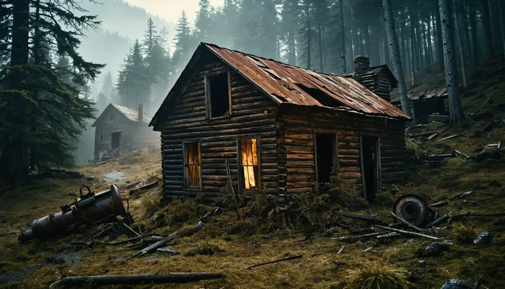
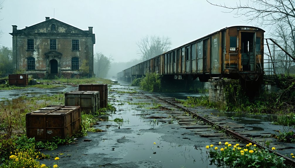
Coal and Logging Origins
Between the late 1700s and early 1900s, Garrett County’s rugged Appalachian terrain attracted waves of extractive industries that birthed dozens of settlements along the North Branch Potomac River. You’ll find coal mining camps like Vindex, Dodson, and Gleason emerged upstream from Bloomington through the 1950s, while lumbering operations carved out company towns deeper in the forests.
These weren’t democratically governed communities—corporate interests owned everything from housing to stores, leaving no room for elected officials. Workers frequently used scrip as currency at company stores, binding them economically to their employers.
Demographic shifts accelerated when timber depletion hit in the late 1800s, followed by coal exhaustion and the Great Depression’s crushing blow. Kempton’s 1913 establishment as a company town exemplified this boom-bust cycle. The catastrophic flood of March 1924 destroyed original structures across the region, forcing residents to rebuild or abandon their settlements entirely.
Meanwhile, historical preservation remains minimal—you’ll discover only cement foundations, collapsed tipples, and overgrown Fort Pendleton trenches marking these vanished industrial outposts.
Border Towns Near WV
While Maryland’s ghost towns scatter across multiple counties, Garrett County dominates this historical landscape with 19 of the state’s 43 documented abandoned settlements—roughly 44 percent of the entire total.
Several of these communities straddle the Maryland-West Virginia border along the North Branch Potomac River, creating shared industrial heritage sites now subject to environmental restoration efforts:
- Kempton – Coal town positioned directly on the state line
- Schell – Extends into Mineral County, West Virginia
- Wilson – Spans Grant County, WV and Garrett County, MD
- Border positioning – Facilitated dual-state resource extraction
- Railroad development – Served regional mining operations across both states
These border settlements emerged during 18th and 19th-century industrial expansion, then collapsed following resource depletion and the Great Depression.
Today, they resist urban redevelopment, remaining testament to Appalachian extraction economics.
Ghost Towns Scattered Across Other Maryland Counties
Maryland’s remaining counties harbor isolated ghost towns that lack the concentrated industrial ruins found in western mining regions but nonetheless preserve fragments of the state’s forgotten communities.
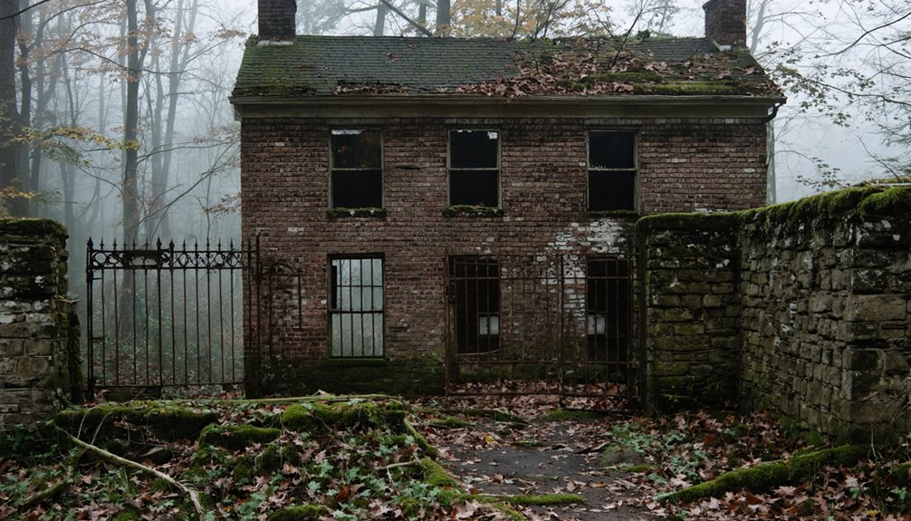
You’ll find Harford County’s Lapidum near Rock Run’s white flint mining operations along the Susquehanna River.
Howard County shares Daniels with Baltimore County—a true ghost town where forest reclaims flood-damaged structures and trails disappear into wilderness, exemplifying urban decay despite historical preservation efforts. The 1972 flood ultimately forced residents to abandon this once-thriving textile mill community.
Prince George’s County offers Good Luck and Fort Washington’s military relics, while Marshall Hall‘s 18th-century mansion ruins stand in Accokeek.
Queen Anne’s County holds Broad Creek, abandoned due to Chesapeake Bay proximity.
Somerset County contains Marion Station and nearly extinct Tulls Corner, both reflecting agricultural shifts that depopulated rural areas across Maryland’s coastal plains. Along the Wicomico River, Whitehaven sits 15 miles southwest of Salisbury, representing another faded settlement on Maryland’s southeastern tip.
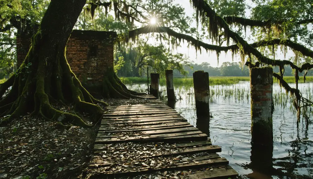
Historic Colonial and Port Settlements Lost to Time
Long before western Maryland’s industrial ghost towns materialized, the colony’s earliest settlements rose and vanished along Chesapeake Bay’s tributaries, leaving archaeological footprints where thriving ports once anchored Maryland’s tobacco economy.
Maryland’s earliest colonial ports rose and fell like tides, leaving only archaeological whispers of their tobacco-trading prominence.
You’ll find Maryland’s cultural heritage embedded in these vanished colonial centers:
- St. Mary’s City (1634-1694): First capital abandoned when Annapolis claimed governmental power
- London Town: South River port with 40-50 buildings serving 300-400 residents
- Oxford (1683): Talbot County’s global tobacco port along strategic waterways
- Early Baltimore Port: Original 1630s settlement relocated for inland access
- Kent and Palmer’s Islands: Frontier outposts consumed by boundary shifts
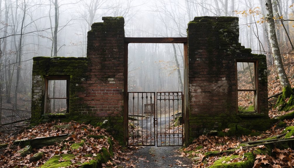
These sites face preservation challenges as residential development and agricultural use erase physical evidence. Unlike Western Maryland’s visible ruins, these colonial ghost towns exist primarily through archaeological investigation and archival documentation. Maryland Town, established by charter on August 8, 1729 and named after Cecilius Calvert, 2nd Lord Baltimore, represents another example of the colony’s evolving settlement patterns during this transformative period.
Appalachian Mining and Logging Communities That Vanished
You’ll find Maryland’s most concentrated ghost town cluster in Garrett County, where eleven coal-mining villages near the Potomac River headwaters rose and fell with the extractive industries of the 18th and 19th centuries. These company towns—like Kempton, which housed 900 residents in the 1930s, and Vindex with its school, churches, and now-vanished stores—thrived on coal, railroad, and iron operations until resource depletion and the Great Depression triggered their collapse.
Garrett County Coal Towns
Along the Potomac River’s eastern banks in Garrett County, dozens of coal towns emerged between the 1850s and early 20th century. Their existence was tied directly to the railroad’s penetration into western Maryland’s Appalachian highlands.
These company-controlled settlements housed immigrant laborers from Lithuania, Italy, Ireland, Wales, and Scotland who extracted coal from the Georges Creek basin.
The most significant communities included:
- Shallmar (Wolf Den Coal Company, 1917) – 500 residents, quality housing, closed 1949
- Kempton (Davis Coal and Coke Company, 1913) – 900 residents by 1930s, Mine No.42 shuttered 1950
- Vindex – Now reclaimed by vegetation, concrete stairs mark former company store
- Dodson – Methodist church and school abandoned after 1920s closures
- Gleason – Remote brick powerhouse remains on West Virginia border
Today, historical preservation efforts reveal scrip currency systems and acid mine drainage‘s lasting environmental impact, offering tourism development opportunities for those seeking authentic Appalachian heritage.
Logging Camps Economic Collapse
While coal extraction sustained Garrett County’s company towns through mid-century, timber operations throughout Maryland’s Appalachian highlands collapsed far earlier, leaving behind settlement patterns that vanished almost entirely from the landscape.
You’ll find that logging camps flourished between the 1880s and 1920s, when companies established temporary settlements that absorbed mountain populations who’d sold their timber rights. These operations trapped workers through scrip systems—company-issued currency worthless beyond camp boundaries—creating debt cycles that prevented economic freedom.
Resource depletion arrived swiftly; merchantable hardwood supplies exhausted within a decade. The economic decline accelerated after World War I, devastating communities dependent on timber wages.
When stocks crashed in 1929, remaining forest product markets collapsed completely. Companies simply relocated, abandoning workers and infrastructure across Maryland’s western mountains.
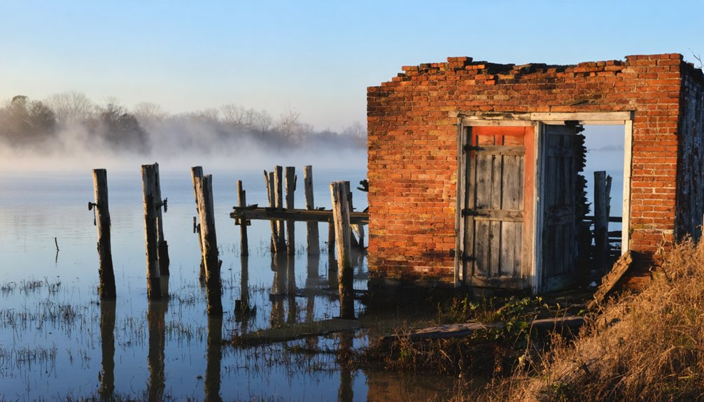
Military Installations and Canal Towns Left Behind
The Chesapeake and Ohio Canal‘s 184.5-mile route carved through Maryland’s landscape, leaving behind a network of settlements that thrived during the waterway’s operational years but withered after its abandonment.
The catastrophic 1924 flood destroyed lock masonry and bridges, prompting railroad owners to repair only Georgetown’s section. You’ll find remnants of this infrastructure decay at several sites:
- Four Locks Ghost Town, where houses stood until recently near the parking area
- Oldtown’s re-watered canal section, now Battie Mixon pond
- Williamsport Canal Basin, preserved by National Park Service
- Century-old aqueduct damage with temporary wooden repairs still visible
- Four Locks Schoolhouse on Four Locks Road
Preservation efforts have transformed these urban decay sites into historical touchstones.
Empty boats rotted where captains abandoned them after 1924, until the National Park Service assumed control in 1938.
How Maryland Compares to Other States Nationally
Maryland’s 15 to 20 documented ghost towns place it squarely in the lower third of national rankings, far behind the western states that dominate the ghost town landscape.
You’ll find Texas leading with 511 sites, California with 346, and Kansas with 308—numbers that dwarf Maryland’s modest count among the nation’s 4,530 mapped locations. Maryland ranks similarly to New York’s 14 abandoned settlements, positioning it just below Georgia and North Carolina’s 16 each.
This limited inventory hasn’t hindered tourism impact, as preservation efforts focus on quality over quantity. Unlike sprawling western territories where mining booms created hundreds of temporary settlements, Maryland’s concentrated geography and stable agricultural economy produced fewer abandoned communities.
Making each documented site historically significant for understanding regional development patterns.
Defining What Qualifies as a Ghost Town in Maryland
Classification of ghost towns in Maryland follows a five-tier system developed by researchers to account for varying degrees of abandonment and preservation. You’ll find these categories essential for understanding how rural depopulation and economic decline manifest across the state’s landscape.
The classification system includes:
- Barren Sites: Completely destroyed locations with only foundations remaining or submerged under dam reservoirs.
- Neglected Sites: Roofless ruins and rubble dominating the landscape in advanced disrepair.
- Abandoned Sites: Standing structures with no residents, where original economic purpose has ceased.
- Semi-Abandoned Sites: Few remaining inhabitants among largely vacant buildings.
- Historic Communities: Functioning settlements reduced to one-fifth or less of boom-era populations.
This framework allows you to evaluate Maryland’s ghost towns objectively, recognizing that abandonment exists on a spectrum rather than as absolute erasure.
Frequently Asked Questions
Can You Legally Visit and Explore Maryland’s Ghost Towns?
You’ll find freedom’s a double-edged sword here. Public regulations permit you to explore legally accessible ghost towns like St. Mary’s City through designated trails, while historical preservation laws strictly prohibit trespassing on hazardous sites like Glenn Dale Hospital.
What Caused Most Maryland Ghost Towns to Become Abandoned?
You’ll find flooding and infrastructure projects caused most abandonments, destroying communities for reservoirs and highways. Environmental relocations and industrial decline followed. These sites now hold historical preservation value and archaeological significance, documenting Maryland’s transformation through primary sources.
Are Any Maryland Ghost Towns Considered Haunted or Paranormal Locations?
Yes, you’ll find several Maryland ghost towns with haunted legends and paranormal sightings. Point Lookout’s former Civil War prison reports frequent encounters, while Baltimore-area sites document 69 combined sightings. Archival records connect these claims to historical tragedies at abandoned locations.
Which Maryland Ghost Town Is Easiest to Access for Tourists?
Point Lookout offers you the easiest tourist access among Maryland’s abandoned towns, featuring developed state park infrastructure, maintained facilities, and clear signage off Route 5. You’ll find documented historical markers and visitor amenities unlike remote ghost town sites.
Do Any Ghost Towns in Maryland Still Have Standing Structures?
You’ll find history frozen in time—many Maryland ghost towns preserve standing structures with remarkable historical preservation. Sites like Fort Carroll, Daniels, and Glenn Dale Hospital offer cultural significance, letting you explore authentic colonial-era buildings and abandoned facilities firsthand.
References
- https://en.wikipedia.org/wiki/List_of_ghost_towns_in_Maryland
- https://kids.kiddle.co/List_of_ghost_towns_in_Maryland
- https://chesapeake-inspired.com/top-haunted-towns-in-maryland/
- https://blog.batchgeo.com/ghost-towns/
- https://www.loveexploring.com/gallerylist/188219/the-us-state-with-the-most-ghost-towns-revealed
- http://freepages.history.rootsweb.com/~gtusa/usa/md.htm
- https://baltimorefishbowl.com/stories/marylands-spookiest-ghost-towns/
- https://www.geotab.com/ghost-towns/
- https://www.atlasobscura.com/things-to-do/maryland/abandoned
- https://www.youtube.com/watch?v=tsc-4AUSklY