You’ll find between 70 and 128 ghost towns scattered across Michigan, with the count varying based on whether you include complete abandonments, partial settlements, or shadow sites with only archaeological traces. The Upper Peninsula dominates this tally—particularly Keweenaw County‘s copper mining districts—while the Lower Peninsula contributes fewer logging and railroad communities. Classification systems range from well-preserved Class A sites to barely-visible Class E remnants, and the stories behind these vanished landscapes reveal Michigan’s boom-and-bust industrial heritage in unexpected detail.
Key Takeaways
- Michigan has approximately 70 to 128 ghost towns, depending on classification criteria used by different sources.
- One source documents 128 locations, while another verifies 73 mapped sites with on-site validation.
- The Upper Peninsula contains the majority, with nearly 100 ghost towns concentrated in former mining districts.
- Keweenaw County has the densest concentration, primarily from abandoned copper mining communities.
- Variations in counts stem from how sources distinguish complete ghost towns from partial or shadow sites.
Total Count of Ghost Towns Across Michigan
While determining Michigan’s exact ghost town count remains challenging, documented estimates range from 70 to 128 abandoned settlements depending on classification criteria and research methodology.
You’ll find one extensive source positioning Michigan as second nationally with 128 documented locations, while EagleEyeExplorer’s detailed mapping project catalogs 73 specific sites.
These variations stem from how researchers classify full ghost towns versus partial or shadow towns—distinctions that markedly impact final tallies.
The Upper Peninsula alone harbors nearly 100 abandoned settlements, concentrated primarily in former mining districts where historical architecture now crumbles under environmental impacts.
Keweenaw County represents the densest concentration, where copper boom towns met swift abandonment.
Resource depletion, railroad removals, and mill closures created these forsaken communities throughout the 19th and 20th centuries, leaving scattered remnants across logging corridors and lakeside properties for you to discover.
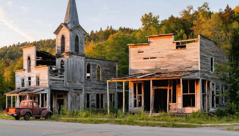
Among Michigan’s most notable abandoned settlements stands Fayette, once a bustling ironworks community that now serves as a preserved historical site showcasing the state’s industrial heritage.
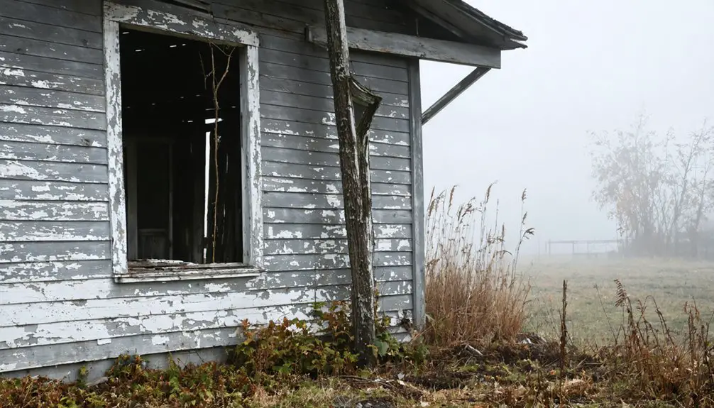
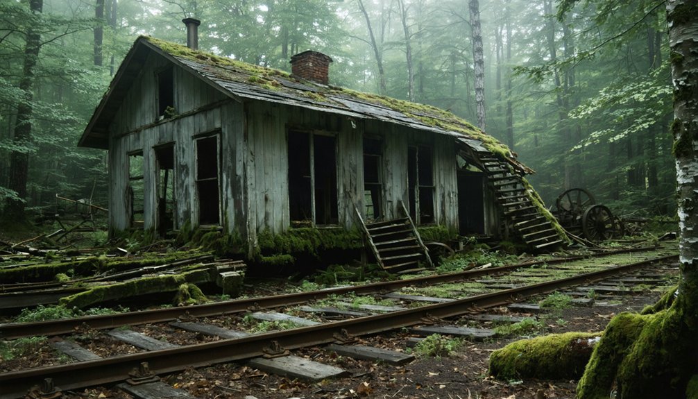
Michigan’s climate plays a key role in how these sites appear today, with weather conditions affecting preservation and leaving remnants often limited to chimneys, foundations, or single structures rather than intact villages.
The Copper Boom Legacy of Keweenaw Peninsula
The Keweenaw Peninsula’s copper deposits—formed over 1.1 billion years ago—created Michigan’s most concentrated cluster of ghost towns, particularly within Keweenaw County where mining operations defined settlement patterns from prehistoric times through the 1960s.
Ancient copper deposits spanning over a billion years shaped Michigan’s unique landscape of abandoned mining towns and forgotten settlements.
You’ll find abandoned infrastructure throughout communities like Gay, Mohawk, and Ahmeek, remnants of an industry that produced over 10 percent of world copper since 1843.
Copper mining peaked when Michigan led national production from 1847-1887, with operations like the Cliff Mine generating $2,519,000 in profits by 1870.
The Central Mine’s 1898 closure marked the beginning of widespread abandonment. By 1870, Central Mine alone sustained a population of 950, including Cornish immigrants who formed the backbone of the mining workforce before the site’s eventual demise.
Over 5,000 prehistoric mining pits reveal Indigenous extraction dating to 5000 BCE, while modern boom-and-bust cycles left behind stamping mills, shaft houses, and entire settlements across the peninsula’s rugged landscape. Ancient miners extracted over 1.5 billion pounds of copper between 3000 BCE and 1200 BCE, yet most of this prehistoric copper remains mysteriously unaccounted for in the archaeological record.
Mapping Michigan’s Abandoned Settlements
You’ll find EagleEyeExplorer’s extensive map documenting 73 ghost town locations across Michigan, with concentrations in the Upper Peninsula’s mining districts and Lower Peninsula’s logging corridors.
The geographic distribution reveals settlement patterns tied directly to resource extraction—copper veins in Keweenaw, iron ranges near Marquette, and pine forests throughout the north.
Most sites remain accessible via county roads and seasonal trails, though you should expect only foundations or single structures surviving Michigan’s harsh weather cycles.
These abandoned settlements include lumber boom towns from the 1800s that flourished briefly during periods of intense logging activity before timber depletion forced their abandonment or transition to other economies.
Several mining communities produced 300 million pounds of copper during their operational decades, with both Central Mine and Baltic reaching this milestone over 34-year periods before eventual closure.
EagleEyeExplorer’s 73 Plotted Locations
Through years of dedicated fieldwork, EagleEyeExplorer has documented 73 abandoned settlements across Michigan‘s landscape, creating what stands as one of the state’s most extensive ghost town archives. Each location received personal verification through on-site visits, with brief historical narratives capturing their stories before they disappear entirely.
These preservation efforts catalog three distinct categories:
- Complete ghost towns – fully abandoned settlements reclaimed by wilderness
- Partial ghost towns – locations with scattered remaining structures and occasional residents
- Shadow towns – evolving communities fading from collective memory
Industrial decline from logging and railroad withdrawal created most abandonments you’ll find plotted. Notable concentrations exist along historic transportation corridors, including a 25-mile stretch of M-28 between Seney and Shingleton that contains four documented ghost towns. The collection functions as both passion project and accessible resource, offering you freedom to explore Michigan’s forgotten spaces during any season. Michigan’s first copper boom peaked between 1850-1881, generating over 11 billion pounds of copper before leaving behind numerous abandoned mining settlements.
A forthcoming YouTube channel will expand documentation of these vanishing landscapes.
Geographic Distribution Patterns
Michigan’s ghost town landscape divides dramatically between its two peninsulas, with the Upper Peninsula hosting the vast majority of abandoned settlements due to its intensive extractive industries.
You’ll find over 70 documented locations concentrated in resource-heavy regions, particularly the Keweenaw Peninsula where mining relics cluster along Highway US-41.
Heat maps reveal this density pattern, showing copper boom towns like Central, Freda, and Cliff aligned with historic transport corridors.
The Lower Peninsula offers far fewer sites—primarily forest remnants from logging camps and railroad communities that vanished after resource depletion.
These distribution patterns trace directly to boom-bust cycles: where copper veins ran deep or timber stood thick, settlements emerged rapidly then disappeared just as quickly, leaving foundations and chimneys scattered across Michigan’s northern wilderness. Many settlements also included Native villages that predated European colonization and have since been lost to history. Some Michigan ghost towns maintain residual populations, with period structures still standing in semi-abandoned communities despite significant depopulation over the decades.
Accessibility and Visiting Tips
Planning your exploration of Michigan’s ghost towns becomes straightforward with digital mapping tools that pinpoint exact locations and filter sites by accessibility. EagleEyeExplorer’s interactive map plots 73 verified locations, while ghosttowns.com lists over 100 Michigan sites with visitability ratings. BatchGeo enables searching by city or zip code to find your nearest abandoned settlement.
Before venturing out, consider these essentials:
- Verify property boundaries to avoid trespassing on private remnants where urban decay meets current ownership.
- Visit during daylight hours when deteriorating structures and remote Upper Peninsula roads pose fewer hazards.
- Consult locals near sites for historical context and precise directions to foundations hidden among regrown forests.
Preservation efforts vary—some locations like Fayette maintain state park access, while others exist as single chimneys reclaimed by wilderness, rewarding those seeking unfiltered historical encounters.
What Qualifies as a Ghost Town
You’ll find Michigan’s ghost town classification depends on three distinct criteria: population loss thresholds, infrastructure dissolution, and physical abandonment levels. A settlement might qualify if it’s experienced a 64% population decline, lost its post office and local government, or deteriorated to just paved roads and a cemetery.
Michigan historians have developed a specific categorization system—ranging from barren to semi-abandoned sites—to document these varying degrees of abandonment across the state’s former communities.
Population Decline Thresholds
Consider these dramatic declines:
- Jennings plummeted 98%—from 2,000 timber workers to just 40 residents after Depression-era collapse.
- Keweenaw copper towns emptied following the catastrophic 1913 strike and subsequent mining failures.
- North Unity vanished entirely after the 1871 fire, forcing complete relocation to Shalda Corners.
Detroit’s 63.6% decline from 1,850,000 residents demonstrates vast majority loss, yet its 673,000 current population and active government disqualify it.
You’ll find strict definitions demand near-total community dissolution, not partial decline.
Types of Abandonment
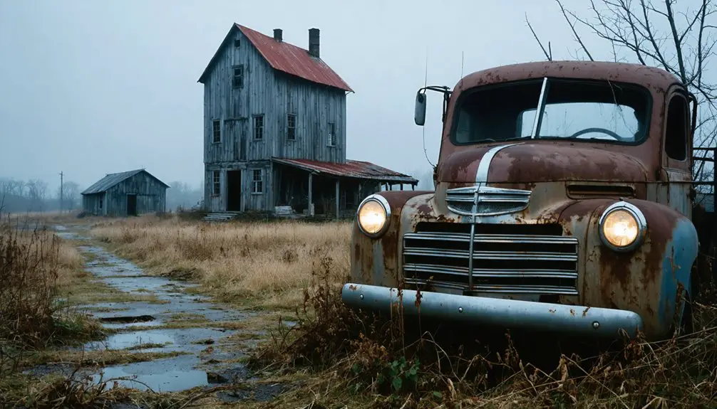
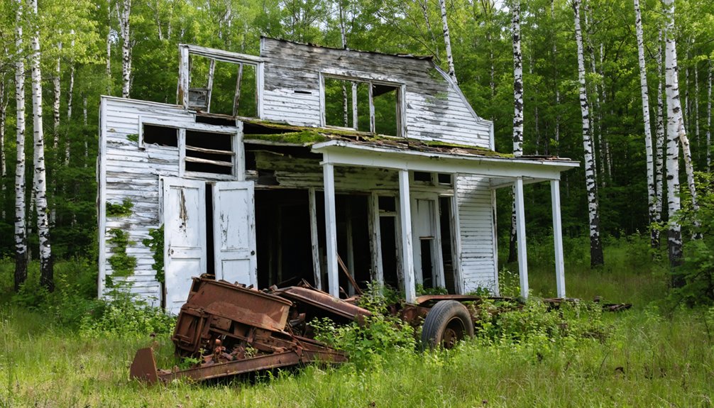
Michigan’s ghost towns emerge from distinct abandonment patterns, each leaving characteristic physical signatures across the state’s landscape. Economic decline dominates Michigan’s ghost town origins—lumber mills exhausted virgin forests, copper mines played out in the Upper Peninsula, and iron ore deposits depleted around former boomtowns. You’ll find towns where single-industry reliance proved fatal when resources vanished.
Natural disasters accelerated abandonment too. Floods devastated riverfront settlements, while mine subsidence created unstable ground beneath communities. Fire swept through wooden structures faster than residents could rebuild.
Human-caused factors transformed thriving settlements into empty shells. Railroad route changes isolated towns from commerce. Dam projects submerged entire communities. Industrial pollution poisoned land around smelters and factories. You’re witnessing Michigan’s documented exodus—population flight leaving behind foundations, main streets, and cemeteries marking where communities once flourished.
Michigan-Specific Classification Criteria
When determining whether a Michigan settlement qualifies as a ghost town, researchers apply a standardized classification system ranging from Class A through Class E, with no state-specific criteria deviating from the general definition.
You’ll find these categories assess physical remains rather than urban legends or folklore.
Historical preservation efforts focus on documenting:
- Complete abandonment sites where roofless ruins mark former commercial centers, their crumbled foundations barely visible through overgrown vegetation.
- Semi-deserted communities maintaining skeleton populations amid deteriorating storefronts and vacant homesteads.
- Faded settlements retaining diminished residents but preserving historic structures as community artifacts.
Michigan’s ghost towns don’t require unique qualifications beyond standard metrics measuring abandonment levels.
Whether you’re exploring Chesterfield Township’s forgotten hamlets or documenting vanished lumber camps, you’ll apply identical classification standards used nationwide, prioritizing tangible architectural evidence over romantic storytelling.
Logging and Railroad Communities That Vanished
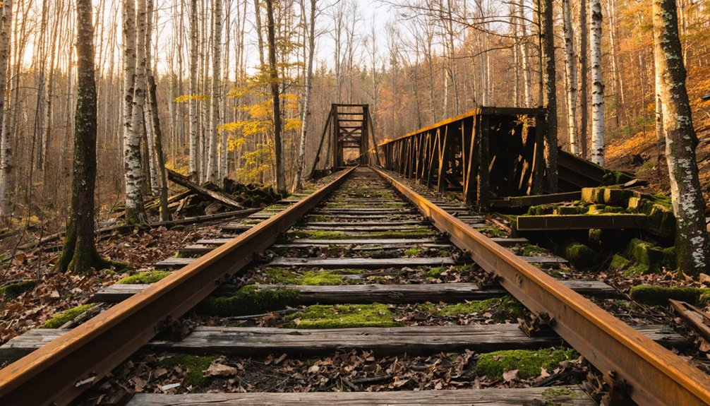
Between 1870 and 1930, Michigan’s vast timber resources fueled the establishment of hundreds of logging camps and railroad towns that would vanish as quickly as they appeared. You’ll find these communities followed a predictable 40-60 year cycle: sawmills processed every available tree, then operations ceased abruptly.
Crescent’s mill ran until 1915 when timber supplies were completely depleted. Workers dismantled equipment and transported it to new locations, leaving boarding houses and railroad sidings empty.
Historical preservation efforts now document these sites, though little remains beyond foundation ruins. Freda’s railroad tracks weren’t demolished until 1971, marking one final infrastructure removal.
Modern tourism has created interest in locating these vanished settlements, yet harsh weather and systematic dismantling erased most physical evidence of communities that once housed thousands.
Upper Peninsula’s Most Notable Ghost Towns
The Upper Peninsula harbors nearly 100 documented ghost towns, with the highest concentration stemming from the Keweenaw Peninsula‘s copper mining collapse and the logging boom‘s subsequent bust across Schoolcraft and Alger counties.
You’ll discover Keweenaw’s mining heritage through sites like Freda, Cliff, Central, and Delaware—settlements abandoned after the devastating 1913 strike and Great Depression decimated the one-industry economy.
Along M-28’s 25-mile stretch between Seney and Shingleton, four ghost towns await exploration:
- Creighton – Logging operation remnants connected to Walsh activities
- Pines – 1920s bar, grill, and general store complex that operated until the 1970s
- Star – Collapsing tourist cabins marking slow abandonment
Fayette State Park preserves Delta County’s industrial past, while Victoria’s ongoing restoration documents early copper extraction.
These sites intertwine mining heritage with Native legends across rugged terrain you’re free to explore.
Dollarville and the American Lumber Company Era
Among the lumber company settlements that dotted Luce County’s forests, Dollarville stands as a prime example of corporate town planning gone silent. You’ll find its remnants two miles west of Newberry, where the American Lumber Company established operations in 1882.
The settlement centered on Robert Dollar’s mill and general store along the Tahquamenon River, with the Detroit, Mackinac and Marquette Railroad providing essential connectivity to regional markets.
Dollar himself stayed just three years before California beckoned, yet his transportation legacy persists through the rail corridor that once bustled with lumber exports.
The post office’s 1919 closure marked industrial decline’s arrival.
Today you’ll discover scattered buildings reclaimed by forest—including a faded hunting lodge—where a company town once thrived on timber’s promise.
Ghost Towns of Sleeping Bear Dunes
When steamships dominated Lake Michigan commerce in the mid-1800s, cord wood operations transformed the Sleeping Bear Dunes coastline into a network of bustling settlements that would ultimately vanish with their industry.
The cord wood trade briefly ignited lakeside prosperity, only to leave behind empty settlements when the steamships stopped calling.
You’ll find these lost communities scattered throughout what’s now protected wildlife sanctuaries along the shoreline.
Three Ghost Towns That Defined the Region:
- Glen Haven – Wood dock settlement that expanded into a full town before automobile transportation isolated it by the 1930s
- Aral – 1880s lumber boom town where Otter Creek met Lake Michigan, now a popular swimming beach
- Burton’s Wharf – Mid-1830s deep-water harbor serving steamships between Chicago and Buffalo
Today’s preserved landscapes reveal farming relics and lumber infrastructure, offering glimpses into Michigan’s timber-driven past before resource depletion scattered these thriving communities.
North Manitou Island’s Abandoned Villages
You’ll find two distinct ghost town sites on North Manitou Island, each marking different chapters in Michigan’s lumber industry. The western shore holds Crescent Village’s remains, where the Smith and Hull Company operated a complete mill town from 1906 to 1915.
Before dismantling nearly everything after power loss emptied the settlement.
On the island’s eastern side, North Manitou Village preserves structures from the 1850s through the Life-Saving Station era, with historic pilings still visible where cordwood stations and lumber operations once dominated the shoreline.
Two Ghost Town Sites
The west side’s Crescent village has vanished completely. Once thriving from 1906-1915, nothing remains after Smith & Hull Company dismantled everything.
What you’ll discover:
- Weathered pilings jutting from Lake Michigan where Crescent’s dock once stood
- Scattered farm remnants and a cemetery marking the east settlement
- Bleached foundations where urban legends of lumber barons now echo through empty forests
Crescent Village on West
Crescent village rose and fell twice along North Manitou Island’s western shoreline, separated by three decades of silence. You’ll find the first Crescent Settlement emerged in the late 1860s around a timber dock, only to vanish when operations ceased in 1873.
The town’s second life began in 1906 when Smith & Hull Lumber Company purchased 4,000 acres and built infrastructure supporting the Lumber Industry—sawmills, a short-line railroad, and a 600-foot dock completed in 1908.
Mill-generated electricity powered every building, from the boarding house to the general store. When operations ended around 1915-1917, darkness consumed the town immediately.
Today you’ll discover nothing but archaeological sites within the wilderness, where crews dismantled everything worth salvaging.
Historic Pilings and Trails
Along North Manitou Island’s eastern shoreline, weathered pilings pierce the shallow waters where Nicholas Pickard’s cordwood station once thrived from the mid-1850s.
These bleached remnants mark former dock locations and the 1927 sawmill site, which still houses 1870s machinery—the island’s sole surviving timber operation.
Miles of wilderness trails lead you through this ghost settlement, connecting:
- The Life-Saving Station with its lighthouse ruins overlooking abandoned docks
- Cottage Row’s shuttered structures perched on windswept bluffs
- Homestead clearings dating to 1875, now reclaimed by forest
You’ll discover evidence of the logging boom that peaked in the 1830s—massive log piles photographed near the village dock around 1910.
The trails wind past crumbling foundations and the island cemetery, revealing how quickly civilization retreats when humans depart.
Exploring Remnants and Ruins Today
When venturing into Michigan’s ghost town sites today, you’ll find preservation levels ranging from well-maintained museum complexes to barely discernible foundation stones hidden beneath forest undergrowth.
Glen Haven’s functional blacksmith shop and Fayette Historic State Park’s iron smelting ruins represent successful preservation efforts, while ghost town myths about abandoned structures often obscure the reality that many sites exist solely as overgrown clearings marked by old apple trees.
You can explore Delaware Mine’s copper-era structures through guided tours or walk Bete Grise’s shoreline independently.
However, preservation challenges persist—deteriorating buildings, hidden mineshafts, and encroaching vegetation threaten historical integrity.
Before exploring, secure property permissions and consult EagleEyeExplorer’s detailed map detailing 73 documented locations.
Local Keweenaw residents offer invaluable historical context that archival records can’t capture.
Frequently Asked Questions
Are Michigan Ghost Towns Legally Accessible to the Public?
You’ll find many Michigan ghost towns legally accessible through public lands and heritage sites, though you must respect private property ownership. Always verify current access rights before exploring, as boundaries and regulations vary considerably by location.
What Safety Precautions Should Visitors Take When Exploring Ghost Towns?
You’ll need proper safety gear including sturdy boots and communication devices when exploring Michigan’s 70+ ghost towns. Always respect historical preservation efforts, travel in groups through remote Upper Peninsula sites, and inform locals of your plans before venturing out.
Can You Camp Overnight Near Michigan’s Ghost Town Sites?
You’ll find legitimate camping at Sleeping Bear Dunes National Lakeshore near Glen Haven’s ghost town, plus lodging at Laurium Manor’s preserved site. However, unauthorized access to ruins risks damaging historical preservation efforts—stick to established campgrounds surrounding documented locations.
Which Ghost Town Has the Most Preserved Buildings Remaining?
Port Oneida Village stands as the crown jewel of historical preservation, where you’ll discover 121 abandoned structures across nearly 2,000 acres—the nation’s largest National Rural Historic District, offering unmatched freedom to explore Michigan’s authentic past.
Do Any Ghost Towns Offer Guided Tours or Historical Markers?
You’ll find guided tours at Laurium Manor’s 45-room mansion and Sleeping Bear Dunes’ ghost towns with interpretive markers. The Calumet Theatre offers haunted legends alongside theatrical history, while Central Mine’s abandoned structures reward overnight explorers seeking authentic Upper Peninsula mining heritage.
References
- https://www.youtube.com/watch?v=7-vjuqiGWJU
- https://wgrd.com/michigan-ghost-town-map/
- https://99wfmk.com/michigan-ghost-town-gallery/
- https://www.nps.gov/slbe/learn/historyculture/ghosttowns.htm
- https://www.geotab.com/ghost-towns/
- https://lostinmichigan.net/category/ghost-towns/
- https://en.wikipedia.org/wiki/List_of_ghost_towns_in_Michigan
- https://www.loveexploring.com/gallerylist/188219/the-us-state-with-the-most-ghost-towns-revealed
- https://www.nailhed.com/2017/10/the-ghost-town-that-moved.html
- https://www.theinnatstonecliffe.com/blog/prehistoric-copper-heist-the-vanished-billions-of-the-keweenaw-peninsula