You’ll find between 500 and 1,200 ghost towns scattered across Nevada, depending on which classification criteria experts apply. Travel Nevada officially documents over 600 sites, while researcher Shawn Hall catalogs more than 1,200 using broader standards that include short-lived mining camps. The discrepancy stems from differing definitions—some require former postal services and businesses, while others accept any failed settlement with archaeological traces. These abandoned towns span 21+ counties, with Nye County alone containing over 2,200 mapped locations from Nevada’s mining boom-and-bust cycles that shaped the state’s settlement patterns.
Key Takeaways
- Official estimates range from 500 to over 1,200 ghost towns in Nevada, with Travel Nevada reporting more than 600 sites statewide.
- Discrepancies in counts result from varying definitions, including criteria for population size, postal service, businesses, and remaining physical structures.
- Shawn Hall documents over 1,200 sites using broader criteria, while expert Tammy estimates approximately 800 ghost towns in Nevada and Eastern Sierra.
- Ghost towns are spread across 21+ counties, with Nye County featuring over 2,200 mapped sites and high concentrations in northern regions.
- Accurate counts are challenged by submerged sites, archaeological traces, inaccessible remote locations, and differing classification standards for abandoned versus semi-abandoned towns.
The Challenge of Counting Nevada’s Ghost Towns
Determining the exact number of ghost towns in Nevada presents a methodological challenge that has produced estimates ranging from approximately 600 to over 1,200 abandoned settlements.
You’ll find this discrepancy stems from conflicting classification criteria among researchers.
The Nevada Ghost Towns & Mining Camps list identifies 600 sites, while author Shawn Hall’s broader standards documented over 1,200.
Without standardized definitions, you’re left navigating inconsistent thresholds for abandonment levels, population requirements, and physical remains.
Some catalogers demand complete desertion; others accept skeleton populations.
T. Lindsay Baker’s framework requires economic purpose extinction—critical for understanding cultural significance.
The distinction between fully and semi-abandoned settlements remains contentious, complicating preservation efforts.
Physical evidence standards vary drastically: some researchers accept cemetery remains alone, while others mandate substantial standing structures for inclusion.
These sites became abandoned due to economic failure following mine closures and resource depletion across the state.
Online resources have exponentially expanded the list, making comprehensive documentation increasingly complex for researchers attempting to catalog Nevada’s historic sites.
What Qualifies as a Ghost Town in Nevada
Nevada’s ghost town classification hinges on three competing definitional frameworks that establish fundamentally different thresholds for inclusion.
Stan Paher’s criteria standards demand 25 residents, a business, and postal delivery—excluding temporary settlements while cataloging 600 sites.
Paher’s rigorous threshold—25 residents, active commerce, mail service—deliberately filters transient camps while documenting six hundred qualifying Nevada locations.
T. Lindsay Baker’s town classification requires the original economic purpose to have vanished, accepting skeleton populations if tangible remains exist for public observation.
Western Mining History adapts Baker’s framework, focusing on mostly-abandoned places where economic activity failed.
You’ll find 90% of Nevada’s cases stem from mining collapse.
Sites range from standing ruins like Rhyolite to foundation remnants and cemeteries.
Virginia City’s thriving status disqualifies it, while inhabited locations earn honorary designation.
These competing definitions make definitive counting impossible without declaring your methodological allegiance.
Remote locations with harsh desert conditions and severe weather patterns accelerated the abandonment process once economic viability disappeared.
Plymouth, Montserrat serves as the only ghost town that functions as a capital of a modern political territory, evacuated in 1995 due to volcanic eruption.
Official Estimates and Expert Opinions
Documented counts vary from 500 to 1,200+ depending on whose methodology you’ll accept as authoritative. Travel Nevada reports more than 600 ghost towns statewide, while author Shawn Hall documents over 1,200 sites.
Stan Paher’s stricter criteria—requiring 25 residents, businesses, and postal delivery—yields fewer qualifying locations, though his documented list supports 160+ verified sites.
Expert Tammy records approximately 800 across Nevada and the Eastern Sierra using inclusive parameters.
These discrepancies stem from definitional rigor rather than disputed facts.
Historical preservation standards conflict with broader cataloging efforts that include short-lived camps and mining strikes.
Visitor accessibility to remote sites complicates verification, as many locations exist only as archaeological traces. Some documented settlements like Callville remain submerged underwater beneath Lake Mead, making comprehensive counts even more challenging. Approximately 90% of Nevada’s ghost towns are linked to historic mining activities that drove the state’s early settlement patterns.
You’ll find consensus that Nevada leads all states in abandoned settlements, but exact totals remain contested territory among researchers and adventure seekers alike.
The Mining Boom That Created Hundreds of Abandoned Towns
When placer gold appeared in streams near Dayton in 1849, prospectors couldn’t have anticipated the cascade of mineral discoveries that would blanket Nevada with hundreds of settlements over the next century.
The 1859 Comstock Lode sparked Virginia City’s explosive growth, where mining technology advanced rapidly to extract silver from unprecedented depths.
You’ll find this pattern repeated throughout Nevada’s boom-bust cycles: Tonopah’s 1900 silver strike, Goldfield’s 1901 gold rush, and the 1965 Carlin Trend discovery each generated new towns.
When production peaked and declined—as Comstock did after 1877, or when silver prices collapsed in 1893—entire communities emptied within months.
The industry shifted focus during 1924–1964 towards base metals, petroleum, and industrial minerals, creating new mining centers while earlier precious metal towns declined.
Small settlements that emerged along wagon routes during the 1800s laid the groundwork for many of these mining camps before they developed into organized communities.
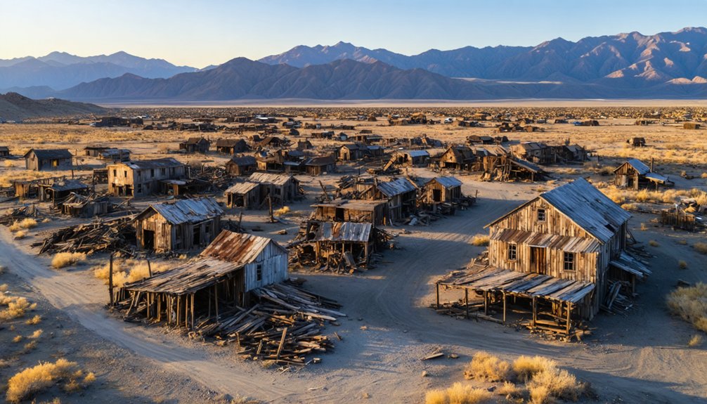
Today, ghost town preservation efforts document these abandoned settlements, physical evidence of Nevada’s unrestricted mining frontier where fortune-seekers established autonomous communities wherever mineral wealth surfaced.
Famous Nevada Ghost Towns Worth Visiting
Among the hundreds of settlements that emptied during Nevada’s mining collapses, five ghost towns maintain sufficient infrastructure and historical significance to warrant visitor attention.
Nevada’s mining boom left behind hundreds of abandoned settlements, but only five ghost towns retain enough structure and history to merit exploration today.
Top documented sites you’ll encounter:
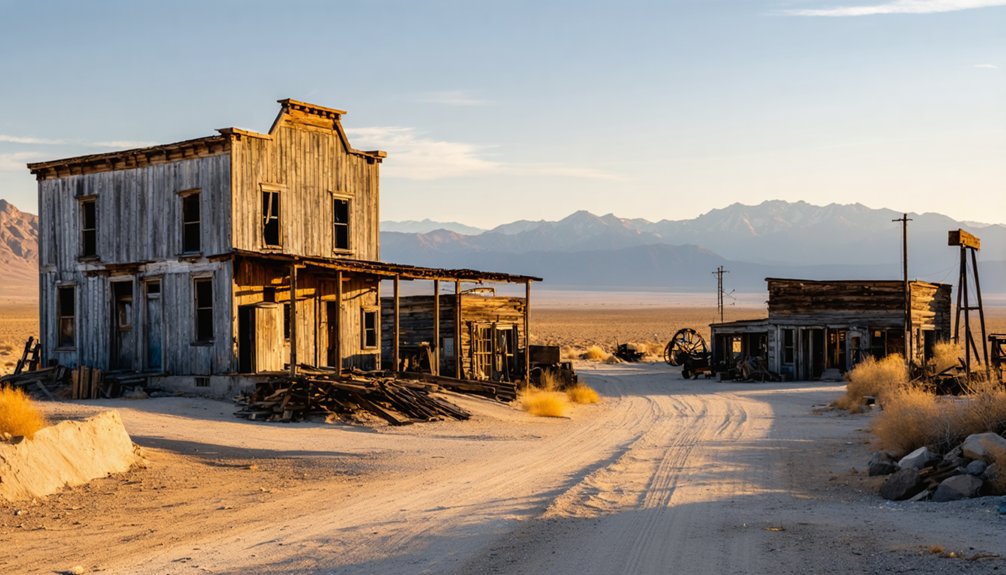
- Rhyolite – This photographer’s destination peaked at 5,000 residents with 50 saloons before mines closed by 1910. You’ll find the train depot alongside the open-air museum featuring Ghost Rider and 12 Apostles sculptures.
- Gold Point – Rebuilt cabins and saloons showcase golden-era artifacts. You can book paranormal-themed tours at this ghost hunting hotspot where paranormal sightings attract investigators.
- Pioche – Silver boom violence created ghost town legends here. Visit Boot Hill Cemetery, the Million Dollar Courthouse, and the haunted Overland Hotel & Saloon.
Jarbidge and Belmont offer additional exploration opportunities, with structures dating 150+ years preserving Nevada’s documented mining heritage. Fort Churchill, established after the Pyramid Lake War in 1860, now operates as a Nevada State Park where you can explore restored military buildings and pioneer history exhibits. Berlin features a preserved 30-stamp mill alongside old miner cabins and a machine shop, while the Fossil House displays the world’s largest Ichthyosaur fossils collection.
Geographic Distribution Across Nevada Counties
You’ll find Nevada’s ghost towns distributed across 21+ counties. With northern regions showing particularly high concentrations due to 19th-century mining booms.
Nye County—the third-largest county in the contiguous United States at 18,000 square miles—requires subdivision into four geographic sections to catalog its extensive sites. This includes remote locations like Batty situated 120 miles northwest of Las Vegas.
Northern counties including Elko, Eureka, Lander, and White Pine feature dedicated listings with numerous documented mining camps. Even smaller counties like Esmeralda and Humboldt contribute isolated remnants to the statewide total of 600-1,200 ghost towns.
Northern Nevada’s Concentration
Northern Nevada’s dominant concentration includes:
- Elko County sites: Aura (operating 1906-1921), Spruce Mountain, and Jarbidge represent mining revivals from 1905-1906 boom periods.
- Pershing County locations: Star City, semi-abandoned Unionville, and neglected Sulphur function as accessible tourist attractions.
- White Pine operations: Ruth and Treasure City served as northern mining hubs with extensive documentation.
This regional clustering reflects cattle ranching expansion and post-1900 mining revivals, creating over 2,200 mapped points of interest where isolation protected sites from modern development.
County-Specific Notable Sites
Nevada’s county-by-county distribution reveals distinct settlement patterns shaped by localized mineral discoveries and transportation corridors.
Churchill County’s Stillwater (1862) and White Plains (1879-1909) demonstrate early agricultural-mining synergy, while Pershing County’s Scossa (1931-1937) represents Nevada’s last major mining camp before federal restrictions curtailed prospecting freedom.
Clark County’s rapid failures—San Juan abandoned weeks after its 1862 founding, Saint Joseph burned 1865-1868—contrast with Nye County’s sustained operations like Tybo’s silver-lead extraction and Berlin’s preserved structures showcasing historical preservation efforts.
Washoe County’s Washoe City (1860-1910s) remains largely neglected despite its cultural significance as an early territorial hub.
You’ll find Nye County contains the most documented sites, with Belmont serving as second county seat while maintaining partial habitation, illustrating Nevada’s complex seamless from frontier territories to administrative jurisdictions.
The Rise and Fall Timeline of Nevada’s Mining Camps
When the Comstock Lode was discovered in 1859, it triggered the first major silver rush in United States history and set in motion a pattern of boom-and-bust cycles that would define Nevada’s settlement for over a century.
You’ll find Nevada’s mining camps followed distinct chronological waves:
- 1860s-1870s Peak Era: Comstock production reached maximum output in 1877. Mining technology advanced rapidly as the transcontinental railroad completion in 1869 enabled heavy equipment transport. Settlement architecture evolved from tents to permanent structures in camps like Pioche, where 72 killings preceded the first natural death.
- 1900s Tonopah-Goldfield Revival: Jim and Belle Butler’s 1900 discoveries launched major resurgence, establishing new camps including Gold Reed, Golden Arrow, and Silverbow.
- 1965-Present Modern Mining: Carlin Trend’s first gold bar marked industrial-scale operations.
Living Ghost Towns vs. Completely Abandoned Sites
Among Nevada’s 600+ documented ghost towns, preservation states vary dramatically between sites that retain permanent residents and those left entirely to the elements. You’ll find living ghost towns like Goldfield (234 residents) and Goodsprings (229 residents) maintaining historic structures—the 1907 courthouse, Santa Fe saloon—while supporting full-time populations far below their peaks.
Belmont never fully emptied after its 1865 silver strike. Conversely, completely abandoned sites like Rhyolite showcase arrested decay: crumbling banks, train depots, and the restored Bottle House stand unpopulated since 1920’s 14-resident low point.
Preservation efforts distinguish these categories, with some living examples functioning as museums. Urban legends surround violent histories—Pioche’s first 72 deaths were murders—yet documented records reveal economic collapse, not folklore, drove most abandonments across Nevada’s mining-dependent settlements.
Resources for Documenting and Exploring Nevada’s Ghost Towns

You’ll find Nevada’s ghost towns documented across three primary resource categories: printed reference guides and digital databases, specialized travel platforms with mapped coordinates, and firsthand explorer documentation through video channels and research blogs.
Nevada Ghost Towns & Mining Camps serves as the foundational print resource, while Forgotten Nevada and Nevada Expeditions provide exhaustive online databases with site-specific historical records.
Explorer-generated content from multi-year documentation projects offers visual evidence and accessibility assessments that supplement archival sources.
Books and Online Databases
For researchers and explorers documenting Nevada’s ghost towns, Stan Paher’s “Ghost Towns & Mining Camps of Nevada” remains the foundational reference guide, offering all-encompassing monographs on abandoned settlements and mining operations spanning 1850-1950. These print resources provide historical accuracy through county-organized documentation, enabling systematic investigation without digital constraints.
Digital databases complement physical archives:
- Wikipedia’s alphabetical listings catalog founding and abandonment dates across Nevada’s counties.
- Forgotten Nevada’s database indexes over 800 locations with verified historical narratives addressing preservation challenges.
- Regional photograph collections document architectural features and “arrested decay” phenomena for comparative analysis.
You’ll find county-specific breakdowns facilitate autonomous exploration planning across Nevada’s 20 mining regions. These resources enable independent verification of settlement patterns, mining operations, and boom-and-bust cycles without gatekeepers controlling access to historical data.
Travel Websites and Maps
Interactive mapping platforms have transformed ghost town documentation, with the Nevada Ghost Towns interactive map providing photographs and historical records for over 500 Nevada and California sites.
You’ll find satellite-based mapping enabling detailed zoom capabilities across 125+ documented ghost towns, revealing structural layouts and ruins.
GIS analysis documents 400+ California narratives while combined Nevada resources catalog 725 ghost towns plus stage stations.
These platforms preserve cultural significance through 552 photographs and 71 color maps documenting everything from emigrant trails to abandoned railroads.
Nevada’s dry climate creates arrested decay, though preservation challenges persist across thousands of structures.
You can coordinate exploration itineraries using alphabetical county listings, regional top-10 recommendations, and search functionality.
Touch-screen interfaces support independent route planning across Nevada’s expansive ghost town geography spanning from Reno to Las Vegas.
Explorer Videos and Blogs
Explorer-produced video documentation and digital narratives provide systematic coverage of Nevada’s 600+ ghost towns, with contributors like Tammy having documented 800 sites across Nevada and the Eastern Sierra region through platforms such as Nevada Ghost Towns and Beyond.
You’ll discover detailed field research through these methodologically-rigorous resources that catalog cultural heritage sites ranging from photographed destinations like Rhyolite to lesser-known mining camps.
Key Documentation Resources:
- Video chronicles – 10:31-minute explorations covering 90% mining-linked settlements, including 4-hour journeys to unlabeled sites.
- Reference integration – 212 verified locations from Stan Paher’s Nevada Ghost Towns & Mining Camps, expanded through Nevada Expeditions and Forgotten Nevada.
- Living ghost towns – Population-14 Midas and dozen-resident Jarbidge, plus haunted legends at Goldfield Hotel.
These platforms enable autonomous exploration planning across thousands of documented historical sites.
Frequently Asked Questions
Are Nevada’s Ghost Towns Safe to Explore on Your Own?
You’ll need serious safety precautions when exploring independently—unstable structures, abandoned mines, and remote locations pose real dangers. Historical preservation laws also restrict access to some sites. Research conditions thoroughly, bring proper gear, and never enter buildings or mine shafts alone.
Can You Legally Take Artifacts From Abandoned Ghost Town Sites?
No, you can’t legally take artifacts from Nevada’s ghost towns. Artifact removal from federal, state, or private lands without permits violates ARPA and state statutes, risking fines up to $20,000 and imprisonment—regardless of a site’s abandoned status.
Which Nevada Ghost Town Is the Most Photographed?
Frozen in time, Rhyolite stands as Nevada’s most photographed ghost town. You’ll find photography hotspots like the iconic Cook Bank building and Tom Kelly Bottle House, where haunted history meets architectural preservation. It’s officially designated Nevada’s most photogenic ghost town.
Do People Still Live in Any of Nevada’s Ghost Towns?
Yes, you’ll find residents in several Nevada ghost towns like Jarbidge and Goldfield, where locals maintain historical preservation of mining structures while sharing local legends. These communities document authentic heritage, letting you experience genuine Old West freedom and autonomy.
What’s the Best Time of Year to Visit Nevada Ghost Towns?
You’ll find ghost town gold during spring (March-May) and fall (September-November), when seasonal weather delivers comfortable 50-80°F temperatures. These best travel months offer supreme road access, fewer crowds, and ideal conditions for documenting Nevada’s abandoned heritage independently.
References
- https://nvtami.com/2024/01/15/how-many-ghost-towns-are-in-nevada/
- https://en.wikipedia.org/wiki/List_of_ghost_towns_in_Nevada
- https://www.visittheusa.com/experience/6-nevada-ghost-towns-explore-if-you-dare
- https://travelnevada.com/ghost-town/
- https://www.youtube.com/watch?v=kg18CwWeMnc
- https://www.discovernorthamerica.co.uk/nevada-destination/discover-nevadas-ghost-towns/
- https://nvtami.com
- https://www.youtube.com/shorts/32Cp6UJglsI
- https://westernmininghistory.com/664/what-is-a-ghost-town-wmh-town-classifications-explained/
- https://travelnevada.com/nevada-magazine/ghost-town-primer/


