You won’t find an exact count since defining “ghost town” varies wildly—flooded reservoir villages, evacuated toxic sites, and forest-reclaimed mining camps all qualify differently. Researchers estimate New York harbors anywhere from dozens to over a hundred abandoned settlements. Ulster County alone lost at least nine communities to the Ashokan Reservoir between 1907 and 1915, while places like Tahawus, Doodletown, and Love Canal tell their own stories of industrial collapse and disaster. The state’s documentation remains fragmented, though preservation advocates continue uncovering sites hidden beneath water and wilderness.
Key Takeaways
- No official count exists; Wikipedia lists some county-by-county, while Geotab surveyed 3,800 ghost towns nationally without New York specifics.
- Notable sites include Doodletown, Tahawus, Letchworth Village, North Brother Island, and Love Canal, each with unique abandonment histories.
- Ashokan Reservoir construction flooded 12,000 acres, destroying West Hurley and other hamlets, displacing approximately 500 homes and entire communities.
- Urban ruins like Buffalo’s Silo City and abandoned World’s Fairgrounds reflect industrial decline and entertainment history from past eras.
- Abandonment causes include economic shifts, infrastructure projects, resource depletion, and environmental hazards like toxic waste dumping.
Conflicting Counts: What Different Sources Say About New York’s Ghost Towns
Determining how many ghost towns actually exist in New York depends entirely on which source you consult—and that’s where the trouble begins.
Wikipedia offers incomplete county-by-county lists without totals, cataloging places like Shavertown, now submerged beneath Pepacton Reservoir.
Geotab’s national database researched over 3,800 ghost towns across America but provides no specific New York figure.
The Lincoln Institute focuses on urban decay metrics, tracking declining zip codes in western New York through housing unit losses rather than counting abandoned settlements.
Meanwhile, historical preservation advocates wrestle with defining what qualifies: Does a flooded hamlet count? What about towns absorbed into neighboring communities? Online resources like Ghosttowns.com and Home Town Locator document settlements such as Reynoldston, Waterville, and Brownsville, though many entries lack comprehensive historical context. New York’s deep historical roots and numerous older buildings also contribute to its reputation for paranormal activity, with some abandoned sites becoming destinations for ghost hunters.
You’ll find pandemic-era references muddying the waters further, with Times Square labeled a “ghost town” during lockdowns—a metaphorical use that conflates temporary emptiness with permanent abandonment.
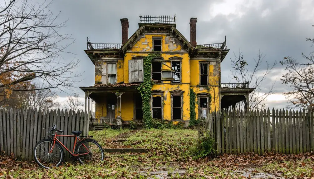
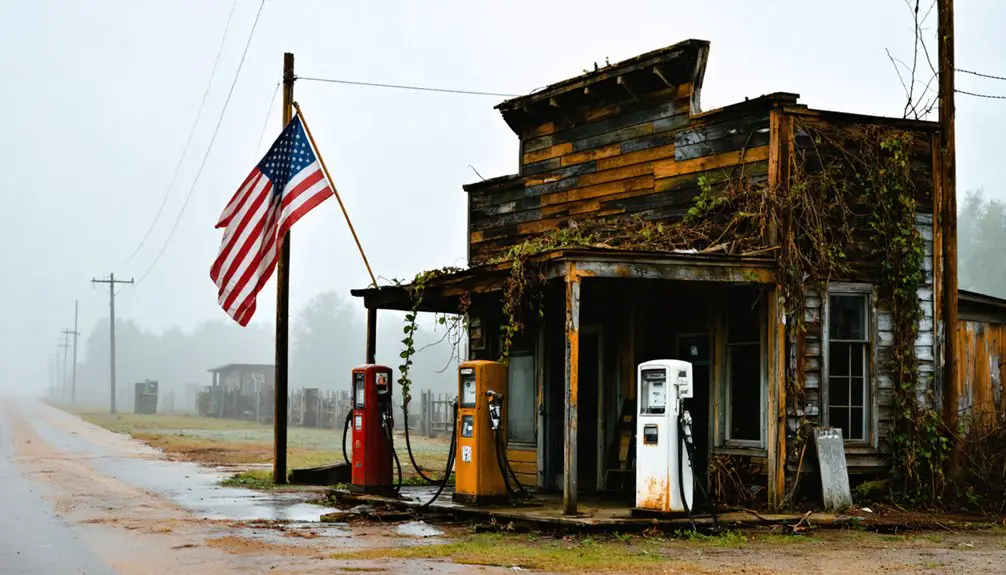
The Most Well-Known Abandoned Settlements Across the State
While archivists debate definitional boundaries, certain New York settlements have captured the public imagination precisely because their ruins remain tangible—you can still walk their overgrown streets, photograph their crumbling facades, and trace the foundations of lives once lived.
These ruins offer something archival records cannot—the visceral experience of touching history’s physical remnants yourself.
Doodletown near Bear Mountain offers labeled home sites from its 1762 settlement.
Tahawus presents rusting mining machinery reclaimed by Adirondack forest, balancing exploration with archaeological challenges.
Letchworth Village’s sprawling campus attracts photographers despite building restrictions.
North Brother Island’s quarantine pavilions document societal isolation practices, though access remains limited.
Love Canal stands as environmental disaster monument—evacuated, restricted, desolate.
Buffalo’s Silo City showcases towering concrete grain elevators that dominated the waterfront for decades before abandonment.
The Abandoned World’s Fairgrounds in Flushing Meadows-Corona Park preserve futuristic pavilions and crumbling towers from the 1964-65 exposition that once drew over 50 million visitors.
Each site presents unique historical preservation tensions: encouraging public engagement while protecting fragile remains.
These locations transcend mere abandonment; they’re outdoor museums where you directly encounter forgotten communities without institutional gatekeeping.
Ulster County’s Submerged and Forgotten Communities
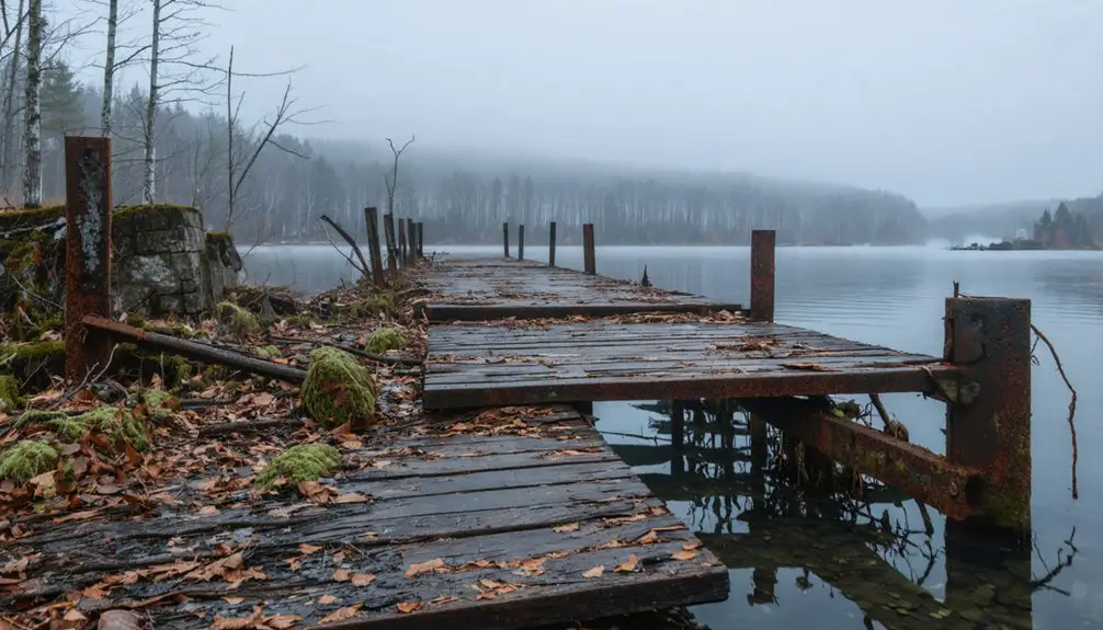
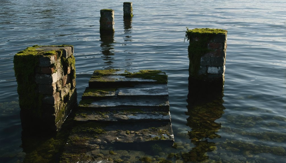
You’ll find Ulster County’s most dramatic ghost towns beneath the Ashokan Reservoir, where West Hurley and three other hamlets were deliberately flooded after New York City condemned 12,000 acres starting in 1908.
The reservoir’s construction destroyed approximately 500 homes and forced residents to accept fixed compensation rates the city set—often below market value—before workers burned their emptied properties.
Beyond the waterline, forgotten communities like Brownville and Potterville joined the ranks of Ulster’s ghost towns.
While 160 demolished buildings within the reservoir’s take line still stand as accessible ruins above the water, these settlements reveal infrastructure remains that include houses, storefronts, and roads frozen in time.
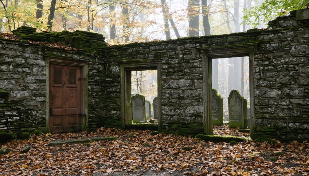
The displacement also required relocating 245 burials from 19 Olive cemeteries to Bushkill Cemetery, where uniform marble gravestones bear alphanumeric codes rather than the names of those laid to rest.
West Hurley Reservoir Drowning
Between 1907 and 1915, New York City’s relentless demand for water erased nine hamlets from Ulster County’s landscape. You’ll find West Hurley’s Bishop Falls now rests 180 feet underwater—a stark reminder of reservoir impact on thriving communities.
Over 500 homes, churches, schools, and businesses vanished beneath the 8,315-acre Ashokan Reservoir.
Community displacement devastated thousands who’d worked bluestone quarries and farmland settled since the early 1700s. The area’s local cheese production—with pot cheese being particularly abundant—contributed to the region’s economy before submersion. Families hired lawyers and fought eminent domain through 90 court cases—nearly half dismissed without compensation.
You can imagine their desperation watching generational properties disappear while legal fees mounted. The construction required 2,800 bodies reinterred from 32 cemetery sites, including many Revolutionary War soldiers whose final resting places were moved to accommodate the flooding.
Today’s reservoir supplies New York City with 600 million gallons daily. But beneath those waters lie Shokan, Ashton, Glenford, and six other hamlets—ghost towns drowning in progress’s wake.
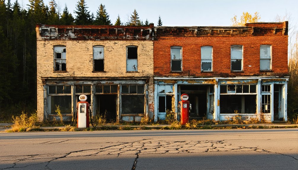
Brownville’s Mining Era End
Water wasn’t the only force erasing Ulster County’s settlements. You’ll find Brownville’s ghost in the abandoned lead mines that riddled Wawarsing’s mountains.
The Ulster Mine near Ellenville operated before 1650, leaving behind massive underground voids—some measuring 200 feet long—before closing in 1932. Mining history here tells a story of perpetual failure: operators worked one shaft for forty years without profit, while another opened in 1837 only to abandon hope entirely.
The abandoned infrastructure stretched beyond lead. Shawangunk millstone quarries shipped 350 tons annually through the D&H Canal until railroads crushed that trade.
Communities like Quarryville and Unionville depended entirely on extraction industries. When profits vanished, so did the towns. Mining regulations in California’s Brownsville District restricted claims to 150 square feet, far smaller than typical operations elsewhere. Milling ore typically yielded between 1/7 to 1/3 ounce of gold per ton, though high-grade pockets occasionally rewarded persistent prospectors. Today, those open stopes remain—cathedral-sized monuments to economic collapse, forgotten beneath mountain laurel.
Mining Booms and Busts: Towns That Disappeared When Resources Ran Out
When iron ore gleamed along the Upper Hudson’s banks in 1826, Archibald McIntyre and David Henderson couldn’t have predicted their discovery would birth one of New York’s most dramatic tales of boom and bust. Their Adirondack Iron Works thrived until 1857, when titanium impurities rendered the ore worthless for iron production.
You’ll find Tahawus experienced abandonment twice—first in 1858, then again in 1989 after titanium mining ceased. This mining history created a complete community with 16 dwellings, a blast furnace, and the Adirondacks’ first bank, all swallowed by wilderness.
Today’s ghost town preservation efforts let you explore remnants freely. The Open Space Institute‘s 2003 purchase opened trails to the 50-foot blast furnace, while interpretive signs mark where prosperity once echoed through these now-silent mountains.
Reservoir Construction: How Water Projects Swallowed Entire Villages
While mining communities vanished when veins ran dry, New York City’s insatiable thirst drowned entire valleys on purpose. Between 1907 and 1941, you’d witness 25 Catskill communities erased—four towns submerged, eight relocated for Ashokan Reservoir alone. Steam whistles blared one hour, signaling your valley’s execution.
They displaced 5,500 people and exhumed 2,500 bodies from 32 cemeteries for $15 per grave. Brown’s Station ceased existing entirely. Neversink, Pepacton, Rock Rift—gone. Italian immigrants and Southern laborers razed your homes and forests with such violence that NYC formed its own police force to control camp brawls.
Today’s historical preservation efforts remain minimal. You’ll find foundations visible at low water, accessible from bridges since 9/11 restrictions killed archaeological efforts. Roadside signs mark what bureaucrats stole for Manhattan’s faucets.
Tragic Abandonments: Love Canal and Other Disaster-Driven Evacuations
Between 1942 and 1953, Hooker Chemical Company dumped 21,000 tons of industrial waste—including dioxin and twelve known carcinogens—into an abandoned canal in Niagara Falls. They capped it, sold the land for one dollar, and a school district built directly atop this toxic time bomb.
Twenty-one thousand tons of poison buried, capped, and sold for a dollar—then crowned with a schoolyard full of children.
By 1978, chemical drums surfaced. Children played in contaminated puddles. Environmental hazards percolated through basements.
Dr. Beverly Paigen documented devastating birth defects and miscarriages among families. President Carter declared the first-ever federal emergency for a man-made disaster.
Urban decay took a haunting form: 400 purchased homes demolished, entire neighborhood rings evacuated. The state spent $15 million relocating 240 families initially, then more.
You’ll find few ghost towns more unsettling than one poisoned by corporate negligence, where government intervention meant erasing communities from existence.
Hudson Valley’s Vanished Communities and Where to Find Their Remains
Not all New York ghost towns met their end through poison or catastrophe—some simply faded as the world moved on, their residents scattered by economics, reservoir projects, and the quiet erosion of rural life.
You’ll find Doodletown’s thirty-plus labeled foundations in Bear Mountain State Park, where hikers explore what became New York’s most famous abandoned settlement. Kensico and West Hurley lie underwater—drowned villages sacrificed for New York City’s thirst. Their stories survive only in historical accounts, fueling urban legends about submerged church steeples.
Oswego hamlet vanished near LaGrange without trace, while Pottersville’s ruins off Lundy Road bear witness to 1927 floods and darker histories. Preservation efforts focus on accessible sites like Doodletown, though its schoolhouse fell to vandals in 1980—proof that documenting these places matters before they disappear completely.
Frequently Asked Questions
Can You Legally Visit and Explore New York’s Ghost Towns?
You can legally explore several New York ghost towns like Doodletown and Tahawus, where historical preservation efforts welcome urban exploration. However, you’ll face restrictions at private properties and submerged sites, so always research access rights beforehand.
Are Any Ghost Town Buildings Still Standing and Accessible Today?
You’ll find abandoned structures still standing at several sites. Tahawus preserves the most intact historical landmarks, while Pottersville’s ruins remain accessible off Lundy Road. Doodletown’s labeled foundations and Trapps Mountain Hamlet offer tangible connections to New York’s forgotten past.
Do People Still Own Property in These Abandoned New York Towns?
You’ll find property owners remain in several abandoned New York towns, though historic preservation restrictions often limit development. Private holdings exist at sites like Parksville and Pottersville, yet contamination concerns and reservoir boundaries severely complicate property resale opportunities.
Which New York Ghost Town Is Easiest to Visit for Beginners?
You’ll find Doodletown easiest—it’s got marked trails and thirty-plus interpretive signs guiding you through preservation efforts. Despite haunted legends swirling around abandoned foundations, the maintained paths and clear access from Route 9W make exploring straightforward and rewarding.
Are There Guided Tours Available for New York’s Ghost Towns?
You won’t find formal guided tours at New York’s ghost towns—they’re self-guided adventures respecting historical preservation. You’ll explore abandoned architecture independently, though North Brother Island requires special permission. It’s your journey through these forgotten places at your own risk.
References
- https://hudsonvalleypost.com/new-york-state-is-home-to-nearly-20-ghost-towns/
- https://lite987.com/11-ghost-towns-new-york-state/
- https://en.wikipedia.org/wiki/List_of_ghost_towns_in_New_York
- https://www.ghosttowns.com/states/ny/ny.html
- https://www.youtube.com/watch?v=nHpIme6oa-c
- https://www.onlyinyourstate.com/experiences/new-york/ghost-towns-ny
- https://www.atlasobscura.com/things-to-do/new-york-state/ghost-towns
- https://943litefm.com/abandoned-ghost-towns-new-york/
- https://www.geotab.com/ghost-towns/
- https://secretnyc.co/ny-ranked-most-haunted-state-2025/