North Carolina contains between 14 and 17 documented ghost towns, depending on how you define complete abandonment versus seasonal or partial habitation. You’ll find the highest concentration—three towns—in Carteret County along the coast, while five cluster within 50 miles of Asheville in the western mountains. These settlements vanished due to dam construction that submerged entire communities, catastrophic hurricanes like the 1899 San Ciriaco storm, Civil War violence, and economic collapse from resource depletion. The stories behind each abandonment reveal distinct patterns across North Carolina‘s diverse landscapes.
Key Takeaways
- North Carolina has approximately 14-17 documented ghost towns, with variations due to differing definitions of abandonment and habitation status.
- Carteret County contains the highest concentration with three ghost towns, while five cluster within 50 miles of Asheville.
- Counts exclude settlements primarily known for ghost stories rather than actual historical abandonment or decline.
- Towns were abandoned due to hydro projects, natural disasters, resource depletion, industry closures, and war events.
- Notable ghost towns include Brunswick Town, Portsmouth Village, Lost Cove, and submerged communities under Fontana and Norman Lakes.
Counting North Carolina’s Abandoned Settlements
Determining exactly how many ghost towns exist in North Carolina proves surprisingly difficult due to inconsistent documentation and varying definitions of abandonment. You’ll find approximately 14 ghost towns identified through state records, while national rankings list 16, and Wikipedia’s incomplete catalog shows 17.
These discrepancies stem from debates over what constitutes true abandonment versus seasonal habitation or partial submersion. Carteret County claims the highest concentration with three documented ghost towns, while five cluster within 50 miles of Asheville.
The counts don’t include settlements shrouded in urban legends or those famous primarily for ghost stories rather than historical abandonment. Your research reveals that hydro energy projects, industrial closures, natural disasters, and Civil War events created most abandonments, though some origins remain mysterious—like Roanoke Colony’s vanished settlers. Resource depletion also contributed significantly to town abandonment throughout North Carolina’s history, particularly affecting mining and timber communities. Some towns met immediate demise, such as Buffalo City, which was killed off overnight when a successful Federal raid permanently shut down its moonshine operations.
Brunswick Town: A Revolutionary War Casualty
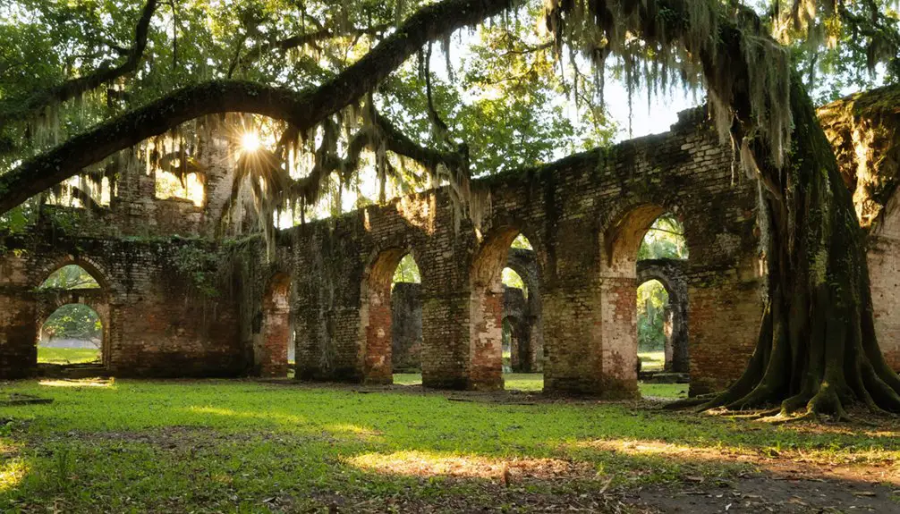
Among North Carolina’s documented ghost towns, Brunswick Town stands as perhaps the most historically significant, its abandonment directly linked to Revolutionary War violence rather than economic decline or natural disaster.
Founded in 1726 by Colonel Maurice Moore, this Cape Fear River port served as a vibrant colonial capital showcasing impressive Colonial architecture before patriots there defied British authority.
Brunswick Town flourished as a prosperous colonial port with grand architecture until Revolutionary defiance sealed its fate.
You’ll find its Revolutionary history began dramatically in 1766 when residents placed Governor Tryon under house arrest during Stamp Act protests—one of America’s first violent resistance acts.
British forces retaliated in spring 1776, burning Russellborough mansion and most structures. The town was attacked under orders from generals Clinton and Cornwallis, who directed troops to set fire to Brunswick as punishment for colonial resistance. Inhabitants fled in 1775, and only two families returned afterward.
At its peak in 1772, the port had handled 147 arriving ships, reflecting its importance as a commercial hub for tobacco, lumber, and naval stores before its destruction.
By 1830, the entire site sold for $4.25.
Confederate earthworks later preserved archaeological remains beneath Fort Anderson‘s fortifications.
Ghost Towns Beneath the Lakes
While most ghost towns succumb to economic collapse or natural disasters, North Carolina’s 20th-century hydroelectric ambitions deliberately erased entire communities beneath manmade reservoirs.
You’ll find Judson and Proctor ghost towns submerged under Fontana Lake after the 1940s dam construction flooded Swain County’s mountain settlements. Lake Glenville similarly consumed an entire community, relocating residents to higher ground.
Lake Norman conceals the 1800s Superior Yarn Mill village, where 50 families once thrived with homes, stores, and a post office. The village included Long Island Mill, which was built in the 1800s before the lake’s formation.
Jordan Lake’s depths hide abandoned homesteads and graves in New Hope Valley. Displaced residents were promised a 30-mile road for cemetery access, but only 6 miles were completed, leaving the remaining parts of Proctor accessible only via trails in Great Smoky Mountains National Park.
This submerged architecture remains largely inaccessible except during extreme droughts or through scuba diving.
State-sanctioned lake preservation policies prioritized electricity generation over these communities, creating North Carolina’s most unusual ghost towns—ones you can’t visit without diving equipment.
Mill Villages and Industrial Relics
North Carolina’s industrial ghost towns emerged not from flooding but from economic forces that rendered entire mill communities obsolete.
Economic collapse, not natural disaster, left North Carolina’s mill towns abandoned—entire communities rendered obsolete when industry moved on.
You’ll find the state’s textile and lumber heritage preserved through industrial archaeology at sites like Coleridge, where the Enterprise Manufacturing Company’s 1880s-1920s architecture earned National Register designation in 1976.
Hyde County’s lumber boomtowns—Burrell, Makleyville, and villages along Scranton and Slade Creeks—vanished after forest depletion converted lands to farmland.
Rotersville, situated on a sandy ridge northeast of Lake Mattamuskeet in the 1920s, maintained a 7.5-mile logging road connecting its sawmill and company store to the Intracoassal Waterway for barge transport.
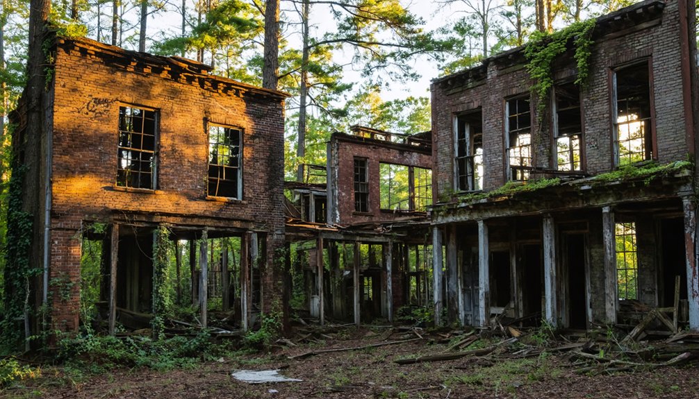
Preservation efforts saved twenty of Henry River Mill Village’s thirty-five worker cottages, now earmarked for tourism development.
Around Forest City, communities like Spindale, Caroleen, and Henrietta became near-ghost towns following mill closures.
At Coleridge, workers transitioned from self-sufficient farming to mill-dependent lives in company-built wooden row houses clustered on small lots near the textile operations.
Franklinville’s company store transformed from 1884 retail space to laundry, then machine shop before fire destroyed it in 1986, illustrating these settlements’ fragile existence.
Diamond City: When Nature Reclaims the Coast
At the eastern end of Shackleford Banks, Diamond City grew from a small settlement called Lookout Woods into the largest community on Cape Banks by the late 19th century, reaching 300 to 500 residents who built houses from shipwreck lumber and sustained themselves through fishing.
A series of devastating hurricanes between 1878 and 1899—culminating in a Category 3 storm on August 17, 1899—destroyed the maritime forest and buried the landscape in sand, making the coastal environment uninhabitable.
Beginning with William Henry Guthrie’s departure and continuing through 1901-1902, residents loaded their salvaged houses onto sailboats and relocated to Harkers Island, abandoning Diamond City entirely by 1902. Unlike Dymond City, which declined after timber was depleted and new transportation routes emerged, Diamond City’s abandonment was triggered by natural disaster rather than economic shifts. Today, no bridges connect the former settlement site to the mainland or Cape Lookout National Seashore, leaving only graveyards and house sites as remnants of the once-thriving community.
Thriving Fishing Village Origins
Long before Diamond City earned its evocative name in 1885, the settlement known as Lookout Woods thrived on the eastern end of Shackleford Banks as the largest community between Cape Lookout and the wider Banks area.
You’ll find its origins intertwined with lighthouse history—the black and white diamonds painted on Cape Lookout Lighthouse inspired the renaming. The seafood economy drove everything: shore-based whaling stations positioned near the Gulf Stream’s migration path, fishing operations producing excellent salted mullet, and boat building workshops lining the shore.
By 1895, roughly 500 residents sustained themselves through this maritime independence. They built homes from beach-racked lumber, cultivated gardens in thick woods, and raised livestock.
The whaling industry’s 1850s boom particularly fueled rapid growth, establishing Diamond City’s reputation as a self-sufficient coastal stronghold.
1899 Hurricane Devastation
This maritime prosperity would face its ultimate test on August 16, 1899, when the San Ciriaco Hurricane barreled toward the North Carolina coast with winds reaching 140 mph. The Category 3 storm delivered unprecedented destruction through a catastrophic dual-water assault.
Northeast winds first drove Pamlico Sound waters across Shackleford Banks, then shifted southwest, pushing Atlantic Ocean surges over the dunes. Two opposing water masses converged on Diamond City, drowning livestock, destroying fishing fleets, and scattering caskets across the landscape.
With barometric pressure plummeting to 28.55 inches and water covering entire islands, survivors confronted total economic collapse. This final blow forced permanent relocation to Harkers Island and mainland communities.
Today, maritime archaeology and cultural preservation efforts document this abandoned settlement, now part of Cape Lookout National Seashore.
Mass Relocation to Safety
Within days of the San Ciriaco hurricane‘s devastating assault on August 17, 1899, Diamond City’s residents faced an irreversible decision: abandon their ancestral settlement or risk annihilation in the next storm. William Henry Guthrie led the exodus, dismantling his home and sailing it across the sound to safer ground.
You’ll find remarkable community resilience in how 300-500 residents systematically relocated entire structures between 1899-1902, transforming Harkers Island from 28 families to nearly 200. They practiced historical preservation through action, loading sailboats weekly with dismantled houses, salvaged materials, and even family remains from five cemeteries.
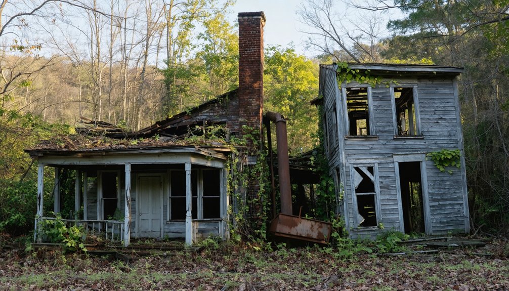
Western Mountains: Where Most Ghost Towns Hide
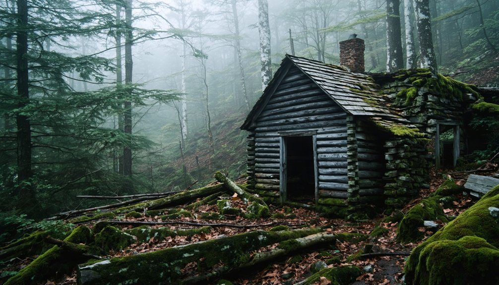
You’ll find the densest concentration of North Carolina’s ghost towns clustered in the western mountain region, where geographic isolation and economic dependence on single industries created vulnerable communities. Lost Cove exemplifies this pattern—founded in the 1860s across 350 acres of dense forest within what’s now Pisgah National Forest.
The settlement sustained itself through timber harvesting and moonshine production for nearly a century. When timber supplies depleted and train service ceased in the mid-1950s, the remote Yancey County location couldn’t support its remaining population, leading to complete abandonment.
Pisgah National Forest Sites
Deep in the rugged terrain of Pisgah National Forest, North Carolina’s western mountains conceal a concentration of abandoned settlements that tell stories of boom-and-bust industries from the early twentieth century. Mortimer thrived as a lumber town before fire and floods destroyed it in 1916 and 1940.
You’ll find remnants like foundations and a cemetery near Wilson Creek, a 24-mile National Wild and Scenic River supporting backcountry exploration.
Lost Cove in Yancey County flourished through moonshining and logging until its last family departed in 1957. Cultural Preservation efforts by SAHC removed one ton of debris before transferring 95 acres to the U.S. Forest Service in 2017.
These sites now protect endangered plants while offering you unrestricted access to history’s Ecological Significance through hiking trails and riverside camping.
Lost Cove’s 350 Acres
Perched above the Nolichucky River in Yancey County’s Poplar Gorge, Lost Cove‘s 350 acres occupy one of North Carolina’s most isolated mountain landscapes at coordinates 36°4′15″N 82°24′08″W.
You’ll find this legendary ghost town accessible only by foot through Pisgah National Forest‘s rugged terrain, where it’s remained deserted for over six decades.
The site encompasses forested perch land that once supported 100 residents through logging, railroading, and moonshine production.
Mystery legends surround the settlement’s high-quality moonshine operations, with tales of underground tunnels used to evade revenue agents during Prohibition.
Today, you can explore three remaining houses, Tipton Chapel’s ruins, and a cemetery among stone chimneys—vestiges of nearly 100 years of determined mountain living that ended in 1957 when the last family departed.
Carteret County’s Coastal Abandoned Communities
Along North Carolina’s treacherous Outer Banks coastline, Portsmouth Village stands as Carteret County’s most historically significant abandoned settlement. Founded in 1753 on Portsmouth Island, this bustling port south of Norfolk peaked at nearly 700 residents by 1860.
The reopening of Hatteras Inlet in 1846 devastated the shipping industry, forcing residents elsewhere.
Civil War impacts accelerated decline when Union soldiers occupied and targeted the village, displacing families who never returned.
By the late 1800s, Portsmouth transformed from a major port to a fishing village.
Relentless hurricanes destroyed infrastructure, washing away cisterns and fences while earning surrounding waters the nickname “graveyard of the Atlantic.”
The post office closed in 1959.
Visiting North Carolina’s Ghost Town Ruins Today
North Carolina’s abandoned settlements offer varying degrees of accessibility, from protected heritage sites to hazardous ruins requiring permission.
You’ll find Fort Dobbs operates as a fully reconstructed historical preservation site with interactive 1750s exhibits.
While Cape Lookout Village remains under National Park Service protection, it is accessible via passenger ferries during warmer months.
Henry River Mill Village requires checking current access rules following recent ownership changes, though its Hunger Games filming location status has spawned urban legends among fans.
Buffalo City presents the most challenging exploration—you’ll need a kayak to paddle over submerged streets where alligators now reign.
Lost Cove’s remnants hide within Pisgah National Forest’s dense wilderness, demanding serious backcountry navigation skills.
Always verify permissions before visiting these time-frozen settlements.
Frequently Asked Questions
Are There Any Ghost Towns in North Carolina That Are Privately Owned?
Yes, you’ll find several privately owned ghost towns in North Carolina. Henry River Mill Village operates under private ownership with access restrictions, while Balsam Mountain Preserve’s development covers Ruby City’s former site, limiting your exploration freedom considerably.
What Caused the Most Ghost Town Abandonments in North Carolina Overall?
Economic decline caused most North Carolina ghost town abandonments overall. You’ll find resource depletion from exhausted mines and logged forests triggered initial departures, but broader economic shifts—failed industries, flooding projects, and isolation—ultimately displaced the largest number of communities.
Can You Stay Overnight in Any North Carolina Ghost Towns?
You’ll find “haunted accommodations” at Henry River Mill Village, where overnight tours let you experience preserved mill houses firsthand. This National Register site welcomes those seeking authentic exploration of North Carolina’s abandoned textile heritage beyond conventional tourist restrictions.
Are North Carolina Ghost Towns Protected by Historic Preservation Laws?
You’ll find legal protection varies by site—Brunswick Town has state historic designation, Henry River Mill’s on the National Register, and Cape Lookout enjoys federal seashore status. Historical preservation laws apply selectively, not universally across all ghost towns.
Which North Carolina Ghost Town Was Abandoned Most Recently?
Land of Oz theme park was abandoned most recently among North Carolina’s historic landmarks. You’ll find it closed in the 1980s—unlike abandoned mining communities or mill towns that emptied decades earlier. Its structures still stand for your exploration today.
References
- https://en.wikipedia.org/wiki/List_of_ghost_towns_in_North_Carolina
- https://www.youtube.com/watch?v=dk0S8fYv9dQ
- https://kids.kiddle.co/List_of_ghost_towns_in_North_Carolina
- https://theseahawk.org/13566/culture/declining-carolina-the-up-and-coming-ghost-towns-of-north-carolina/
- https://www.visitnc.com/list/ncs-mysterious-disappearances-and-abandoned-places
- https://www.geotab.com/ghost-towns/
- https://www.onlyinyourstate.com/experiences/north-carolina/nc-ghost-towns
- https://www.loveexploring.com/gallerylist/188219/the-us-state-with-the-most-ghost-towns-revealed
- https://www.heritagedaily.com/2021/03/brunswick-town-the-abandoned-colonial-town-in-north-carolina/138101
- https://amrevnc.com/brunswick-town/