You’ll find dramatically different counts of Oklahoma’s ghost towns depending on your source—ranging from 236 cataloged sites to approximately 2,000 vanished communities documented throughout the state’s history. The discrepancy stems from varying definitions: some researchers count only sites with visible structures or ruins, while others include any community with discontinued post offices or significant population decline. Pushmataha County alone holds 13 recognized ghost towns, from short-lived Gee to decades-old Kosoma. Understanding what counts as “abandoned” reveals Oklahoma’s complex settlement patterns.
Key Takeaways
- Oklahoma has approximately 236 cataloged ghost towns, though estimates range from 240 to 2,000 depending on definitions and criteria used.
- Pushmataha County contains Oklahoma’s highest concentration with 13 recognized ghost towns, including Kosoma, Jumbo, Gee, and Zoraya.
- Discrepancies in counts arise from varying definitions, with some requiring visible structures while others include any ceased community activity.
- Towns were abandoned due to resource depletion, railroad routing changes, natural disasters, environmental contamination, and economic decline.
- Major ghost towns include Picher, evacuated in 2009 for toxicity, and Ingalls, famous for the Dalton gang shootout.
Counting Oklahoma’s Lost Communities: The Numbers Vary Widely
When you start counting Oklahoma’s ghost towns, the numbers tell different stories depending on who’s doing the tallying. BatchGeo estimates over 240 abandoned communities, while the Encyclopedia of Oklahoma History identifies approximately 2,000.
OnlyInYourState concurs with that higher figure, and Rootsweb’s compilation documents 359 towns through discontinued postmarks alone.
This variation stems from different definitions—some count only vanished settlements, others include towns with 80% population decline or unused remains.
You’ll find disagreement on whether places like Texola, with 20-30 residents among dozens of empty buildings, qualify as ghost towns.
The criteria matter for cultural preservation efforts and potential urban redevelopment projects. These classifications range from barren ghost towns with no remaining structures to neglected sites that still retain buildings but lack populations. Over one-third of the 359 recorded towns with stamped postmarks are now considered ghost towns. Whether it’s 240 or 2,000, Oklahoma’s landscape holds remarkable evidence of communities that once thrived, then faded when economic circumstances shifted.
What Qualifies as a Ghost Town in Oklahoma?
The discrepancy in Oklahoma’s ghost town counts stems directly from how researchers define these abandoned places.
You’ll find some authors like T. Lindsey Baker consider any town where “the reason for being ceased” as qualified, while others demand visible structures or archaeological evidence.
Schmidt’s classification system offers five categories ranging from barren sites to historic communities, helping you distinguish between completely vanished settlements and partially occupied ones.
The Morris Criteria focuses specifically on Oklahoma, identifying places with 80% population decline from peak levels.
Historical documentation reveals over 2,000 potential ghost towns statewide, though this varies based on whether you’re counting foundation remnants, standing buildings, or just cemetery plots as sufficient proof of former habitation.
Many of these abandoned settlements emerged during oil boom periods, when towns could develop practically overnight following resource discoveries.
Extensive research compiled in Ghost Towns of Oklahoma published in 1978 and *Here Today* in 2024 provides comprehensive documentation of these vanished communities.
The Leading Causes Behind Town Abandonment
You’ll find that Oklahoma’s ghost towns didn’t disappear randomly—they fell victim to three primary forces that reshaped the state’s settlement patterns.
Economic collapses following resource depletion, railroad companies’ routing choices that determined commercial viability, and nature’s destructive power through floods and tornadoes created the abandoned landscapes you can still explore today.
These factors, documented in territorial records and county archives, reveal how quickly a thriving community could transform into a collection of empty buildings and overgrown streets.
Liquor towns along the Indian Territory boundary flourished briefly until the 1907 statehood law made Oklahoma a dry state, eliminating their primary economic purpose.
Violence also contributed to town decline, as outlaw gang shootouts with U.S. Marshals marked the beginning of the end for communities like Ingalls in 1893.
Economic Boom and Bust
Across Oklahoma’s landscape, dozens of once-thriving communities rose and fell with the fortunes of their natural resources.
You’ll find Picher’s story particularly striking—founded in 1913 after zinc and lead discoveries. Its population swelled beyond 9,000 by 1925. Workers flooded in, mines expanded underground, and prosperity seemed endless.
Then reality hit: decades of extraction depleted the deposits, triggering mining decline throughout the 1920s-30s.
Oil boomtowns followed similar trajectories. Santa Fe thrived from 1921-1950 before its fields ran dry, leaving only skeletal rigs behind. Rising operational costs and international competition accelerated closures.
The environmental impact proved devastating—Picher earned the label “America’s most toxic town,” forcing residents to flee contamination. By 1983, the EPA designated it a Superfund site due to extensive lead and zinc pollution.
Without economic diversification, these communities couldn’t survive resource exhaustion, condemning them to abandonment. Highway construction further isolated many struggling towns, as interstate bypasses rerouted travelers away from populations under 50,000, eliminating the traffic that once sustained local diners and gas stations.
Railroad Routing Decisions
When railroad companies wielded absolute power over commerce in territorial and early statehood Oklahoma, their routing decisions determined whether communities prospered or perished. Railroad influence reshaped the landscape dramatically—the Missouri, Kansas and Texas Railroad bypassed Boggy Depot and North Fork Town in 1872, erasing their relevance as trade centers. Town rivalries intensified these outcomes.
In Tillman County, Frank Kell routed his line two miles from Eschiti, establishing Kell City instead. Cross Oklahoma lost its depot battle to Ponca City and vanished. Parkersburg’s 700 residents relocated en masse to Clinton in 1904 when two railroads intersected there.
You’ll find these patterns repeated across Oklahoma: companies consolidated routes, merged systems, and eliminated stops like Avery, leaving elevated rail grades as monuments to communities that couldn’t survive being bypassed. The Oklahoma Central Railway, which served towns including Lehigh, Vanoss, and Byars after its 1905 construction, saw much of its line dismantled in the 1930s following its merger into Santa Fe. These abandoned railway beds remain visible today as straight routes cutting through the prairie, silent testimony to the transportation networks that once sustained now-vanished towns.
Natural Disaster Devastation
While railroad companies controlled commercial fate through deliberate routing choices, Oklahoma’s ghost towns also fell victim to forces beyond human calculation. You’ll find Picher’s devastation particularly striking—an EF-4 tornado with 165 mph winds leveled 150 homes in 2008, killing six residents. Yet nature merely accelerated what underground mine collapses had started.
By 2006, 159 structures faced subsidence risk from collapsing tunnels. Contaminated groundwater from abandoned mines poisoned Tar Creek, creating a 1979 superfund site. Drought effects and wildfires progression compounded these disasters across other settlements.
When federal buyouts began post-tornado, over 200 families evacuated. Schools closed by 2009. Today, Picher stands empty—a symbol of cumulative catastrophes where human exploitation met nature’s wrath, sealing one town’s irreversible fate.
Pushmataha County and Other Ghost Town Hotspots

You’ll find Pushmataha County holds Oklahoma’s highest concentration of documented ghost towns, with communities like Jumbo, Kosoma, Sardis, Zoraya, and Nolia scattered across its rugged southeastern terrain.
The county’s abandoned settlements reflect the boom-and-bust cycles of asphalt mining, timber extraction, and agricultural displacement that defined the region’s early twentieth-century economy.
Meanwhile, the Norman area and other population centers across the state harbor their own clusters of forgotten communities, each telling distinct stories of Oklahoma’s territorial and statehood eras.
Pushmataha County Leads Statewide
Pushmataha County claims the title of Oklahoma’s ghost town capital, with 13 documented abandoned communities scattered across its southeastern landscape—more than any other county in the state.
You’ll find these settlements arose from different economic waves, leaving behind mining relics and traces of forgotten railroad routes that once promised prosperity.
Key Pushmataha County Ghost Towns:
- Kosoma (1888-1954) – One of the oldest, with residential structures still standing after 66 years of operation.
- Jumbo (1906-1950s) – Mining town that collapsed when ore deposits depleted.
- Gee (1909-1911) – Remarkably short-lived, lasting just two years before complete abandonment.
- Zoraya (1905-1919) – Maintained a post office for 14 years before residents departed.
These sites represent Oklahoma’s 236 cataloged modern ghost towns, though historians estimate 2,000 communities have vanished throughout state history.
Norman Area Ghost Towns
Beyond Pushmataha County’s concentrated cluster, Oklahoma’s ghost town landscape spreads across diverse regions, with the Norman area serving as a strategic vantage point for exploring central Oklahoma’s vanished settlements. You’ll find Warren Cemetery’s preserved grounds documenting early farmland communities that disappeared after the Land Run era.
Norman artifacts from trading posts and institutions like High Gate Academy reveal how settlements evolved before statehood. Within striking distance, you can explore Macomb’s 1903 remnants in Pottawatomie County and Marshall’s 1890 foundations in Logan County.
Cemetery preservation efforts throughout these sites protect the region’s material history, letting you trace settlement patterns from boom to abandonment. The central Oklahoma corridor contains fewer concentrations than Pushmataha, yet offers accessible documentation of territorial expansion and decline.
Famous Oklahoma Ghost Towns Worth Exploring
Oklahoma’s abandoned settlements tell stories of boom-and-bust cycles, outlaw legends, and environmental catastrophe that shaped the state’s frontier identity.
Ghost town legends and abandoned architecture await your discovery across the state:
- Picher – Ottawa County’s toxic Superfund site where lead and zinc mining created environmental devastation. Evacuated in 2009, sealed mine entrances mark this cautionary tale of industrial exploitation.
- Texola – Living ghost town on the Oklahoma-Texas border featuring Route 66’s decrepit 1930 Magnolia Gas Station and one-room jail, accessible from Lawton.
- Ingalls – Northwest of Stillwater, this railroad town witnessed the Dalton gang shootout in the 1890s. Outlaws found unexpected refuge here.
- Skedee – Pawnee County settlement that lost 97.5% of its population. It declined from 2,000 residents to just 51 by 2010.
How Researchers Track and Document Vanished Settlements
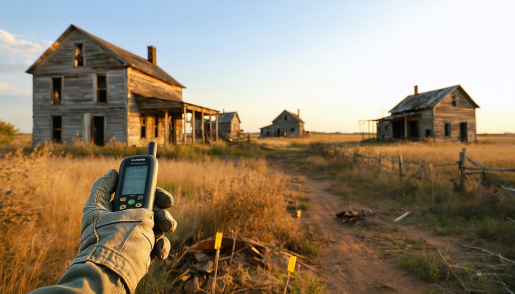
When historians set out to catalog Oklahoma’s vanished settlements, they’re beginning detective work that demands equal parts scholarship and shoe leather. You’ll find researchers driving thousands of miles—over 8,000 in some studies—visiting 300 sites to photograph crumbling structures and interview remaining residents.
Their archival methods include combing through vertical files at the Oklahoma Historical Society and primary sources at the Western History Collection, piecing together why towns died from railroad disputes, economic collapse, or natural disasters.
Environmental assessment plays an *essential* role too, particularly in mining communities where researchers analyze chat piles and lead contamination levels. They’re comparing 1970s documentation with current conditions, tracking which settlements persisted and which finally surrendered to time’s relentless march.
Oklahoma’s All-Black Ghost Towns and Their Historical Significance
Among the ghost towns scattered across Oklahoma’s landscape, none carry more profound historical weight than the state’s all-Black settlements—communities founded by emancipated individuals who sought something the post-Civil War South couldn’t offer: the chance to govern themselves without the shadow of prejudice and mob violence.
These pioneering communities represented more than towns—they embodied the radical promise of true self-determination for formerly enslaved people.
Oklahoma hosted more all-Black towns than any state, with thirteen still incorporated today.
Cultural preservation efforts by the Coltrane Group now document these communities through tours and grants, while architectural analysis reveals their once-thriving commercial districts.
Key surviving settlements include:
- Langston – Largest remaining town with 3,400 residents, home to Langston University
- Boley – Founded 1903, once the most renowned
- Clearview – Declined from 600 residents to 48
- Rentiesville – Population dropped from 400 to near 100
Frequently Asked Questions
Can You Legally Visit and Explore Oklahoma’s Ghost Towns?
You’ll need to do your homework first—many ghost towns sit on private property requiring permission. However, historic preservation efforts have created tourism opportunities at accessible sites like Park Hill and Kenton, where you’re free to explore legally and safely.
Are Any Oklahoma Ghost Towns Considered Haunted or Have Paranormal Activity?
Yes, you’ll find supernatural legends throughout Oklahoma’s ghost towns. Beer City, Picher, and Ingalls feature haunted landmarks tied to outlaw violence and toxic deaths. Bathsheba’s mysterious all-female colony and Kusa’s abandoned structures attract paranormal investigators seeking authentic frontier spirits.
What Happens to Property Ownership When a Town Becomes Abandoned?
You’d think there’d be a “reset button,” but property ownership follows complex paths: tax foreclosure transfers titles, land reclamation by counties occurs, or historical preservation groups intervene. Your deed technically survives abandonment until legal processes conclude.
Which Oklahoma Ghost Town Is Closest to Oklahoma City?
Marshall’s your closest ghost town, just 30 miles north in Logan County. You’ll discover historical preservation efforts among weathered buildings that’ve become tourist attractions. Founded in 1890, it’s accessible via back roads for authentic exploration of Oklahoma’s frontier heritage.
Has Any Oklahoma Ghost Town Successfully Revived and Repopulated?
You’ll find true ghost town revivals rare—Radium Town merged with Claremore rather than independently reviving. Historical preservation efforts and tourist attractions like Route 66 sustain semi-abandoned towns such as Texola, but complete repopulation remains elusive in Oklahoma’s forgotten communities.
References
- http://sites.rootsweb.com/~oktttp/ghost_towns/ghost_towns.htm
- http://www.ou.edu/news/articles/2024/may/ou-researcher-unveils-book-of-oklahomas-ghost-towns.html
- https://www.youtube.com/watch?v=J_wcP7xbV4w
- https://okcfox.com/news/local/discover-oklahomas-five-ghost-towns-with-less-than-ten-residents
- https://www.okhistory.org/publications/enc/entry?entry=GH002
- https://www.geotab.com/ghost-towns/
- https://blog.batchgeo.com/ghost-towns/
- https://www.onlyinyourstate.com/experiences/oklahoma/creepy-ghost-towns-ok
- https://www.youtube.com/watch?v=5d-wHDTIbb0
- https://academic.oup.com/whq/advance-article-abstract/doi/10.1093/whq/whag003/8441011


