You’ll find between 136 and 195 documented ghost towns across Utah, though the exact count depends on which classification system you’re consulting. The Utah Automated Geographic Reference Center reports 195 abandonments, while Geotab mapping identifies 136 settlements. This variance stems from differing definitions—some sources only count completely abandoned sites, while others include semi-abandoned communities retaining minimal populations. The state’s mining, railroad, and agricultural settlements each faced distinct patterns of decline, and understanding these classification frameworks reveals why documentation standards produce such different totals.
Key Takeaways
- Utah has between 136 and 195 ghost towns depending on the source consulted and definition used.
- Counts vary because authorities disagree on what qualifies as abandoned versus semi-abandoned settlements.
- Classification systems range from completely abandoned Class 1 towns to 50% occupied Class 5A historic communities.
- Most Utah ghost towns resulted from mining booms, railroad dependency, resource depletion, and catastrophic flooding.
- The Great Basin Desert west of Salt Lake City contains numerous mining ghost towns like Frisco and Silver Reef.
Counting Utah’s Abandoned Settlements
When researchers attempt to catalog Utah’s ghost towns, they encounter a fundamental challenge: the count varies dramatically based on classification criteria. The Utah Automated Geographic Reference Center documents 195 abandonments, while Utah Life Magazine reports over 140, and Geotab mapping identifies 136.
These numerical disparities stem from definitional disagreements about what constitutes genuine abandonment versus partial occupancy. You’ll find these settlements scattered across 29 counties, each preserving distinct architectural styles reflecting their founding industries—mining camps, agricultural communities, and railroad towns. Similar to Nevada’s 106 ghost towns or Montana’s extensive collection of abandoned settlements, Utah’s landscape tells the story of boom-and-bust cycles across the American West.
Urban legends often obscure factual histories, yet official records confirm Carbon County holds the highest concentration with 18 documented sites. The classification variance reflects legitimate scholarly debate: does a town with three remaining residents qualify as “ghost,” or must complete abandonment occur? Many sites remain accessible near major roads, though others require off-road vehicles for remote exploration.
What Qualifies as a Ghost Town in Utah
The numerical discrepancies in Utah’s ghost town tallies reflect an underlying taxonomic problem: no universal standard defines when a settlement crosses from “declining” to “ghost.” Classification systems employed by researchers typically organize these sites into five hierarchical categories based on structural integrity and population retention.
Class 1 sites show complete urban decay—barren ground requiring archaeological investigation. Class 2 through 3 represent progressively better preservation states, with Class 3 structures potentially restorable through historic preservation efforts. Class 4 designates semi-abandoned towns retaining under 10% of peak populations, while Class 5A encompasses active historic communities maintaining over 50% occupancy. Beyond structural conditions, researchers also categorize ghost towns by original town purposes including mining, railroad transportation, logging, military operations, and agricultural ranching.
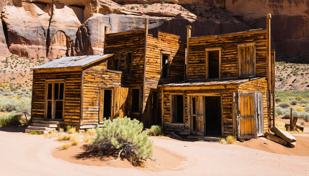
You’ll find most abandoned settlements require complete resource depletion and permanent resident exodus to qualify authentically. Sites like Grafton and Silver Reef demonstrate how historic preservation can complicate classification, maintaining structural integrity despite abandonment. Natural disasters have also created instant ghost towns, as demonstrated when a catastrophic 1983 landslide buried Thistle’s structures under silt and water.
Ghost Towns of the Great Basin Desert
West of Salt Lake City, the Great Basin Desert harbors some of Utah’s most historically significant abandoned settlements, where mining booms created ephemeral communities that vanished as rapidly as they emerged.
You’ll discover Frisco, fifteen miles west of Milford, notorious for its twenty-three saloons and daily violence that earned it recognition as the wildest town in the region—unknown entertainment by today’s standards.
Silver Reef, northwest of Leeds, represents the only U.S. location where silver was commercially extracted from sandstone formations.
Eureka, founded in 1870 on gold-silver deposits, peaked at 4,000 residents by 1910.
The abandoned architecture spans stone kilns, cemetery markers, and deteriorating equipment at sites like Old Irontown and Sulphurdale.
Tooele County’s Gold Hill was active during 1892 as a significant mining operation in the region.
Frisco’s charcoal kilns remain as tangible evidence of the industrial infrastructure that supported nineteenth-century mining operations.
These settlements within the Great Basin National Heritage Area preserve evidence of frontier resource extraction and subsequent demographic collapse.
Mining Boom Towns That Went Bust
Utah’s mining boom towns experienced explosive growth and catastrophic decline within decades, creating settlements that transformed from thriving commercial centers into abandoned relics of industrial ambition.
Silver Reef became southern Utah’s most populous place during the 1870s-1880s as the first sandstone silver discovery. You’ll find Wells Fargo building remains and foundations on the National Historic Register.
Silver Reef defied geological expectations as sandstone silver fueled southern Utah’s largest settlement before inevitable abandonment left only Wells Fargo ruins.
Frisco, fifteen miles west of Milford, drew prospectors despite notorious lawlessness until an 1885 mine collapse devastated the town. Historic preservation efforts maintain its cemetery and stone kilns as mining relics. Today, Frisco exists only as ruins of buildings and abandoned charcoal kilns that reflect its Wild West prosperity.
Eureka’s population peaked near 4,000 in 1910; today 600 residents preserve the Tintic Mining Museum and jail. Silver City and Mammoth ghost towns feature remnants of mining history in the Eureka vicinity near old mines.
Ophir’s mines closed in the early 1970s, leaving original buildings for its thirty-eight remaining inhabitants to maintain as semi-ghost status.
Railroad Towns Left Behind by Progress
Railroad expansion across Utah’s landscape during the late 1800s spawned dozens of settlements that existed solely to serve the iron routes connecting America’s coasts.
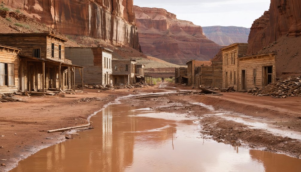
You’ll find Promontory’s remnants north of the Great Salt Lake, where the 1869 Transcontinental Railroad connection created brief prosperity before settlement decline reduced it to foundations and memories.
Promontory initially thrived but became rough with saloons and card rooms attracting undesirable elements.
Carbon County’s ghost towns—Spring Canyon, Standardville, Wattis—depended entirely on rail access for coal transport until diesel engines altered operational needs.
Thistle served Spanish Fork Canyon travelers until a 1983 landslide obliterated it completely.
Mill Fork’s cemetery marks where a thriving rail stop once existed, containing graves of children, accident victims, and a murder/suicide victim.
Terrace near Wendover, Colton south of Soldier Summit, and Wahsatch in Summit County followed identical trajectories: rapid growth serving railroad demands, then abandonment when technological progress rendered them obsolete.
Southern Utah’s Pioneer Settlements
You’ll find Grafton among southern Utah’s most documented pioneer ghost towns. It was established in 1859 when Nathan Tenney led five families to settle along the Virgin River.
The settlement collapsed in 1866—just two years after its formal founding—when Brigham Young’s consolidation order following Navajo raids forced residents to relocate to larger, defensible communities.
Grafton’s agricultural infrastructure, including irrigation systems and cotton fields central to Young’s “Utah’s Dixie” vision, was subsequently destroyed by Virgin River floods that swept through the abandoned townsite.
Grafton’s Mormon Settlement History
Among the hundreds of settlements Mormons established across the American West between 1847 and 1900, Grafton emerged as a quintessential example of their colonizing ambitions and the harsh realities that often thwarted them. Founded in 1859 by five families led by Nathan Tenney, the community grew to 168 residents by 1866.
You’ll find it was part of Brigham Young’s 1861 Cotton Mission, which called 300 families to Utah’s “Dixie” region.
Continuous floods, Paiute and Navajo conflicts during the Black Hawk War, and food shortages from overplanted cotton forced residents to Rockville in 1866.
Though 40 returned in 1868, only four families remained by 1890.
The last residents departed in 1944, transforming Grafton into the West’s most photographed ghost town—now essential for historical preservation and tourism development.
Flood-Destroyed Agricultural Communities
Between Christmas Day 1861 and February 1862, forty-four days of continuous rainfall unleashed catastrophic floods across southwestern Utah’s Washington County.
These floods nearly obliterated the region’s nascent Mormon settlements along the Virgin and Santa Clara Rivers. Fort Clara washed away entirely, forcing survivors eastward to establish modern Santa Clara. Adobe Fort Harmony collapsed, killing two children.
St. George, Duncans Retreat, Adventure, and Northrop suffered inundation as agricultural infrastructure disintegrated.
The Virgin River‘s violent descent—7,800 feet over 160 miles—created flash floods that repeatedly destroyed communities.
Historic flood management proved futile; pioneers rebuilt bridges 140 times and canals 70 times between 1850-1938.
These relentless disasters claimed 26 lives and ultimately forced abandonment of multiple settlements.
Without effective flood recovery strategies, residents couldn’t sustain orchards and farms against repeated obliteration by cloudburst torrents.
Flood-Ravaged Communities Near Capitol Reef
You’ll find several ghost towns clustered near Capitol Reef National Park that share a common demise: catastrophic flooding. Aldridge, established 11.1 miles east of Fruita in 1890, survived merely a decade before floods forced its dozen families to abandon their fruit orchards and alfalfa fields.
Similarly, Mesa-Elephant near Caineville collapsed after the 1897 flood devastated its ten families, while Caineville itself endured recurring floods from 1896 until the massive 1909 deluge triggered mass relocation.
Aldridge’s Brief Settlement Era
Located at the mouth of Pleasant Creek along U-24, approximately 11 miles east of Capitol Reef National Park headquarters, Aldridge emerged in 1882 when Mosiah Behunin became its first settler.
By 1890, Mormon pioneers had developed a small community producing fruits, alfalfa, melons, and vegetables through Fremont River irrigation.
This Aldridge settlement history demonstrates how pioneers supplemented farming with lime extraction from local limestone deposits.
However, flood impact analysis reveals the community’s fatal vulnerability.
Frequent Fremont River flooding devastated downriver settlements, and Aldridge lacked sufficient arable land to sustain recovery.
The flood plain supported no more than ten families by 1920.
Unlike neighboring Fruita, which survived and prospered, Aldridge succumbed to these combined pressures and was abandoned by 1900, leaving only limestone kilns as archaeological remnants.
Giles Ghost Town History
When the Hyrum Burgess family arrived on the north side of the Fremont River in 1883, they initiated what would become one of Wayne County’s most ambitious yet ultimately doomed agricultural settlements.
You’ll find this ghost town—originally called Blue Valley, later Giles—at milepost 110 on Utah State Route 24, where Bentonite clay created the distinctive blue-gray soil that named the valley.
By 1900, 200 residents thrived here, constructing Wayne County’s largest adobe meetinghouse and a three-mile irrigation canal.
Catastrophic floods between 1909-1910 destroyed their water infrastructure, forcing complete abandonment by 1919.
Today, historical preservation efforts remain minimal at this remote site near Capitol Reef National Park, though it attracts independent explorers seeking authentic tourist attractions untouched by commercialization.
Persistent Irrigation System Failures
The Fremont River’s unpredictable flood cycles destroyed multiple Wayne County settlements between 1882 and 1919, creating a corridor of abandoned communities that now defines the Capitol Reef region’s ghost town landscape. You’ll find three primary casualties of irrigation failures along this watershed: Caineville (1882), Mesa (1887), and Blue Valley (1883). Each community’s collapse stemmed from inadequate watershed management technology available to frontier settlers.
The devastation followed predictable patterns:
- Mesa experienced complete abandonment by 1898 after just eleven years, following catastrophic 1897 floods.
- Blue Valley’s 200 residents departed by 1919 when dug canals proved impossible to maintain.
- Caineville suffered dam washouts every two to three years, forcing mass exodus after 1909.
Modern floods continue threatening infrastructure, with 2022 events washing vehicles through Capitol Gorge.
These irrigation failures demonstrate how environmental constraints shaped Utah’s settlement geography.
The Carbon Corridor’s Deserted Mining Camps
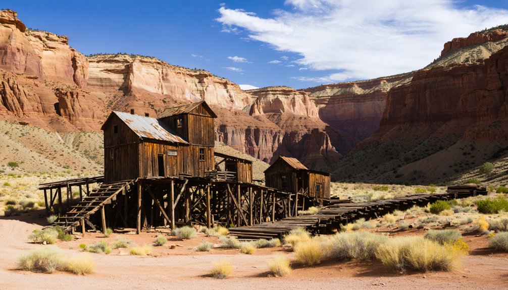
Stretching between Price and Moab, the Carbon Corridor harbors the skeletal remains of over a dozen coal mining camps that once thrived during the early-to-mid 20th century.
You’ll discover settlements like Coal City National, where mines discovered in 1908 remained dormant until 1920s development, and Sweet camp, which housed 200 residents before closing in the early 1950s.
Carbon Coal Company’s operation peaked at 500 inhabitants across 60 company-owned houses.
Winter Quarters, Utah’s first opened mine, lasted merely 28 years.
By the 1960s, exhausted veins and declining demand triggered mass abandonment.
Today’s industrial archaeology reveals foundation remnants and structural debris along the Energy Loop Scenic Byway, though preservation challenges persist from environmental degradation and decades of neglect.
Variations in Official Ghost Town Records
Although Utah’s abandoned settlements dot the landscape with remarkable consistency, counting them presents formidable challenges that produce wildly divergent tallies across official sources.
Official classifications vary dramatically between agencies, with some recognizing only documented mining camps while others include ranching homesteads and railroad stops.
Record discrepancies emerge from several key factors:
- Preservation criteria differ between state historical societies and federal land management agencies
- Classification systems range from seven-tiered preservation scales to simple binary distinctions
- Geographic boundaries create uncertainty when settlements straddle county lines or private-public land interfaces
- Documentation standards vary profoundly, with some archives requiring extensive historical verification while others accept anecdotal evidence
You’ll find estimates spanning from dozens to hundreds depending on which authority you consult and what definitional framework they’ve adopted.
Frequently Asked Questions
Can Visitors Legally Explore Utah’s Ghost Towns?
You can legally explore many Utah ghost towns on public land, but you’ll face legal restrictions at sites with private ownership. Always verify access rights beforehand—trespassing laws apply even at abandoned locations, protecting both property and historical preservation efforts.
Which Utah Ghost Town Is the Most Photographed?
Grafton stands as the West’s most photographed ghost town, where you’ll discover exceptional photography hotspots among five preserved structures. The Grafton Heritage Partnership’s historic preservation efforts maintain this iconic 1862 settlement near Zion National Park for your exploration.
Are Any Ghost Towns in Utah Privately Owned?
Yes, you’ll find several privately owned Utah ghost towns. Grafton’s under Historic preservation by private partnership since the 1920s. Silver Reef, Ophir, and Frisco also have private Land ownership, with restoration societies maintaining these sites for visitors.
What Caused More Ghost Towns: Mining or Agriculture?
Mining caused more ghost towns in Utah than agriculture. You’ll find mining communities experienced rapid boom-and-bust cycles with severe environmental impact, while agricultural settlements declined gradually, leaving fewer sites requiring historical preservation efforts today.
Do People Still Live in Any of Utah’s Ghost Towns?
Yes, you’ll find people stubbornly inhabiting “ghost” towns—Eureka hosts 600 residents, while Ophir’s 38 maintain historical preservation efforts. Cisco and Lucin each house single occupants, creating unconventional wildlife habitats where human presence paradoxically sustains abandonment’s romance.
References
- https://en.wikipedia.org/wiki/List_of_ghost_towns_in_Utah
- https://www.visitutah.com/things-to-do/history-culture/ghost-towns
- https://www.youtube.com/watch?v=JpQK8jnTaxc
- https://www.familysearch.org/en/wiki/Utah_Ghost_Towns
- https://capitolreefcountry.com/ghost-towns/
- https://history.utah.gov/wp-content/uploads/2018/08/Maps-GhostTowns.pdf
- https://www.loveexploring.com/gallerylist/188219/the-us-state-with-the-most-ghost-towns-revealed
- https://www.ksl.com/article/51008090/7-utah-ghost-towns-that-are-worth-a-visit-this-summer
- https://www.utahlifemag.com/blog/post/4-ghost-towns
- https://hub.arcgis.com/datasets/9e70861968164a0eb26293a2da73de39_0/data


