You’ll find 9 officially named ghost towns in Vermont, including Glastenbury, Somerset, and Ricker Basin, though archival records suggest dozens more abandoned settlements exist across Bennington, Windham, and Windsor counties. These communities emptied between 1820 and 1950 due to westward migration, industrial collapse, and resource depletion. Many sites now rest within state parks and national forests, preserving cellar holes, mill foundations, and cemeteries. Understanding their locations, accessibility requirements, and the historical forces behind Vermont’s rural abandonment reveals a complex landscape shaped by economic transformation and environmental challenges.
Key Takeaways
- Wikipedia identifies 9 named Vermont ghost towns, including Glastenbury, Somerset, Greenbanks Hollow, and Ricker Basin across multiple counties.
- The complete count remains uncertain, with sources acknowledging possible undercounting and incomplete historical records of abandoned settlements.
- Ghost towns span at least six counties, concentrated primarily in Bennington, Windham, and Windsor regions of Vermont.
- Vermont has approximately 10,879 vacant properties, representing 3% of housing stock, with rural vacancy increasing 25% since 2010.
- Most settlements were abandoned between 1820–1870 due to westward migration, resource depletion, floods, and economic decline.
Counting Vermont’s Abandoned Settlements: The Numbers Debate
While pinning down Vermont’s exact number of ghost towns proves elusive, the available data reveals a fractured landscape of abandoned settlements scattered across the state’s rural counties. You’ll find Wikipedia documenting nine named locations—Greenbank’s Hollow, Glastenbury, Lewiston, Ricker Basin, Smith Family Farms, Smithfield, Somerset, Sterling, and West Castleton—though sources acknowledge this list remains incomplete.
The counting debate intensifies when you examine VHFA’s estimate of 10,879 vacant properties representing 3% of housing stock. Rural counties experienced 25% increases in residential vacancies from 2010 to 2021, driven by population decline and economic factors dating back to the 1820-1870 outmigration period. Over 10,000 Vermonters migrated west during the 1849 Gold Rush, establishing an early pattern of settlement abandonment that contributed to the state’s ghost town phenomenon. Vermont’s 0.4% vacancy rate stands as the lowest in the nation, indicating that despite historical abandonments, the state now maintains a tightly occupied housing market.
This uncertainty stems from scattered properties, cloudy titles, and fundamental disagreements over what constitutes a ghost town versus temporary vacancy.
Documented Ghost Towns Across Vermont Counties
You’ll find Vermont’s documented ghost towns distributed across at least six counties, with concentrations in Bennington, Windham, and Windsor Counties, reflecting patterns of 19th-century industrial development.
The most extensively documented sites include Glastenbury’s charcoal production settlements, Somerset’s logging infrastructure, and Copperfield’s 1880s copper mining operations, all supported by archival records and physical remnants. Ricker Basin on Ricker Mountain exemplifies settlements reclaimed by nature, now preserved within Little River State Park’s scenic environment.
State preservation efforts have incorporated several abandoned settlements into public lands, with West Castleton now protected within Bomoseen State Park and various Orange County mining sites marked along State Highway 113A. Plymouth Union once thrived as a post village with factories, churches, and hotels before transitioning to rural farmland.
Major Ghost Town Locations
Across Vermont’s diverse counties, documented ghost towns reveal distinct patterns of settlement and abandonment tied to the state’s industrial history.
You’ll find Greenbank’s Hollow in Caledonia County, where its covered bridge stands as the sole witness to a vanished mill community.
Bennington County’s Glastenbury, steeped in urban legends and folklore stories, once housed 250 residents before its lumber industry collapsed.
Windsor County’s Lewiston thrived as a railroad hub serving the Connecticut River’s shipping routes until economic shifts ended its significance.
Somerset in Windham County operated as a riverside logging outpost before disappearing into what’s now Green Mountain National Forest.
Rutland County preserves West Castleton’s stone foundations within Bomoseen State Park, where you’re free to explore remnants of Vermont’s autonomous frontier past.
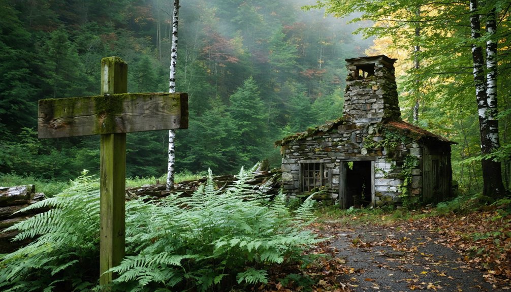
Washington County contains Ricker Basin, where a hillside cemetery and abandoned farmhouse remain accessible through trails at Little River State Park.
This former thriving community became a ghost town after the devastating 1934 flooding that forced its complete abandonment.
Mining and Logging Communities
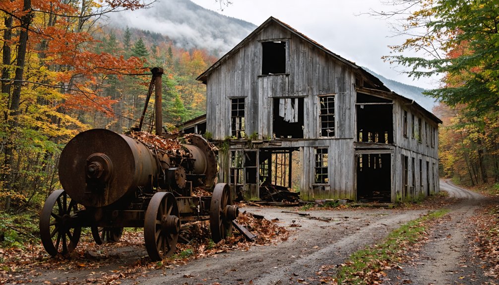
Vermont’s extractive industries carved communities from wilderness, only to abandon them when resources depleted or markets collapsed. You’ll find South Vershire’s copper mining legacy in stone walls and EPA-monitored smelter ruins, where 1,800 residents once sustained one of America’s top producers before market failure triggered economic decline.
Somerset and Glastenbury both peaked through logging operations—Somerset serving as a Deerfield River timber hub with blast furnaces and mills, while Glastenbury’s 241 residents supported charcoal kilns until an 1898 flood destroyed critical infrastructure. State disincorporation followed in 1937. Glastenbury’s territory spans about 27,000 acres, now predominantly owned by the U.S. National Forest Service.
Rooks Mine represents Vermont’s 1850s gold rush, where returning miners traced Buffalo Creek’s placer deposits to vein sources.
Greenbanks Hollow’s woolen mill, once employing 45 workers producing Civil War uniforms, exemplifies industrial urban decay after fire consumed Benjamin Greenbank‘s operation. The community, located a few miles south of Danbury, supported nearly 15,000 sheep in the 1870s as wool production anchored the local agricultural economy.
State Park Preserved Sites
State preservation efforts have transformed several of Vermont’s abandoned settlements into accessible historic sites where visitors can examine industrial and agricultural ruins firsthand. You’ll find Greenbanks Hollow in Caledonia County featuring a restored covered bridge alongside mill foundations.
Meanwhile, Ricker Basin within Little River State Park preserves the deteriorating Almeron Goodell farmhouse and hillside cemetery.
Glastenbury in Bennington County retains foundations from its lumber-era peak of 250 residents, now protected within Green Mountain National Forest.
Somerset’s stone walls and Waters Hill Cemetery document early sheep farming settlements. The cemetery contains at least 35 graves surveyed in 1940, with burials dating from 1794 to 1861.
These preserved sites face ongoing preservation challenges from weathering and vandalism, yet they counter urban legends with documented evidence of Vermont’s industrial past. Ricker Basin features visible remnants including stone walls and foundations, with material artifacts like glass bottles and farming tools still found among the leaves.
Smith Family Farms demonstrates agricultural heritage through cellar holes, though original structures have vanished entirely.
Famous Sites: From Glastenbury to South Verser
You’ll find Vermont’s most infamous ghost town in Glastenbury, where the Bennington Triangle’s unsolved disappearances between 1945 and 1950 compound the settlement’s abandonment narrative. The town’s dissolution followed typical patterns—logging industry collapse, failed farming ventures, and population exodus—yet its reputation stems from five documented missing persons cases that remain unresolved in state archives.
In contrast, South Vershire’s Copperfield copper mine represents Vermont’s extractive economy ghost towns, where the 1880s mining operations left tangible archaeological evidence: stone walls, smelter ruins along State Highway 113A, and documented production records that trace the boom-to-bust cycle typical of mineral-dependent communities.
Glastenbury’s Dark History
Deep in the Green Mountains, Glastenbury’s transformation from a thriving lumber town to an abandoned settlement began with bloodshed. You’ll find two murders—one in Fayville (1892) and another in Bickford Hollow (1897)—marking the community’s downward spiral.
The population plummeted below twenty by 1920, prompting Vermont’s General Assembly to disincorporate both Glastenbury and Somerset in 1937.
The area’s notoriety intensified with the Bennington Triangle disappearances between 1945-1950, when five people vanished without explanation.
Supernatural legends persist, rooted in indigenous stories warning of a man-eating stone and cursed boulders. The Abenaki deliberately avoided this mountain, sensing malevolent forces.
Today, researchers debate theories ranging from energy vortices to alternate dimensions, though archival records offer no definitive answers.
Mining Boom at Copperfield
While supernatural mysteries shrouded Glastenbury’s abandoned settlements, Copperfield’s demise stemmed from economic exhaustion rather than unexplained disappearances.
You’ll find this Vermont Copper Belt site near South Strafford flourished through copper mining beginning in 1829, when local farmers partnered with Boston businessmen and Baltimore investors to extract massive sulfide deposits.
The Tyson family dominated operations through the century’s final decades, introducing chromite refractories and operating the region’s largest copperas manufactory on Copperas Hill.
Underground shafts and charcoal smelting operations dotted the landscape as copper production surged intermittently throughout the 1800s.
Why Vermont’s Towns Were Abandoned
Environmental factors compounded these losses—flooding washed out critical transportation links while deforestation eliminated the economic foundation.
When populations dwindled to handfuls, disincorporation became inevitable.
Where to Find Ghost Towns: State Parks and Forest Locations
Vermont’s ghost towns concentrate within two primary state parks that offer documented trails to abandoned settlements.
You’ll find Ricker Basin’s remains within Little River State Park, where the History Trail and Dalley Loop Trail provide access to cellar holes, sawmill foundations, and the deteriorating Almeron Goodell Farmhouse. The 1934 flood and subsequent dam construction submerged portions of this 1816 community, creating underwater preservation efforts alongside accessible hiking routes.
At Bomoseen State Park, the three-quarter-mile Slate History Trail guides you through West Castleton’s abandoned 1800s slate industry village. Trail maps available at park offices separate documented history from urban legends surrounding these sites.
Both locations maintain seasonally accessible paths through stone walls, cemeteries, and industrial remnants, offering unrestricted exploration of Vermont’s vanishing nineteenth-century settlements.
Planning Your Visit: Access and Safety Considerations
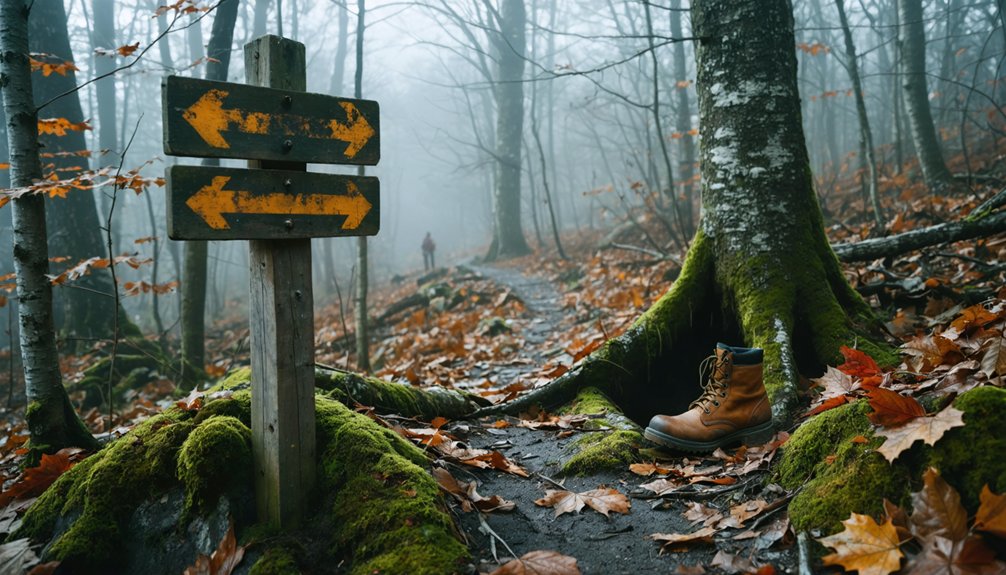
Before venturing into Vermont’s abandoned settlements, you’ll need thorough preparation addressing the unique challenges these sites present. These remote locations demand self-reliance—cell service proves unreliable, terrain can mislead even experienced hikers, and isolation amplifies every risk.
Contact property owners beforehand for permission and visiting details, as trespassing restrictions apply to many sites. State parks may require advance permits for accessing certain ruins.
Essential preparations include:
- Proper navigation tools (GPS, detailed maps) and sturdy footwear for traversing cellar holes and unstable foundations
- Daylight-only exploration with companions, never alone in wilderness areas like Glastenbury’s 36-square-mile expanse
- Seasonal awareness—winter renders trails inaccessible while summer offers best conditions for photographic opportunities
Despite urban legends surrounding some locations, documented hazards—quarry pits, dense vegetation, deteriorating structures—present genuine dangers requiring serious preparation and respect for Vermont’s reclaimed wilderness.
Frequently Asked Questions
Are There Any Haunted Ghost Towns in Vermont?
Yes, you’ll find Glastenbury stands as Vermont’s most notorious haunted ghost town, featuring mysterious disappearances spanning two centuries. Its archaeological significance includes preserved cellar holes and charcoal kilns, while historical preservation efforts document paranormal legends throughout the wilderness.
Can You Buy Property in Vermont’s Abandoned Towns?
You’ll discover that ship has sailed—Vermont’s abandoned towns offer no real estate opportunities. Historical preservation mandates guarantee state parks, national forests, and public trusts maintain these ghost town sites, completely restricting private property purchases in formerly inhabited areas.
What’s the Best Time of Year to Visit Vermont Ghost Towns?
You’ll find the most suitable seasonal accessibility from mid-September through mid-October, when fall foliage enhances historic preservation sites with vibrant colors while exposing foundations. Summer offers extended daylight and dry trails, though you should avoid winter’s restrictive snow coverage and limited access.
Do Any Ghost Towns Have Guided Tours Available?
You’ll find absolutely zero guided tours at Vermont’s ghost towns—they’re purely self-exploration destinations. Historical preservation focuses on maintaining archaeological discoveries like foundations and cellar holes, letting you discover these reclaimed sites independently through trails and unmarked paths.
Which Vermont Ghost Town Is Easiest for Families With Children?
West Castleton offers you the easiest family-friendly exploration within Bomoseen State Park’s maintained grounds. Historic preservation integrates safely with park amenities, providing supervised trails, picnic facilities, and accessible ruins—perfect for children seeking adventure without demanding terrain or hazards.
References
- https://en.wikipedia.org/wiki/List_of_ghost_towns_in_Vermont
- https://ghost-towns.close-to-me.com/states/vermont/
- https://kids.kiddle.co/List_of_ghost_towns_in_Vermont
- https://www.youtube.com/watch?v=4cgF1LgkQE0
- https://www.youtube.com/watch?v=2fvPo9iQC-w
- https://www.loveexploring.com/gallerylist/188219/the-us-state-with-the-most-ghost-towns-revealed
- http://freepages.rootsweb.com/~gtusa/history/usa/vt.htm
- https://happyvermont.com/2014/10/23/glastenbury-ghost-town/
- https://www.geotab.com/ghost-towns/
- https://vermontvacation.com/haunted-vt/


