You’ll find approximately 33 documented ghost towns scattered across Wyoming, though the actual count runs higher when you include unrecorded settlements and communities straddling the line between abandoned and barely inhabited. These remnants trace back to the 1860s gold discoveries, railroad construction, and subsequent mining booms that sparked rapid settlement followed by equally swift abandonment. Fremont County holds the most with six documented sites, while clusters concentrate near historic routes like the Oregon Trail and early railroad corridors. The complete story behind these vanished communities reveals patterns of resource exhaustion, economic collapse, and frontier ambition.
Key Takeaways
- Wyoming contains approximately 33 documented ghost towns, though the actual number is likely higher due to undocumented sites.
- Fremont County has the most ghost towns with six, while many others cluster within 50 miles of Cheyenne.
- The boundary between ghost towns and active communities is blurred, as Atlantic City had 37 residents in 2010.
- Ghost towns arose from mining, ranching, and railroad activities, often along the Oregon Trail and early railroad corridors.
- Notable ghost towns include Benton, South Pass City, Gebo, Jeffrey City, and Lost Springs, each with unique histories.
Counting Wyoming’s Abandoned Settlements
According to current mapping data, Wyoming contains approximately 33 documented ghost towns, though this figure represents an incomplete inventory of the state’s abandoned settlements.
You’ll find these deserted landscapes classified into three distinct categories: barren sites with minimal remnants, neglected communities showing decay, and abandoned locations preserving historic architecture. Fremont County leads with six ghost towns, while five clusters within 50 miles of Cheyenne.
Historical records reveal numerous additional sites awaiting formal documentation. The actual count remains fluid—settlements like Atlantic City blur boundaries between ghost town and living community, with 37 residents recorded in 2010.
Carbon marks Wyoming’s first coal mine location, while Platinum City existed briefly from 1928 to 1938. South Pass City’s gold rush began in 1868 after the Cariso Lode discovery, with over 2,000 residents during its two-year peak. Bear River City, constructed in the early 1860s for the Union Pacific railroad crossing, was eventually torched and abandoned following the violent Bear River City Riot of November 19, 1868. Each site documents Wyoming’s boom-and-bust cycles across mining, ranching, and railroad eras.
The Gold Rush Legacy and Mining Boom Towns
While California prospectors traveled the Emigrant Trails through Wyoming in 1842, they made the territory’s first documented gold discovery in Sweetwater Creek—a finding that wouldn’t trigger immediate settlement but established the region’s mineral potential.
Wyoming’s first documented gold discovery in 1842 revealed the territory’s mineral wealth decades before settlement would follow.
The 1867 Fort Bridger soldiers’ strike changed everything, transforming the landscape from farming communities into bustling mining centers.
The Sweetwater District’s explosive growth followed established transportation routes:
- South Pass City reached 3,000 residents by 1869, becoming Wyoming’s second-largest town
- Atlantic City housed 2,000 miners in ramshackle dwellings during peak operations
- Miners Delight emerged as the district’s third settlement
- 1,500 lodes were claimed across the region
Frank McGovern’s 1867 discovery of the Miner’s Delight lode sparked the initial boom that attracted waves of prospectors and settlers to the region. Native tribes including Arapaho, Cheyenne, and Sioux fiercely protected their land against the influx of prospectors and settlers.
Notable Ghost Towns and Their Peak Populations
Among Wyoming’s most documented ghost towns, Atlantic City presents a striking discrepancy between legend and census data. Founded in 1868, it supposedly reached 2,000 residents by 1870, yet official records show just 325 people.
This pattern of inflated population claims reveals significant sociocultural impacts across Wyoming’s mining settlements.
Gebo’s verifiable peak exceeded 2,000 residents during coal operations from 1907 to 1938, making it the county’s largest town.
Lost Springs incorporated in 1911 with 200 workers before declining to just five by 1960.
Jeffrey City’s uranium boom created dramatic demographic shifts before its bust. The former mining boomtown in Fremont County now stands as a ghost town following the collapse of uranium demand.
Bryan flourished briefly during railroad construction, then vanished when tracks relocated. The town became obsolete after track realignment, leaving visible platform lines in the earth near its original river crossing site.
You’ll find these towns represent documented evidence of Wyoming’s boom-bust cycles, where freedom-seeking prospectors created communities that rarely matched their legendary populations.
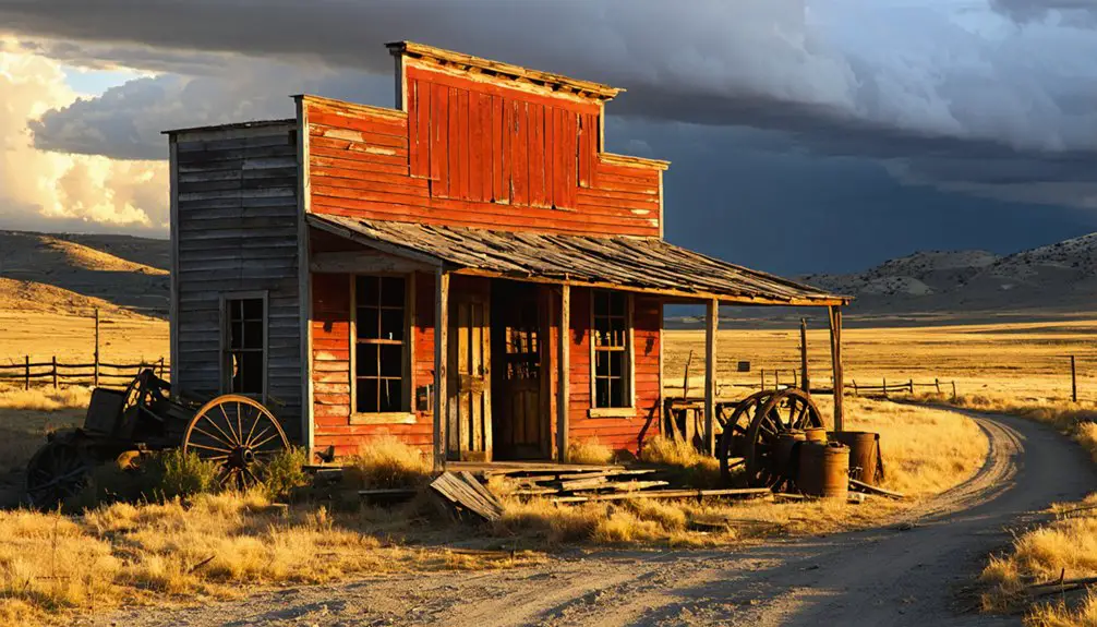
Benton: The Three-Month Wonder
You’ll find one of Wyoming’s most remarkable ghost towns in Benton, named after Missouri Senator Thomas Hart Benton. It was established when the Union Pacific Railroad reached the site in July 1868.
The settlement’s population exploded to approximately 3,000 residents within weeks, supported by twenty-five saloons, five dance halls, and a newspaper. Despite its rapid growth, Benton lasted only three months, earning it distinction as Wyoming’s first ghost town when it was abandoned by September 1868.
The town was notorious for its lawlessness, with over 100 men dying in gunfights during its brief existence. Located near the North Platte River, approximately 11 miles east of Rawlins, the site is now marked by a Union Pacific milepost.
Senator Benton’s Namesake Town
When the Union Pacific Railroad established its railhead at milepost 672.1 in July 1868, the town of Benton materialized on the eastern edge of Wyoming’s Red Desert, eleven miles east of present-day Rawlins. Named after Senator Thomas Hart Benton, this construction camp embodied the raw frontier spirit that drew westward pioneers.
The senator’s namesake town reflected the untamed character of railroad expansion:
- Water scarcity forced residents to haul barrels from the North Platte River at $1 each
- Whiskey sold cheaper than water at 5 cents per glass
- 25 saloons and 5 dance halls served the transient population
- A cemetery was needed on establishment day
Benton earned its notorious reputation as a “modern Sodom” where murder became an everyday occurrence, with over 100 graves filled within just a few months of the town’s founding. The massive 100-foot canvas “Big Tent” housed gambling and entertainment operations that epitomized the town’s concentration of vice.
Today, Benton’s remnants survive as historical preservation sites and tourist attractions near Rawlins, marking Wyoming Territory’s first documented ghost town.
July 1878 Population Boom
As the Union Pacific’s rails pushed westward in summer 1868, Benton transformed from empty prairie into what observers called “nearer a repetition of Sodom and Gomorrah than any other place in America.”
Within weeks of the railroad’s July arrival at milepost 672.1, the construction camp’s population swelled to over 3,000 residents during peak weekends, earning its notorious nickname as the “Three-Month Wonder.”
Twenty-five saloons and five dance halls materialized almost overnight, anchored by the infamous “Big Tent” brothel and the Belle of the West tent saloon—soon dubbed the “Bucket of Blood” for its relentless violence.
You’ll find whiskey sold for five cents per glass—cheaper than water.
Over 100 deaths occurred during Benton’s three-month existence, with historian Charles G. Coutant documenting murder as an everyday occurrence.
Today’s faded landmarks stand silent, their ghost stories echoing Wyoming’s wildest frontier chapter.
Rapid Rise and Fall
Union Pacific’s construction crews laid the final rails into milepost 672.1 in July 1868, and Benton materialized within days. You’d witness 3,000 residents establishing Wyoming’s most notorious hell-on-wheels settlement, where economic shifts created temporary prosperity through vice.
The town’s infrastructure reflected frontier chaos:
- 25 saloons and 5 dance halls serviced railroad workers
- Whiskey cost less than water, hauled two miles from North Platte River
- Over 100 men died in documented street gunfights
- Mormon wagon trains departed carrying 2,000 Saints to Utah
South Pass City’s Rise and Preservation
Following the discovery of gold in the Carissa Lode by a party from Fort Bridger during the summer of 1867, South Pass City emerged in a gulch below the mine within the Sweetwater Mining District. You’ll find this settlement reached approximately 1,000 residents by 1869, constructing over 250 buildings at its 1868 peak. The town became Wyoming’s second incorporated city that year.
Beyond mining wealth—the Carissa produced over $15,000 in gold by 1868—South Pass City secured its place in American history when William Bright introduced the nation’s first women’s suffrage bill in 1869.
Esther Hobart Morris became the first woman holding public office nationwide in February 1870.
Wyoming purchased the site in 1966, establishing South Pass City State Historic Site.
Historical preservation efforts restored 23 original structures containing 30,000 artifacts, creating one of Wyoming’s premier tourist attractions.
Why These Communities Disappeared
While South Pass City’s preservation showcases Wyoming’s mining heritage, most ghost towns met far different fates—abandoned when the economic forces sustaining them collapsed.
You’ll find these communities disappeared through predictable patterns:
- Resource depletion: South Pass exhausted placer gold by the early 1870s. Jeffrey City’s uranium mines played out by the 1980s, and Gebo’s coal seams went inactive after 1938.
- Single-industry dependency: Jeffrey City lost 95% of its population when the mine closed. This eliminated shops, schools, and clinics overnight.
- Corporate failures: Fraudulent stock indictments shuttered copper operations at Rudefeha, Dillon, and Rambler. These closures erased entire communities.
- Geographic isolation: Remote locations like Van Tassell and Arminto couldn’t sustain populations without mining income.
Limited preservation efforts mean cultural heritage vanishes with these settlements.
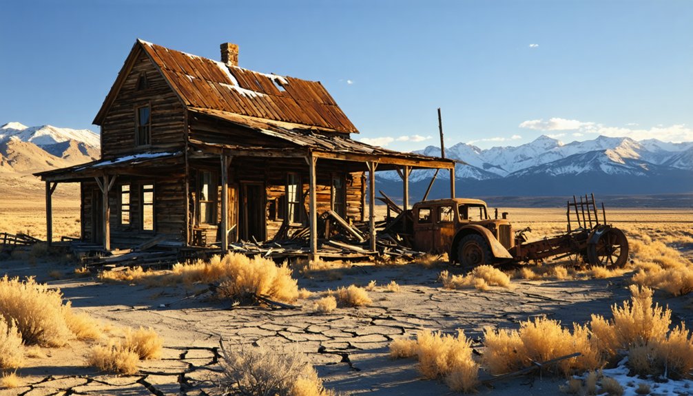
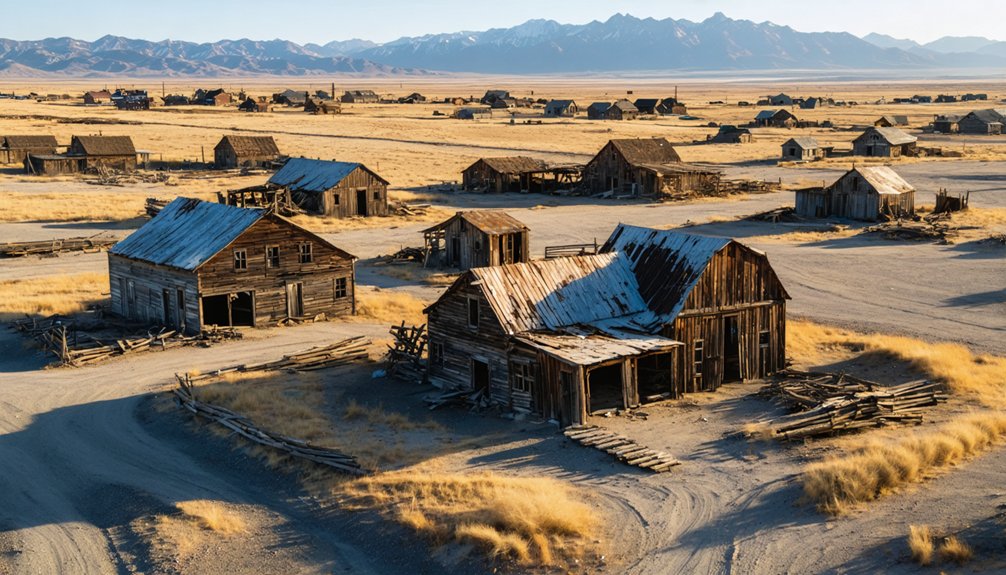
What Remains Today: Structures and Landmarks
Across Wyoming’s abandoned settlements, you’ll discover physical remnants ranging from meticulously preserved downtown districts to scattered foundation stones. South Pass City stands among the West’s best-preserved sites, offering accessible shops and residences frozen in gold rush time. Its visitor center displays an 1890 flag with 44 stars.
South Pass City preserves Wyoming’s gold rush era through accessible historic structures and a visitor center showcasing an authentic 44-star flag from 1890.
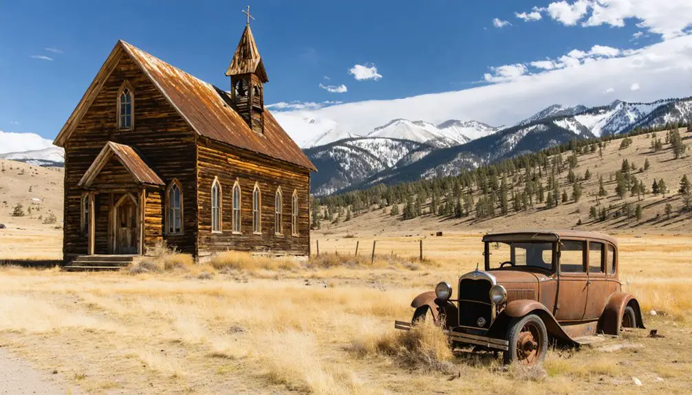
The Grand Encampment Museum relocated 19 structures from surrounding ghost towns, creating artistic reconstructions of regional life through relocated buildings including a two-story outhouse and aerial tram segments.
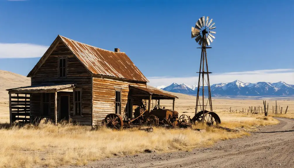
Mining relics dominate other locations. Piedmont’s beehive-shaped charcoal kilns mark the prairie since 1971’s National Register listing. Gebo’s concrete foundations trace street grids through sage hills, while cemetery headstones document early 1900s settlers.
You’ll find brick fragments, steel remnants, and hazardous open pits where coal operations once thrived, each site preserving evidence of Wyoming’s extractive past.
Exploring Ghost Town Locations Across the State
You’ll find Wyoming’s ghost towns clustered in distinct geographic patterns, with the highest concentrations occurring in southwestern counties where mining and railroad activities peaked between 1867 and 1911.
The terrain presents significant accessibility challenges, as many settlements like Kirwin and Rambler required traversing mountain passes and Continental Divide crossings that remain difficult even today.
Hot Springs County alone contains multiple documented ghost towns including Jibo and Gebo, while the Highway 230 corridor south from Saratoga provides access to several abandoned mining communities such as Rudefeha and Dillon.
Major Regional Concentrations
Wyoming’s ghost towns cluster in five distinct geographic regions, each defined by the extractive industry that drew settlers and the transportation networks that sustained them.
Cultural heritage sites concentrate in:
- South Pass City Region – Gold mining settlements from the late 1860s, with preservation efforts protecting Oregon Trail infrastructure and assay offices through National Register designation.
- Carbon County Mining Corridor – Copper and coal towns like Rambler and Rudefeha along Continental Divide routes, featuring unfilled mineshafts and standing structures.
- Hot Springs County Coal Belt – Gebo’s 17 preserved buildings documenting 1907-era mining operations north of Thermopolis.
- Southwestern Railroad Network – Union Pacific stations including Piedmont (1867) and charcoal kilns near Evanston serving transcontinental expansion.
Each concentration reveals how boom-and-bust cycles shaped settlement patterns across Wyoming’s unforgiving landscape.
Accessibility and Terrain Challenges
While Wyoming’s ghost towns offer glimpses into frontier history, reaching these abandoned settlements demands careful planning and appropriate equipment. Accessibility barriers vary considerably across sites. Kirwin requires four-wheel drive via Wood River Road, crossing streams and maneuvering rough stretches through the Absarokas. High clearance vehicles handle the final mile to leveled townsite foundations.
Experienced drivers can manage unpaved routes in 2WD or AWD, though County Rd 237’s bumpy dips demand slow rolling.
Terrain wayfinding grows more complex with seasonal closures. Snow blocks primitive roads by mid-November, rendering Miner’s Delight inaccessible despite infrastructure upgrades. Post-storm conditions require heightened caution at high elevation locations.
You’ll encounter eroded cuts, crumbly badlands edges, and cactus obstacles at pull-offs. Guided tours from Cody serve non-drivers, while 4×4 rentals await in Meeteetse for independent exploration through these sixty-three-mile mountain routes.
Notable County Distribution Patterns
Beyond traversing rugged mountain passes and seasonal road closures, understanding where these abandoned settlements cluster reveals Wyoming’s historical development patterns. Fremont County dominates the state’s ghost town landscape with six documented sites, accounting for nearly one-fifth of Wyoming’s 33 verified ghost towns.
County-level distribution reflects distinct economic drivers:
- Mining zones concentrated settlements – Grand Encampment’s copper boom spawned six interconnected towns before simultaneous collapse.
- South Pass City preserves frontier heritage – Gold rush operations created Fremont County’s most accessible historical site.
- Hot Springs County coal operations – Gebo’s coal mining infrastructure served industrial expansion before abandonment.
- Oregon Trail corridors – Rongis functioned as Sweetwater River stage station serving westward migration.
Modern conservation efforts balance wildlife habitats with heritage tourism access, protecting both ecological systems and historical artifacts throughout these scattered settlements.
Frequently Asked Questions
Are Wyoming Ghost Towns Safe to Visit Without a Guide?
You can safely explore most Wyoming ghost towns independently, though preservation efforts recommend respecting fragile structures. While haunted stories add intrigue, real dangers include unstable buildings, abandoned mines, and remote locations—you’ll need proper preparation over supernatural concerns.
Can You Camp Overnight at Wyoming’s Ghost Town Sites?
You’ll find overnight camping permitted at Forest Service and BLM ghost town sites like Kirwin and Miner’s Delight, where dispersed camping respects historical preservation guidelines. Prepare for wildlife encounters in remote locations, though state historic sites typically prohibit overnight stays.
Which Ghost Town Is Closest to Yellowstone National Park?
South Pass City stands closest to Yellowstone among Wyoming’s ghost towns. You’ll find historical preservation efforts protecting its 1860s structures while wildlife habitats now thrive where 2,000 miners once lived, documented through chronological records of frontier independence.
Do Any Ghost Towns Charge Admission Fees or Require Permits?
Like time’s gatekeepers preserving memory’s fragments, yes—you’ll encounter admission fees at historic preservation sites. Tourist attractions like Old Trail Town charge $8-$15, while South Pass City requests $3-$5. However, you’re free to explore Miner’s Delight without cost.
What Artifacts Can Legally Be Taken From Ghost Town Sites?
You can’t legally take any artifacts from Wyoming’s ghost towns. Preservation regulations prohibit removing items from federal, state, or BLM lands. Artifact legality exists only on private property with owner permission—most sites remain protected.
References
- http://www.theghosttownhunter.com/aboutthebooks.html
- https://travelwyoming.com/blog/stories/post/5-wyoming-ghost-towns-you-need-to-explore/
- https://www.wyomingcarboncounty.com/things-to-do/?id=123:5-ghost-towns-to-explore
- https://www.youtube.com/watch?v=GEoxbcwf8Ks
- https://sites.rootsweb.com/~wytttp/ghosttowns.htm
- https://www.ghosttowns.com/states/wy/wy.html
- https://www.geotab.com/ghost-towns/
- http://userpages.aug.com/bdobson/ghost4.html
- https://en.wikipedia.org/wiki/List_of_ghost_towns_in_Wyoming
- https://www.rv.com/archive/wyomings-spook-route/