You’ll find Tacaogane marked on Jean-Baptiste-Louis Franquelin’s 1684 map of Louisiana, situated near the confluence of the Ohio and Tennessee Rivers in present-day southern Illinois. This mysterious settlement, likely derived from Iroquoian or Algonquian languages, vanished from historical records shortly after its cartographic appearance. While William Nelson Moyers suggested the name means “between two waters,” no archaeological evidence has confirmed the exact location. The settlement’s fleeting existence holds deeper secrets within Illinois’ rich indigenous history.
Key Takeaways
- Tacaogane appeared on Franquelin’s 1684 Louisiana map near the Ohio River in present-day Illinois before vanishing from historical records.
- Located between Massac and Pope counties, the settlement likely served as a cultural crossroads for Native Americans and European traders.
- The name “Tacaogane” possibly means “between two waters” and has Iroquoian or Algonquian linguistic origins.
- No physical evidence or archaeological findings confirm Tacaogane’s existence, despite its cartographic documentation.
- The settlement disappeared before major European colonization, with its legacy surviving primarily through early French mapping efforts.
The Mystery Behind the Name
Where exactly did the enigmatic name “Tacaogane” originate? The name’s roots likely stem from either Iroquoian or Algonquian languages, though scholars haven’t reached a consensus on its precise source.
William Nelson Moyers offered one of the most intriguing name interpretations, suggesting it means “between two waters” – a fitting description for its location near major river confluences. The settlement’s strategic position across the Ohio made it a significant point of interest.
Moyers’ interpretation of Tacaogane as “between two waters” elegantly captures the site’s position amid converging rivers.
The cultural significance of Tacaogane emerges from its appearance on French cartographer Jean-Baptiste-Louis Franquelin‘s 1684 Louisiana map. Recent studies combining documentary and archaeological data have helped reconstruct the settlement patterns in this region.
You’ll find that French explorers often recorded Native American names phonetically, which may explain why the true meaning remains elusive. The name could’ve referred to a tribal group, a geographical feature, or a temporary settlement, reflecting the complex interactions between indigenous peoples and European colonists in southern Illinois.
Historical Map References
While French colonial maps of the late 17th century often depicted settlements along major waterways, Tacaogane’s most significant cartographic appearance came from Jean-Baptiste-Louis Franquelin’s 1684 map of Louisiana.
You’ll find the settlement marked distinctly across the Ohio River, near where the Tennessee and Cumberland Rivers meet.
The map accuracy of this period remains questionable, as Tacaogane’s exact location fluctuates between what’s now Massac and Pope counties in Illinois.
While the cartographic significance of Franquelin’s work can’t be understated, later maps tell a different story. By the late 18th century, Tacaogane had virtually disappeared from regional maps, suggesting either abandonment or renaming.
Modern historical collections, including the Digital Library of Illinois, provide layered views of the area but haven’t definitively pinpointed Tacaogane’s location. Research suggests the name itself may be a corruption of Algonquian words used to describe the settlement’s inhabitants. The ghost towns of southern Illinois have been thoroughly documented in Richison’s detailed county maps.
Geographic Location and Features
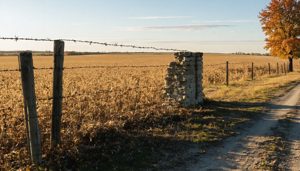
Three major waterways converge near the historic site of Tacaogane, located in present-day Massac County, Illinois.
You’ll find this ghost town positioned strategically at the river confluences of the Ohio and Tennessee Rivers, though its exact location remains uncertain. The area’s ecological habitats supported both native populations and early settlers, featuring mixed hardwood forests and rich riverside environments. Much like Buda, Illinois, the town’s population has dwindled significantly over time, leaving behind remnants of its historical significance. A historic 1684 map first documented the settlement’s existence.
- Natural landmarks include the Grand Chain of Rocks, which created challenging navigation conditions.
- Dense wilderness and unsettled territory dominated the landscape during the 17th-19th centuries.
- Seasonal flooding patterns influenced settlement choices and development.
- River systems served as vital transportation corridors for trade and communication.
The site’s position near major waterways made it an important hub for regional movement, though the surrounding wilderness limited land-based travel options.
Early Settlement Theories
Based on Jean-Baptiste-Louis Franquelin’s 1684 map of Louisiana, the mysterious settlement of Tacaogane emerged as an intriguing point of European recognition in what’s now southern Illinois.
You’ll find that early trade likely played a significant role in Tacaogane’s establishment, as it was strategically positioned between the Mississippi and Ohio rivers.
The settlement’s name, possibly derived from Iroquoian or Algonquian languages, hints at substantial indigenous interactions that shaped its development.
While specific details remain elusive, Tacaogane might’ve served as an essential stopping point for travelers and merchants moving through the region.
Through indigenous interactions, the settlement potentially functioned as a cultural crossroads where Native American tribes, particularly the Kaskaskia, engaged with European explorers and traders in early commerce networks.
Archaeological Significance
Despite its intriguing appearance on Franquelin’s 1684 map, Tacaogane’s archaeological significance remains largely theoretical, as no physical evidence has yet confirmed the settlement’s existence. Modern archaeological methods have yielded no artifacts or structural remains in the proposed location near the Ohio-Tennessee Rivers confluence.
You’ll find that Tacaogane presents unique challenges for researchers seeking settlement evidence:
- No major excavations have targeted the specific site
- Absence of material culture contrasts with the region’s rich archaeological record
- Location differs from known Mississippian settlement patterns
- Proximity to Kincaid Mounds hasn’t produced connecting evidence
While the region’s strategic importance for trade and migration is well-documented, you’ll need to wait for future archaeological surveys to potentially uncover tangible proof of Tacaogane’s existence.
Cultural and Linguistic Origins
You’ll find that Tacaogane’s name reflects the complex linguistic landscape of colonial Illinois, where Iroquoian and Algonquian languages intersected.
The term, first documented on Franquelin’s 1684 map, likely means “between two waters” and stems from indigenous descriptions of the settlement’s location near major river confluences.
While the exact Native American language source remains unclear, the name’s survival through European documentation provides an essential link to the region’s pre-colonial identity and the indigenous peoples who first inhabited the area.
The area now represents one of many lost Illinois communities that have been completely abandoned and converted to farmland over time.
Language Mysteries and Origins
The mysterious name “Tacaogane” presents one of Illinois’ most intriguing linguistic puzzles, as its origins remain unclear despite appearing on Jean-Baptiste-Louis Franquelin’s 1684 map of Louisiana.
You’ll find this settlement’s language evolution particularly fascinating, as it represents a complex layer of indigenous heritage across the region.
- Possible roots in Iroquoian or Algonquian languages, though exact meanings remain disputed
- Strategic location near the confluence of the Ohio, Tennessee, and Cumberland rivers
- No clear connection to surviving Mississippian settlements, despite its historical documentation
- Name may reference speakers of another language, adding to its cultural significance
While the settlement’s physical traces have vanished, its linguistic mystery continues to challenge our understanding of early Illinois history.
Iroquoian-Algonquian Name Connections
Building on the linguistic mystery of Tacaogane, patterns emerge when examining Iroquoian and Algonquian cultural connections in Illinois.
You’ll find that both groups maintained extensive trade networks and formed strategic alliances, leading to significant linguistic exchange across their territories. The name “Tacaogane” itself might reflect these Iroquoian connections or Algonquian influences, as both language families left their mark on regional place names.
While archaeological evidence remains limited, you can trace the cultural significance through the 1684 Franquelin map of Louisiana. The Digital Research Library provides valuable insights into these indigenous communities and their historical presence.
The location’s linguistic heritage likely stems from the rich tradition of both groups, who shared agricultural practices and settlement patterns in the region.
Though the exact origin remains unclear, Tacaogane’s name represents the complex web of Native American interactions in colonial-era Illinois.
Vanishing From the Records
Appearing mysteriously on Jean-Baptiste-Louis Franquelin’s 1684 map of Louisiana, Tacaogane has since vanished from contemporary records, leaving historians puzzled about its true nature and location.
This ghost town’s historical obscurity deepens as you explore the limited documentation of this settlement, believed to be situated in either Massac or Pope County, Illinois.
You’ll find these intriguing aspects about Tacaogane’s disappearance:
- No modern maps reference this settlement, though it once appeared across from the Tennessee and Cumberland rivers
- Archaeological evidence hasn’t confirmed its exact location or existence
- The settlement’s name likely derives from Iroquoian or Algonquian origins
- Despite its cartographic significance, it lacks detailed descriptions in historical accounts
These gaps in documentation continue to challenge researchers seeking to uncover Tacaogane’s story.
Regional Historical Context
You’ll find evidence of complex indigenous settlement patterns where Tacaogane once stood, near the convergence of major waterways that shaped early regional development.
French explorers and mapmakers in the late 1600s documented scattered native villages throughout the Ohio River corridor, though many settlements remained fluid and temporary.
The strategic location near the Tennessee and Cumberland rivers suggests Tacaogane served as a significant point of cultural contact between native groups and European traders traversing these essential water routes.
Native Settlement Patterns
Long before Tacaogane became a ghost town, the Illinois region thrived with diverse Native American settlements, particularly those of the Illinois Confederation.
These tribes developed sophisticated Native agriculture practices and adapted to the region’s rich resources, establishing both permanent and seasonal settlements.
You’ll find the area’s tribal migrations were influenced by several key factors:
- Seasonal hunting patterns that followed game movements across the territory
- Climate changes that affected crop cultivation and food availability
- Pressure from European settlement and expanding colonial interests
- Inter-tribal conflicts that shaped territorial boundaries
The Illinois Confederation’s presence shaped the region’s development through their established trade networks and agricultural practices, though their influence gradually diminished due to diseases, conflicts, and forced displacement through treaties.
The French explorers maintained friendly relationships with the Illinois tribes until British settlement disrupted the established alliances.
Their legacy lives on in the archaeological sites and place names that dot the landscape today.
The Mascouten hunters left their mark on the region’s cultural heritage through their Buffalo Rock paintings.
Early European Exploration
The earliest European documentation of Tacaogane emerged in 1684 when French cartographer Jean-Baptiste-Louis Franquelin placed the settlement on his map of Louisiana, situating it near the strategic confluence of the Ohio, Tennessee, and Cumberland rivers.
As French explorers charted their exploratory routes through the Mississippi and Ohio River valleys, they established essential connections with native settlements that would shape the region’s future.
You’ll find that Tacaogane’s exact location remains debated between present-day Massac and Pope counties, Illinois, reflecting the uncertainties of 17th-century mapping.
The French presence here preceded the major influx of English-speaking settlers, with traders using the waterways to connect their colonial interests from the Great Lakes to the Gulf of Mexico through native interactions.
Modern Historical Legacy

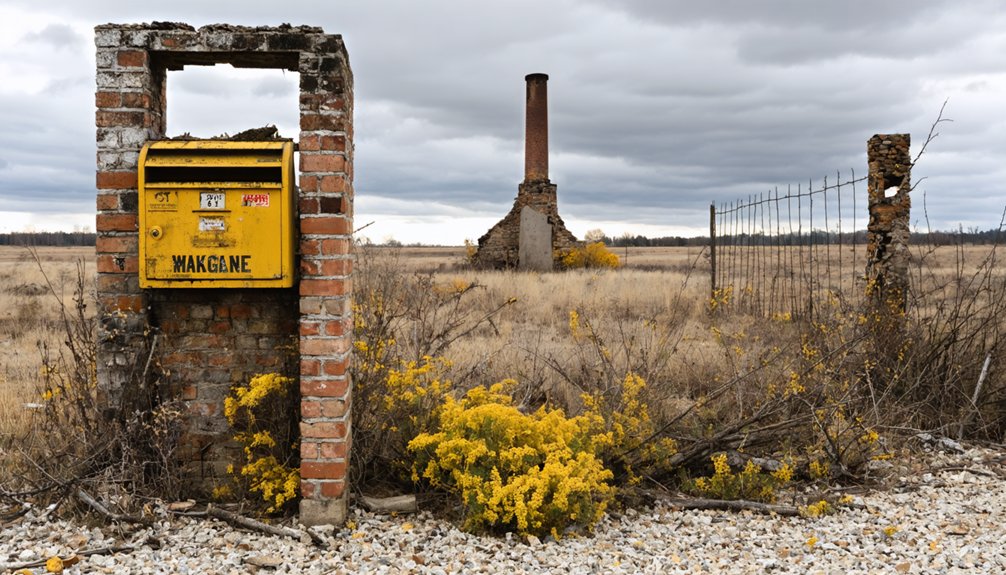
Unlike better-documented Illinois ghost towns, Tacaogane’s modern historical legacy remains remarkably sparse, with only fragmentary references in specialized academic works and cartographic studies.
You’ll find its historical significance vastly different from places like Kaskaskia, where physical remnants and local traditions persist.
- No known archaeological excavations have been conducted at the presumed site
- The settlement’s name survives primarily through Franquelin’s 1684 map
- Modern ghost town narratives rarely include Tacaogane in their collections
- No cultural or heritage tourism elements preserve its memory
The town’s obscurity in contemporary records suggests it vanished before the major waves of European settlement transformed Illinois.
Unlike 19th-century ghost towns that left behind cemeteries, foundations, or local legends, Tacaogane has faded almost completely from both physical and cultural memory.
Frequently Asked Questions
Were There Any Documented Natural Disasters That Contributed to Tacaogane’s Abandonment?
Imagine searching through time’s dusty pages – you won’t find any documented natural disasters causing the abandonment. Historical records don’t show floods, fires, or storms directly contributing to this settlement’s disappearance.
Did French Fur Traders Establish Any Known Trading Relationships With Tacaogane?
You won’t find documented proof of French traders establishing fur exchange relationships with Tacaogane. While they operated in the region, no primary sources or archaeological evidence confirms their presence there.
What Seasonal Migration Patterns Might Have Influenced the Settlement’s Occupation?
You’ll find that seasonal patterns drove occupation, with spring fishing and planting, summer harvesting, fall hunting, and winter migration to sheltered areas influencing how people moved through the settlement.
Were There Any Documented Conflicts Between Tacaogane and Neighboring Indigenous Groups?
You won’t find concrete records of conflicts, though territorial disputes likely occurred. Historical maps hint at indigenous alliances, but specific interactions between Tacaogane and native groups remain largely undocumented.
You’d be crazy to miss Tacaogane’s prime spot controlling river trade at the Ohio’s major confluences. Its location mastered strategic routes between Tennessee and Cumberland rivers, dominating 1680s regional commerce.
References
- https://en.wikipedia.org/wiki/Tacaogane
- https://naturalresources.house.gov/uploadedfiles/swensontestimony03.15.07.pdf
- https://www.jstor.org/stable/480806
- https://www.youtube.com/watch?v=gM3ZIgtFzBk
- https://www.freakyfoottours.com/us/illinois/
- https://www.worldanvil.com/w/vacuum-decay-podcast-rantmanc/a/tacaogane2C-il-settlement
- https://drloihjournal.blogspot.com/p/lost-towns-of-illinois-series.html
- https://illinoisgenweb.org/references/historical-locations-within-illinois.html
- https://en.wikipedia.org/wiki/List_of_ghost_towns_in_Illinois
- https://www.youtube.com/watch?v=93k0qtvzkn4&vl=en-US