You’ll discover Kapoho’s remarkable 1,300-year legacy as a thriving Hawaiian coastal village, known for its fertile volcanic soils and pristine waters. The community first faced devastation in 1960 when volcanic eruptions destroyed nearly 100 structures, though residents rebuilt around the surviving tide pools and hot springs. In 2018, a second eruption completely buried the town, leaving only Cape Kumukahi Lighthouse standing – a symbol of one of Hawaii’s most compelling tales of paradise lost.
Key Takeaways
- Kapoho was a historic Hawaiian coastal village destroyed twice by volcanic eruptions, first in 1960 and completely in 2018.
- The 1960 eruption destroyed nearly 100 structures, though the community rebuilt around tide pools and hot springs afterward.
- Prior to destruction, Kapoho supported 300 residents with homes, schools, and churches, thriving on fertile volcanic soil.
- The 2018 eruption obliterated all remaining structures and natural features, including Hawaii’s largest freshwater lake.
- Only Cape Kumukahi Lighthouse survived both eruptions, standing as a memorial to the former town’s location.
The Rise and Fall of Paradise
While many Hawaiian settlements have endured nature’s fury, Kapoho’s story stands out as a particularly poignant tale of paradise found and lost.
You’ll find its origins over 1,300 years ago, when settlers created innovative irrigation systems that transformed the coastal area into a thriving agricultural community. Despite the geological impact of nearby Kīlauea volcano, Kapoho flourished into a vibrant town with homes, schools, and churches by the mid-20th century. When Hawaii became a state in 1959, residents felt a false sense of security as minor tremors occurred in the months leading up to disaster.
The community’s cultural resilience shone through after the devastating 1960 eruption destroyed nearly 100 structures. Residents rebuilt, establishing new homes and reviving tourism around the area’s famous tide pools and hot springs. Kapoho’s tragic fate began when ground cracked severely along a fault through the town on January 13, forcing hundreds of residents to evacuate.
Despite nature’s destruction in 1960, Kapoho’s spirit endured as its people rebuilt their lives and welcomed visitors to their coastal paradise.
Yet nature would strike again in 2018, when Kīlauea’s fury completely buried Kapoho, erasing this twice-built paradise beneath layers of unstoppable lava.
Natural Wonders Lost to Lava
When lava from Kīlauea’s eruptions engulfed Kapoho in 1960 and 2018, it didn’t just destroy homes – it obliterated an array of stunning natural wonders. You would’ve once found Hawaii’s largest lake here, along with 80 rare anchialine pools teeming with unique marine life. The hot springs that drew visitors to this paradise vanished beneath molten rock.
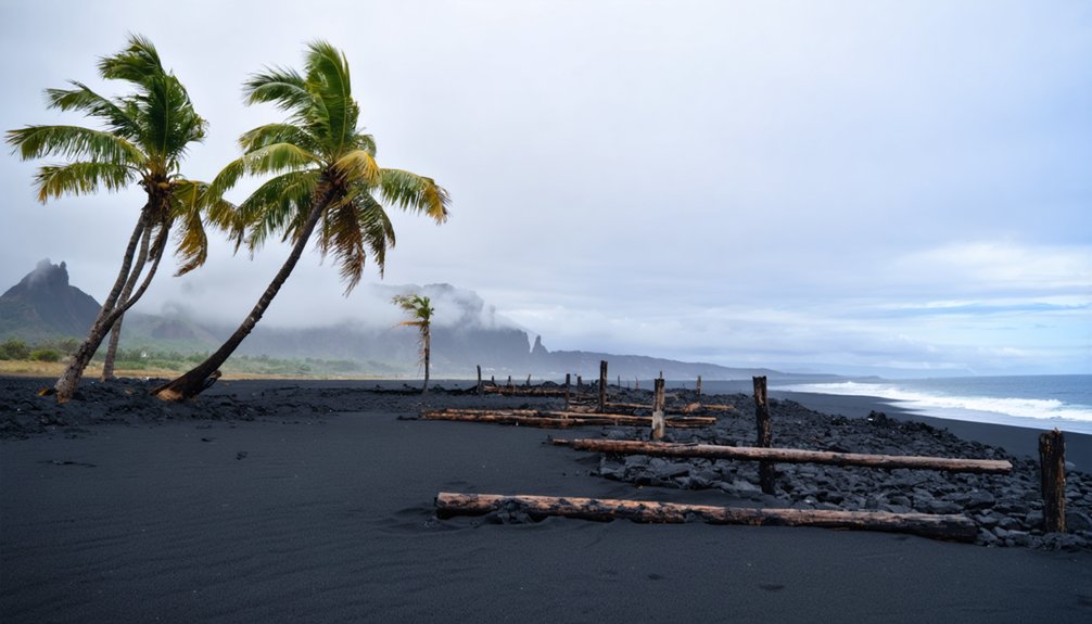
The destruction reshaped the entire coastline, as Kapoho Bay disappeared under massive lava flows that created 875 acres of new land. The 2018 eruption alone claimed 500 acres of forest reserve, forever altering the area’s rich biodiversity. The 122 million cubic meters of lava from the 1960 eruption permanently transformed the landscape. The area’s transition from a million-dollar homes destination to devastation marked a dramatic reversal of fortune.
Today, ecosystem restoration faces enormous challenges, as the water body loss has eliminated critical habitats. Where pristine coastal wetlands and vibrant forests once stood, you’ll now find stark volcanic landscape that bears little resemblance to its former glory.
Life Before the Eruptions
Before nature reclaimed Kapoho in 1960, you’d have found a vibrant agricultural town of 300 residents nestled near Hawaii’s easternmost point, where sugar cane fields stretched across the volcanic landscape.
You could have relaxed in the town’s famous hot springs resort or explored the pristine tide pools teeming with marine life along the shoreline.
The close-knit community’s daily life centered around farming, small businesses, and the Cape Kumukahi Lighthouse, which guided ships through Pacific waters while standing sentinel over this rural paradise.
The peaceful rhythm of life was disrupted when residents endured over 1,000 earthquakes leading up to the devastating 1960 eruption.
The community spent nearly two months watching helplessly as the approaching lava gradually consumed their beloved town.
Thriving Agricultural Community
During its agricultural heyday, Kapoho thrived as a fertile paradise in Hawaii’s Puna district, where the unique volcanic soils and abundant rainfall of 100 inches per year created ideal conditions for farming.
You’d find farmers cultivating exceptionally sweet papayas and bananas, showcasing their agricultural resilience by planting directly in volcanic cinders using hand tools. Some farmers even managed to grow crops in the black cinder soil left behind from the 1960 eruption.
The tight-knit community fostered strong community bonds through their shared agricultural pursuits. You could see farmers working together, connected by unpaved roads, a railroad station, and local stores that served their needs.
The traditional Hawaiian ahupuaʻa system influenced their farming practices, creating diverse agro-ecosystems from the mountains to the sea. These sustainable practices supported the cultivation of diverse native crops, including taro, sweet potatoes, and breadfruit.
Despite the ever-present volcanic risks, farmers consistently rebuilt and adapted after eruptions, demonstrating their unwavering commitment to this fertile but volatile land.
Natural Paradise Homes
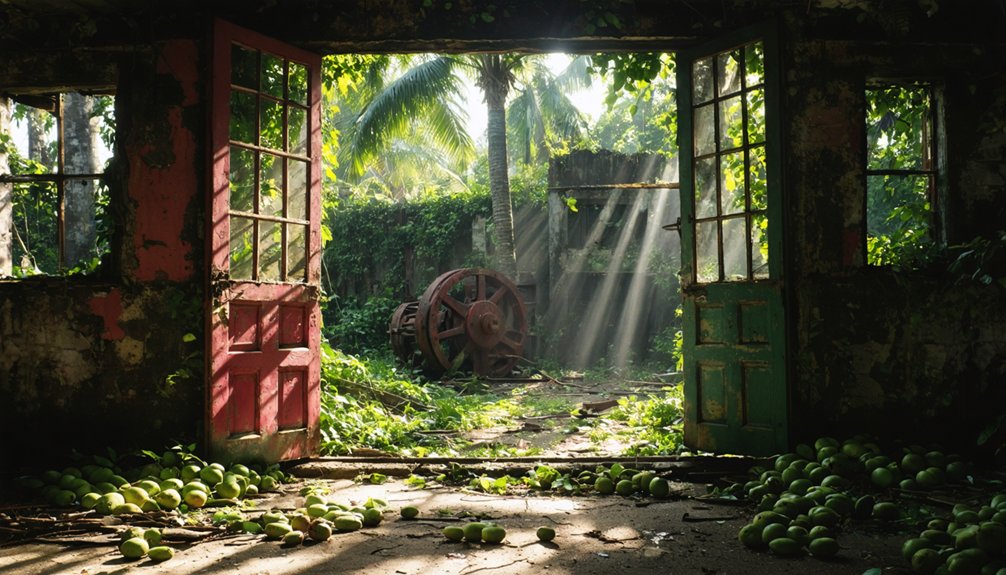
Anyone lucky enough to live in pre-eruption Kapoho enjoyed a tranquil coastal paradise where roughly 300 residents made their homes amid lush tropical vegetation and natural wonders.
You’d find private homes scattered throughout this rural haven, where natural hot springs and pristine tide pools were just steps from your door.
These tropical retreats offered you direct access to some of Hawaii’s most stunning natural features, including the historic Cape Kumukahi Light and the mysterious Green Lake within Kapoho Crater.
Despite the constant threat of residential erosion from volcanic activity, homeowners embraced the area’s unique geography, building their lives around the hot spring resort and agricultural ventures that defined this easternmost community on the Big Island.
The 1960 Volcanic Catastrophe
A series of over 1,000 small earthquakes shook Kapoho on January 12, 1960, marking the beginning of one of Kīlauea’s most devastating eruptions.
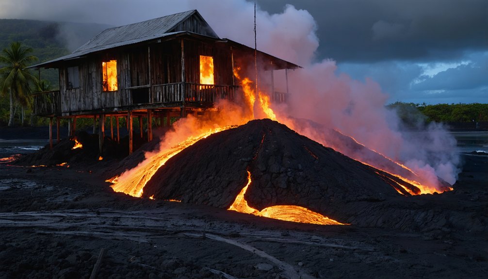
The seismic activity quickly led to deep cracks in streets, followed by an ominous red glow above the town on January 13. You’d have witnessed massive lava fountains shooting up to 300 meters high, producing fast-moving ʻaʻā flows that relentlessly advanced toward the Pacific Ocean.
Despite attempts to divert the flow with earthen barriers and water spraying, the molten rock engulfed Kapoho by January 28.
The lava characteristics changed as new magma mixed beneath the surface, ultimately destroying nearly 100 homes, businesses, and a beloved hot spring resort.
Only the Cape Kumukahi lighthouse survived, standing sentinel over what would become a ghost town.
2018’s Final Destruction
The final hours of Kapoho began with a seven-hour pumice fall during strong kona winds on January 27, 1960.
You’d have witnessed the final devastation unfold rapidly as ‘a’a lava flowed through the streets, overwhelming buildings by midnight. Despite the community’s resilience in building multiple earthen barriers, the lava found its way underground, emerging near Kapoho School before destroying it by noon.
The town’s last two standing buildings succumbed to lava on January 30. Nearly 100 structures, including homes, businesses, and a hot spring resort, were lost.
As temperatures rose and fountains reached heights of 300 meters, the eruption continued until February 19.
When it ended, you’d have found Kapoho transformed into a ghost town, buried under pumice, ash, and hardened lava.
Legacy of a Vanished Community
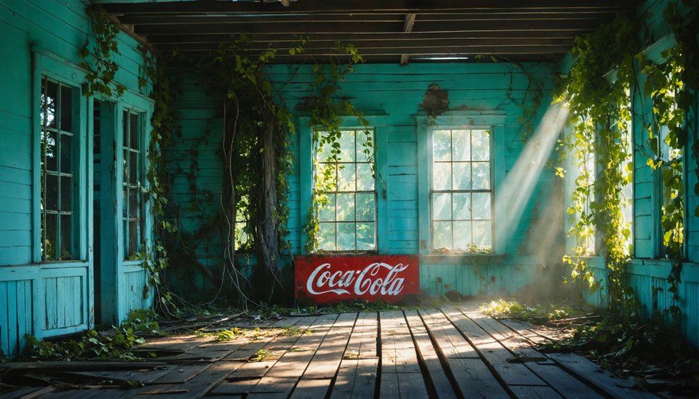
Before becoming a ghost town, Kapoho flourished as a vibrant coastal village in Hawaii’s Puna District, where fertile volcanic soils and pristine waters supported generations of farmers, fishermen, and families.
You’ll find Kapoho’s legacy lives on through stories of remarkable community resilience, as residents rebuilt their lives after the devastating 1960 eruption, only to face nature’s fury again in 2018. The iconic Cape Kumukahi Lighthouse remained standing through both eruptions as a symbol of hope and perseverance.
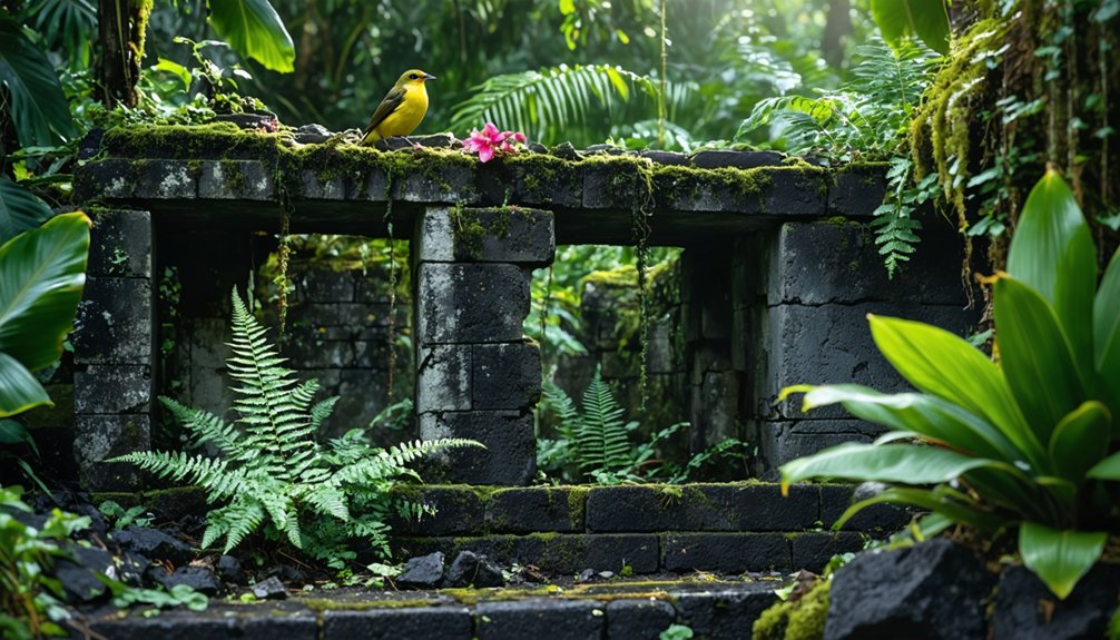
The town’s cultural identity endures in oral histories that chronicle life among the tide pools, Green Lake, and geothermal wonders that once drew visitors from around the world. Ancient Hawaiian communities utilized these waters for their brackish shrimp farming practices.
While Pele’s lava has reclaimed the physical landscape, Kapoho’s spirit persists in the memories of those who called it home and the lessons it taught about living harmoniously with Hawaii’s dynamic volcanic environment.
Nature’s Transformation and Recovery
You’ll witness nature’s remarkable resilience in Kapoho as the 2018 Kīlauea eruption‘s massive lava flows, which created 875 acres of new land, begin their transformation into living ecosystems.
The destruction of Hawaii’s largest freshwater lake and 13.7 square miles of existing landscape has initiated a long-term process of volcanic soil formation, where pioneer species will gradually colonize the hardened lava.
While the immediate aftermath devastated local habitats, new ecological communities are emerging on the fresh volcanic terrain, demonstrating how life adapts and regenerates in the wake of volcanic activity.
Volcanic Rebirth Process
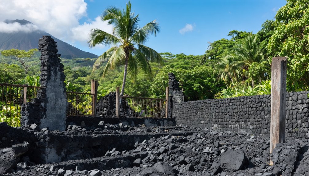
Following Kapoho’s destruction in 1960, intense lava flows reaching temperatures of 20-50°C completely transformed the landscape through a process of thermal and structural reset. The lava buried all existing structures and created new land formation, extending the shoreline by 100 meters and birthing volcanic cones like Puʻu Laimana that rose over 100 meters high.
You’ll find nature’s rebirth began with a blanket of pumice and ash covering the barren lava field. Over time, wind and rain broke down the volcanic rock, creating pathways for water and nutrients.
The process initiated ecological succession as weathering released minerals from the basalt. New drainage patterns emerged, while cracks in the cooled lava served as aquifers. Steam vents and geothermal heat continued influencing the soil conditions, preparing the foundation for life’s return.
New Ecosystem Development
Since Kapoho’s burial under lava in 1960, nature has commenced on a slow, unpredictable path of ecological succession.
You’ll find the barren lava fields gradually breaking down through weathering, creating tiny pockets where soil can accumulate. Pioneer species like lichens, ferns, and grasses emerge first, taking hold in cracks and depressions across the volcanic landscape.
The harsh conditions have led to a challenging recovery process, where invasive competition often overwhelms native plants.
Without organized restoration efforts, you’ll see mostly non-native grasses and shrubs dominating the terrain. Unlike actively restored sites like Ka’ūpulehu, where thousands of native seedlings thrive, Kapoho’s new ecosystem remains fragmented and less diverse, shaped by ongoing volcanic activity and limited soil development.
Frequently Asked Questions
Can Visitors Safely View the Former Kapoho Site From Any Nearby Locations?
Like Pompeii, you can’t safely visit Kapoho’s ruins. Your only viewing locations are distant glimpses from Cape Kumukahi Lighthouse, but safety measures restrict access due to unstable lava fields and dangerous terrain.
Are There Any Surviving Artifacts or Structures From Pre-Eruption Kapoho?
You’ll find virtually no surviving artifacts or structures, as lava flows buried all archaeological discoveries. Only the Kapoho Lighthouse remains, though its historical significance lives on through photographs and records.
What Happened to the Cape Kumukahi Lighthouse After 2018?
You’ll find the lighthouse still standing tall, having survived the 2018 eruption. Though access is limited by lava-blocked roads, ongoing lighthouse restoration efforts continue while managing coastal erosion impacts.
Do Any Former Kapoho Residents Still Hold Regular Community Gatherings?
After losing 100% of their town in 2018, you won’t find organized community memories or reunion events among former Kapoho residents. The complete destruction scattered the community without established gathering spaces.
Has New Marine Life Emerged in Areas Where Tide Pools Once Existed?
You’ll find limited marine biodiversity in former tide pool areas, with no significant coral or fish populations yet established. While some algae and microorganisms exist, full tide pool restoration remains decades away.
References
- https://kalanipkg.com/2017-8-island-culture-forgotten-towns
- https://www.to-hawaii.com/big-island/cities/kapoho.php
- https://www.mysteries-of-hawaii.com/blog
- https://nvtami.com/2023/04/26/big-island-hawaii-ghost-towns/
- https://www.geotab.com/ghost-towns/
- https://www.youtube.com/watch?v=DFs7xxORc1I
- https://en.wikipedia.org/wiki/List_of_ghost_towns_in_Hawaii
- https://kids.kiddle.co/List_of_ghost_towns_in_Hawaii
- https://imagesofoldhawaii.com/something-was-amiss/
- https://en.wikipedia.org/wiki/Kapoho