
You’ll find the ghost town of Keystone, Oklahoma submerged beneath Keystone Lake since 1964. Founded in 1900 at the Arkansas and Cimarron Rivers’ confluence, it flourished as a notorious liquor trade hub between Indian and Oklahoma Territories. The town peaked at 1,000 residents before Oklahoma’s 1907 statehood brought prohibition. When the Keystone Dam project began in 1956, the bustling frontier settlement vanished underwater, where its streets and buildings now rest as silent witnesses to a colorful past.
Key Takeaways
- Keystone became a ghost town when the original townsite was completely submerged underwater during the construction of Keystone Dam in 1964.
- Originally established in 1900, Keystone thrived as a liquor trade hub with over 1,000 residents before Oklahoma’s statehood and prohibition.
- The town’s decline began in 1907 with Oklahoma’s statehood and prohibition laws, eliminating its primary economic driver.
- Remnants of Keystone’s streets and buildings now rest at the bottom of Keystone Lake, creating an underwater archaeological site.
- The town’s demise was sealed when major railroad routes bypassed the area, cutting off vital transportation links.
The Birth of a River Town
At the convergence of the Arkansas and Cimarron Rivers, Keystone emerged in 1900 as an essential settlement in Oklahoma’s Triangle Country. You’ll find its name reflects the strategic location between Creek and Osage reservations, where river navigation and cultural exchanges flourished among Native American groups and settlers alike. The Keystone Historical Society formed in 1975 to preserve the area’s rich heritage.
The land teemed with buffalo, deer, and turkey before settlement, while the Arkansas Valley and Western Railroad’s arrival in 1902 transformed Keystone into a crucial cattle shipping point. Early explorers like Thomas Nuttall traversed these lands, documenting the region’s rich natural resources and indigenous cultures.
You can trace the town’s connections to nearby communities like Mannford, named for its Cimarron River ford crossing, and Prue. Together, they formed a network of river towns that shaped early Oklahoma’s transportation and trade landscape until Keystone Lake’s creation in the 1960s.
The history of Wellston Colony, Oklahoma is also intertwined with these river towns, serving as a significant location for settlers drawn to the economic opportunities along the waterways. As trade routes expanded, Wellston Colony played a pivotal role in the agricultural development of the region, contributing to the overall growth of early Oklahoma. The interactions among these communities laid the foundation for the cultural and social dynamics that would define the area for years to come.
Life Before Statehood
Before Oklahoma statehood, you’d have found Keystone thriving as a significant liquor trade hub along the Indian Territory border, where federal restrictions on alcohol sales didn’t apply.
The town’s strategic position at the railroad junction made it a natural gathering point for traders moving goods between Indian Territory and Oklahoma Territory in the early 1900s. When the Curtis Act threatened to dissolve tribal governments in 1898, the region faced significant uncertainty about its future governance.
During this period, the Five Civilized Tribes had established sophisticated settlements in Indian Territory before being forced to relocate through removal policies.
As trains chugged through daily, bringing both legitimate commerce and bootleggers, Keystone’s reputation grew as a place where the rules of Indian Territory met the more permissive atmosphere of the frontier.
Liquor Trade Hub
During Oklahoma’s pre-statehood period, Keystone emerged as one of several essential “liquor towns” strategically positioned along Indian Territory’s borders.
You’d find a bustling economy driven by legal liquor sales, as the town capitalized on its location near the dry Indian Territory. The liquor legislation differences between territories created a perfect trading opportunity that Keystone’s entrepreneurs quickly seized. Like No Man’s Land communities of the era, the lack of strict law enforcement attracted those seeking freedom from regulations. The town eventually met its decline when the Keystone Dam was constructed in 1960.
Jewish merchants, arriving by rail around 1892, joined the economic transformation, establishing retail businesses alongside the thriving saloons and gambling halls.
With a population exceeding 1,000 by the early 1900s, Keystone’s streets buzzed with cowboys, farmhands, and travelers seeking spirits.
While less notorious than other whiskey towns, you’d still encounter the familiar mix of vice and occasional violence that characterized these strategic trading posts.
Railroad Junction Prominence
When the Southern Kansas Railroad, a subsidiary of the Atchison, Topeka and Santa Fe Railway, laid tracks through Indian Territory in 1887, Keystone emerged as an essential rail junction.
You’d have witnessed the town’s swift transformation as it became one of the first post offices in the Cherokee Outlet by 1888, marking a significant milestone in the region’s railroad expansion.
The town’s strategic position near the Cherokee Strip made it a fundamental hub for livestock and agricultural commerce.
The Cherokee Strip Association ranches dominated the area’s economic activities before the land run of 1893.
The area’s rich history includes Camp Arbuckle’s establishment in 1834 during early military expeditions.
As transportation evolution accelerated, the Colorado, Kansas & Oklahoma Railroad added another line in 1911, cementing Keystone’s role as a regional nexus.
You’d have found bustling rail yards operating 24 hours, complete with maintenance shops, roundhouses, and Harvey Houses serving travelers along these important trading routes.
The Liquor Trade Era
Located strategically at the junction of the Cimarron and Arkansas rivers, Keystone emerged in 1900 as one of Oklahoma Territory’s bustling “liquor towns.”
The settlement’s position along the boundary between Oklahoma and Indian Territory proved advantageous, as it could legally sell alcohol while neighboring areas remained dry.
You’d have found a thriving liquor culture in Keystone, where saloons and dance halls drew cowboys, cattle dealers, and traders from across the region. Much like the old trade center of Danville, the town became a hub of commercial activity.
The town’s waterway access made it ideal for distributing spirits throughout the territory. The entire town now rests beneath the 73 feet deep waters of Keystone Lake.
This economic prosperity wouldn’t last, though. When Oklahoma achieved statehood in 1907, the state’s strict prohibition laws forced a dramatic economic shift.
Like other liquor towns such as Corner, Violet Springs, and Keokuk Falls, Keystone’s main source of revenue vanished overnight.
Decline and Economic Shifts
The decline of Keystone’s lucrative liquor trade began abruptly with Oklahoma’s statehood and prohibition laws in 1907, forcing the town to scramble for new economic foundations.
You’ll find that the construction of Keystone Dam in 1960 dealt the final blow, submerging the original townsite and displacing the remaining population.
The town’s fate had already been sealed decades earlier when major railroad routes bypassed the area, cutting off essential transportation links that might’ve sustained alternative industries.
Pre-Statehood Liquor Trade
Prior to Oklahoma statehood in 1907, stark differences in liquor regulations between Oklahoma Territory and Indian Territory shaped Keystone’s economic landscape.
While Oklahoma Territory maintained looser pre-statehood regulations on alcohol sales, federal laws strictly prohibited liquor in Indian Territory through the Trade and Intercourse Acts of 1802 and 1834. You’d find tribal leaders actively opposing alcohol distribution, even imposing their own penalties to prevent consumption.
Despite these restrictions, bustling smuggling networks emerged as bootleggers exploited weak enforcement along territorial borders.
Keystone capitalized on this dynamic, establishing itself as a prominent “liquor town” where alcohol trade drove local prosperity. The town’s strategic position helped it profit from both legal sales in Oklahoma Territory and illicit distribution into Indian Territory, creating a lucrative but precarious economic foundation.
Dam Construction Impact
Following years of flood control planning, construction of the Keystone Dam began in 1956, forever altering the economic and physical landscape of this once-thriving trade hub.
By 1964, you’d find a massive 121-foot-high structure stretching 4,600 feet across the Arkansas River, its concrete spillway equipped with 18 tainter gates controlling the water’s flow.
The dam’s impacts were swift and irreversible. Your former hometown disappeared beneath Keystone Lake’s waters, drowning local businesses, farms, and established trade routes.
While the dam brought new hydroelectric power by 1968 and created recreational opportunities, these economic consequences couldn’t replace what was lost.
The original community scattered as the waters rose, transforming centuries-old riverfront commerce into a submerged memory, now hidden beneath the lake’s surface.
Railroad Route Changes
Once essential to Keystone’s economic prosperity, railroad routes began their steep decline in the mid-20th century, drastically reshaping the town’s commercial landscape.
You’d have seen major railroads like the Katy, Rock Island, and Frisco gradually abandon their lines, severely limiting your access to crucial markets. The railroad history of the region shows passenger service vanishing by 1979, while freight operations dwindled as trucks took over transportation duties.
From a peak of 6,500 rail miles in 1920, Oklahoma’s network shrank to half that size by 2000. These economic impacts hit Keystone hard – you couldn’t rely on trains anymore for shipping agriculture or oil products, and the town’s commercial importance suffered as its transportation lifelines were cut one by one.
The Keystone Dam Project
The U.S. Army Corps of Engineers began dam engineering on Keystone Dam in January 1957, completing the massive structure in September 1964.
You’ll find this impressive flood management project 15 miles west of Tulsa, where it spans the Arkansas River just downstream of its confluence with the Cimarron River.
Standing 121 feet high and stretching 4,600 feet long, the dam’s concrete section features 18 tainter gates and nine sluices to control water flow.
By 1968, two hydroelectric units were churning out 70,000 kilowatts of power.
The project created Keystone Lake, which now serves multiple counties and provides essential resources for the region, including water supply, flood control, and recreation.
Today, you’ll see ongoing safety modifications, including plans to raise the dam by 10.5 feet and reinforce critical structures.
Beneath the Waters

When Keystone Lake filled in 1964, it submerged the original townsite of Keystone, established around 1900 along the Arkansas River.
Today, you’ll find this underwater archaeology site about 15 miles west of Tulsa, where streets, foundations, and building remnants create a time capsule of regional history beneath the surface.
During drought conditions, you can sometimes glimpse the submerged history as water levels drop, revealing brick structures and old roadways from this once-thriving community.
- Concrete foundations rest silently on the lake bottom, marking where homes and businesses once stood
- Fish now swim through the ghostly remains of main street
- Old building outlines create an eerie underwater landscape visible through sonar
- During low water, worn brick walls occasionally break the surface, telling tales of the past
Legacy and Modern Recreation
While the original town now rests beneath Keystone Lake’s waters, its legacy lives on through extensive recreational opportunities that draw visitors year-round.
Though submerged beneath the lake, Keystone’s spirit endures as a vibrant hub for year-round outdoor recreation and adventure.
You’ll find 16 recreational areas, including three alcohol-free beaches and four marinas that support your boating adventures. The lake’s waters teem with diverse fish species, from striped bass to catfish, while the surrounding wilderness offers prime hunting and wildlife viewing.
Beyond recreation, you’ll discover how cultural tourism and historical preservation efforts keep Keystone’s memory alive. The Keystone Ancient Forest preserves the region’s natural heritage through maintained trails, while local organizations promote the submerged town’s significance.
Whether you’re camping, hiking, or participating in sailing events through the Windycrest Sailing Club, you’re experiencing a transformed landscape that honors its past.
Wildlife and Natural Heritage
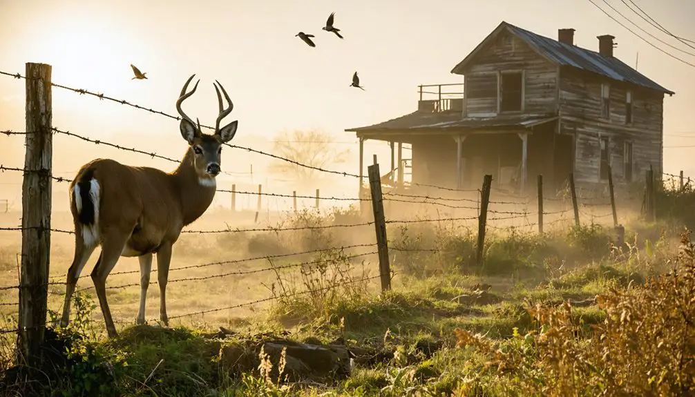
Living beneath Keystone Lake’s expansive waters, diverse wildlife communities thrive in carefully managed habitats. The area’s wildlife conservation efforts protect critical ecosystems where white-tailed deer roam freely alongside coyotes and bobcats.
You’ll find natural habitats ranging from prairie dog colonies that support over 200 species to productive riparian zones where Great Blue Herons nest in established rookeries.
- Bald eagles soar along river corridors from November through March, while pelicans gather below the dam year-round
- Prairie dogs engineer complex underground cities, creating refuges for endangered black-footed ferrets and burrowing owls
- Waterfowl and shorebirds flock to Cottonwood Creek during seasonal flood and drawdown periods
- Bass, catfish, and crappie populate the lake’s waters, drawing anglers to productive fishing spots
Frequently Asked Questions
Were Any Artifacts Recovered From Keystone Before the Flooding?
You’ll find numerous artifact discoveries from 1979’s archaeological survey, including stone tools, pottery, projectile points, metal fragments, and architectural remains – all highlighting the historical significance of pre-flooding settlements.
Did Any Original Buildings Survive Relocation Before the Lake’s Creation?
While mountains of historical significance were lost forever, you won’t find confirmed records of any original architecture surviving relocation. The town’s buildings likely vanished beneath Keystone Lake’s rising waters in 1964.
What Happened to the Residents Who Were Displaced by the Dam?
You’d find most displaced residents moved to nearby towns, facing displacement impacts like lost social networks and livelihoods. Despite these challenges, community resilience showed as families maintained cultural connections in new locations.
Are There Visible Remnants of Keystone During Periods of Low Water?
Like ghostly apparitions from Instagram’s past, you’ll spot submerged structures only during extreme drought conditions when lake levels drop considerably. Don’t count on regular sightings, as water management keeps ruins hidden.
Did Any Prominent Families From Keystone Establish Businesses in Nearby Towns?
While you’ll find that Keystone families likely moved to surrounding towns after the dam’s construction in 1960, there aren’t any documented cases of specific business establishments they founded in nearby communities.
References
- https://www.okhistory.org/publications/enc/entry?entry=GH002
- https://okmag.com/blog/a-ghostly-site/
- http://tccconnection.com/keystone-lakes-history-a-story-of-nature-and-a-former-town/
- https://en.wikipedia.org/wiki/Keystone_Lake
- https://www.swt.usace.army.mil/Locations/Tulsa-District-Lakes/Oklahoma/Keystone-Lake/History/
- https://keystoneok.yest.info/lake_info.htm
- https://mannfordmuseum.org/keystone-crossroads-historical-society/
- https://keystonelakeliving.wordpress.com/2012/12/22/keystone-lake-area-history/
- https://gateway.okhistory.org/explore/partners/KCHS/
- https://en.wikipedia.org/wiki/History_of_Oklahoma


