You’ll find Kwigiumpainukamiut’s ghost town remains in southwestern Alaska’s Bethel Census Area, marked by a distinctive 200-yard clearing along the Kuskokwim River. This former Yup’ik settlement once served as an essential trading hub between indigenous peoples and Russian traders, featuring strategic defensive ridges and multiple ethnic living areas. Today, only shallow footings and ground depressions hint at its past, while archaeological findings continue to reveal the rich cultural tapestry of this abandoned riverside community.
Key Takeaways
- Kwigiumpainukamiut was a significant Yup’ik settlement along Alaska’s Kuskokwim River that now exists only as archaeological remains.
- The site features a distinctive 200-yard clearing with ground depressions and shallow footings where buildings once stood.
- Archaeological evidence reveals a multi-ethnic community where Yup’ik, Athabascan, and Russian cultural elements merged through trade and settlement.
- The abandoned settlement deteriorates due to freeze-thaw cycles, wind exposure, and climate change impacts on permafrost stability.
- The site maintains cultural significance through indigenous oral histories and successful repatriation of ancestral remains marked by Orthodox ceremonies.
Geographic Location and Natural Setting
Nestled in southwestern Alaska‘s Bethel Census Area, Kwigiumpainukamiut lies at approximately 61°34′07″N latitude and 159°13′33″W longitude.
You’ll find this remote ghost town between Chuathbaluk and Napaimute, directly across from Kolmakoff Island in the untamed Kuskokwim River region.
The site’s distinctive geographic features include a 200-yard clearing covered in tan grass during early spring. This natural setting exemplifies Alaska’s rugged beauty, with the clearing positioned along riverbanks that once served as crucial transportation routes. The indigenous people traditionally engaged in subsistence fishing activities along these waters.
The surrounding natural resources and waterways provided sustenance for early settlers through fishing and river commerce. The area’s subarctic climate shapes the landscape, featuring boreal vegetation and seasonal shifts from winter snow to spring grasslands, all preserved in their pristine state.
Historical Settlement Patterns
You’ll find that Kwigiumpainukamiut’s location along the Kuskokwim River shaped its early development as a crucial Yup’ik settlement and trading hub.
The river’s importance as a transportation corridor influenced both indigenous seasonal migrations and later Russian trading patterns, with approximately 13,500 Yup’ik people moving between camps in the Yukon-Kuskokwim Delta region. Similar to how themes of ambition drove settlers in other frontier regions, the Yup’ik people demonstrated remarkable adaptability in establishing and maintaining their trading networks.
The establishment of nearby Kolmakovskiy Redoubt by Russian traders in the mid-19th century altered traditional settlement patterns, drawing indigenous communities closer to trading posts while maintaining their seasonal fishing and hunting practices.
River Trade Routes Impact
Located strategically between Chuathbaluk and Napaimute, Kwigiumpainukamiut emerged as an essential node along the Kuskokwim River’s extensive trade network.
You’ll find its position directly across from Kolmakoff Island, where a 200-yard clearing served as an important landing site for traders and travelers.
The settlement’s trade dynamics reflected the broader patterns of Alaska’s river-based commerce, where the waterways acted as natural highways connecting remote communities.
These routes didn’t just facilitate the movement of goods like fish, fur, and manufactured items – they sparked cultural exchange between native groups, traders, and settlers, much like how over 600 workers from twenty different countries found their way to Kennicott during its mining peak.
Like the glacial rebound that contributed to Dyea’s decline, natural forces gradually altered the landscape around Kwigiumpainukamiut.
Yet as transportation methods evolved and river traffic patterns shifted, Kwigiumpainukamiut’s significance waned.
Today, it stands as a ghost town, evidence of how changing trade routes can determine a settlement’s fate.
Indigenous Migration Patterns
The indigenous history of Kwigiumpainukamiut stretches back to the earliest human migrations across the Bering Land Bridge, some 10,000 to 20,000 years ago.
You’ll find that indigenous migration patterns in this region reflected the dynamic relationship between people and their environment. As Holocene warming submerged the land bridge, early settlers adapted to diverse ecological niches, particularly along river systems and coastal areas. The Russian-American Company would later exploit these established communities for fur trading purposes.
Like other Native Alaskan communities, the area’s inhabitants likely followed seasonal movements tied to fish runs and hunting grounds. This cultural adaptation was typical of inland Athabaskan groups, who maintained multiple camps throughout the year. The Athabaskans settled in Alaska’s vast interior regions, developing sophisticated hunting and gathering practices.
The region’s settlement patterns mirrored those found throughout Alaska, where coastal villages supported more permanent populations while inland groups remained more mobile to maximize resource utilization.
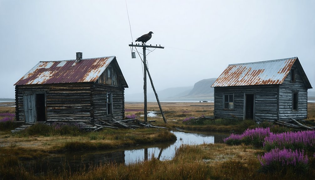
Life Before Abandonment
Situated along the Kuskokwim River across from Kolmakoff Island, Kwigiumpainukamiut once thrived as a small but active indigenous settlement in Alaska’s Bethel Census Area.
The history of Kalakaket, Alaska, is rich with stories of resilience and cultural heritage. As the local communities adapted to the changing environment, their traditions and practices were passed down through generations. Today, the area reflects a blend of historical significance and modern-day life, celebrating its unique roots while embracing new opportunities.
You’d have found a tight-knit community occupying a 200-yard clearing, where community dynamics centered around riverine activities and seasonal rhythms.
Daily life revolved around subsistence strategies that took full advantage of the region’s natural resources. You would’ve seen residents fishing the river’s waters, trapping local wildlife, and engaging in small-scale trade with neighboring settlements.
The community’s layout followed the riverbank, with modest structures built from local materials suited to the harsh boreal environment. While the settlement didn’t feature extensive infrastructure, it maintained the essential elements needed for survival in Alaska’s remote wilderness.
The Path to Becoming a Ghost Town
As economic pressures mounted in the early twentieth century, Kwigiumpainukamiut faced a cascade of challenges that ultimately led to its abandonment.
You’ll find that economic shifts from subsistence to cash economies dealt the first blow, while the depletion of profitable resources left little incentive for residents to stay.
The town’s remote location between Chuathbaluk and Napaimute proved increasingly problematic as transportation costs soared.
Cultural changes also accelerated the exodus, with families seeking communities that offered better educational opportunities and modern amenities.
Without sustainable industries or government support, you’d have witnessed a steady population decline that created a self-reinforcing cycle.
As residents departed, maintaining essential services became impossible, spurring even more people to relocate to more viable settlements along the Kuskokwim River.
The devastating 1918 flu pandemic swept through the region, further accelerating the town’s decline as families sought medical care elsewhere.
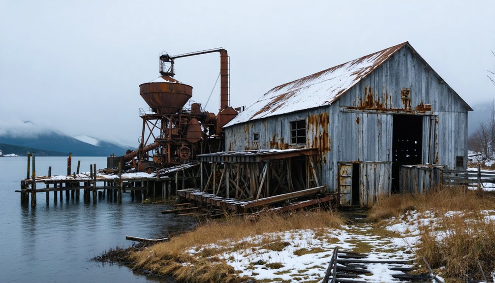
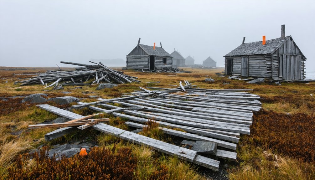
Physical Remnants and Archaeological Findings
Today you’ll find Kwigiumpainukamiut as a distinctive 200-yard clearing with tan grass, where archaeological investigations have focused on uncovering subsurface features and settlement patterns.
The site’s visible remnants are minimal, with no standing structures remaining, though The Kwig Dig has revealed artifacts that offer insights into the former inhabitants’ daily lives. Similar to Alaska’s 100 ghost towns, the site stands as a testament to the temporary nature of human settlements in this rugged territory.
While natural processes have reclaimed much of the settlement, the isolated location has helped preserve potential archaeological materials beneath the surface, including possible house foundations, storage cellars, and domestic artifacts.
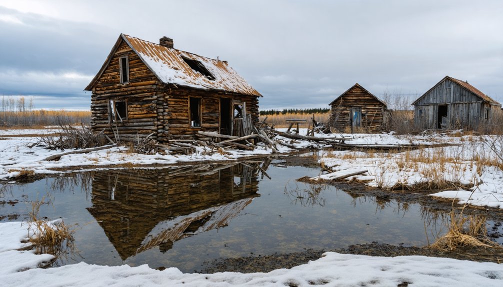
Visible Building Foundations Today
The visible remnants of Kwigiumpainukamiut consist primarily of a distinct 200-yard clearing that stands out against the surrounding birch-covered hillsides.
You’ll find this open space nestled in a semicircular depression backed by strategically cleared ridges, which once provided essential defensive visibility.
Unlike more intact ghost towns such as Kennicott, foundation visibility at Kwigiumpainukamiut is subtle, marked mainly by uneven ground textures and soil discoloration.
Structural decay has left no standing buildings; instead, you’ll discover fragmented traces of former dwellings through shallow footings and ground depressions.
The site’s remote riverbank location has allowed natural processes to reclaim most above-ground features, though the clearing’s persistence indicates purposeful land management from its occupied past.
Archaeological Artifacts Unearthed Locally
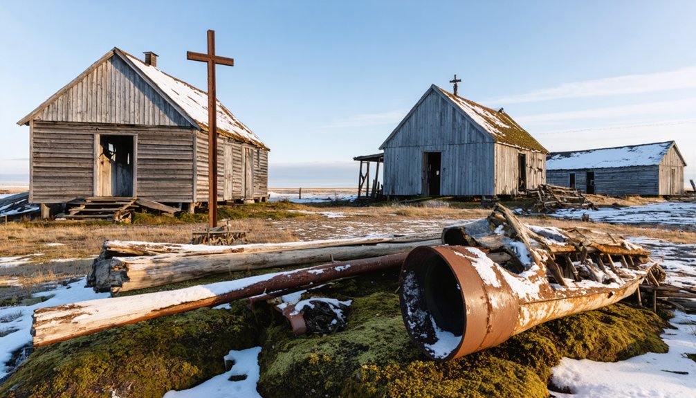
Significant archaeological discoveries at Kwigiumpainukamiut reveal a complex multi-ethnic community shaped by cultural exchange and religious transformation.
You’ll find the site’s archaeological significance reflected in artifacts that tell a story of cultural adaptation. Locally crafted molds for Orthodox crosses demonstrate how residents integrated Russian religious practices into their daily lives during the 1800s.
The settlement’s unique cultural heritage is evident in its distinct living areas, where both Yup’ik and Athabascan groups maintained separate quarters while coexisting. DNA analysis of recovered dog remains shows the introduction of European breeds following contact, while some specimens suggest previously unknown local breeds.
These findings, along with human remains repatriated in 2009 to the Crooked Creek community, connect modern residents directly to their ancestors who once called this place home.
Site Layout And Features
Beyond the artifacts that document its cultural heritage, Kwigiumpainukamiut‘s physical layout reveals a carefully planned settlement spanning approximately 200 yards along Alaska’s Bethel Census Area.
The settlement layout, positioned across from Kolmakoff Island, showcases strategic placement for both survival and community dynamics. While no standing structures remain today, you’ll find the site’s original footprint preserved in its clearing, covered by seasonal tan grass in spring. Archaeological evidence suggests the inhabitants primarily spoke Yupik language during the settlement’s active period.
- The broad, open terrain suggests areas once dedicated to dwellings and communal gatherings.
- Proximity to the river indicates intentional positioning for trade and fishing access.
- The site’s scale points to a modest but organized community, likely serving as a trading post rather than an industrial center.
The remote location has protected this ghost town from development, preserving its archaeological integrity.
Environmental Impact on Site Preservation
While remote Alaskan wilderness typically shields abandoned settlements from human interference, Kwigiumpainukamiut faces severe environmental challenges that threaten its preservation.
The site contends with intense climatic challenges, including destructive freeze-thaw cycles that destabilize building foundations through permafrost movement. You’ll find erosion threats accelerated by wind exposure, precipitation, and seasonal river fluctuations near Kolmakoff Island.
Natural reclamation processes continue to transform the 200-yard clearing, as tan grasses and successive vegetation both protect and obscure archaeological features.
Without human intervention, the site’s deterioration accelerates through root damage, ground saturation, and riverbank erosion. Climate change poses additional risks, as warming temperatures affect permafrost stability and alter the hydrological conditions that once made this location viable for settlement.
Local Indigenous Connections
Despite its abandoned status today, Kwigiumpainukamiut represents a complex intersection of Yup’ik Eskimo and Deg Hit’an Athabascan cultures during the late 19th and early 20th centuries.
The village’s Indigenous stories and cultural practices remain alive through oral histories collected in the 1980s, revealing deep connections to this historically significant site. The community’s social structure was influenced by practices seen at other settlements, where mixed marriages between Native men and local Indigenous women were common.
- Local communities maintained traditional subsistence patterns, including salmon fishing and small mammal hunting, while adapting to trade with nearby Russian settlers.
- Spiritual beliefs and cultural practices shaped the community’s response to the unauthorized removal of ancestral remains in 1930.
- The successful repatriation of remains in 2009, marked by a Russian Orthodox ceremony, demonstrates the enduring spiritual and cultural significance of the site to Indigenous peoples.
Modern Significance and Research Value
Since its abandonment, Kwigiumpainukamiut has emerged as a valuable research site that offers unique insights into Alaska’s complex historical development.
You’ll find the ghost town‘s remains serving multiple research purposes, from archaeological excavations revealing multi-ethnic interactions to environmental studies tracking climate change impacts in remote regions.
The site’s significance extends beyond its historical value, as it provides essential data about economic factors that led to its abandonment – information that’s relevant to understanding similar communities today.
Understanding why communities fail helps prevent similar outcomes, making Kwigiumpainukamiut’s story relevant for modern town sustainability.
As part of Alaska’s cultural heritage, Kwigiumpainukamiut presents opportunities for interdisciplinary research spanning anthropology, ecology, and history.
You can explore how the site continues to inform strategies for sustainable community development while offering unique tourism potential for those seeking to understand Alaska’s rich past.
Frequently Asked Questions
When Was the Last Recorded Permanent Resident in Kwigiumpainukamiut?
You won’t find records of the last resident in this ghost town, as historical data is limited. Research challenges have left gaps in documenting when the final inhabitant departed.
Are There Any Seasonal Hunters or Fishermen Who Still Use the Site?
You can’t definitively confirm if seasonal fishing or hunting practices occur there today. While the site’s location suggests potential use, no documented evidence exists of current subsistence activities.
What Was the Peak Population of Kwigiumpainukamiut Before Abandonment?
You’ll find that population statistics aren’t definitively documented, but based on historical significance and settlement size, peak numbers likely didn’t exceed a few dozen people during seasonal subsistence activities.
Does Anyone Legally Own the Land Where Kwigiumpainukamiut Stands Today?
You can’t definitively determine the current legal status of this land, though it’s likely under state, federal, or Native corporation ownership given Alaska’s typical land ownership patterns for ghost towns.
The history of Ohagamiut, Alaska is marked by the rise and decline of its once-thriving community. Many artifacts and remnants from its past can still be found, offering a glimpse into the lives of those who once inhabited the area. Understanding this history is crucial for recognizing the cultural significance of the land and the existing claims of the local Native corporations.
Have Any Valuable Artifacts Been Discovered at the Site Recently?
Like a blank canvas waiting for its first brushstroke, you won’t find any recent artifact recovery at this site. Historical significance remains unexplored, as no valuable discoveries have been documented lately.
References
- https://kids.kiddle.co/Kwigiumpainukamiut
- https://www.youtube.com/watch?v=NsI8bIhJ2pA
- https://en.wikipedia.org/wiki/Kwigiumpainukamiut
- https://www.youtube.com/watch?v=Cz0IGc2Uy0E
- https://www.youtube.com/watch?v=GNjMpM6b58o
- https://www.gi.alaska.edu/alaska-science-forum/ghost-towns-scattered-across-alaska-map
- https://en.wikipedia.org/wiki/List_of_ghost_towns_in_Alaska
- https://library.alaska.gov/hist/hist_docs/docs/asl_F901_A295_no_7_web.pdf
- https://www.wikiwand.com/en/map/Kwigiumpainukamiut
- https://nametour.neocities.org/list/list71