You’ll find Leroy, Montana’s ghostly remains tucked away in Blaine County, where it was established in 1912 from northeastern Chouteau County. This once-thriving mining community peaked at 500 residents, supporting a hotel and school before fires and mining challenges led to its decline. Today, you can explore weathered wooden structures and rusted mining equipment via dirt roads, though no formal preservation efforts protect the site. The town’s story reflects broader patterns of Montana’s frontier resource settlements.
Key Takeaways
- Leroy was established in 1912 in northeastern Montana, reaching a peak population of 500 before declining due to mining challenges.
- The town’s economy relied heavily on gold and silver mining, with significant activity in the Gold Hill area during the late 1800s.
- A devastating fire in 1905 and the closure of mines by 1921 led to Leroy’s eventual abandonment and ghost town status.
- Today, Leroy features deteriorating wooden structures, abandoned mining equipment, and ruins accessible via dirt roads for visitors.
- Located at coordinates 47.874, -109.319, Leroy sits among rolling plains and the Pioneer Mountains in north-central Montana.
Historical Roots in Blaine County
When Montana’s state legislature established Blaine County in 1912, they carved it from the northeastern section of Chouteau County, creating a new administrative region named after statesman James G. Blaine.
Montana’s lawmakers formed Blaine County in 1912 by splitting Chouteau County, honoring statesman James G. Blaine with the new territory.
You’ll find this area’s cultural heritage deeply rooted in both Native American traditions and pioneer settlement patterns, with the Gros Ventre and Assiniboine peoples having first inhabited these northern plains.
The region’s early development centered around agricultural practices that adapted to challenging environmental conditions. Students at Montana State University under Dr. Burlingame’s guidance documented these pioneering agricultural efforts through detailed research papers.
You’d have seen scattered homesteads and small communities emerging around rail stops and trading posts, as settlers tried to build sustainable lives despite water scarcity and harsh weather.
While some towns flourished briefly, others wouldn’t survive the economic shifts that shaped Blaine County’s rural landscape, much like the decline that occurred when placer gold was exhausted in other Montana settlements.
Life During the Settlement Era
As settlers established themselves in Leroy during the late 1800s, you’d have found a community shaped by the harsh realities of frontier life.
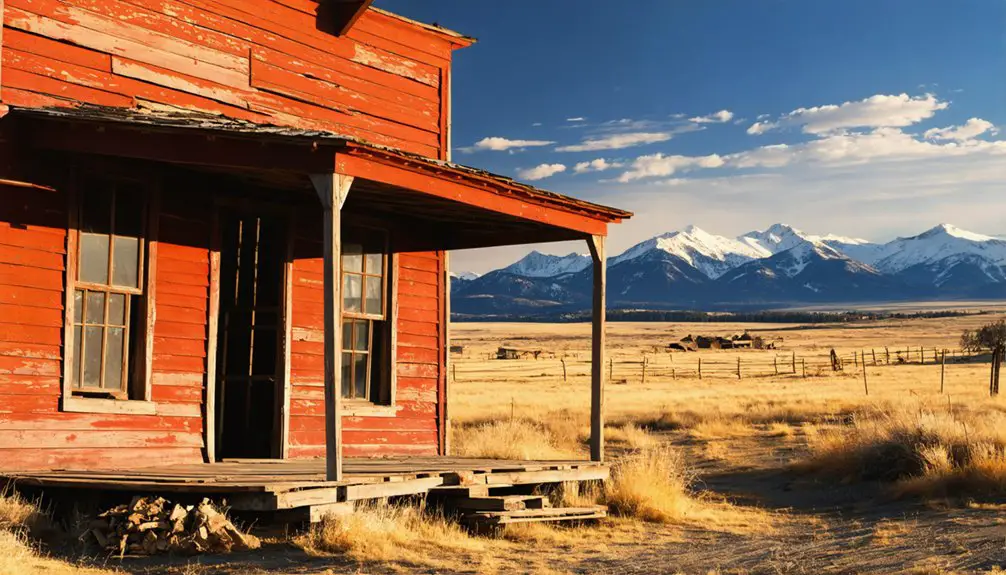
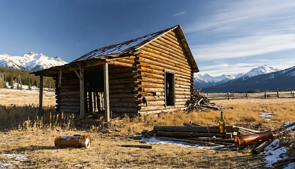
Settlement challenges included hastily constructed wooden homes with minimal foundations, built small to preserve heat during Montana’s unforgiving winters. Similar to other mining towns, these structures were built in a haphazard construction style without proper foundations. You’d have witnessed miners and ranchers adapting to the rugged environment, using local materials for insulation and relying on wood stoves for warmth. The town reached its peak with a population of 500, supporting various businesses including a hotel, school, and miners’ union hall.
Community dynamics centered around the saloons and trading posts, where you could’ve exchanged news and supplies.
Despite the town’s frontier nature, you’d have experienced relatively low crime rates. Daily life meant dealing with rudimentary roads, basic services, and the constant influence of mining’s boom-bust cycles.
Water access from nearby creeks proved essential for both survival and mining operations.
Geographic Features and Natural Setting
The remote townsite of Leroy sits nestled in north-central Montana’s vast landscape at coordinates 47.874, -109.319. Located in Blaine County, Montana, the site is marked on official geological survey maps.
You’ll find yourself surrounded by rolling plains that gradually shift into the dramatic Pioneer Mountains to the south and southwest. These natural landscapes showcase the region’s diverse geological features, from glacially-carved peaks to old-growth forests estimated to be over 500 years old. The area contains impressive geological formations of granodiorite rock, creating striking dark-hued outcroppings.
If you explore the surrounding terrain, you’ll discover a rich tapestry of environments where prairie meets mountain.
The area’s unique position creates a climate that supports both grassland and alpine ecosystems. Wildlife thrives here – you might spot elk, black bears, or moose roaming through the varied terrain.
Mountain lakes and streams dot the wilderness, while Arctic Grayling swim in the crystal-clear waters.
Economic Rise and Decline
Like many Western boomtowns, Leroy’s economic trajectory soared with the discovery of rich gold and silver deposits in the late 1800s. You’d find prospectors flocking to the area, establishing mining claims that yielded impressive quantities of precious metals, particularly in the Gold Hill area where mines produced around 400,000 ounces of gold and silver. Similar to Elkhorn’s prosperity, the mines generated significant monthly revenue during peak production.
The town’s economic sustainability proved fragile, though, as it relied heavily on a single industry. While the peak years between the 1890s and 1910s saw thriving businesses, schools, and infrastructure, Leroy’s community resilience was tested by devastating fires, including a major one in 1905. The mining operations required significant investment as they shifted from simple placer mining to more complex underground hardrock mining.
The town’s decline accelerated as mining operations faced challenges, leading to the closure of key establishments – the last saloon in 1918 and the post office by 1921.
Remnants and Current State
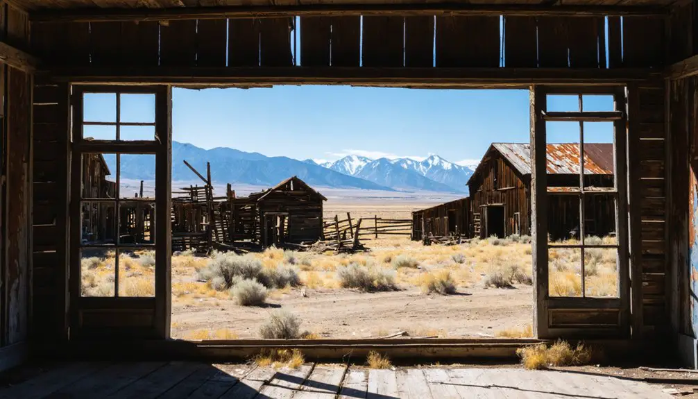
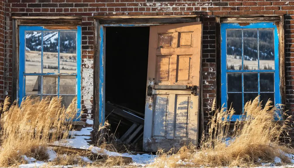
Today’s visitors to Leroy encounter a haunting snapshot of Montana’s mining legacy, with dilapidated wooden structures and scattered ruins telling the story of its eventual abandonment.
Time-worn remnants of Montana’s mining past stand silently at Leroy, where abandoned structures whisper tales of forgotten fortune.
You’ll find weathered buildings with missing roofs and walls, while rusted mining equipment and wooden debris litter the ground. Like the charcoal kilns of Piedmont, Wyoming, these industrial remnants provide a window into early resource extraction. The physical decay continues unchecked, as no formal preservation efforts protect the site.
If you’re planning to explore, you’ll need to navigate carefully around unstable structures and overgrown vegetation. Despite Montana’s population growth slowing, the ghost town continues to draw curious visitors seeking a glimpse into the past.
the history of Sixteen, Montana reveals tales of prosperity and decline, as well as the lives of those who once called it home. Often overshadowed by more famous ghost towns, Sixteen offers a unique glimpse into the rugged pioneer spirit that characterized the region. Explorers are often captivated by the remnants of old structures and artifacts left behind, each telling a story of the town’s vibrant past.
While there aren’t any official facilities or guided tours, the site’s accessibility via dirt roads makes it a draw for photographers and history buffs.
Remember that visitor safety depends on your own judgment, as there aren’t any protective barriers or warning signs marking hazardous areas.
Notable Neighboring Ghost Towns
When you explore the ghost towns neighboring Leroy, you’ll find Ingomar and Ismay standing as prime examples of how railroad communities transformed into abandoned settlements.
Along the former Milwaukee Road corridor, these towns showcase the dramatic population shifts that occurred when agricultural communities and transportation hubs lost their economic foundations.
You can trace the region’s settlement patterns through places like Lennep, where the interplay of ranching operations and railroad infrastructure once supported thriving communities.
Mining Town Population Shifts
Although Montana’s ghost towns often tell individual stories of boom and bust, several abandoned settlements near Leroy illustrate the broader pattern of mining-driven population shifts across the region.
You’ll find this reflected in places like Coolidge, where advanced utilities couldn’t prevent abandonment once silver mining failed in the 1920s, and Glendale, which saw its 2,000 residents disperse after its charcoal smelter ceased operations.
Population migration followed predictable patterns tied to mining technologies and infrastructure development. When towns gained smelters and railroad connections, like Neihart in 1886 and 1891, you’d see rapid growth.
But these communities remained inherently unstable, with residents ready to move on when mineral yields dropped or economic conditions changed, as demonstrated by the mass exodus following the 1893 Sherman Silver Purchase Act repeal.
Ranch Settlement Patterns
Scattered across Montana’s eastern plains, ranch settlements near Leroy emerged in distinct patterns that you can still trace through ghost towns like Dooley and Comertown.
You’ll find evidence of strategic ranch infrastructure, with homesteads positioned near essential water sources and transportation routes. Each settlement featured clustered buildings designed for efficient livestock management, including barns, corrals, and grain storage.
Towns like Ingomar and Maudlow grew as crucial railroad stops, serving the surrounding ranching communities with supplies and livestock shipping points.
The ranch settlements’ careful spacing optimized land use while maintaining workable distances for ranch hands. You can spot the remnants of barbed wire fencing that once defined property boundaries and controlled cattle movement between neighboring claims and grazing lands.
Historic Transportation Routes
Located along essential 19th-century migration paths, Leroy connected to Montana’s broader network of mining and settlement trails, including the famous Bozeman Trail that slashed 400 miles off the journey from the Oregon Trail to interior gold fields.
You’ll find notable ghost towns like Virginia City and Nevada City about 90 minutes from Bozeman, while Bannack stands as a preserved reminder of Montana’s mining heritage.
These settlements faced significant transportation challenges, from treacherous mountain passes to violent conflicts with Native American tribes defending their territories.
The network of freight and mining routes that served these communities shaped their rise and eventual decline, as wagons and stagecoaches navigated rough terrain to move supplies, equipment, and fortune-seekers throughout the region.
Legacy of Montana’s Rural Past
When you explore Montana’s ghost towns like Leroy, you’ll find connections to the broader transformation of rural life, where once-thriving ranches dotted the prairie alongside mining communities.
As you venture further, you can also discover historic sites in Chico, Montana, each telling a unique story of the region’s past. These sites serve as a testament to the rich heritage and cultural significance of the area, attracting history enthusiasts and curious travelers alike. Exploring these landmarks deepens your understanding of the lives that shaped this remarkable landscape.
You can trace how settlement patterns shifted from isolated homesteads and small agricultural outposts to more centralized farming operations, leaving behind both mining camps and prairie towns.
Montana’s ghost towns offer a window into this rural evolution, showing how communities adapted or vanished as economic forces reshaped the American West’s agricultural and mining landscape.
Ranch Life Evolution
Montana’s ranching heritage traces its roots to the mid-19th century, when pioneering cattlemen like Johnny Grant and Nelson Story laid the foundation for what would become a defining industry.
You’ll find that ranching innovations emerged from necessity, as the brutal winter of 1886-1887 forced a dramatic shift from open range grazing to fenced operations. These changes brought new cattle adaptations, with ranchers breeding hardier stock suited to Montana’s unforgiving climate.
What you’re seeing today stems from those early challenges. Ranchers developed sophisticated infrastructure – barns, windmills, and irrigation systems – while organizations like the Montana Stockgrowers Association established standards that transformed cattle operations into a multibillion-dollar industry.
The cowboy culture you witness now reflects generations of adaptation to the region’s unique environmental and social demands.
Vanishing Prairie Towns
While ranching communities adapted and thrived, many prairie towns across Montana’s landscape faced a different fate.
You’ll find these once-bustling settlements scattered throughout the state, their weathered buildings standing as silent witnesses to boom-and-bust cycles driven by mining and railroad economies.
When gold, silver, or copper prospects dried up, or metal prices plummeted during events like the Panic of 1893, these towns often couldn’t sustain themselves through agriculture alone. Their populations dwindled rapidly, leaving behind empty storefronts, abandoned homes, and quiet streets.
Today, preservation efforts highlight the cultural significance of these ghost towns, protecting them from complete disappearance. You can still explore their original structures – from old saloons to schoolhouses – offering glimpses into the dynamic communities that once called these prairie outposts home.
Rural Settlement Patterns
Throughout the late 1800s, diverse settlement patterns emerged across Montana’s vast landscape, shaped by federal land policies and transportation networks.
You’ll find that homestead challenges varied greatly – while the 1862 Homestead Act‘s 160-acre allotment proved insufficient in arid regions, the Desert Land Act‘s 640-acre provision attracted ranchers to larger tracts.
If you’d explored these settlements, you’d have discovered that rural communities weren’t just scattered homesteads but interconnected networks. Settlers built their lives around schools and post offices, forming tight-knit communities where neighbors helped each other with harvests and barn-raising.
The railroads, particularly the Great Northern and Northern Pacific, determined where many of these communities took root, with settlements flourishing along transportation corridors that provided crucial links to markets and supplies.
Frequently Asked Questions
Are There Any Paranormal or Ghost Stories Associated With Leroy?
You’ll find numerous ghost sightings at Leroy, with local legends telling of shadow figures, unexplained crashes, and demonic entities. Paranormal investigators have documented mysterious phenomena throughout the 52-acre ghost town property.
What Indigenous Tribes Originally Inhabited the Area Before Leroy’s Settlement?
You’d find the Blackfeet (Pikuni) tribe primarily inhabited this region, while the Gros Ventre (Atsina) and Assiniboine Native tribes shared adjacent territories. These groups held great historical significance before settlement changed everything.
Can Visitors Legally Explore and Photograph the Remaining Structures?
Before you venture out, you’ll need to verify exploration guidelines and obtain photography permits – if any structures remain on private land, you must get the owner’s permission first.
Were There Any Famous Outlaws or Notable Criminal Incidents?
You’ll find Butch Cassidy’s Wild Bunch operated nearby, with outlaw legends suggesting they used the area’s rugged terrain. Local criminal activities included train robberies and shootouts along their Montana escape routes.
Did Any Significant Historical Figures or Celebrities Ever Visit Leroy?
You won’t find records of any famous visitors in Leroy’s history – its historical significance came from local ranching pioneers like Oswald Strand and Henry Macdonald rather than celebrity appearances or notable figures.
References
- https://www.youtube.com/watch?v=YU0y9_5Ylbg
- https://mtlandreliance.org/the-legacy-of-leroy-strand/
- https://arc.lib.montana.edu/msu-student-papers/item/237
- https://southwestmt.com/specialfeatures/this-is-montana/mountain-ranges/southwest-montanas-east-pioneer-mountains/
- https://en.wikipedia.org/wiki/List_of_ghost_towns_in_Montana
- https://backroadplanet.com/montana-ghost-towns/
- https://archiveswest.orbiscascade.org/ark:80444/xv42443
- https://www.mtmemory.org/nodes/search?viewtype=grid
- https://mhs.mt.gov/pubs/Magazines/
- https://www.distinctlymontana.com/get-know-blaine-county