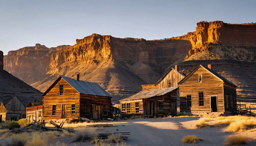
Leslie Gulch isn’t a ghost town—it’s a remote Oregon canyon named after cattleman Hiram E. Leslie, who died from a lightning strike in 1882. You’ll discover towering volcanic spires formed 15.5 million years ago from rhyolite ash erupted by the Mahogany Mountain caldera, not abandoned buildings. The area hosts California bighorn sheep and 26 plant species found nowhere else on Earth. While the nearby settlement of Watson now lies submerged beneath reservoir waters, Leslie Gulch’s true treasures are geological and biological wonders waiting beyond 22 miles of unpaved roads.
Key Takeaways
- Leslie Gulch was originally called Dugout Gulch and served as a wagon and mail route connecting Rockville to Watson.
- The canyon was renamed after cattleman Hiram E. Leslie, who was killed by lightning in the area in 1882.
- The nearby settlement of Watson, once a significant location, now lies submerged beneath reservoir waters.
- Indigenous peoples used Leslie Gulch as hunting and fishing grounds for approximately 5,000 years before modern settlement.
- No ghost town exists at Leslie Gulch today; the area is primarily known for its geological formations and wildlife habitat.
The Fiery Geology Behind Leslie Gulch’s Otherworldly Landscape
Approximately 15.5 million years ago, the Mahogany Mountain caldera erupted with catastrophic force, ejecting roughly 280 cubic kilometers of rhyolite ash across the landscape that would eventually become Leslie Gulch.
A volcanic cataclysm 15.5 million years ago unleashed 280 cubic kilometers of rhyolite ash, forging Leslie Gulch’s foundation.
The eruption released mobile molten froth filled with hot volcanic gases that welded together upon landing, forming ash-flow tuff up to 1,000 feet thick. These volcanic formations created the foundation for today’s dramatic terrain.
Erosion processes over fifteen million years carved the soft welded tuff into distinctive hoodoos and honeycomb patterns. Rain and snowmelt selectively wore away softer deposits, exposing geological layers and creating steep slopes with vertical pitted towers.
Meanwhile, harder basalt intrusions resisted weathering, forming dark columnar structures visible throughout the rimrock—a demonstration to nature’s patient sculpting. When lava from these basalt dikes reached the surface, it solidified as a hard cap, slowing erosion and preserving the underlying formations. The resulting landscape displays a vibrant palette of reds, oranges, yellows, and browns across the towering rhyolite cliffs and spires.
From Dugout Gulch to Lightning Strike: How the Canyon Got Its Name
While geological forces shaped Leslie Gulch‘s physical character over millions of years, a single moment in 1882 gave the canyon its enduring name. You’re traversing what locals originally called Dugout Gulch—a wagon and mail route connecting Rockville to Watson through the Owyhee Canyonlands.
That year, pioneer cattleman Hiram E. Leslie drove his herd up this remote gulch toward Cow Creek when lightning struck him dead.
The tragedy became local legend, prompting settlers to rename the canyon in his honor. Today, you’ll find few ghost town remnants along this route, though Watson persists near Owyhee Reservoir. Watson now lies at the bottom of the Owyhee Reservoir, submerged beneath the waters that transformed this remote landscape.
Unlike the region’s mining history that drew prospectors elsewhere, Leslie Gulch remained cattle country. The 14-mile canyon road still follows that original pioneer route—a testament to one rancher’s fatal encounter with nature’s raw power. Long before these pioneer routes existed, the area served as hunting and fishing grounds for Native Americans dating back approximately 5,000 years.
California Bighorn Sheep and Wildlife of the Owyhee Canyonlands
Beyond the towering rock formations and historical wagon routes, Leslie Gulch harbors one of Oregon’s most remarkable wildlife success stories: the California bighorn sheep.
Leslie Gulch stands as a testament to Oregon’s wildlife conservation triumph through its thriving California bighorn sheep population.
You’ll find these majestic animals traversing the rugged Owyhee Canyonlands, part of Oregon’s 4,000 to 4,200 statewide population across 32 herds.
Desert habitat preservation efforts have established new units in these canyon regions, supporting bighorn sheep migration through native terrain.
The East Beatys Butte/Alvord Peaks unit, encompassing this area, offers prime desert-type habitat on public lands.
While multi-year drought, overgrazing, and predation challenge population growth, these sheep thrive alongside Rocky Mountain elk, mule deer, and pronghorn.
The California bighorn sheep’s recovery contrasts sharply with their Sierra Nevada cousins, which declined from over 1,000 individuals in twenty historic subpopulations to just two populations by the 1970s due to hunting, disease, and domestic sheep introduction.
Oregon’s 2023 surveys documented healthy lamb-to-ewe ratios, demonstrating successful management of these iconic symbols of western wilderness and freedom.
Trophy-quality rams in the region have scored up to 180 in 2025, earning recognition as Boone and Crockett specimens.
Botanical Treasures Found Nowhere Else on Earth
You’ll find eight rare plant species thriving in Leslie Gulch, with two annuals—Packard’s blazing star and Etter’s groundsel—existing nowhere else on Earth. These botanical treasures owe their survival to the canyon’s unique volcanic soils, particularly the greenish-yellow ash-tuff talus slopes formed from the Leslie Gulch Tuff formation.
The region’s unusual juxtaposition of northern mesic and southern xeric floras, combined with specialized rhyolitic ash substrates, has created conditions that support at least 26 endemic plants throughout the Owyhee volcanic soils. Water and wind have carved deep canyons after volcanic ash converted to rock, shaping the dramatic landscape over millions of years. The towering cliffs display striking desert hues sculpted over millions of years, creating a dramatic backdrop for these rare botanical specimens.
Endemic Species of Leslie Gulch
Among the rust-colored cliffs and volcanic formations of Leslie Gulch, you’ll discover one of Oregon’s most remarkable botanical concentrations—a collection of plants that exist nowhere else on Earth. Two species thrive exclusively in this drainage: Packard’s Blazing Star (Mentzelia packardiae) and Ertter’s Groundsel (Senecio ertterae), both anchored to the canyon’s distinctive greenish-yellow ash-tuff slopes.
You’ll find Grimy Ivesia at only three sites within these walls, while Narrow-Leaved Monardella, identified in 2014, grows on rhyolitic ash tuff outcrops. The Bentonite Biscuitroot occupies nearby Succor Creek’s clay-rich soil—Oregon added it to the endangered species list in spring 2024.
These rare species habitat zones require specific volcanic geology, making endemic plant conservation efforts critical for their survival in this unrestricted landscape. Research has shown that physical substrate properties, rather than chemical features, primarily determine which plants can establish themselves on these specialized volcanic surfaces. The Bureau of Land Management established an Area of Critical Environmental Concern in 1995 to protect Ertter’s Groundsel and its fragile habitat from recreational and mining pressures.
Rare Habitat and Soil Conditions
The volcanic soils beneath your feet tell a story that began 15.5 million years ago, when catastrophic eruptions from the Mahogany Mountain caldera blanketed this landscape with rhyolite ash. This consolidated ash, known as Leslie Gulch Tuff, reaches depths of 1,000 feet and creates soil diversity found nowhere else on Earth.
The Three Fingers caldera added another rhyolite layer 100,000 years later, further enriching these ecological hotspots.
This unique geology supports rare plant species through:
- Honeycombed volcanic towers providing isolated microclimates for endemic perennials
- Talus slopes offering specialized growing conditions in deeply eroded canyons
- Protected watersheds spanning 11,000 acres under BLM’s Area of Critical Environmental Concern designation
You’re witnessing botanical treasures that thrive exclusively in this remote Malheur County sanctuary.
Planning Your Visit: Roads, Routes, and Remote Access
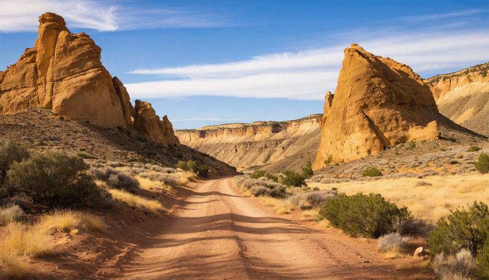
Getting to Leslie Gulch requires traversing approximately 22 miles of unpaved roads from US Route 95, with two primary approaches available depending on your starting point. From Marsing, Idaho, you’ll travel south 19 miles before turning onto McBride Creek Road.
As you venture deeper into the stunning landscapes, prepare for road trip adventures in leslie gulch that will take you past striking rock formations and unique wildlife. The winding roads offer picturesque views and plenty of opportunities for photos, making every stop along the way memorable. Don’t forget to pack a picnic to enjoy amidst the natural beauty of this hidden gem.
The southern route begins in Jordan Valley, Oregon, heading north 18 miles on US 95. Both routes converge at Leslie Gulch Road via connecting roads spanning 8-9 miles.
You’ll need a full fuel tank—services don’t exist here.
While four-wheel drive isn’t strictly required, high clearance helps navigate washboarded sections.
GPS proves unreliable in this remote territory, so verify your route beforehand.
Wet weather renders roads impassable.
The Rockville community marks your 8-mile checkpoint, with Leslie Gulch signage appearing 1.5 miles past Succor Creek Road junction.
Rock Climbing and Camping Among the Volcanic Towers
You’ll find more than 80 established climbing routes on Leslie Gulch‘s distinctive volcanic tuff formations, though the rock proves less solid than Oregon’s renowned Smith Rock.
The BLM’s Slocum Creek – Leslie Gulch Campground offers 10 units from March through November, positioning you directly among bighorn sheep habitat and towering rock pinnacles.
Spring and fall provide the best conditions for exploring both sport and traditional routes while camping beneath the canyon’s striking geological features.
Unique Volcanic Tuff Climbing
Formed 15 million years ago when rhyolite pyroclastic flows from the Mahogany Mountain caldera swept across this landscape, Leslie Gulch’s rosy golden cliffs now tower up to 1,000 feet thick and provide some of Oregon’s most distinctive climbing terrain.
You’ll find over 80 established routes scaling these volcanic formations, where trapped gases created natural pockets and honeycombs during cooling.
The color stratigraphy displays spectacular desert hues—yellows, greens, and reds streaked with blacks and browns.
The climbing experience here offers:
- Honeycomb textures providing natural handholds through differential weathering patterns
- Vertical pitted pinnacles rising from consolidated ash-flow tuff
- Sport and traditional routes threading through spires less solid than Smith Rock
A moratorium on new route development protects these fragile towers, though existing bolted climbs remain accessible for your exploration.
Camping Near Wildlife Habitat
Beyond the climbing routes, Slocum Creek Campground serves as your base for exploring Leslie Gulch‘s wildlife habitat. It offers nine free campsites on a first-come, first-served basis with a 14-day maximum stay.
You won’t need camping permits or reservations through Recreation.gov—just claim your spot when you arrive. Each site includes covered picnic tables and fire rings, with eight sites featuring accessible amenities.
A pit toilet’s available, but bring your own water.
Wildlife preservation rules restrict camping and fires exclusively to this designated area within the Area of Critical Environmental Concern.
You’ll share the landscape with over 200 California bighorn sheep—the country’s largest herd—plus mule deer, elk, bobcats, coyotes, and rattlesnakes.
Overnight backpacking and horses aren’t permitted, protecting this critical habitat while you explore during daylight hours.
Frequently Asked Questions
What Happened to the Town of Watson Near Leslie Gulch?
Watson’s ghost town history mirrors countless pioneer dreams—you’ll find its abandoned structures now rest beneath Owyhee Reservoir’s waters. The dam’s construction in the 1930s flooded this once-thriving settlement, erasing the community forever from accessible existence.
When Did Native Americans First Inhabit the Owyhee River Area?
Early habitation shows you’ll find Native settlements dating back 9,500 years at Dirty Shame rock shelter. The upper Owyhee watershed’s earliest documented site, Nahas Cave, reveals human presence around 6,000 years ago through detailed archaeological evidence.
Are Rattlesnakes Common in Leslie Gulch During Summer Months?
Yes, rattlesnakes are common during summer months. You’ll find them active in their preferred rattlesnake habitat of rocky, sagebrush terrain. Practice summer safety by wearing boots, staying on trails, and watching for them during cooler morning and evening hours.
Why Is There a Moratorium on Drilling New Climbing Routes?
Climbers crossed the line by drilling artificial pockets into blank rock faces, prompting BLM’s regulatory restrictions. The moratorium addresses environmental impact concerns and unauthorized route modification, protecting Leslie Gulch’s natural climbing features while you await formal management guidelines.
How Long Does the Drive on Leslie Gulch Road Typically Take?
The drive takes over one hour for the 14-15 mile stretch due to challenging road conditions. You’ll average just 10-15 mph on the washboard gravel surface, making travel duration considerably longer than typical paved highways.
References
- https://www.wanderinraw.com/post/leslie-gulch
- https://flyfisherscluboregon.com/literary-angler-leslie-gulch-orvs-and-a-grand-slam/
- https://npshistory.com/brochures/blm/or/leslie-gulch-succor-ck-nbcb-1990-2.pdf
- https://en.wikipedia.org/wiki/Leslie_Gulch
- https://33andfree.live/2021/12/27/visit-leslie-gulch-in-oregon/
- https://traveloregon.com/things-to-do/destinations/parks-forests-wildlife-areas/leslie-gulch/
- https://pnwphotoblog.com/ghost-town-of-watson-oregon/
- https://www.blm.gov/blog/2022-05-16/drawing-lightning-and-inspiration-southeastern-oregon
- https://wickershamsconscience.wordpress.com/2017/06/20/geology-101-leslie-gulch/
- https://www.lorjorexplore.com/blog/timber-gulch-oregon


