Lone Pine Station isn’t a true ghost town but evolved from a crucial frontier settlement into a resilient community. Named after a solitary Jeffrey pine, it survived the devastating 1872 earthquake that killed 27 people and transformed its architecture from adobe to wood-frame buildings. The Southern Pacific Railroad connection in 1883 boosted its economy until decline in the 1960s. You’ll discover how this historic hub connects to nearby abandoned mining settlements and Hollywood’s film legacy.
Key Takeaways
- Lone Pine Station transformed from a railroad hub after the Southern Pacific line arrived in 1883, connecting mining operations to broader markets.
- The Carson & Colorado narrow gauge railroad’s 1960 closure caused economic decline as businesses relocated to highway-accessible areas along US 395.
- Former railroad buildings in Lone Pine have been repurposed as residences and retail spaces, preserving the town’s transportation heritage.
- Lone Pine serves as a gateway to nearby abandoned mining settlements including Cerro Gordo, Darwin, and Swansea.
- While not entirely abandoned, Lone Pine maintains historical structures that showcase its evolution from indigenous trading post to mining supply center.
The Solitary Pine That Named a Town
As the rugged frontier of the American West expanded throughout the 19th century, settlers often named their communities after distinctive natural landmarks that dominated the local landscape.
Lone Pine exemplifies this practice perfectly. You’ll find that the settlement drew its identity from a solitary Jeffry pine standing boldly at the mouth of a canyon in the Owens Valley.
This natural landmark served as more than mere pine symbolism—it functioned as a vital reference point for weary miners and travelers traversing the harsh desert terrain.
The tree’s distinctive silhouette against the eastern Sierra Nevada provided immediate geographical orientation. When prospectors and suppliers needed a central hub, they naturally gravitated to this recognizable feature, establishing a trading center that would grow into a settlement of eighty adobe buildings. Much like California’s silver-mining towns, these settlements often arose quickly following resource discoveries in the region.
The area was first inhabited by Paiute tribes before the arrival of non-native settlers between 1860 and 1862.
From Paiute Trading Routes to Mining Hub
Long before European settlers arrived in what would become Lone Pine Station, the Owens Valley served as a critical junction in an elaborate network of indigenous trade routes.
The Nüümü (Owens Valley Paiute) maintained extensive connections across the Sierra Nevada, exchanging salt, pinenuts, and obsidian primarily with Western Mono and Miwok groups during summer and fall months. The Nüümü people referred to this region as Payahüünadü, meaning the Land of Flowing Water.
Salt, pinenuts, and obsidian flowed across Paiute trade networks, connecting the Nüümü with Mono and Miwok peoples through seasonal exchanges.
This Paiute trade foundation transformed rapidly with settler arrival in the 1860s. You’d have witnessed the mining shift begin in earnest by 1872, as silver ore shipments commenced via steamers Bessie Brady and Mollie Stevens across Owens Lake. Since “Lone Pine” has multiple meanings, travelers sometimes confused this location with other similarly named places across the American West.
The Carson and Colorado Railroad‘s completion in 1883 revolutionized transportation, connecting Lone Pine Station to broader markets. This narrow gauge lifeline became the region’s only dependable transportation for decades, facilitating the area’s evolution from indigenous commerce center to thriving mining hub.
The Great Earthquake of 1872 and Its Aftermath
When you visit Lone Pine today, you’re walking through a town fundamentally reshaped by the devastating 1872 earthquake that claimed 27 lives—over 10% of the population—and destroyed 60 of the settlement’s 80 buildings.
The disaster’s aftermath marked a critical architectural turning point as survivors abandoned vulnerable adobe and stone construction in favor of more earthquake-resistant wood-frame buildings.
This structural transformation is evident in the rebuilt Meysan family store and throughout the reconstructed town, with only the historically significant “Old Adobe Wall” remaining as evidence to pre-earthquake Lone Pine. The earthquake also created Diaz Lake, which became a permanent geographic feature of the area. A common grave at California Historical Landmark #507 memorializes fourteen victims of this catastrophic event.
Destruction and Mass Casualties
The devastating earthquake that struck Lone Pine Station on March 26, 1872, would forever alter the town’s trajectory and claim the lives of over 10% of its residents.
In the earthquake aftermath, 52 of 59 houses collapsed, with just 20 of 80 total buildings remaining standing. Most structures were adobe and stone constructions that crumbled as the earth shifted laterally about 5 meters. The quake was so powerful that it created a fault scarp over 2 meters tall that dramatically changed the landscape.
Twenty-seven souls perished that night as they slept, including a daughter of the Meysan family. The earthquake was described as having a violent twisting motion that contributed to the extensive destruction.
Sixteen victims were laid to rest in a mass grave north of town—fifteen coffins with one holding both a mother and infant. This burial site now stands as California Historical Landmark No. 507, a somber memorial to community resilience as survivors rebuilt using wood rather than adobe materials.
Architectural Shift Afterward
Following the catastrophic 1872 earthquake, Lone Pine Station underwent a profound architectural transformation that reshaped its physical identity and construction practices for generations.
You’ll notice the stark shift from vulnerable adobe structures to wood-frame buildings embodying early seismic innovation. After losing his daughter and home, Charles Meysan exemplified this change, rebuilding with wood rather than mud brick. The total damage estimate of $132,000 in Lone Pine alone underscored the necessity of this architectural revolution.
The “Old Adobe Wall”—the sole surviving pre-quake remnant—stands as testimony to past vulnerabilities.
Builders incorporated thicker foundations and lighter materials, developing architectural resilience through simpler rectangular forms with improved bracing. The extended surface rupture of over 60 miles influenced where and how residents rebuilt their homes.
Construction patterns changed too, with smaller, separated rooms reducing collapse hazards. Though formal codes didn’t exist yet, informal standards emerged from hard-won experience.
Settlers also reconsidered site selection, avoiding known fault zones and creating buffer spaces that influenced future town planning.
Rise and Fall of the Southern Pacific Railroad Connection
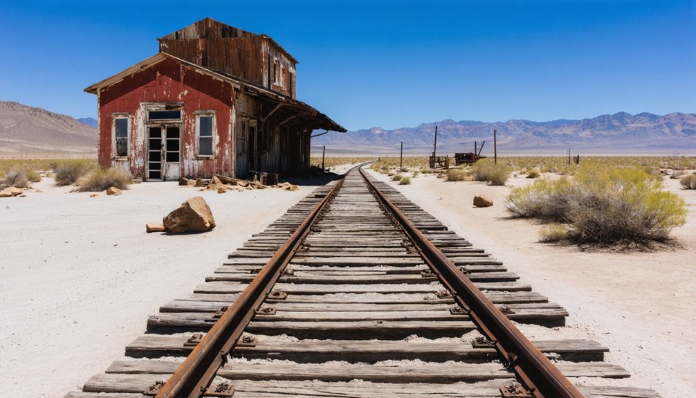
If you visit Lone Pine Station today, you’ll find the abandoned rails of the Southern Pacific’s narrow gauge line that once transformed the Owens Valley economy by connecting this remote area to broader markets.
The railroad, completed to Keeler in 1883 and nicknamed “The Slim Princess,” facilitated the transport of mining supplies and agricultural goods while supporting the growth of towns throughout the valley.
You can still trace the old railroad grade where most tracks have been removed since the 1960 abandonment, with the converted depot and several remnants standing as silent witnesses to this essential transportation link.
Railroad’s Economic Impact
As railroads extended their iron tendrils through California’s remote landscapes in the late 19th century, Lone Pine Station experienced a profound economic transformation that would define its trajectory for decades.
The 1882 arrival of Carson and Colorado’s narrow gauge line catapulted the settlement from isolated outpost to vibrant transport hub.
You’d have witnessed dramatic growth as mining economy flourished—ore from Inyo Mountains and Darwin Mines now efficiently shipped to distant markets.
Railroad tourism emerged as travelers could finally access the remote beauty of Owens Valley without arduous stagecoach journeys.
The 1910 Southern Pacific depot became the nexus of commerce, particularly supporting the Los Angeles Aqueduct construction that brought unprecedented materials, workers, and capital to the region.
Abandoned Rails Today
The ghost of prosperity haunts Lone Pine Station where Southern Pacific‘s steel arteries once pumped economic lifeblood through Owens Valley.
Today, you’ll find only ghostly remnants of the once-vital Jawbone Branch that connected Mojave to Owenyo.
Walking along US Route 395, you can trace abandoned tracks where standard gauge rails met Southern Pacific’s narrow gauge at Owenyo’s transfer station.
The rails north of Searles vanished between 1972-1984, with sections through Lone Pine removed by 1997. By 1999, the remaining southern segments disappeared forever.
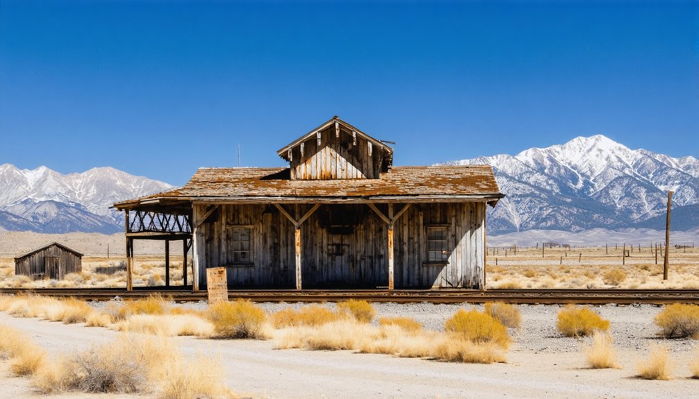
While the Lone Pine depot building survives as private property, most infrastructure has surrendered to desert terrain.
The railroad’s skeletal grade remains visible—a dusty reflection of freedom’s price when mail contracts ended and automobiles conquered the American West.
Silver Boom: Cerro Gordo’s 4.5 Million Ounce Legacy
Cerro Gordo’s silver deposits yielded one of the most significant mineral legacies in California’s mining history, producing an estimated 4.5 million ounces of silver during its operational lifespan.
The story began in 1865 when Mexican miners led by Pablo Flores discovered rich veins that would transform the region.
Ghost Structures: What Remains of the Station Today
If you visit Lone Pine Station today, you’ll find abandoned rail infrastructure that once connected bustling mining operations to larger markets.
The remaining station structures include weathered platforms, dilapidated loading areas, and foundations now integrated into private residences with restricted access.
These ghost structures stand as silent witnesses to the region’s transportation history, surrounded by the skeletal remnants of nearby mining operations and company town buildings.
Abandoned Rail Infrastructure
Once a bustling hub of railroad activity, Lone Pine Station now exists primarily as scattered remnants along the former Southern Pacific Railroad‘s Lone Pine Branch.
Built around 1912 to support the Los Angeles Aqueduct construction, this standard gauge line connected Mojave to Owenyo, where it met the narrow gauge Carson and Colorado Railroad.
The railway history is visible from US Route 395, though most small bridges have vanished and rails were removed from four grade crossings north of Inyokern.
This infrastructure legacy underwent systematic dismantling—the line north of Searles was abandoned between 1972-1984, while track through Lone Pine to Bartlett disappeared by 1997.
The final segment from Bartlett to Searles was removed around 1999.
Today, only the Trona Railway section south of Searles remains active for mineral shipments.
Station Ruins Today
The physical remnants of Lone Pine Station tell a compelling story of adaptation and decay in the years since rail operations ceased.
The main station building survives with remarkable structural integrity, having been repurposed first as a private residence by 1997 and later as a bookstore by 2003.
You’ll find the original platform still intact, though accessibility is severely limited by “No Trespassing” signs and guard dogs protecting the private property.
Nearby, abandoned industrial buildings stand as silent sentinels near Owens Lake, withstanding the harsh desert conditions at 4,200 feet elevation.
The rails themselves have vanished—removed north through Bartlett by the late 1990s—leaving only the grade as evidence of the former line.
Without bridges, these pathways remain hazardous despite occasional use by adventurous dirt bikers.
Hollywood’s Backdrop: Film History in the Alabama Hills
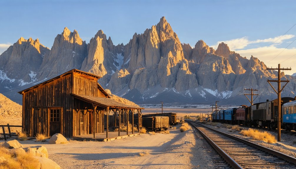
Just a few hours from the bustling film studios of Los Angeles, Alabama Hills has served as a chameleon-like backdrop for over 400 productions throughout cinema history.
The rugged versatility of Alabama Hills transformed this desert landscape into Hollywood’s chameleonic outdoor studio.
This cinematic landscape’s versatility transformed it into Hollywood’s favorite outdoor set since “The Round-Up” premiered in 1920.
The area’s film legacy includes:
- Western classics featuring John Wayne, Roy Rogers, and Clint Eastwood
- Epic productions like “Gunga Din” (1939), where elaborate sets recreated Northern India
- Contemporary blockbusters including “Iron Man” (2008) and “Django Unchained” (2012)
- Television series and music videos utilizing the distinctive rock formations
You’ll find this film history celebrated at the annual Lone Pine Film Festival and the Museum of Western Film History, which offers guided tours to these iconic locations.
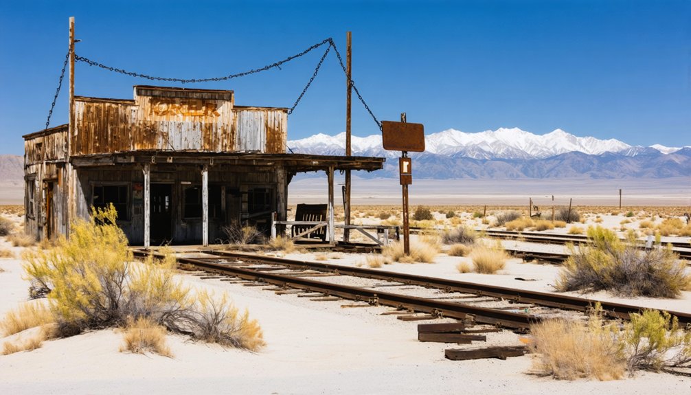
Neighboring Ghost Towns: Owenyo, Swansea and Keeler
Beyond the rugged terrain of Lone Pine and the cinematic landscape of Alabama Hills lie three distinct ghost towns that chronicle the rise and fall of Owens Valley’s industrial era.
Owenyo, established in 1905, served as a vital railroad interchange where narrow and standard gauge lines met, facilitating regional commerce until the 1960s. Five miles north of Lone Pine, only foundations remain today.
Swansea, once a bustling smelting center for Cerro Gordo’s silver and lead, now consists of scattered ruins along Owens Lake’s western shore.
Keeler, the easternmost settlement, functioned as the terminus of the Carson & Colorado narrow-gauge railroad.
These abandoned sites form a triangle of ghost town heritage, telling the story of how rail connections shaped—and ultimately abandoned—communities that once thrived on mining, shipping, and industrial ambitions in the harsh Owens Valley.
Life After the Railroad: Economic Transformation
When the last narrow gauge trains departed from the Carson & Colorado line in 1960, they carried away more than passengers and freight—they transported Lone Pine Station’s economic foundation.
The economic decline that followed transformed the region’s commercial identity completely.
When rail left, so did prosperity, forcing the valley to reinvent itself through highway commerce and tourism.
You’ll find four key changes that reshaped the area after rail abandonment:
- Businesses migrated from rail depots to highway-accessible locations along US 395
- Former railroad buildings were repurposed as private residences or retail spaces
- Freight transportation shifted entirely to road-based logistics
- Tourism gradually replaced industrial activity as the economic driver
The freight shift began earlier with the Lone Pine Branch line supporting Los Angeles Aqueduct construction, but ultimately proved insufficient to sustain rail operations.
As trucks replaced trains, the economic geography reorganized, leaving ghost towns where bustling stations once stood.
Preservation Efforts and Heritage Tourism
Despite numerous historical challenges, Lone Pine Station‘s remaining structures represent a living museum of the Eastern Sierra’s architectural evolution.
You’ll find the Meysan’s general merchandise store among the few survivors of the devastating 1872 earthquake, showcasing how wood-frame construction outlasted adobe buildings during seismic events.
Heritage conservation efforts focus on protecting these architectural remnants while balancing tourism impact.
The area’s rich history—from indigenous Paiute settlements to mining operations and Hollywood film productions—creates a compelling narrative for visitors.
The interconnected ghost towns of Cerro Gordo, Darwin, and Swansea form a heritage tourism circuit that contextualizes Lone Pine’s significance as a regional supply hub.
When exploring these preserved sites, you’re witnessing not just abandoned structures but the resilience of frontier communities that adapted through natural disasters and economic changes.
Frequently Asked Questions
What Happened to Alice Meysan’s Actual Burial Site?
You’ll find Alice Meysan’s burial site preserved in the communal grave on Harvey Hill, where she rests with fifteen other earthquake victims, protected by fencing and marked as a historical landmark.
Did Any Descendants of Original Settlers Remain in Lone Pine?
Like oaks rooted in native soil, descendant stories endure. You’ll find the Clyde family—George Swarthout’s descendants—maintained historical connections in Lone Pine for generations, preserving their homestead and legacy since the 1860s.
Were There Documented Paranormal Experiences in Abandoned Buildings?
You’ll find numerous documented paranormal investigations revealing ghostly sightings in the Belshaw House, American Hotel, and Bunkhouse. These include apparitions, moving objects, unexplained sounds, and persistent bloodstains from violent historical deaths.
What Indigenous Artifacts Have Been Discovered Near Lone Pine Station?
You’ll find grinding stones, arrowheads, ancient pottery, and volcanic glass tools from Paiute-Shoshone peoples near Lone Pine. Petroglyphs with calendar functions and indigenous burial artifacts remain culturally significant despite illegal excavations.
How Did Water Rights Conflicts Affect Lone Pine’s Development?
While you might expect settlement patterns to remain unaffected, water disputes devastated Lone Pine’s growth potential. You’ve lost indigenous autonomy, agricultural viability, and sustainable development opportunities through LADWP’s systematic groundwater depletion.
References
- https://nvtami.com/2024/04/26/owens-valley-ghost-towns/
- https://lonepinechamber.org/history/ghost-towns-of-the-lone-pine-area/
- https://www.backroadswest.com/blog/ghost-town-trail-near-lone-pine/
- http://www.owensvalleyhistory.com/stories/exploring_a_ghost_railroad01.pdf
- https://sgphotos.com/photostories/inyos/
- http://freepages.rootsweb.com/~gtusa/history/ontheroad/us6a.htm
- https://www.youtube.com/watch?v=4lwAShZvU2k
- https://www.latimes.com/archives/la-xpm-2006-oct-08-me-then8-story.html
- http://www.owensvalleyhistory.com/stories/chronological_history_ov.pdf
- https://thereitistakeit.org/portfolio-item/track-2/


