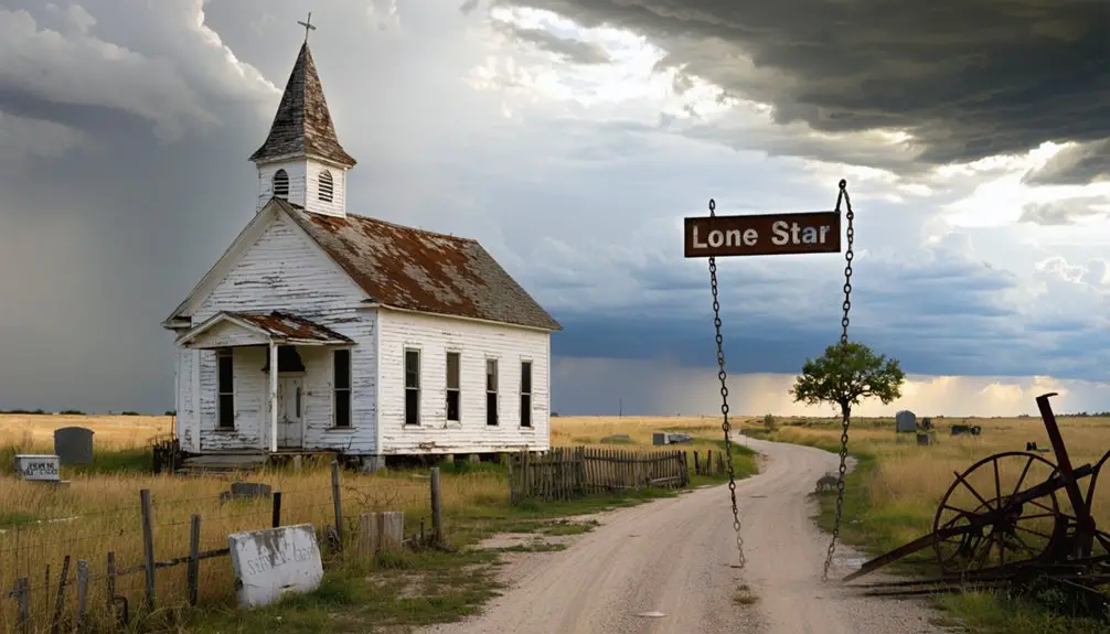
You’ll find Lone Star’s remains beneath Lake Wister’s waters in LeFlore County, Oklahoma. This once-thriving frontier town emerged along the Poteau River during the late 1880s railroad boom, growing to include over 300 businesses and houses. The construction of Wister Dam in 1949 submerged the original townsite, though artifacts and foundations still rest on the lake bottom. The town’s fascinating story of boom, bust, and submergence holds many more surprising details.
Key Takeaways
- Lone Star was a thriving Oklahoma town with over 300 businesses and houses during its peak development period.
- The town’s economy relied heavily on natural resources and commerce, making it susceptible to economic instability.
- In 1949, Wister Dam’s construction led to the flooding of Lone Star’s original townsite beneath Lake Wister.
- Historical remnants of Lone Star, including building foundations and artifacts, remain preserved under Lake Wister’s waters.
- The town’s memory lives on through oral histories, photographs, and museum exhibits maintained by local historical societies.
The Rise of a Railroad Town
As railroads rapidly expanded across Oklahoma Territory in the late 1880s, the region underwent a dramatic transformation that would shape its development for decades to come.
You’d have witnessed major lines like the Frisco, Santa Fe, and Rock Island pushing through the territory, following historic trade routes and establishing crucial transportation corridors from Arkansas to Texas and Kansas to the Red River.
Early visionaries like C.G. Jones and Henry Overholser worked tirelessly to ensure that major rail carriers would establish routes through the region.
Oklahoma City’s remarkable growth from a population of 10,000 to 91,000 between 1900 and 1920 demonstrated the transformative power of rail connectivity.
At strategic points along these new rail lines, you’d have seen towns spring up almost overnight.
Railroad companies established watering stops and depots that quickly attracted settlers, merchants, and entrepreneurs.
These rail-centered communities became bustling hubs of commerce and migration, their very survival dependent on their proximity to the iron horse.
The railroad expansion literally determined which settlements would thrive and which would fade into obscurity.
Life Along the Poteau River
While prehistoric peoples first carved out their existence along the Poteau River‘s banks, this crucial waterway would later shape Oklahoma’s development through centuries of human activity.
From ancient settlements to modern times, the Poteau River remains a vital force in Oklahoma’s cultural evolution and growth.
You’ll find evidence of ancient Mound Builders who constructed temples and burial sites between 500-1300 A.D., followed by increasingly complex hunting and gathering societies that relied heavily on riverine resources. Bernard De Harpe led the first documented French expedition through the region in 1719.
The French named it “Poteau” around 1716, establishing trade relationships with Native settlements in the region. By the 1830s, the river served as a crucial boundary within the Choctaw Nation, separating Skullyville and Sugar Loaf counties.
Life along its banks wasn’t always easy – devastating floods, like the one in 1845, destroyed homes and crops. Yet the fertile valley lands continually drew settlers seeking opportunity and independence. Near the river’s mouth at Belle Point, it converges with the Arkansas River.
Economic Growth and Commerce
Like many Oklahoma boomtowns of its era, Lone Star’s meteoric rise stemmed from the discovery of valuable natural resources that triggered a swift economic transformation.
You’d have found a bustling commercial district filled with saloons, grocery stores, meat markets, bakeries, and laundries catering to the influx of workers and settlers. By the height of development, the area boasted over 300 businesses and houses.
The town’s economic dependency on resource extraction became both its strength and weakness. Similar to whiskey towns along territorial boundaries, Lone Star’s location enabled profitable liquor trade operations. While businesses thrived during the boom period, serving a growing population with disposable income, they lacked diversification beyond supporting the dominant industry workforce.
This made Lone Star vulnerable to boom-bust cycles when resource production declined or labor demands shifted. The town’s location near jurisdictional boundaries initially helped commerce flourish, particularly in the liquor trade, until changing regulations altered its economic landscape.
The Impact of Wister Dam
The construction of Wister Dam in 1949 marked a pivotal transformation in Lone Star’s landscape and regional water management.
You’ll find this U.S. Army Corps of Engineers project revolutionized the area by creating Lake Wister, which now serves as the primary drinking water source for LeFlore County and neighboring communities.
The dam’s impressive flood mitigation capabilities can store up to 473 million cubic meters of floodwater, protecting thousands of downstream residents.
While you might notice the dam’s presence through the expanded recreational opportunities at Lake Wister State Park, it’s also quietly working to maintain water quality for sixteen cities and rural water districts.
The Corps regularly monitors the dam’s structural integrity, ensuring it continues its essential role in flood control and water supply management throughout eastern Oklahoma. Recent inspections have confirmed that water movement through operational gate seals remains within expected parameters.
As part of the Tulsa District’s Civil Works era, Wister Dam was one of several major projects completed to enhance flood control and water management in the Arkansas River Basin.
Legacy Beneath the Waters
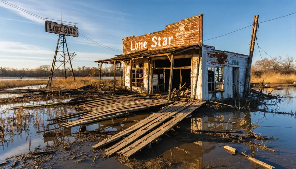
Once the waters of Lake Wister rose in 1949, they submerged much of Lone Star’s original townsite, leaving behind a complex underwater legacy you can’t easily see today.
Like the two thousand ghost towns across Oklahoma, natural and human factors played a decisive role in Lone Star’s ultimate fate. Similar to how the US Army Corps of Engineers flooded Aliway in the 1950s, these submerged towns represent a pattern of infrastructure development reshaping Oklahoma’s landscape. Beneath the surface, building foundations and cultural artifacts remain as silent witnesses to the community that once thrived there. You’ll find these submerged remnants have created an unintended time capsule, though accessing them presents significant challenges for historians and archaeologists.
The town’s legacy lives on through oral histories, photographs, and archived documents that help preserve the memory of what lies beneath.
While you can’t walk Lone Star’s streets anymore, its story endures through local historical societies and museum exhibits. The submerged artifacts serve as powerful reminders of how progress and water management decisions can permanently alter communities and landscapes.
Frequently Asked Questions
Are There Any Surviving Photographs of Lone Star’s Original Buildings and Residents?
You’ll find limited historical documentation, with scattered photographic evidence of relocated buildings, but no confirmed surviving photos of original residents in public archives or collections.
What Native American Tribes Inhabited the Lone Star Area Before Settlement?
Like shifting winds across the prairie, you’d find the Kiowa and Comanche dominated the area’s tribal history, while Caddo, Wichita, and Plains Apache peoples left their cultural significance through seasonal hunting grounds.
Did Any Famous Outlaws or Historical Figures Pass Through Lone Star?
While you’ll find no confirmed outlaw encounters at Lone Star, its position along the railroad meant travelers, including possible renegades and lawmen, likely passed through during its historical significance as a stop.
Were There Any Notable Accidents or Disasters Before the Town’s Flooding?
You’d be surprised, but while you might expect dramatic tales from an old frontier town, there weren’t any documented major accidents or disasters in Lone Star before its flooding impact. The town’s safety record remained unremarkable.
What Happened to the Cemetery and Burial Sites After Wister Lake Formed?
You’ll find they carefully executed cemetery relocation efforts, moving burial sites to higher ground before Wister Lake’s formation. Some remains become visible during lake draw-downs, accessible via surrounding access roads.
References
- https://en.wikipedia.org/wiki/List_of_ghost_towns_in_Oklahoma
- https://www.okhistory.org/publications/enc/entry?entry=GH002
- https://kids.kiddle.co/List_of_ghost_towns_in_Oklahoma
- https://www.youtube.com/watch?v=gctV_3kGeGo
- https://www.ghosttowns.com/states/ok/lonestar.html
- http://dougdawg.blogspot.com/2007/08/okc-trains-part-2.html
- https://www.greatamericanstations.com/stations/oklahoma-city-ok-okc/
- https://groundworkcenter.org/how-passenger-rail-helped-these-two-southern-towns/
- https://www.okhistory.org/publications/enc/entry?entry=HA047
- https://www.okhistory.org/publications/enc/entry?entry=RA004


