You’ll find the remains of two abandoned settlements on Mount Mansfield’s slopes: the ghost towns of Mansfield and Sterling. These rural communities, established in the early 1800s, relied on sawmills, logging, and limited farming before their dissolution between 1828-1855. Sterling’s 23,040 acres were divided among neighboring towns, while Mansfield’s legacy lives on in the mountain’s name. The stories behind these lost communities reveal fascinating glimpses into Vermont’s pioneer history.
Key Takeaways
- Sterling and Mansfield were once-prosperous Vermont settlements near Mount Mansfield that later became ghost towns through territorial dissolution.
- Sterling maintained a population of 233 residents at its peak before being divided among neighboring towns from 1828-1855.
- The town of Mansfield’s name lives on through Mount Mansfield, despite the settlement’s disappearance from Vermont’s active communities.
- These mountain settlements supported logging and sawmill operations but ultimately proved unsustainable for long-term habitation.
- The abandoned towns’ territories were redistributed to Johnson, Morristown, and other neighboring communities by the mid-19th century.
The Lost Towns of Mansfield and Sterling
Two once-thriving Vermont settlements, Sterling and Mansfield, met their fate through a series of 19th-century annexations that forever changed the region’s municipal landscape.
These lost settlements shared similar rural economies, dependent on sawmills, logging operations, and limited farming in the mountainous terrain.
Sterling, chartered in 1805 with 23,040 acres of mainly forested land, reached a peak population of 233 residents before its gradual dissolution.
Despite its 23,040 pristine forested acres and 233 hardy residents, Sterling could not sustain itself in Vermont’s challenging landscape.
From 1828 to 1855, Sterling’s territory was systematically divided among Johnson, Morristown, and Mansfield.
The historical significance of these ghost towns lives on through the preserved wilderness that now defines the region.
Nearly 50% of Sterling is now preserved within Mt. Mansfield State Forest, protecting the mountainous landscape for future generations.
You’ll find their legacy in today’s Mansfield State Forest, Underhill State Park, and the network of trails maintained by the Green Mountain Club.
The area’s first hiking initiatives began when Frederick G. Fleetwood organized early trail development efforts in Morrisville in 1911.
Origins Behind the Mountain’s Name
The indigenous Abenaki people originally named Vermont’s highest peak Mozôdebiwajok, meaning “Moosehead Mountain,” before European settlers transformed its identity. This name highlighted the mountain’s Indigenous significance before colonial mapping altered the region’s nomenclature. The mountain’s distinctive profile resembles a sleeping giant, adding to its mystique and cultural significance.
The naming evolution of Mount Mansfield followed three distinct phases:
- Early use of the translated “Moosehead Mountain” by English speakers
- Establishment of the town of Mansfield through New Hampshire land grants
- Transfer of the town’s name to the mountain after Mansfield’s division between Underhill and Stowe
While you’ll find competing theories about whether the name honors Moses Mansfield or Lord Mansfield, historical evidence points to the dissolved town of Mansfield as the primary source of the mountain’s current name, though definitive proof remains elusive. The mountain achieved further recognition when it was designated as a U.S. National Natural Landmark in 1980.
A Face in the Mountains: The Sleeping Giant
Standing majestically above Vermont’s landscape, Mount Mansfield‘s distinctive ridgeline presents one of nature’s most remarkable anthropomorphic formations – a human face in repose.
As you trek through the scenic trails, don’t miss the chance to explore ghost towns near Mount Mansfield. These hidden gems offer a fascinating glimpse into the region’s rich history and the stories of those who once inhabited the area. Each abandoned building and crumbling facade invites you to imagine the lives that were once intertwined with this breathtaking backdrop.
You’ll find clearly defined facial features along the mountain’s profile: The Forehead, The Nose, and The Chin – which marks the summit at 4,393 feet.
When viewed from Stowe, you’re witnessing what locals have long called the “Sleeping Giant” or “Great Stone Face.” This natural wonder’s cultural significance traces back to an 1858 legend about a giant who lay down to rest and never woke up. A notable Cave of the Winds cleft cuts 200 feet deep into the mountain’s face. The mountain’s original Abenaki name was Mozodepowadso, meaning Moosehead Mountain.
The story, possibly born from 19th-century regional competition with New Hampshire’s own rocky profile, has become deeply woven into Vermont’s identity.
Today, this ancient face continues to captivate visitors while preserving its Ice Age alpine vegetation atop The Chin.
Life and Death in Early Mountain Settlements
Braving harsh conditions and geographic isolation, settlers first established themselves around Mount Mansfield in the mid-18th century, primarily emigrants from Connecticut seeking new opportunities in Vermont’s wilderness.
In the shadow of Mount Mansfield, Connecticut settlers carved out new beginnings amid Vermont’s untamed wilderness, defying isolation and nature’s extremes.
Fort Dummer became the first permanent settlement in Vermont in 1724, establishing a foothold for future communities in the region.
From 1763 to 1791, the non-Indian population of the region grew dramatically from just 300 to 85,000 settlers.
The settler hardships were immense, yet their community resilience shone through their resourceful adaptations.
You’ll find evidence of their determination in three key survival strategies:
- Converting unheated meetinghouses into multi-purpose spaces for both worship and town governance
- Developing local manufacturing capabilities, particularly wagon-making by 1816
- Establishing a barter economy, exemplified by trading oxen for essential items like cook stoves
Their spiritual devotion remained unwavering despite the challenges, as they maintained religious gatherings through bitter winters in unheated buildings, while gradually building separate churches as their numbers grew.
Legends of Chief Moosalamoo
While settlers struggled against the mountain’s harsh conditions, an older narrative echoed through the valleys – that of Chief Moosalamoo, a respected Abenaki leader whose legacy became intertwined with Mount Mansfield itself.
You’ll find Moosalamoo’s legacy deeply embedded in the mountain’s very name, which scholars believe evolved from his own. Through Abenaki storytelling, he’s portrayed as the guardian of the mountain’s secrets, a figure who embodies the sacred connection between leadership and nature. The stories have persisted for over 11,000 years, preserving his memory and teachings. Original Abenaki names like Mozdebiwajo described the mountain’s physical features rather than commemorating individuals.
The Abenaki name “Tawapodiiwajo” and “Moziozagan” further reflect this cultural heritage, linking both the chief’s presence and the mountain’s distinctive profile to their traditional worldview.
Today, you’ll encounter his enduring influence in the Moosalamoo National Recreation Area, where conservation efforts preserve both the natural landscape and the spiritual significance he represented.
Haunted Tales From Gold Brook Bridge
You’ll find Gold Brook Bridge‘s most enduring paranormal reports center on inexplicable temperature fluctuations, ghostly apparitions, and unexplained scratches on both vehicles and visitors.
The legend of Emily, which emerged in the late 1960s, tells of a jilted bride-to-be who took her life at the bridge after her wealthy suitor failed to meet her for their planned elopement.
While historical records fail to confirm Emily’s existence or death at the site, the bridge’s reputation as Vermont’s most haunted crossing has attracted paranormal investigators and curious visitors for over five decades.
Paranormal Bridge Activity Reports
Since its construction in 1844, Gold Brook Bridge has earned a reputation as one of Vermont’s most actively haunted locations, with extensive documentation of unexplained phenomena reported by visitors, paranormal investigators, and local residents.
Your chances of experiencing ghostly encounters increase considerably at dusk, when visitors regularly document spectral sightings of a weeping woman known as Emily.
The most common paranormal activities you’ll encounter include:
- Electronic malfunctions and battery drainage of fully charged devices
- Unexplained physical marks or scratches appearing on visitors’ skin
- EVP recordings capturing a female voice responding to questions
While historical records don’t confirm Emily’s death at the bridge, the consistent pattern of paranormal activity has transformed this covered bridge into a considerable site for those seeking evidence of supernatural phenomena.
Origins of Emily’s Legend
The ghostly influences behind the legend weren’t rooted in historical fact.
No records confirm any deaths at Gold Brook Bridge, and the name “Emily” emerged spontaneously through Ouija board sessions or Stead’s imagination.
Despite its fabricated origins, the story’s romantic elements and tragic narrative helped it become deeply embedded in Vermont’s folklore, transforming a simple covered bridge into a legendary haunted location.
The Mountain’s Early Tourist Legacy
During the mid-nineteenth century, Mount Mansfield emerged as a pivotal destination in New England’s burgeoning tourist industry, marked by Stillman Churchill’s pioneering 1850 resort hotel in Stowe.
As you explore the mountain’s history, you’ll discover how W.H.H. Bingham transformed tourist infrastructure by establishing the iconic Summit House in 1858, accommodating up to 75 overnight guests.
The mountain’s tourist appeal drove rapid development, highlighted by:
- Summit hotels spreading across New England peaks, including Camel’s Hump and Killington
- Formation of the Mount Mansfield Hotel Company in the 1860s, backed by international investors
- Strategic consolidation of properties ensuring market dominance
This tourism boom sparked early conservation awareness, as mounting visitor interest coincided with widespread deforestation, eventually leading to state and federal protection initiatives that preserved the mountain’s natural grandeur.
Frequently Asked Questions
What Wildlife Species Currently Inhabit Mount Mansfield’s Slopes and Ridges?
You’ll discover remarkable species diversity across Mount Mansfield’s slopes, from black bears and moose to Bicknell’s thrush, while wildlife conservation efforts protect rare alpine insects and amphibians in their natural habitats.
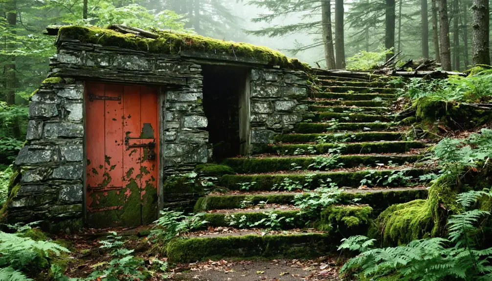
Are There Any Surviving Structures or Artifacts From the Ghost Towns?
Like footprints in shifting sand, abandoned buildings haven’t survived time’s march. You’ll find no intact ghost town structures today, just stone cairns and old carriage roads marking where settlers once dwelled.
When Is the Best Season to Observe the Mountain’s Face-Like Profile?
You’ll find the best times for viewing the face profile from May through October, with late summer and early fall offering ideal visibility due to seasonal changes and clearer conditions above the treeline.
What Modern Hiking Trails Follow the Original Settler Paths?
You’ll find historical routes preserved in today’s Long Trail, Hell Brook Trail, and Nose Dive Trail, where ancient trail markers and settler paths still guide your journey across rugged mountain terrain.
How Has Climate Change Affected Mount Mansfield’s Ecosystem Over Time?
You’ll witness dramatic ecosystem changes on the mountain, including shorter snow seasons, increased trail erosion, threatened alpine species, and shifted growing periods – all direct results of climate impact intensifying since 2000.
References
- https://obscurevermont.com/tag/mount-mansfield/
- https://www.vermonter.com/origin-mount-mansfield/
- https://obscurevermont.com/tag/stowe-vermont/
- https://www.instagram.com/reel/DBqvoTHO7Ck/
- https://vermonthistory.org/journal/misc/AccidentalTourists.pdf
- https://gmcsterling.org/htm/au_hist2.htm
- https://gmcsterling.org/htm/au_hist.htm
- https://www.stowehistoricalsociety.org/a-history-of-stowe
- https://vermonthistory.org/client_media/images/exhibits/Long Trail Exhibit.pdf
- https://urbanpostmortem.wordpress.com/2015/03/04/the-strange-wampahoofus/


