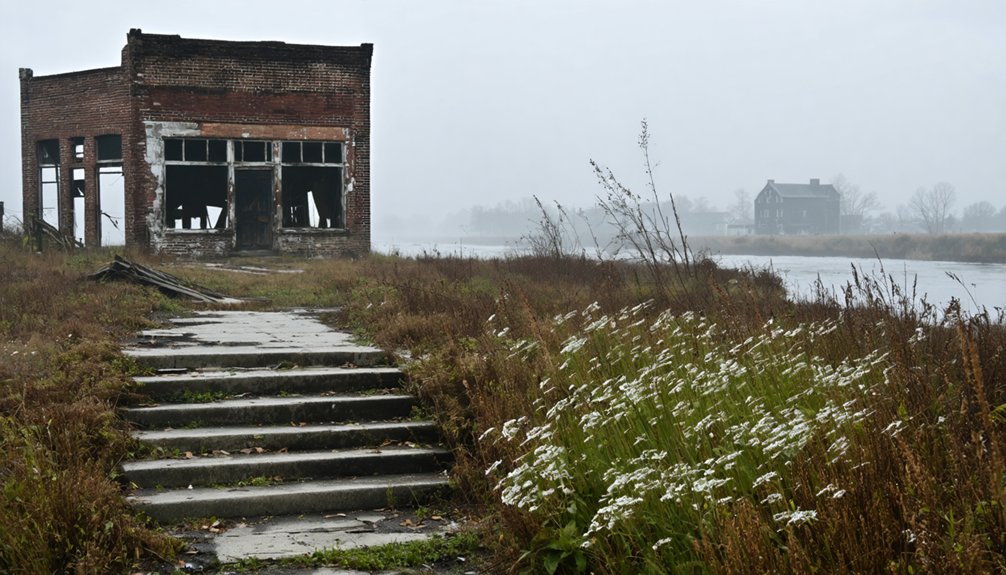
You’ll find Napoleon’s ghostly remains beneath the waters of the Mississippi River, where this once-bustling Arkansas port town of 2,000 residents met its demise. Founded in the 1820s and named after Bonaparte, Napoleon thrived through steamboat trade until the Civil War brought military occupation in 1862. A fateful decision to cut through a protective island, combined with floods and erosion, completely erased the town by the 1880s. The town’s dramatic transformation from prosperity to underwater ruins holds surprising revelations about nature’s power over human ambition.
Key Takeaways
- Napoleon was a thriving Mississippi River port town in Arkansas during the 1840s-1850s with 2,000 residents and significant steamboat traffic.
- The town’s fate was sealed when Civil War forces cut through a protective island, exposing Napoleon to destructive river currents.
- By the 1870s, the Mississippi River had completely eroded and devoured every building in Napoleon, leaving nothing behind.
- The final major structure, a marine hospital, was destroyed in 1868, marking the beginning of the town’s complete disappearance.
- Today, only the Catholic church bell survives as a preserved artifact, while the original town site lies buried under river silt.
The Birth of a Strategic River Port
While French explorer Jacques Marquette first documented the strategic confluence of the Arkansas and Mississippi Rivers in 1673, it wasn’t until the 1820s that this location would begin its transformation into the bustling river port of Napoleon, Arkansas.
You’ll find the founding vision took shape when merchant Frederick Notrebe established warehouses at this strategic crossroads, recognizing its potential to rival major cities like St. Louis and New Orleans.
Named after Napoleon Bonaparte, the settlement quickly attracted ambitious developers Stephen van Rensselaer Ryan and Jonas Mapes, who built a warehouse and hotel complex connected to Arkansas Post by a well-maintained road.
Developers Ryan and Mapes transformed the frontier settlement into a commercial hub, establishing vital trade connections through strategic infrastructure.
The town’s formal establishment was marked by its 1837 post office opening, followed by the Arkansas General Assembly‘s 1839 charter for the Napoleon and Little Rock Railroad, signaling the community’s aspirations for inland connectivity. The location became a crucial Mississippi River trade hub throughout the 1840s and 1850s.
By the town’s peak, a diverse population of two thousand residents made Napoleon their home, including merchants, doctors, carpenters, and river workers.
Economic Golden Age and Social Life
Napoleon’s rise from a frontier outpost to a thriving river port marked one of Arkansas’s most dynamic economic transformations of the mid-19th century.
At its peak, you’d have found a bustling town of up to 2,000 people experiencing remarkable economic prosperity, driven by steamboat traffic and cotton trade. Like its namesake who enacted the Napoleonic Code to modernize legal systems, the town established structured commerce regulations to govern trade.
The social dynamics reflected both opportunity and inequality:
- Merchants and professionals formed the upper class, controlling commerce and civic life
- Skilled craftsmen and river workers created a growing middle class
- Local laborers worked in various service industries, from hotels to coffeehouses
- Enslaved people, numbering 310 by 1860, provided forced labor that underpinned the economy
Despite its economic success, Napoleon gained notoriety for its rough atmosphere, with Mark Twain noting its daily fights and frequent inquests.
The Challenges of River Life
Although the strategic location at the confluence of two major rivers brought prosperity to Napoleon, this same geography created constant challenges that threatened the town’s very existence.
You’d have faced perilous river navigation through Beulah Bend’s treacherous 10-mile arc, where boats slowed to navigate shifting sandbars and unpredictable currents. Commercial risks soared as vessels battled snags, fires, and boiler explosions, while river pirates preyed on vulnerable ships in isolated stretches. The worst maritime disaster occurred when the Sultana explosion killed over 2,000 people in 1865.
Nature’s forces proved relentless, as seasonal floods reshaped channels and ice halted winter traffic. Your survival would’ve depended on adapting to these constant changes, watching levees crumble and docks become useless as the rivers carved new paths. The Arkansas River mouth marked the town’s location, making it a crucial but precarious settlement point.
Disease, mosquitoes, and harsh weather only compounded the daily struggles of river life.
Civil War’s Devastating Impact
As Arkansas teetered on the edge of secession in 1861, Governor Henry Massie Rector‘s seizure of Napoleon’s marine hospital and ammunition stores marked the beginning of the town’s wartime destruction.
The military occupation that followed would transform this once-thriving river port into a ghost town, as Union forces established control by September 1862. The strategic location attracted Union expeditions, including one that recruited 125 black soldiers for the Second Arkansas Regiment. S.V.R. Ryan, who had helped establish Napoleon’s infrastructure as postmaster and businessman, watched helplessly as his town crumbled.
- You’d have witnessed the courthouse’s burning in January 1863, when Union soldiers used it for firewood during a harsh blizzard.
- The community disintegration accelerated as guerrilla warfare made civilian life impossible.
- You’d have seen Union forces dig a fateful channel near Beulah Bend, redirecting the Mississippi River’s flow toward Napoleon.
- By 1867, the river had washed away significant portions of the town, sealing its fate as Union military priorities outweighed civilian needs.
Environmental Forces and Nature’s Revenge
You’ll find Napoleon’s demise was sealed by a fateful Civil War decision to cut through a protective island, exposing the town directly to the Mississippi River’s ruthless currents and erosion.
The river’s unrelenting force steadily devoured the town’s foundations, with buildings crumbling into the waters and high-water events accelerating the destruction throughout the 1860s.
River’s Destructive Power
While military strategy drove Union forces to dig a canal through Napoleon’s protective island during the Civil War, this tactical decision triggered devastating natural consequences that would seal the town’s fate.
The altered river dynamics transformed the landscape, unleashing the Mississippi’s raw power directly against the vulnerable settlement. Like many settlements that faced natural disasters, Napoleon’s abandonment serves as a stark reminder of nature’s destructive potential.
The ecological consequences were swift and merciless:
- The redirected current relentlessly eroded Napoleon’s riverbank, causing buildings to collapse into the turbulent waters.
- The 1868 destruction of the marine hospital marked the beginning of widespread structural failure.
- By the 1870s, the river had completely devoured every building in town.
- The creation of Beulah Bend oxbow lake stands as proof of the massive environmental transformation.
You can still spot traces of Napoleon’s ruins during low water, but the mighty Mississippi claimed its revenge against human interference.
Flooding Seals Town’s Fate
Through a devastating combination of recurring floods and altered river dynamics, Napoleon faced its ultimate demise in the early 1880s. The flood impact of 1882 proved catastrophic, submerging the entire town and much of Desha County.
You’ll find that this disaster, coupled with relentless river erosion, marked the point of no return for the struggling settlement.
The town’s vulnerability stemmed from an Army-constructed canal that redirected the Mississippi’s flow directly at Napoleon’s banks. Within a decade, this engineering intervention accelerated the erosion that had already plagued the community.
Nature Reclaims Lost City
Since Napoleon’s abandonment in the 1880s, nature has methodically reclaimed the once-bustling river port through relentless cycles of flooding, sedimentation, and ecological succession.
You’ll find little trace of human settlement as the Mississippi’s powerful waters have buried the town’s remains under layers of silt, while native vegetation has steadily marched across the landscape.
- Floodwaters continuously reshape the terrain, depositing sediment that transforms former streets into wetlands.
- Native forests of cypress, tupelo, and oak have returned, breaking through old foundations.
- Wildlife recolonization has created thriving habitats for diverse species in the floodplain.
- River dynamics occasionally reveal glimpses of Napoleon’s ruins on sandbars during low water, offering fleeting windows into the past.
The delta’s natural rhythms have triumphed, turning this lost civilization into a reflection of nature’s resilience.
The Town’s Final Days

As Union forces seized control of Napoleon in September 1862, the town’s fate took a devastating turn that would ultimately lead to its complete destruction.
You’d have witnessed the final community gatherings as residents fled their homes, while Union soldiers destroyed parts of the town to maintain river control.
The town’s last residents watched helplessly as nature conspired with wartime damage to erase their community.
Powerless against the combined forces of war and river, the last townsfolk could only witness their home’s gradual disappearance.
After troops dug a channel through a protective island, the Mississippi River’s strengthened currents began consuming Napoleon’s riverbank. Buildings collapsed one by one into the churning waters.
Once a thriving chief Arkansas port before the Civil War, Napoleon’s significance as a commercial hub made its destruction even more tragic.
Located 24 miles east of present-day Kelso at the junction of two major rivers, Napoleon’s strategic position had once been its greatest asset.
Historical Legacy and Modern Discovery
You’ll find relics of Napoleon’s past scattered along the Mississippi River, where artifacts from the once-bustling port town occasionally surface during low water periods.
The town’s Catholic church bell, preserved through generations and now housed in McGehee, serves as a tangible connection to Napoleon’s vibrant history.
The stories of this lost river town continue through historical records and family accounts, offering glimpses into life at one of Arkansas’s most important 19th-century river ports.
Hidden Artifacts Reveal Past
The hidden artifacts of Napoleon, Arkansas tell a compelling story of both Native American civilization and early European contact, revealed through systematic excavations beginning in the 1880s.
The archaeological significance of the Menard-Hodges site has preserved an essential chapter of cultural heritage that would’ve otherwise been lost to time.
- Edward Palmer’s Smithsonian excavations uncovered earthen mounds and fired clay, establishing the site’s importance.
- Clarence B. Moore’s discovery of 160 burials yielded 214 ceramic vessels, providing critical insights.
- Glass beads and metal ornaments in burial sites prove early European trade connections.
- The iron church bell remains one of the only surviving artifacts from the American town.
While the Mississippi River claimed most of Napoleon’s physical history, these preserved Native American artifacts continue telling the area’s rich story.
River Stories Live On
Beyond the recovered artifacts, Napoleon’s most enduring legacy flows through the stories passed down by generations of river folk and historians alike.
The town’s cultural echoes resonate through tales of wealthy planters mingling with riverboat crews, and social gatherings that rivaled those in New Orleans and Memphis.
You’ll find river tales of Napoleon’s marine hospital, which once served countless river workers until the Civil War swept it away.
While the Mississippi’s waters have long since claimed the physical town, you can still hear Napoleon’s story ring out through McGehee’s preserved church bell.
During low water, the river occasionally reveals glimpses of the ruins, reminding you that beneath those muddy waters lies a demonstration to the untamed power of the mighty Mississippi.
Frequently Asked Questions
Are There Any Remaining Artifacts From Napoleon That Can Be Viewed Today?
Time has taken its toll, but you’ll find the historical iron church bell preserved at McGehee’s Catholic Church, while other artifacts occasionally peek through the Mississippi’s waters during low levels.
What Happened to the Families Who Lived in Napoleon After Its Destruction?
You’ll find most families scattered to nearby river towns like Arkansas City and Memphis, with their forced relocations creating lasting historical impacts on regional development and social structures along the Mississippi.
Did Any Businesses Successfully Relocate From Napoleon to Nearby Towns?
You’ll find several successful business relocations to Arkansas City, including Mike Emerick’s merchant operation, while other entrepreneurs like W.A. Redman and Thomas Leverett helped establish new commercial centers for town preservation.
Were There Any Documented Paranormal Activities in Napoleon Before Its Disappearance?
You won’t find any confirmed ghost sightings in Napoleon before its watery demise. Historical accounts focus solely on the town’s earthly challenges, with no documented paranormal activity in official records.
How Deep Underwater Is the Original Town Site of Napoleon Today?
You’ll find Napoleon’s submerged history lies approximately 15-30 feet underwater, though exact depth varies with river levels. During extreme droughts, you might glimpse remnants of this once-proud town.
References
- http://sites.rootsweb.com/~ardesha/napoleon.htm
- https://www.treasurenet.com/threads/napoleon-arkansas-ghost-town.108551/
- https://encyclopediaofarkansas.net/entries/napoleon-desha-county-356/
- https://www.hmdb.org/m.asp?m=255065
- https://www.hmdb.org/m.asp?m=107758
- https://en.wikipedia.org/wiki/Arkansas_River
- https://twainsgeography.com/chapter/napoleon-vicksburg-1882
- https://en.wikipedia.org/wiki/Napoleon
- https://www.arkansasheritage.com/docs/default-source/ahpp-documents/sandwiching-tour-scripts/arkansas-city-tour-script-2011c8e61766-520d-45da-b0c2-7572e3055a81.pdf?sfvrsn=deb7409_5
- https://www.nplusonemag.com/online-only/city-by-city/lessons-of-the-arkansas/


