You’ll find New Burlington’s haunting story beneath the waters of Caesar Creek Lake in southwestern Ohio. This once-vibrant farming village, established in the 18th century, thrived until the 1970s when the U.S. Army Corps of Engineers built a massive flood control dam. The project forced residents to abandon their homes, farms, and tight-knit community of 275 people. John Baskin’s intimate documentation of the town’s final days reveals the human cost of progress.
Key Takeaways
- New Burlington was a thriving Ohio village that now lies submerged beneath Caesar Creek Lake due to a 1938 flood control project.
- The U.S. Army Corps of Engineers began dam construction in 1971, forcing residents to abandon their homes and community.
- Author John Baskin documented the town’s final days, capturing personal stories of families facing displacement and loss.
- The community’s transformation resulted in 11,000 acres of private farmland becoming public space, including Caesar Creek State Park.
- Only scattered ruins and historical markers remain to remind visitors of New Burlington’s existence before its submersion.
The Early Days of a Farming Village
While the hardwood forests of southwestern Ohio still dominated the landscape, the first settlers arrived to establish what would become New Burlington in the 18th century.
You’d have found these pioneers clearing dense oak and maple stands, transforming wilderness into fertile farmland through backbreaking labor. Their farming practices focused on creating flat cornfields, though the work was arduous and dangerous.
By 1876, the village had grown into a prosperous community with a population of 275 residents.
As families arrived by wagon, they built a tight-knit community where survival depended on strong community bonds. Local businesses emerged to support agricultural life – sawmills, grist mills, and blacksmiths became fixtures of the village.
This vibrant farming community would later face displacement when the Army Corps of Engineers began constructing a massive flood control dam in 1967.
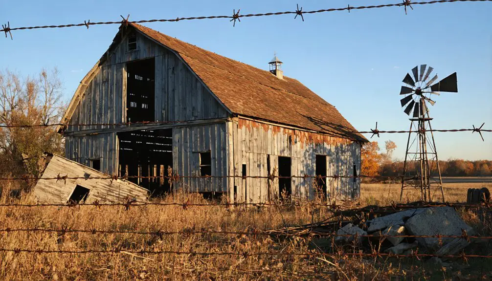
Life Along Cesar Creek Before the Dam
Beyond the village’s early farming roots, Caesar Creek carved a dramatic path through southwestern Ohio, creating a picturesque valley beneath Harveysburg hill. You’d find a self-sustaining community where farming techniques adapted to the creek’s seasonal moods, with families learning to work around the turbulent watershed’s patterns. Near New Burlington junction, the creek merged with Andersons Fork to form a significant waterway. The valley eventually became part of what would transform into a 2,830-acre lake after the dam’s construction.
Caesar Creek’s winding waters shaped Harveysburg’s destiny, transforming early settlers into master farmers who danced with nature’s rhythms.
- Log cabins dotted the valley’s bluffs and caves, evidence of pioneer determination.
- A wooden covered bridge connected communities across the rushing waters.
- Local community events centered around the Methodist church and Masonic lodge.
- Small businesses thrived, from the village grocery to the local hardware store.
While Harveysburg sat safely on its 100-foot bluff, other settlements faced nature’s whims. The creek’s waters shaped daily life, influencing everything from planting schedules to travel routes between the village’s gathering spots.
The Army Corps Project That Changed Everything
As Congress authorized the Flood Control Act of 1938, New Burlington’s fate was sealed, though residents wouldn’t know it for decades.
The U.S. Army Corps of Engineers began transforming the region in 1971, constructing a massive 165-foot-high earthen dam that would forever change the landscape and lives of those who called New Burlington home. Similar to the Upper Mississippi Valley Division established in 1929, this project showcased the Corps’ expanding role in major water infrastructure.
You won’t find this farming village on modern maps – it lies beneath the waters of Caesar Creek Lake.
The Corps’ flood management strategy required the creation of a 2,830-acre reservoir, leading to community displacement as the waters rose in 1978. Like modern gated dam systems that manage water levels, the project gave engineers precise control over water flow.
The project converted 11,000 acres of private farmland into public space, including what’s now Caesar Creek State Park.
While the dam successfully controls flooding in the Ohio River basin, it came at the cost of a community’s extinction.
A Community’s Final Year Through Baskin’s Eyes
You’ll find a powerful window into New Burlington’s final days through John Baskin’s intimate documentation, as he lived among the last residents and captured their personal stories of loss.
During his year in an abandoned farmhouse, Baskin witnessed families struggling with the slow dismantling of their community while balancing everyday life with the knowledge of their town’s impending doom.
His poetic yet unflinching narrative preserves the voices of those who watched their homes transform into empty shells, recording both the physical decay and the deep emotional toll on those who remained until the end.
The Army Corps of Engineers arrival marked the beginning of profound changes, as surveyors and their equipment sparked widespread alarm throughout the close-knit farming community.
The New York Times praised the book as an unmatched eulogy for the American people, recognizing its significance in preserving the story of a vanishing way of life.
Living History Through Words
Through the lens of writer John Baskin, New Burlington’s final year comes into sharp focus, revealing the gradual unraveling of a close-knit farming community.
Living in an abandoned farmhouse, Baskin captured oral histories that paint a vivid picture of community resilience in the face of inevitable displacement. His work as an Alicia Patterson fellow allowed him to deeply document the town’s stories and memories. Cornstalk College students and teachers were among the many voices preserved in his chronicles.
You’ll find yourself transported to 1978 through these haunting scenes:
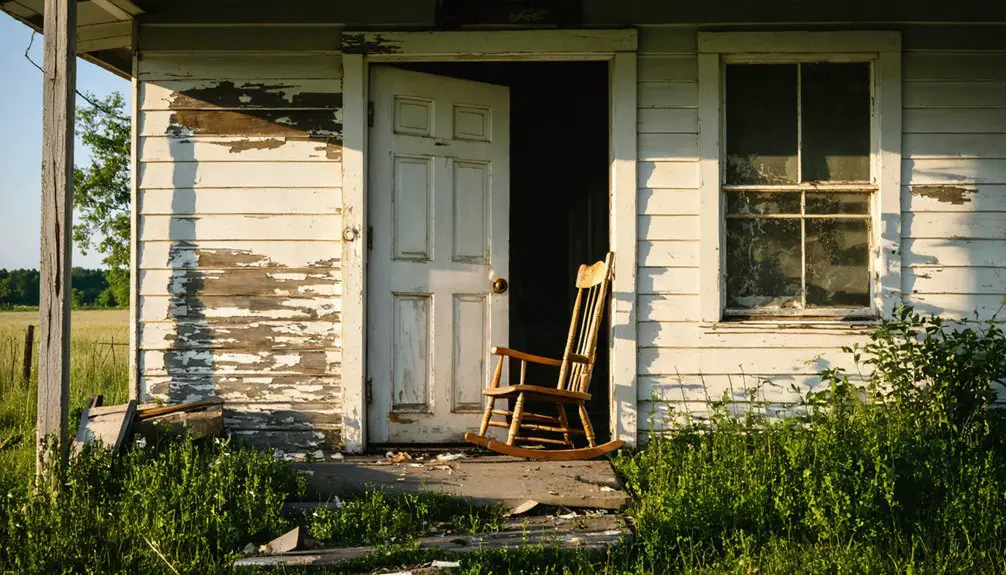
- Dark windows staring out from empty homes, while nature slowly reclaims the streets
- Neighbors watching helplessly as scavengers strip away fence posts and fuel tanks
- Surveyor’s equipment appearing in fields, spreading waves of anxiety through the town
- Families maintaining their daily routines even as their world crumbles around them
Baskin’s dispassionate yet empathetic documentation preserves this American village’s final chapter, ensuring its story won’t be lost beneath Caesar Creek Lake’s waters.
Personal Stories Of Loss
Beyond Baskin’s historical record lies a tapestry of personal heartbreak woven into New Burlington’s final chapter.
Through his year-long stay in an abandoned farmhouse, you’ll discover intimate portraits of families grappling with the forced exodus from their ancestral homes. Each emotional narrative reveals interrupted dinners, disrupted traditions, and the gradual dismantling of lifelong personal connections as neighbors scattered to different locations.
You can sense the community’s anguish in the physical decay – ivy stripped from chimneys, scavengers picking apart empty houses, and weeds overtaking once-manicured yards.
The residents’ stories paint a vivid picture of their deep roots, now severed by progress. Their collected memories serve as the last evidence to a vanished way of life, preserved through Baskin’s careful documentation of their final year together.
Forced Exodus: When Residents Said Goodbye
When the U.S. Army Corps of Engineers announced their dam project near Morrow, Ohio, New Burlington’s 300 residents faced an inevitable fate.
Throughout the late 1960s and early ’70s, you’d have witnessed the heartbreaking dissolution of strong community bonds as families were forced to relocate one by one.
The emotional farewell unfolded in stages:
- Neighbors watching helplessly as cherished homes were dismantled or demolished
- Family farms that had passed through generations being surrendered to eminent domain
- Churches and businesses closing their doors forever
- Desperate last-minute searches through buildings for forgotten treasures before demolition
Some residents held out hoping for better terms, while others sold early and moved on.
But by 1978, the village stood empty, waiting for the waters that would erase its physical presence forever.
From Town Streets to Lake Waters
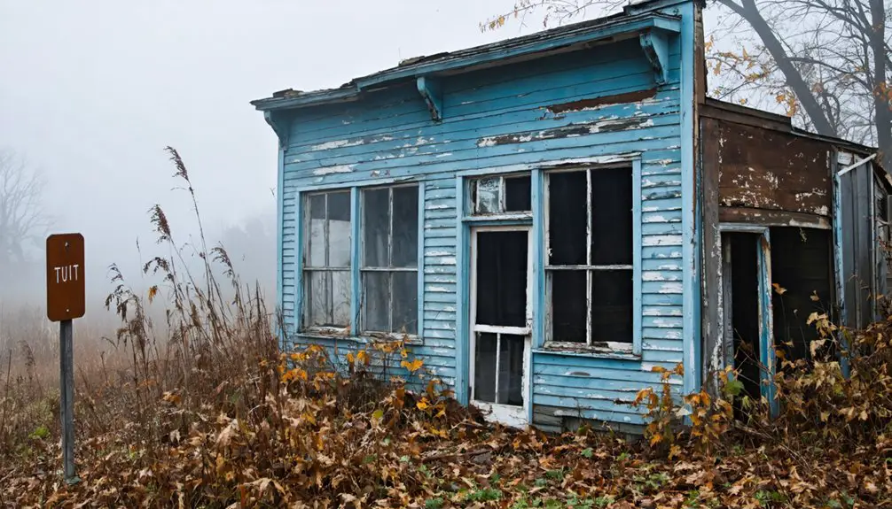
As the final residents departed New Burlington in the late 1970s, the U.S. Army Corps of Engineers began the town’s transformation into what would become Caesar Creek Lake.
You would’ve seen scavengers strip abandoned buildings of everything valuable – doorknobs, lumber, and metal tanks. Bulldozers then cleared what remained, leaving empty lots where homes once stood.
Piece by piece, the town vanished – first to scavengers who claimed its bones, then to machines that erased its footprint.
Nature quickly reclaimed these spaces as weeds sprouted through former foundations and streets. The town’s agricultural landscape, nestled in limestone terrain, gave way to rising waters as the reservoir filled.
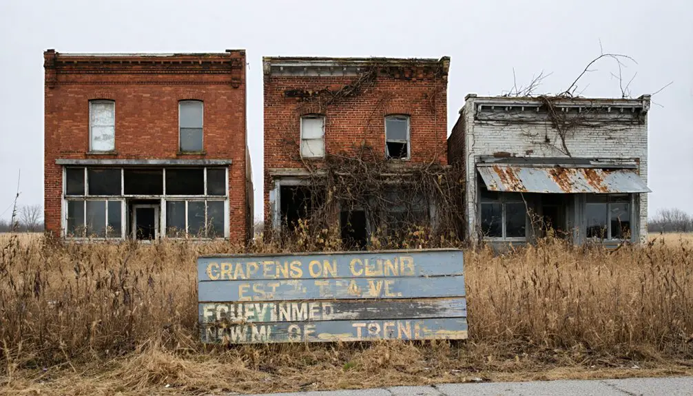
What was once a bustling farming village disappeared beneath 2,830 acres of man-made lake. Today, you’ll find a thriving state park where streets once ran, with only occasional ruins and historical markers reminding visitors of New Burlington’s existence.
What Remains: Memory and Modern Day
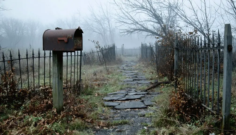
Though most of New Burlington lies beneath Caesar Creek Lake‘s waters, scattered remnants still whisper stories of the past.
You’ll find memory preservation efforts alive through photographs, oral histories, and museum gatherings where former residents share their experiences. The emotional legacy lives on through John Baskin’s memorials and scattered narratives of displacement and resistance.
Today, you can explore these ghostly remains within Caesar Creek State Park:
- Concrete steps leading to long-gone homes
- Original town roads cracked by emerging trees
- Empty window frames gazing across abandoned lots
- The old main street bridge near where the grocery store once stood
While official markers are few, the site’s transformation from vibrant town to natural preserve stands as evidence to both progress and loss, inviting you to reflect on community bonds forever changed.
Frequently Asked Questions
How Deep Underwater Is the Original New Burlington Site Today?
You’ll find the original site at varying underwater depths between 18-40 feet, with typical submersion around 30 feet, though exact measurements aren’t confirmed due to seasonal water fluctuations.
Were Any Buildings Successfully Relocated Before the Flooding Began?
You won’t find records of successful building preservation through relocation, as time constraints and logistical challenges prevented any significant structure moves before the flooding. Most buildings were simply abandoned or demolished.
Did Any Residents Receive Financial Compensation for Their Forced Relocation?
You’d think Uncle Sam would keep receipts, but while Ohio’s relocation laws guaranteed compensation, specific payment records aren’t public. Evidence suggests residents got some money, though many felt shortchanged.
Can Visitors Scuba Dive to See Remnants of the Town?
You can’t scuba dive to explore the submerged ruins since there’s no documented underwater access program, and lake conditions, including underwater visibility, make viewing historic structures impractical even with scuba gear.
What Happened to the Cemetery and Graves in New Burlington?
Like stone sentinels standing guard, you’ll find most graves still rest where they were originally placed. Though the town’s gone, cemetery preservation efforts kept the historic burial ground intact within Caesar Creek State Park’s boundaries.
The area surrounding Caesar Creek State Park carries a rich narrative steeped in the blue sulphur springs ghost town history. Visitors often express a sense of nostalgia as they explore the remnants of this once-thriving community, imagining the lives that shaped its vibrant past. Each echo of the wind seems to whisper tales of the those who once sought solace in the therapeutic waters.
References
- https://aliciapatterson.org/john-baskin/new-burlington-ohio-when-a-town-dies/
- https://www.johnebaskin.com/the-story-begins
- https://en.wikipedia.org/wiki/New_Burlington_(book)
- https://warrencountypost.com/g/waynesville-oh/n/138247/remembering-village-no-more
- https://www.youtube.com/watch?v=HA2LAcif5eY
- https://aliciapatterson.org/john-baskin/new-burlington-ohio-when-a-town-diesjohn-harlan-pickin-a-history/
- https://warren.ohgenweb.org/Bogan/bogan330.html
- https://en.wikipedia.org/wiki/Caesar_Creek_State_Park
- https://letthejourneysbegin.wordpress.com/2012/03/23/harveysburg-ohio-on-caesars-creek-lake-a-little-village-with-a-big-history/
- https://www.mindat.org/loc-230336.html