You’ll find New Hampton’s ghost town remains in Ohio, where pioneering settlers established a hopeful community in 1822. The town initially thrived with 93 lots, a Baptist church, and bustling businesses along Main Street. When the National Road bypassed the settlement in the late 1820s, residents relocated their homes and businesses to the newly founded West Jefferson. Today, only the historic New Hampton Cemetery and scattered artifacts mark this once-promising frontier town’s existence, with each weathered gravestone telling part of its fascinating story.
Key Takeaways
- New Hampton was established in 1822 in Ohio Territory but became a ghost town by 1840 after economic decline and population exodus.
- The town’s downfall occurred when transportation routes changed, with the National Road and railroads bypassing the settlement.
- Only the New Hampton Cemetery remains today, featuring original settler graves and serving as the primary historical landmark.
- Residents relocated buildings and businesses to nearby West Jefferson, leaving the original 93 lots completely abandoned.
- Archaeological evidence, including ceramic fragments and foundation remnants, provides insights into pioneer life in early Ohio settlements.
The Birth of a Pioneer Settlement
In 1822, as pioneers pushed westward into the Ohio Territory, the settlement of New Hampton emerged through the determined efforts of early settlers like Moses Dudley from Maine.
Much like the Native American tribes who had inhabited the region for thousands of years before them, these brave pioneers faced untamed wilderness, establishing their community near crucial river routes that served as lifelines for transportation and survival. They brought their New England cultural practices with them, carefully planning their settlement to mirror the familiar town structures they’d left behind.
Following the paths blazed by Revolutionary War veterans, settlers sought Congress lands that offered clear property titles at modest prices. The Bellefontaine & Sandusky road provided vital access for military and civilian travel through the region.
Despite pioneer hardships, they built simple log structures and established essential community institutions, including a Baptist church and post office, laying the groundwork for what they hoped would become a thriving frontier town.
Early Town Layout and Development
You’ll find New Hampton’s original design encompassed 93 lots spread across 8 streets, forming a thoughtfully planned grid south of Hampton Cemetery on Frey Avenue.
Like many Ohio ghost town communities, New Hampton’s fate mirrors the pattern of sudden abandonment and decline that befell numerous settlements across the state.
Exploring ghost towns in Ohio can reveal fascinating stories and remnants of the past. Each location offers a glimpse into the lives of those who once inhabited these now-desolate places. As one ventures through these forgotten sites, the echoes of history become palpable, making it a truly immersive experience.
The town’s commercial district centered around Main Street, featuring two general stores, three taverns, a hotel, and a post office to serve the local population.
Samuel Jones’s 1823 donation of land for the Baptist church provided a spiritual and social anchor for the developing community.
The settlement was officially renamed West Jefferson in 1833 to prevent confusion with other similarly named towns in the region.
Original Streets and Lots
Eight carefully planned streets formed the backbone of New Hampton’s original 1822 layout, with founders Samuel Sexton and Samuel Jones establishing 93 lots in an organized grid pattern along Ludlow’s Road. Similar to other locations bearing the New Hampton name, careful planning was essential to establish distinct geographical boundaries.
You’ll find the town’s original lot sizes were remarkably uniform, designed to standardize property values and simplify sales. The street naming reflected the town’s practical approach, with Main Street serving as the primary thoroughfare aligned with Ludlow’s Road. When the National Road was constructed, it led to the town’s eventual abandonment.
Here’s what made the layout distinctive:
- Streets intersected to form navigable rectangular blocks
- The Baptist church occupied a central lot as a community focal point
- Mixed-use lots supported homes, taverns, and shops
- Main Street functioned as the commercial spine for trade and travel
Town Business Establishments
Commerce bustled through New Hampton’s early business district, anchored by two general stores and three taverns along Ludlow’s Road.
You’d find a hotel catering to weary travelers, while the post office (operating 1830-1833) handled official communications and business transactions.
The town’s founders, Samuel Sexton and Samuel Jones, strategically positioned these establishments to capitalize on the trading route‘s traffic. Much like the haunted Lazarus Building in Columbus, these historic structures held their own unique stories and secrets.
Similar to how Bodie Mining Town in California transformed from a bustling population of 10,000 to a ghost town, New Hampton experienced its own dramatic decline.
The brick Baptist church near the town cemetery served as both a religious and social hub, demonstrating the historical significance of community gathering spaces.
However, business adaptation became essential when the National Road diverted commerce northward.
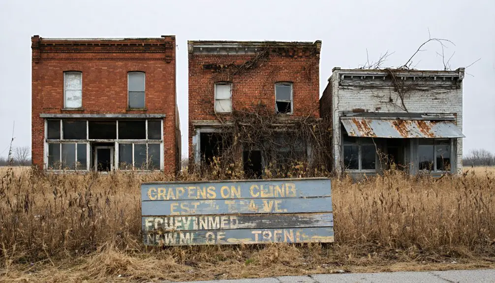
Many establishments closed or relocated to West Jefferson, and by 1883, only one hotel remained, marking the town’s steady decline into a ghost town.
Land Donation and Planning
While Samuel Jones and Samuel Sexton laid the groundwork for New Hampton in 1822, their vision materialized through a carefully planned grid of 93 lots spread across 8 streets on the south side of what would become Hampton Cemetery.
This early example of community planning showcased their commitment to organized land use and development. The town served as the Main Street village for nearly a decade before declining.
Key aspects of New Hampton’s layout included:
- A centrally located brick Baptist church near the cemetery
- Samuel Jones’ donated cemetery lot, where his wife Elizabeth became the first burial in 1823
- Streets sized to accommodate future growth and commerce
- Designated spaces for residential, commercial, and public use
Their thoughtful land use planning created a foundation for what they hoped would become a thriving rural community with essential services and social institutions.
Key Landmarks and Buildings
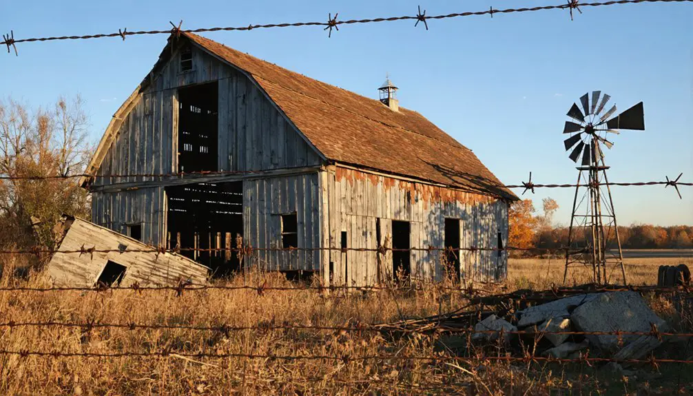
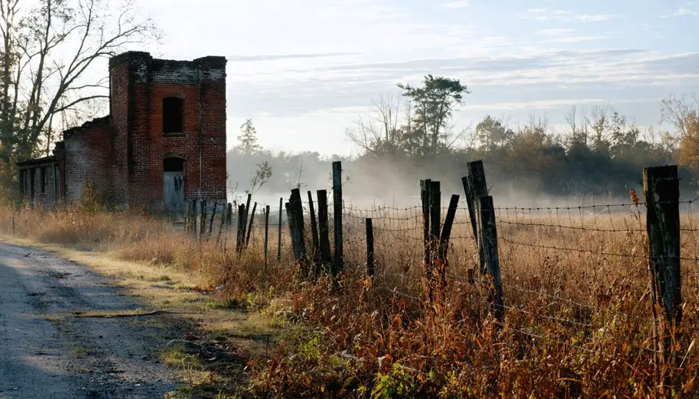
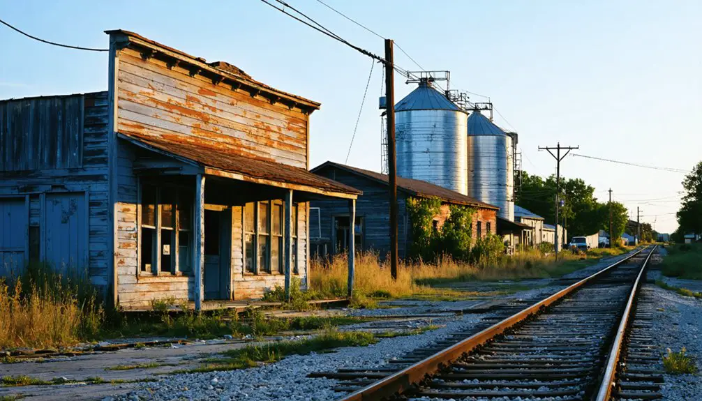
Although New Hampton eventually became a ghost town, several key landmarks defined its brief existence in the 1820s and 1830s. The brick Baptist church and New Hampton Cemetery stood as symbols of historic significance, with the cemetery remaining today as a monument to the community’s heritage.
You’ll find the final resting places of the town’s earliest settlers there, including Elizabeth Jones and Samuel Sexton’s family members. The area’s haunting atmosphere draws visitors interested in historical exploration sites, similar to other notable Ohio locations.
The town’s commercial district buzzed with two general stores, three taverns, a hotel, and a post office along the original Ludlow’s Road. While these structures have since vanished, their locations along the town’s eight-street grid showcased New Hampton’s ambitious plans before the National Road diverted traffic and sealed its fate.
The National Road’s Impact
You’ll find that New Hampton’s decline mirrors the shifting fortunes of many National Road communities as rail networks superseded the historic thoroughfare in the mid-1800s.
The town’s position along this once-vital transportation artery initially spurred economic growth, but as rail lines bypassed the settlement, residents gradually migrated to better-connected areas.
The population exodus accelerated through subsequent decades as newer highways like U.S. Route 40 drew traffic and commerce away from the original National Road corridor, leaving New Hampton to fade into obscurity.
Economic Shift and Decline
Once the National Road’s construction was completed north of New Hampton in the late 1820s, the town’s economic fortunes took a dramatic downturn.
You’ll find that despite the community’s resilience, the shift in transportation routes proved devastating to New Hampton’s survival. The economic nostalgia of bustling taverns and general stores quickly faded as businesses and residents relocated to Jefferson to capitalize on the National Road’s opportunities.
The decline manifested in four critical ways:
- The post office closed by 1833, severing essential communication links
- The Baptist church was abandoned by 1840
- Merchants and service providers lost their clientele to National Road towns
- Even entire buildings were physically moved to Jefferson, leaving only the cemetery and remnants of Main Street behind
Transportation Route Changes
When Congress authorized the National Road in 1806 as America’s first federally funded highway, it set in motion transformative changes that would reshape Ohio’s settlement patterns.
You’ll find that New Hampton’s story reflects the broader transportation evolution that swept through the region. The road’s advanced macadam surface initially drew steady traffic through Ohio’s small towns, but this route significance wouldn’t last forever.
As railroads emerged and the National Gateway project modernized freight transport with $842 million in infrastructure improvements, towns like New Hampton lost their strategic advantage.
The shift from horse-drawn wagons to trains, and later to interstate highways, redirected commercial traffic away from the historic corridor. Communities that once thrived on National Road travelers found themselves bypassed and economically isolated.
Population Migration Patterns
As the National Road’s construction progressed northward in the late 1820s, it triggered a dramatic exodus from New Hampton that would seal the town’s fate.
You’ll find the demographic shifts followed a clear pattern as residents sought better opportunities along the new federal highway.
The migration motivations became evident in four key ways:
- Entire families physically relocated their homes and businesses to towns along US 40.
- The town’s founders, Samuel Sexton and Samuel Jones, abandoned their investment and returned to New Jersey.
- Religious institutions, including the Baptist church, moved operations to West Jefferson.
- By 1840, nearly all of New Hampton’s original 93 lots stood empty, with the population absorbed into growing National Road communities.
Rise of West Jefferson and Economic Shifts
The establishment of West Jefferson in 1833 marked a pivotal transformation from its humble beginnings as New Hampton, founded by Samuel Jones and Samuel Sexton in 1822.
Despite pioneer struggles, the town’s location on the National Road proved essential, as you’d have seen stagecoaches running multiple times daily, connecting local merchants to markets as far as Boston and New York City.
The town’s economic resilience showed through its diverse enterprises – five taverns, two general stores, and a thriving pork packing industry supported by the fertile Darby Plains.
West Jefferson’s economic foundation rested on its varied businesses, from local taverns to a robust pork industry thriving in Darby Plains.
While the railroad’s arrival in 1848 shifted commerce away from the National Road, West Jefferson adapted by diversifying its economy.
The introduction of natural gas in the early 1900s further modernized the town, ensuring its survival despite changing transportation patterns.
The Ghost Town Legacy
When you visit New Hampton Cemetery today, you’ll find one of Ohio’s most poignant reminders of how transportation infrastructure could make or break pioneer settlements.
The ghost town’s legacy serves as a compelling case study of early American development, where the National Road’s bypass led to the complete abandonment of what was once a promising frontier community.
You can still trace parts of the original Main Street along Ludlow’s Road and explore the historic cemetery where Elizabeth Jones and other founding families rest, offering tangible connections to this pivotal chapter in Madison County’s history.
Preserving Pioneer Memory
Through dedicated preservation efforts, New Hampton’s pioneer legacy endures primarily in its historic cemetery and the Ohio Historical Marker #2-49 along Frey Avenue.
You’ll find evidence of pioneer resilience and cultural heritage carefully maintained by local historical societies, ensuring future generations can connect with this important piece of Ohio’s past.
Key elements of New Hampton’s preservation include:
- Original burial grounds containing graves of town founders’ families dating to the 1820s
- Remnants of Main Street that once aligned with historic Ludlow’s Road
- Detailed documentation of the original 93-lot town layout with eight streets
- Archived church records and oral histories that tell the story of early settlers’ migration to the National Road corridor
Transportation’s Impact Today
Since transportation networks shaped the fate of pioneer settlements, New Hampton’s ghost town legacy vividly illustrates how shifting travel routes can doom or sustain early communities.
Today, you’ll find only the Hampton Cemetery and traces of Ludlow’s Road where this ambitious town once stood, while West Jefferson thrives just miles away along US 40, the former National Road.
Modern transportation trends continue to influence urban evolution in Madison County, much as they did two centuries ago.
While you won’t find commercial traffic on Ludlow’s Road anymore, historical markers preserve the memory of New Hampton’s rise and fall.
The site serves as a powerful reminder of how infrastructure decisions can determine whether communities flourish or fade into ghost towns.
Cemetery as a Historical Monument
Hampton Cemetery stands as the most significant historical monument of New Hampton’s vanished community, established between 1822-1830 during the town’s founding years.
This sacred ground‘s historical significance extends far beyond its role as a burial place, serving as one of the few physical remnants of the ghost town’s existence.
You’ll discover these notable features that highlight the cemetery’s preservation and cultural importance:
- Original settler graves, including Reverend Isaac Jones and Elizabeth Jones, the first burial in 1823
- Veterans’ final resting places from multiple conflicts, including the Civil War
- Well-maintained historic tombstones that provide genealogical records for researchers
- Ohio Historical Marker #2-49, educating visitors about New Hampton and Ludlow’s Road
The cemetery continues to serve the community today, with newer burials maintaining its living connection to the past.
Pioneer Families and Their Stories
When pioneers first ventured into Ohio’s untamed wilderness, the Hampton family emerged as one of the region’s most influential settler groups.
Their pioneer struggles began in Virginia’s Shenandoah Valley, where Noah Hampton established mills along Opequon Creek in the 1730s.
The family’s legacy grew as they acquired vast landholdings stretching nearly a mile.
Lost to Time: New Hampton’s Disappearance
The construction of America’s first federally funded highway, the National Road, sparked the downfall of New Hampton in the early 1830s.
As pioneer challenges mounted, you’d have witnessed a dramatic shift in trade dynamics when the new federal highway drew commerce away from Ludlow’s Road, New Hampton’s lifeline.
The town’s fate unfolded in these pivotal developments:
- Residents, including founders Samuel Sexton and Jones, relocated their homes and businesses to Jefferson.
- The post office operated briefly from 1830-1833 before closing.
- Local enterprises, including two general stores and three taverns, couldn’t sustain the population.
- By 1840, only the Baptist church remained before its eventual closure.
Today, only the cemetery and fragments of Main Street survive as silent testimonies to New Hampton’s existence.
Archaeological and Physical Remnants Today
Despite New Hampton’s near-complete disappearance from Ohio’s landscape, several physical remnants offer modern visitors and researchers glimpses into this lost pioneer settlement.
You’ll find the New Hampton Cemetery, established around 1806, serving as the most significant surviving site with its Wyoming-style headstones and graves of original settlers. A segment of Ludlow’s Road, Ohio’s first state road, still winds past the cemetery as an unpaved reminder of the town’s brief existence.
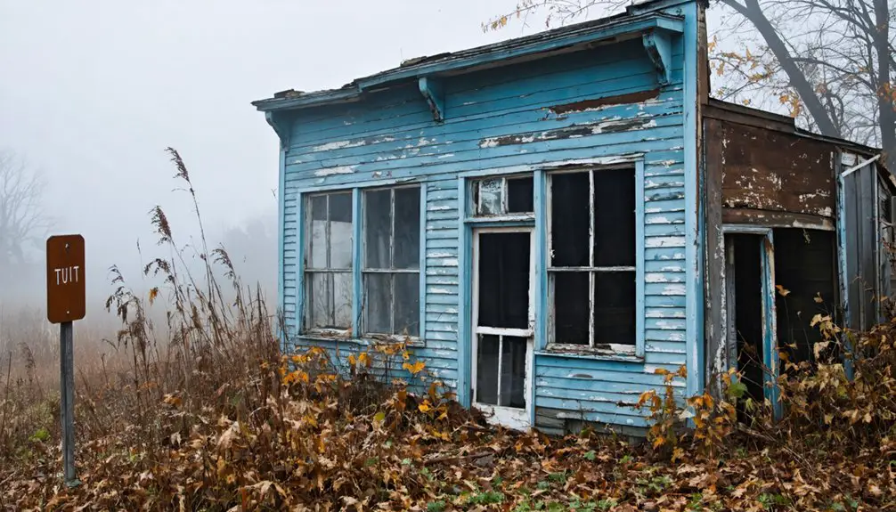
While no buildings remain standing, the area holds archaeological potential through possible subsurface foundations and scattered material culture.
Surface artifacts like ceramics and metal fragments near the cemetery and road could reveal insights into pioneer life. Ohio Historical markers now guide you through this ghost town’s story, preserving its memory for future generations.
Frequently Asked Questions
Were There Any Notable Crimes or Incidents Recorded in New Hampton?
You won’t find any documented crime history or notable incidents in this settlement’s records. The town’s entire existence was peaceful, with its decline driven by economic changes rather than conflict.
What Was the Average Property Value of Lots in New Hampton?
Like many lost treasures of history, you won’t find exact property market values, though historical appraisal suggests lots likely ranged from $1-5 per acre before the town’s economic decline in 1840.
Did Native American Tribes Have Settlements in the New Hampton Area?
You’ll find that Native tribes, particularly the Shawnee and Lenape, established settlements throughout central Ohio’s river valleys, though specific documentation of settlements at New Hampton’s exact location remains uncertain.
What Was the Total Population of New Hampton at Its Peak?
Imagine standing in a bustling 1883 frontier town – you’d see about 800 residents going about their daily lives. Historical demographics confirm this peak population before the town’s dramatic decline toward abandonment.
Were There Any Documented Natural Disasters That Affected New Hampton?
You won’t find any documented flood history or earthquake impact in the records – there’s no evidence of natural disasters contributing to the town’s decline. Economic factors, particularly the National Road’s construction, caused its abandonment.
References
- https://ohioghosttowns.org/top-10-small-towns/
- https://kids.kiddle.co/List_of_ghost_towns_in_Ohio
- https://en.wikipedia.org/wiki/New_Hampton
- https://www.hmdb.org/m.asp?m=12523
- https://ohioghosttowns.org/madison-county/
- https://www.youtube.com/watch?v=qRa_Xgrb80k
- https://ohiogenealogyexpress.com/hardin/hardinco_hist_1883/hardinco_1883_hist_pg_0599_dudleyTwp.htm
- https://www.dbksurveys.com/pdfs/Pioneer and General History of Geauga.pdf
- http://sites.rootsweb.com/~ohmhs/pioneer.htm
- https://www.youtube.com/watch?v=QWTtG6njIDs