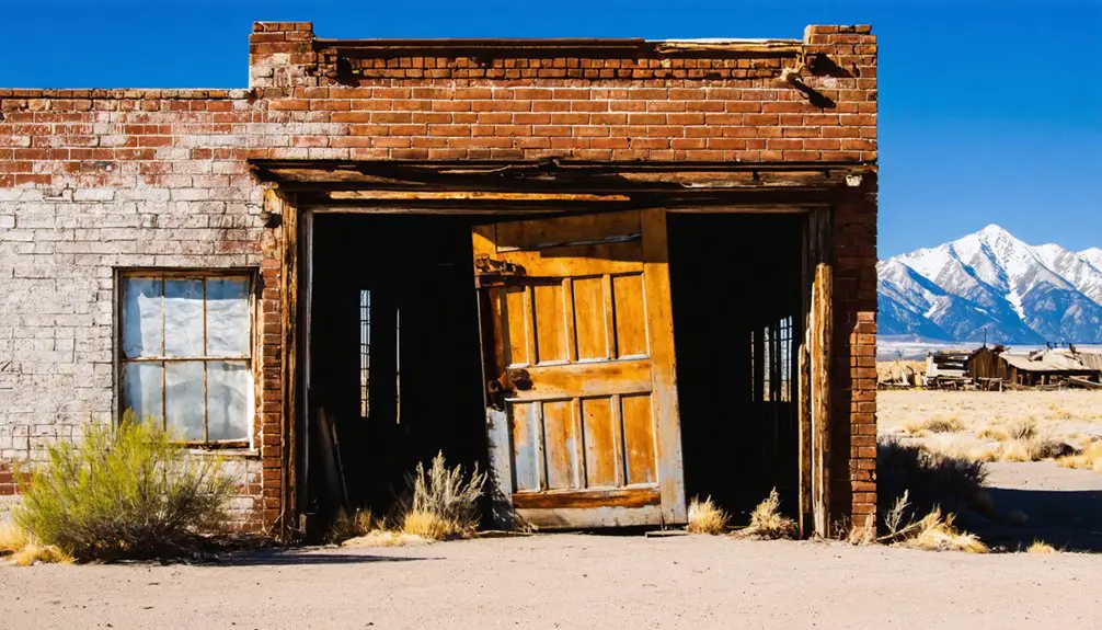
You’ll find Northrop’s ghost town remains at the confluence of the North and East Forks of the Virgin River in Utah, where Mormon pioneers established a settlement in 1861. Led by Isaac Behunin, this ambitious cotton-growing colony of 220 families worked alongside Perrusit Indians until the devastating Great Flood of 1862 destroyed everything. The survivors relocated to higher ground, establishing what you know today as Springdale. The story of Northrop’s brief existence reveals fascinating insights into pioneer resilience and nature’s power.
Key Takeaways
- Northrop was established in 1861 by Isaac Behunin at the confluence of North and East Forks of the Virgin River in Utah.
- The settlement of 220 families focused on cotton farming but struggled with alkaline soil and unpredictable Virgin River flooding.
- The catastrophic Great Flood of 1862 completely destroyed Northrop, washing away all structures and forcing survivors to abandon the settlement.
- Survivors relocated to higher ground, establishing what would become modern-day Springdale to avoid future flooding disasters.
- Northrop’s location on unstable floodplain soils and vulnerability to multiple watershed runoffs ultimately led to its complete abandonment.
The Birth of a Pioneer Settlement
While Mormon pioneers were expanding settlements throughout southern Utah Territory, Isaac Behunin established Northrop in 1861 at the confluence of the North and East Forks of the Virgin River. The settlement’s pioneer motivations aligned with the broader vision of creating a self-sustaining cotton-growing colony in Washington County. For historical accuracy and clarity, researchers often need to ensure articles about Northrop are properly linked to distinct geographical references.
You’ll find that these early settlers chose the location strategically, drawn by the agricultural aspirations made possible by the river’s irrigation potential. They quickly implemented proven Mormon settlement techniques, including organized farm village planning and grid layouts. The community implemented Brigham Young’s plat, which organized their farming and commercial activities around a central community hub.
The community of roughly 220 families, including Swiss converts, brought diverse skills and resources to the endeavor. Following traditional Mormon colonization patterns, they integrated religious and civil governance while prioritizing essential crops like potatoes and corn for immediate survival.
Life Among the Perrusit Indians
During the 1860s, the Perrusit Indians, a large and amicable Southern Paiute clan, maintained close relations with Northrop’s Mormon settlers near the forks of the Virgin River. The Perrusit lifestyle involved seasonal movement patterns based on available resources.
Heavy winter rains made their traditional hunting grounds nearly impassable for over a month.
You’d find the Perrusit culture deeply rooted in seasonal hunting and gathering practices, with their people expertly tracking deer, rabbit, and small game throughout the region. They’d generously share their knowledge of Indigenous subsistence with settlers like Isaac Behunin’s family, teaching them survival strategies in the harsh environment.
While the Perrusit welcomed Mormon settlers as potential allies against hostile tribes, their population soon faced devastating challenges from introduced diseases.
Initial alliance between Perrusit and Mormon settlers proved bittersweet as disease epidemics ravaged the indigenous population.
Despite these hardships, they continued their traditional practices of harvesting native plants, brewing medicinal teas, and maintaining their ancestral connections to the land through oral histories and cultural ceremonies.
Cotton Mission Dreams and Early Agriculture
When you explore the Mormon Cotton Mission of 1861, you’ll find pioneers like Isaac Behunin arriving at Northrop with clear directives from Brigham Young to establish cotton production along the Virgin River.
You’ll see these determined settlers implementing traditional cotton cultivation methods – from hand planting to weaving – while battling the harsh realities of desert agriculture. The farmers struggled against alkaline soil conditions, making crop yields unpredictable and difficult to sustain. Their efforts mirrored the cotton growing practices of the southern states.
Their agricultural aspirations faced immediate challenges from the Virgin River’s unpredictable flooding, which repeatedly damaged farmland and tested the settlers’ resolve to maintain their cotton-growing enterprise.
Mormon Cotton Pioneers
In 1861, Brigham Young initiated the ambitious Mormon Cotton Mission to establish self-sufficient cotton production within Utah Territory, reducing dependence on eastern U.S. markets. This Mormon migration brought hundreds of families to southwestern Utah’s “Dixie,” where they’d pioneer agricultural innovation through adapting cotton cultivation to the harsh desert environment. Limited tools and resources made farming operations especially challenging for the early settlers. The Cotton Mission effort began after successful cultivation in Santa Clara in 1854, proving the viability of growing cotton in the region.
- Early experiments in Santa Clara proved cotton could grow in Utah’s climate.
- Settlers established communities along the Virgin River basin for irrigation.
- Farmers imported cotton seed and developed local ginning operations.
- Communities shared resources and knowledge for economic survival.
- Cotton cultivation merged with other crops like grapes, figs, and sugar cane.
You’ll find these determined pioneers transformed the landscape through irrigation systems and communal farming efforts, viewing their work as both an economic necessity and a religious calling of equal importance to preaching the gospel.
Virgin River Farming Challenges
Throughout the late 1860s, Virgin River farmers confronted devastating challenges that tested their resilience and agricultural ambitions.
You’ll find that their irrigation techniques, starting with the Pintura Ditch in 1868, required extensive infrastructure including diversion dams, canals, and headgates to manage the river’s unpredictable flow. The initial construction of these systems cost approximately $3,310 per ditch.
Flood management became critical after disasters like the 1862 flood destroyed settlements and farmland. You’d have seen farmers adapting by relocating to higher ground and forming irrigation districts to share infrastructure costs.
Their early focus on cotton proved risky, leading to a necessary shift toward food crops and alfalfa. While diesel pumps arrived after 1900, most farmers couldn’t afford them.
Despite these setbacks, they persisted with dry farming methods and community-based solutions, creating a unique agricultural landscape shaped by both Mormon cooperation and environmental constraints.
The Great Flood of 1862
The Great Flood of 1862 stands as the largest recorded flood in the history of the American West, devastating communities from the Columbia River to San Diego and stretching inland through Utah Territory.
The devastating 1862 flood ravaged the American West, wreaking havoc from the Pacific Northwest through California and into Utah.
You’ll find the flood’s historical significance particularly evident in Northrop’s story, where the settlement met its end just months after its founding.
This catastrophic event brought:
- 43 days of continuous rain and snowfall starting November 1861
- Equivalent of 10 feet of precipitation in California alone
- Creation of a 300-mile-long inland sea in California’s valleys
- Complete destruction of Northrop at the Virgin River confluence
- Forced relocation of survivors to what’s now Springdale
The flood recovery proved impossible for Northrop, as the entire settlement washed away, leaving no structures behind at the original site. The devastation extended throughout Washington County, where early Utah settlements were nearly destroyed by the raging Virgin and Santa Clara Rivers.
From Destruction to Relocation

Following the devastating flood of 1862, Northrop’s survivors faced a critical decision about their future.
You’ll find their community resilience shone through as they chose to abandon their original settlement completely and seek higher ground. Their relocation strategies prioritized safety and growth potential, leading them to establish what would become modern-day Springdale.
The move wasn’t easy – they’d to leave behind their initial investments in Northrop’s infrastructure.
However, you can see their determination as they maintained their agricultural focus while adapting to their new environment. The settlers’ choice of location proved wise, as it offered better protection from the Virgin River’s flooding while providing ample space for cotton cultivation.
This strategic relocation transformed their vulnerable outpost into a stable, enduring community.
Geographic Challenges and Natural Forces
You’ll find Northrop’s fatal flaw in its precarious location at the confluence of the North Fork and East Fork of the Virgin River, where the merging waters created heightened flood risks.
The settlement’s position on unstable floodplain soils at 37.16250°N, 113.01250°W made structures particularly vulnerable to erosion and water damage during high-flow events.
When the Great Flood of 1862 struck, these geographic vulnerabilities converged with extreme weather conditions, leading to the complete destruction of the fledgling cotton colony.
River Junction Hazards
Located at the volatile confluence of the North Fork and East Fork of the Virgin River, Northrop faced multiple geographic hazards that would ultimately contribute to its demise. The merging rivers created complex hydrodynamics that made the settlement particularly vulnerable to natural forces beyond human control.
- Intense river hazards emerged from turbulent flow conditions where the forks met.
- Increased sediment deposition at the confluence led to unstable channel shifting.
- Limited buildable land between the forks forced settlement in risky flood zones.
- Loose alluvial soils near the junction promoted rapid erosion during floods.
- Seasonal flow variations caused unpredictable channel migrations and bank collapse.
These challenging conditions at the river junction, combined with the catastrophic Great Flood of 1862, proved insurmountable for the early settlers of Northrop.
Floodplain Settlement Risks
Despite the rich alluvial soil that initially attracted settlers, Northrop’s position within the Virgin River floodplain proved to be a fatal geographic vulnerability.
You’ll find that the settlement’s location at the confluence of the North and East Forks of the Virgin River exposed it to runoff from multiple watersheds, dramatically increasing flood risks.
The settlers’ lack of reliable hydrological data and flood prediction methods left them dangerously unprepared for nature’s forces.
When the Great Flood of 1862 struck, it devastated the year-old settlement, washing away homes, mills, and precious topsoil.
These floodplain vulnerabilities, combined with poor settlement planning, forced survivors to abandon Northrop entirely and relocate to higher ground in Springdale, where they’d face fewer geographic hazards.
Terrain Vs Pioneer Survival
The challenging terrain surrounding Northrop compounded the settlement’s vulnerabilities beyond its floodplain location.
You’ll find that pioneer survival strategies were severely tested by the rugged landscape where steep canyons met converging rivers. The terrain’s resilience against human settlement manifested through:
- Rocky, thin soils that limited agricultural expansion and crop diversity
- Steep canyon walls that concentrated flash floods and intensified their destructive power
- Variable elevations that complicated building sustainable infrastructure
- Seasonal water flow changes that challenged irrigation systems
- Complex river confluence patterns that increased flood unpredictability
This harsh environment, coupled with limited hydrological data in the 1860s, made it nearly impossible for pioneers to establish long-term defenses against nature’s forces.
The settlement’s eventual destruction by the Great Flood of 1862 proved that the terrain’s challenges were ultimately insurmountable.
The Rise of Modern Springdale
After remaining relatively isolated for decades, Springdale experienced a transformative period beginning with the completion of the Zion-Mt. Carmel Highway and Tunnel in 1930. This engineering marvel carved through sandstone provided essential east-west access, marking the town’s evolution from a remote settlement to a vibrant gateway community.
The 1930 Zion-Mt. Carmel Highway transformed Springdale from isolation, carving through sandstone to create a vital portal between east and west.
The tourism impact accelerated when Springdale incorporated in 1959, enabling the town to manage community growth through modern municipal services.
You’ll find the transformation particularly evident in the shift from an agricultural economy to one centered on hospitality and tourism. While preserving pioneer architectural elements, the town embraced art galleries, theaters, and eclectic shops.
Despite welcoming global visitors, Springdale’s 500 permanent residents maintain their commitment to environmental stewardship and small-town values, creating a unique blend of historic charm and modern amenities.
Preserving Northrop’s Pioneer Legacy
While physical remnants of Northrop no longer exist at its original site near the Virgin River’s confluence, the settlement’s pioneer legacy endures through meticulous historical documentation and preservation efforts.
You’ll find this heritage preserved through:
- Written accounts from early settlers, maintained by pioneer descendant organizations like the Daughters of Utah Pioneers
- Regional museums and archives collecting maps, photographs, and pioneer records
- Educational programs highlighting community resilience during the 1862 flood
- Local historians documenting the relationship between settlers and Perrusit Indians
- Heritage tours connecting visitors to Northrop’s role in Utah’s cotton mission
Through these preservation efforts, you can trace how Northrop’s brief existence shaped the development of modern Springdale and exemplified the pioneering spirit that defined early Utah settlement.
Frequently Asked Questions
What Modern Landmarks or Roads Are Closest to Northrop’s Original Location?
You’ll find Utah State Route 9 running through Springdale as the closest modern infrastructure, while the Virgin River forks serve as natural landmarks near the historical preservation area.
Were Any Artifacts or Personal Belongings Recovered After the Flood?
You’d think floods would destroy everything, but they’ve ironically helped expose artifacts. After waters receded, archaeologists recovered Chinese coins, porcelain fragments, and preserved food remnants that revealed past residents’ lives.
How Many Total Residents Lived in Northrop During Its Brief Existence?
While exact population estimates don’t exist in ghost town history records, you’ll find most historians believe Northrop had between 20-50 residents during its brief existence from 1861-1862.
In the surrounding area, visitors can explore the historic sites in Notom, Utah, which reflect the rich heritage of early settlers. These remnants provide a unique glimpse into the past, showcasing the challenges faced by those who dared to call this rugged land home. While Northrop may have been short-lived, its story is woven into the broader narrative of the region’s development.
What Happened to Isaac Behunin After Leaving Northrop?
After Northrop, Isaac’s journey led him to establish Springdale, farm in Zion Canyon where he’d name the area, and finally settle in Long Valley until his death in 1881. Behunin’s legacy endures.
Did Any Descendants of Original Northrop Settlers Remain in Washington County?
You’ll find that Isaac Behunin’s descendants remained in Washington County, establishing lasting historical significance through Springdale. However, there’s limited evidence of other settlers’ descendants stories continuing in the region.
References
- https://en.wikipedia.org/wiki/Northrop
- https://www.youtube.com/watch?v=JpQK8jnTaxc
- https://www.youtube.com/watch?v=m5VZUROE_1g
- https://jacobbarlow.com/tag/ghost-towns/
- https://en.wikipedia.org/wiki/Bacchus
- https://en.wikipedia.org/wiki/Mormon_settlement_techniques_of_the_Salt_Lake_Valley
- https://historytogo.utah.gov/pioneers/
- https://www.uen.org/utah_history_encyclopedia/c/COTTON_MISSION.shtml
- https://www.gutenberg.org/files/59914/59914-h/59914-h.htm
- https://wchsutah.org/towns/northrop.php


