You’ll find Arkansas’s ghost towns scattered across the state as reminders of zinc mining booms, timber operations, and visionary resort schemes. Rush thrived during World War I with 5,000 residents extracting zinc from Buffalo River valley deposits, while Monte Ne’s grand hotel complex now lies submerged beneath Beaver Lake. Old Davidsonville served as the territory’s first county seat before flooding drove residents away in 1823. Timber towns like Graysonia and Agnos rapidly depleted forests before corporate operators abandoned their sawmills. Each site preserves distinct archaeological evidence of Arkansas’s extractive economy and settlement patterns.
Key Takeaways
- Rush reached 5,000 residents during World War I as Arkansas’s most prosperous zinc mining city before closing in the 1950s.
- Monte Ne’s 320-acre resort featured the world’s largest log hotel and now lies submerged beneath Beaver Lake for divers.
- Old Davidsonville, founded in 1815, served as Arkansas’s first territorial county seat before flooding and economic collapse caused abandonment.
- Graysonia and Agnos exemplify timber boom towns that rapidly expanded then collapsed after lumber companies depleted surrounding forests.
- Rush, Monte Ne, and Old Davidsonville offer public access as protected historic sites within state and federal parks.
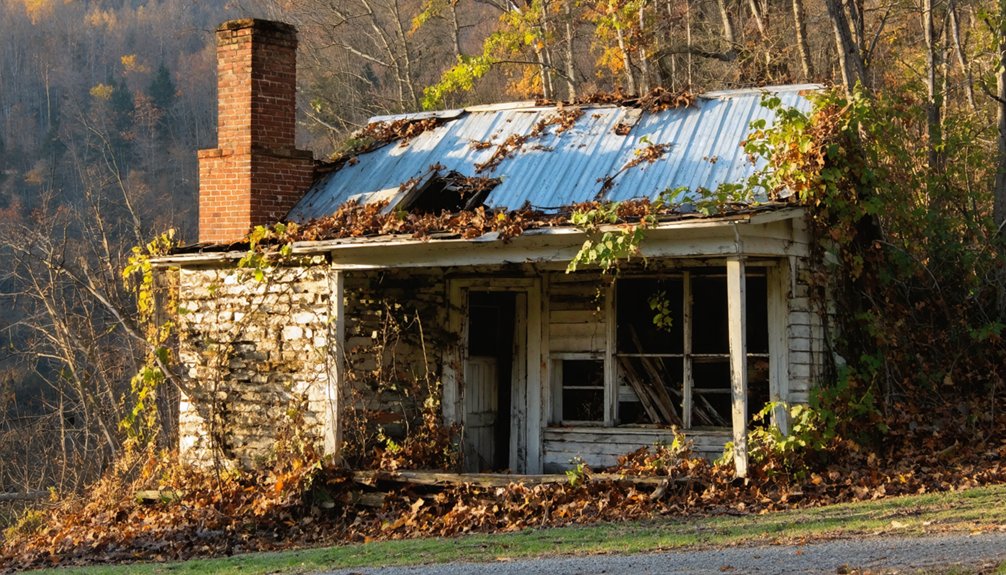
Rush: Arkansas’s Premier Zinc Mining Settlement
While farmers and prospectors combed the Buffalo River valley in the 1880s chasing Indian legends of silver, they stumbled upon something far more valuable along Rush Creek. That 1887 smelter test run revealed green zinc oxide fumes instead of precious metal, launching an economic boom that’d transform southern Marion County into Arkansas’s mining epicenter.
George Chase’s Morning Star Mining Company extracted a single 12,750-pound mass of pure smithsonite, while “Turkey Fat” ore assayed at 75% zinc concentration. By World War I, you’d find 5,000 residents populating what became Arkansas’s most prosperous per-capita city, supplying critical wartime materials. At its peak, the settlement boasted several operating mines alongside numerous businesses and homes that lined its streets.
Today you’ll discover smelter remnants from 1886 alongside interpretive trails through the Rush Historic District, preserved within Buffalo National River’s boundaries since 1972. The post office closed in the mid-1950s, causing Rush’s final loss of identity as remaining inhabitants drifted away.
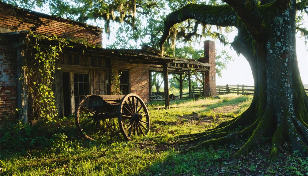
Monte Ne: The Visionary Resort Beneath Beaver Lake
On Monte Ne‘s wooded hillsides 140 miles northwest of Rush, William Hope “Coin” Harvey turned 320 acres of Silver Springs valley into Arkansas’s most ambitious resort experiment.
You’ll find remnants of what was once the world’s largest log hotel—Missouri Row stretched 305 feet using 8,000 hewn logs. Harvey’s 1900 vision included Arkansas’s first indoor pool, Italian gondoliers, and a private railroad connecting guests from Lowell.
Harvey earned his nickname from Coins Financial School, a pamphlet that sold over 1 million copies in its first year. Today, scuba divers can explore the submerged structures beneath Beaver Lake’s waters, while exhibits in nearby Rogers preserve the memory of this once-grand resort.
Old Davidsonville: The Territory’s First County Seat
Just fifteen miles south of the Missouri border in what’s now Randolph County, Old Davidsonville claimed Arkansas’s most prestigious territorial distinctions before vanishing entirely by the 1830s. Founded in 1815 as Lawrence County’s seat, you’ll find this settlement hosted the territory’s first post office, land office, and courthouse.
At its peak, 200 residents engaged in frontier commerce along the Black River, with populations swelling to 600 during court sessions. Economic collapse in 1823 and the Southwest Trail’s rerouting triggered irreversible decline. The town’s vulnerability to frequent flooding further isolated the community and contributed to its abandonment. By the 1830s, Davidsonville disappeared completely.
Today’s 163-acre state park preserves its archaeological significance—excavations reveal undisturbed street grids, foundations, and artifacts from Arkansas’s earliest territorial administration, offering you tangible connections to frontier self-governance. The site drew notable figures including Stephen Austin, who served as circuit court judge before earning his title as “the father of Texas.”
Pinnacle Springs: The Healing Waters That Drew Thousands
You’ll find thirteen springs once flowed within a square mile of Pinnacle Springs, each bearing names like “Professor’s Pool” and “Spring Lake” that promised miraculous cures for ailments. Thousands traveled to this northern Faulkner County health resort in the late 1880s, drawn by claims that its rare combination of iron, manganese, and chlorine carbonate waters rivaled Eureka Springs and Hot Springs.
At its peak, the town supported twelve bathhouses, eight stores, two hotels, two shoe shops, a post office, and various other businesses catering to health-seekers and residents alike. When the post office closed on September 30, 1891, the town’s population collapsed as word spread that the waters failed to cure diseases and the area’s reputation soured from lawlessness and racial discord. Jeff Collier first discovered the springs in 1880, leading to the development of what would become a prominent resort community under James D. Martin and the Pinnacle Springs Land Company the following year.
Thirteen Springs’ Medicinal Claims
When Dr. Alvah Jackson discovered these springs in 1856, he immediately recognized their commercial potential. His “Dr. Jackson’s Eye Water” launched a marketing phenomenon that would draw thousands seeking cures.
During the Civil War, he operated a cave hospital treating wounded soldiers with spring water and natural remedies.
The springs’ promoted healing powers addressed:
- Kidney and urinary disorders – Bright’s Disease, diabetes, stones
- Reproductive issues – Enlarged prostate, menopause irregularities
- Systemic conditions – Paralysis, insomnia, anemia
- Inflammatory diseases – Cystitis, bladder ailments
You’ll find testimonial accuracy remains questionable, as daily newspaper accounts often attributed improvements to climate change or exercise rather than water alone. Faith based healing played significant roles in this primitive medical era, where hope often substituted for scientific treatment. Unlike the later European settlers, no tribal evidence suggests the Osage or other Native American tribes considered the springs to have medicinal value. The Quapaw Indians ceded the land around similar hot springs to the United States in 1818, leading to federal protection of these healing waters.
Decline After Post Office Closure
The post office closure on September 30, 1891, didn’t just end mail service—it marked Pinnacle Springs’ official death certificate. You’ll find the collapse happened swiftly once the spring water’s healing claims proved false and Captain Martin withdrew his businesses. Residents scattered to Guy, Damascus, and Greenbrier, fleeing the stagnant regional economy and lawlessness that plagued the town’s final days.
Fires consumed buildings during the exodus, while survivors dismantled residual abandoned structures and hauled them elsewhere. By the 1900s, only campers visited the barren site. Today, you’ll discover mere footings hidden in undergrowth and carved names on rock walls. The springs themselves barely trickle now. Where bustling districts once thrived, pasture and forest reclaimed everything—a memento/record/chronicle/monument to how quickly frontier dreams vanish.
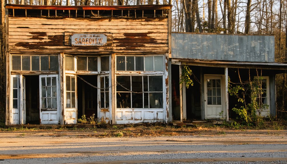
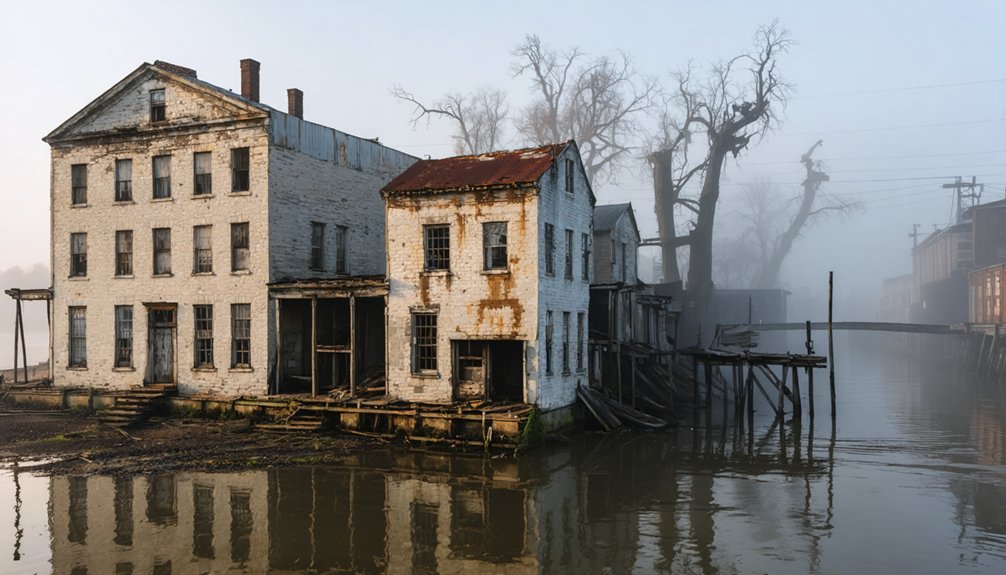
Calico Rock and East Calico: River Commerce on the White
Along the banks of the White River, French traders and trappers established Calico Rock as a frontier trading post, where the colorful rock formations resembling calico textile gave the settlement its distinctive name. This wasn’t your refined rivertown—taverns dispensed “Peppersauce” moonshine to thieves, vagabonds, and brawlers along Calico Creek’s shanty-lined banks.
Where colorful calico cliffs met frontier lawlessness, French trappers built a trading post that attracted more vagabonds than respectable citizens.
By the 1890s, steamboat traffic patterns made East Calico a crucial port:
- Steamboat landing operated at Calico Creek’s mouth
- Ferry service connected river travelers
- Missouri Pacific Railroad tracks arrived in 1902
- Combined rail-river hub supported zinc mining and timber operations
Industrial infrastructure changes transformed the lawless settlement into a legitimate boomtown. Law-abiding citizens drove out the Peppersauce Alley crowd, replacing knife fights with commerce. Today, twenty abandoned buildings mark where respectability once replaced frontier chaos.
Timber Towns: Graysonia and Agnos
You’ll find Arkansas’s timber ghost towns rose and fell with mechanical precision—Graysonia swelled to 1,000 residents by World War I as its sawmill churned out 150,000 board feet daily, the South’s largest operation.
The Grayson-McLeod Lumber Company’s “cut and move” strategy stripped Clark County forests bare within two decades, forcing mill closure in 1931 when the Depression compounded resource exhaustion.
Agnos followed similar patterns in Izard County’s northern timberlands, where smaller operations depleted White River tributary forests and left behind foundations reclaimed by second-growth pine.
Boom and Bust Cycles
When timber companies swept through Arkansas in the early twentieth century, they built entire communities around their sawmills, only to abandon them once the forests were exhausted. You’ll find Graysonia and Agnos exemplify this pattern of unsustainable practices that defined Arkansas’s lumber era.
The boom-and-bust sequence followed predictable stages:
- Rapid establishment – Companies constructed entire towns with housing, hotels, and infrastructure within months
- Peak production – Mills employed 500+ workers, processing over 150,000 board feet daily during WWI demand
- Resource depletion – “Cut and move” strategies exhausted local timber within two decades
- Economic collapse – Mill closures eliminated employment, triggering mass exodus
This economic vulnerability left communities defenseless when the Great Depression struck. Graysonia’s main mill closed in 1931, while Agnos simply vanished after logging companies relocated their operations.
Railroad and Lumber Operations
The railroad networks that crisscrossed Arkansas’s timber regions functioned as the circulatory system of an industry built on extraction and rapid depletion. You’ll find that lines like the Antoine Valley Railroad and Ultima, Thule, Arkadelphia, & Mississippi Railway hauled finished lumber while also running direct logging trains to mills.
Mill technology improvements enabled Graysonia’s operation to dwarf competitors—producing 150,000 board feet daily with over 500 employees, compared to Mauldin’s mere 25,000 board feet. Company consolidation strategies accelerated when the Bemis family’s 1924 acquisition created Ozan-Graysonia Lumber Company, later merging with Ozan Lumber Company in 1935. These combined operations controlled 52,000 acres and multiple retail yards.
When timber supplies exhausted, many railroad spurs were simply abandoned—left to rust among cutover landscapes.
Resource Depletion and Abandonment
- Dwindling timber supplies by 1931 as virgin forests disappeared
- Great Depression’s onset in 1929 crushing lumber markets
- Failed cinnabar mining pivot after 1932 mercury operations proved insufficient
- Population collapse from 1,000 to zero as workers fled
You’ll find similar patterns at Agnos, where timber depletion triggered abandonment. These company towns couldn’t survive once corporations extracted what they wanted and moved on.
Exploring What Remains: Visiting Arkansas Ghost Towns Today
While many Arkansas ghost towns have vanished entirely, several sites remain accessible to modern visitors who seek tangible connections to the state’s abandoned past. Rush, protected within Buffalo National River‘s boundaries, exemplifies modern preservation efforts that balance historical protection with public access. You’ll find three designated trails threading through skeletal remains of stores, homes, and the old smelter—though you’re urged to maintain distance from unstable structures.
Monte Ne offers unique recreational tourism opportunities when Beaver Lake‘s water levels drop, revealing concrete towers and amphitheater foundations to kayakers and boaters. Old Davidsonville Historic State Park preserves Arkansas’s first county seat from 1815, where you can walk grounds once bustling with steamboat commerce. These protected sites let you explore abandoned communities without trespassing restrictions common at privately-owned ghost towns.
Frequently Asked Questions
How Do Arkansas Ghost Towns Differ From Ghost Towns in Western States?
Unlike Western ghost towns preserved by arid climates, Arkansas’s humid Ozarks erased yours—economic factors like zinc booms and transportation changes couldn’t sustain communities. Rush alone survives with ruins, while Western counterparts like Bodie remain intact, romanticized frontier monuments.
What Caused Most Arkansas Ghost Towns to Disappear Without Leaving Structures?
Economic decline from mining bust cycles and natural disasters like Civil War destruction and Mississippi River floods erased most Arkansas ghost towns. You’ll find impermanent tent settlements and repeated flooding left nothing behind, unlike stone structures out West.
Are There Any Safety Concerns When Exploring Arkansas Ghost Towns?
You’ll face real dangers: crumbling structures risk collapse, while potential risks of trespassing carry legal consequences. Take precautions for visitors—check property ownership, watch for unstable floors, avoid boarded buildings, and never explore alone in these forgotten Arkansas remnants.
How Many Total Ghost Town Sites Have Been Documented in Arkansas?
Arkansas has documented approximately 20 ghost towns in national rankings, though you’ll find this number varies by source. The count includes abandoned mining camps like Rush and forgotten logging settlements such as Graysonia, with many sites remaining unverified.
Among the ghost towns in Arkansas to explore, you’ll discover intriguing histories and remnants of bygone eras. Each site offers a glimpse into a unique past, often surrounded by stunning natural landscapes. Adventurers and history enthusiasts alike can uncover stories that linger in these abandoned places, making each visit a captivating experience.
Among the ghost towns in northwest Arkansas, you can unearth fascinating tales that reflect the region’s rich history. The eerie remnants of these once-thriving communities often tell stories of economic booms and subsequent declines, drawing curious visitors eager to connect with the past. Exploring these locations can also provide insights into local culture and the environmental changes that have shaped the landscape over time.
Can You Take Artifacts From Arkansas Ghost Town Locations?
No, you can’t legally take artifacts from Arkansas ghost towns due to strict artifact regulations. Legal ownership concerns apply whether sites are on private or public land, requiring permission or permits to avoid serious penalties including felonies.
References
- http://freepages.rootsweb.com/~gtusa/history/usa/ar.htm
- https://everafterinthewoods.com/forgotten-ghost-towns-in-arkansas-that-are-eerially-scenic/
- https://www.youtube.com/watch?v=U4kJjjbcnMM
- https://aymag.com/arkansas-backstories-ghost-towns/
- https://www.axios.com/local/nw-arkansas/2024/01/02/arkansas-ghost-towns-mapped
- https://www.uaex.uada.edu/environment-nature/musings-on-nature-blog/posts/ghost-towns.aspx
- https://abandonedar.com
- https://en.wikipedia.org/wiki/List_of_ghost_towns_in_Arkansas
- https://encyclopediaofarkansas.net/entries/rush-ghost-town-marion-county-1270/
- https://www.katepantier.com/discover-the-ghost-town-of-rush-arkansas-hidden-historic-gem/