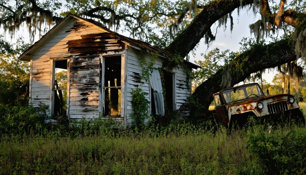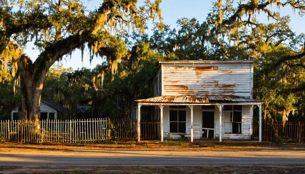
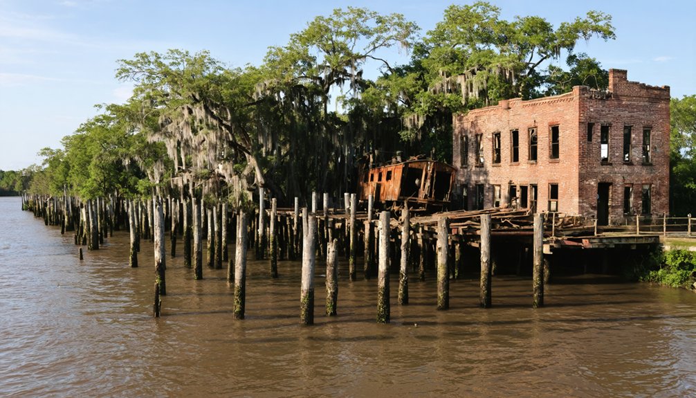
Louisiana’s ghost towns reveal the devastating power of nature’s forces along the Gulf Coast. You’ll find Bayou Chene buried under 12 feet of silt, La Balize erased by the 1865 hurricane, and Torras abandoned after catastrophic floods. The 1915 Category 4 hurricane completely obliterated Frenier and Ruddock, killing over 100 residents between them. Waterloo’s ruins lie beneath subdivision streets, while fragments of these lost communities persist only in archives, photographs, and swampland debris that historians continue to document.
Key Takeaways
- Bayou Chene thrived on houseboats until the 1927 flood buried it under 12 feet of silt by the late 1940s.
- La Balize, Louisiana’s oldest French settlement from 1682, was repeatedly destroyed by hurricanes until 1865 erased all traces.
- Frenier and Ruddock were completely obliterated by a 1915 Category 4 hurricane that killed 118 residents between both towns.
- Torras transformed from a promising shipping hub to a ghost town after devastating 1890 and 1912 floods and railroad relocation.
- Waterloo, a strategic 1820s export center, vanished after an 1884 flood and mid-1890s arson destroyed remaining structures.
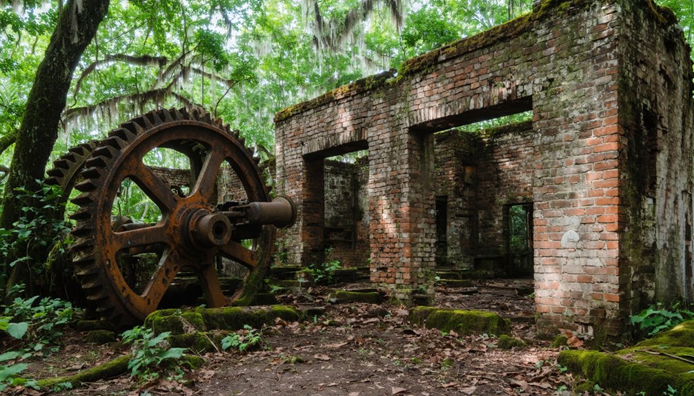
Bayou Chene: A Community Swallowed by the Atchafalaya Basin
Deep within Louisiana’s Atchafalaya Basin, Bayou Chene emerged in 1795 as a settlement where the Chitimacha Tribe had previously occupied the waterlogged landscape. You’ll find a community that thrived on houseboats and stilts, complete with schools, churches, and stores elevated above the swamp.
By the 1920s, 700 residents logged cypress, raised livestock on floating rafts, and cultivated small plots accessible only by boat.
The Great Mississippi Flood of 1927 and subsequent disasters sealed Bayou Chene’s fate. Twelve feet of silt buried everything by the late 1940s. Today, descendants maintain cultural preservation efforts through photographs and oral histories, transforming their floating town into folklore and legends. The Army Corps documented this vanished world, ensuring you’ll remember how nature reclaimed what residents built.
La Balize: Louisiana’s Oldest French Settlement at the River’s Mouth
At the Mississippi River’s mouth, where Robert de La Salle planted a wooden beacon bearing the French coat of arms in 1682, Louisiana’s most exposed settlement would rise and fall with relentless regularity. La Balize—”the seamark”—controlled river passage through treacherous sandbars and currents.
By 1721, French engineers erected a 62-foot wooden pyramid above the delta marshes, establishing a pilot station where fishermen and river guides met incoming vessels bound for New Orleans.
Hurricane destruction became the settlement’s defining pattern. The 1740 storm obliterated the original site. Rebuilding followed in 1778, only to face repeated annihilation. After September 1860’s catastrophic blow, pilots abandoned the location entirely, relocating to Pilottown. The 1865 hurricane erased all remaining traces from the Louisiana delta landscape, leaving only the Balize Delta’s name as evidence to this vanished frontier outpost.
Torras: The Failed Shipping Center of Red River Landing
You’ll find Torras’s transformation from Red River Landing to ghost town rooted in one man’s determination and nature’s refusal to cooperate. Joseph Torras, a Barcelona-born entrepreneur who founded the settlement and later lent it his name in 1902, envisioned a permanent shipping empire at the confluence of two mighty rivers.
His ambitions crumbled when the catastrophic May 1, 1890 levee failure flooded thousands, followed by railroads choosing nearby Lettsworth’s drier ground over his water-logged docks.
Joseph Torras’s Ambitious Vision
Joseph Torras envisioned transforming Red River Landing into Louisiana’s premier inland shipping hub, leveraging his strategic position at the confluence of the Mississippi, Red, and Atchafalaya Rivers. You’ll find his blueprint for family wealth accumulation emerged from Confederate commissary work managing cotton transportation logistics between Alexandria and Texas until 1864.
He’d positioned himself as chairman of the Atchafalaya Basin levee district‘s executive board, controlling critical infrastructure that protected his 8,000-acre Turnbull Island and 1,200 Pointe Coupee Parish acres. His son-in-law N.P. Phillips executed the final phase in 1902, establishing the post office bearing Torras’s name.
The enterprise depended entirely on river commerce maintaining dominance over rail—a gamble that ultimately failed when transportation patterns shifted and essential railroad infrastructure collapsed.
The Devastating 1912 Flood
When heavy winter snowmelt combined with surging waters from the Ohio, Cumberland, and Tennessee Rivers in late March 1912, the Mississippi Valley faced one of its most catastrophic floods on record. You’d have witnessed the river stage at Cairo reaching 53.94 feet, inundating vast territories across six states.
The Hymelia Crevasse on May 14 started as a crawfish hole before expanding into a 500-foot-wide gap, devastating St. Charles Parish. Memphis suffered particularly severe damage when its levee collapsed on April 5, submerging twenty-five city blocks and displacing 1,300 residents. At least eight people died, with unconfirmed reports suggesting 200 fatalities.
The flood aftermath brought widespread destitution, while economic recovery proved painfully slow as floodwaters receded less than an inch daily across Lower Lafourche’s prosperous farmlands.
Railroad Relocation’s Final Blow
At the turn of the twentieth century, Torras emerged along both sides of the Texas & Pacific Railroad tracks with ambitions that far exceeded its brief existence. Founded in 1902 and named after Barcelona-born planter Joseph Torras, this settlement occupied a strategic position where the Mississippi, Red, and Atchafalaya Rivers converged.
You’ll find that railroad relocation ultimately sealed Torras’s fate—when the Texas & Pacific moved its tracks, the town ceased to exist entirely. The economic decline mirrored Red River Landing’s demise after the old railroad bridge collapsed, ending commercial traffic that once sustained steamboats, warehouses, and merchants.
Today, no buildings mark where Torras stood, leaving only the Corps of Engineers’ river gauge downstream as evidence of this vanished shipping center.
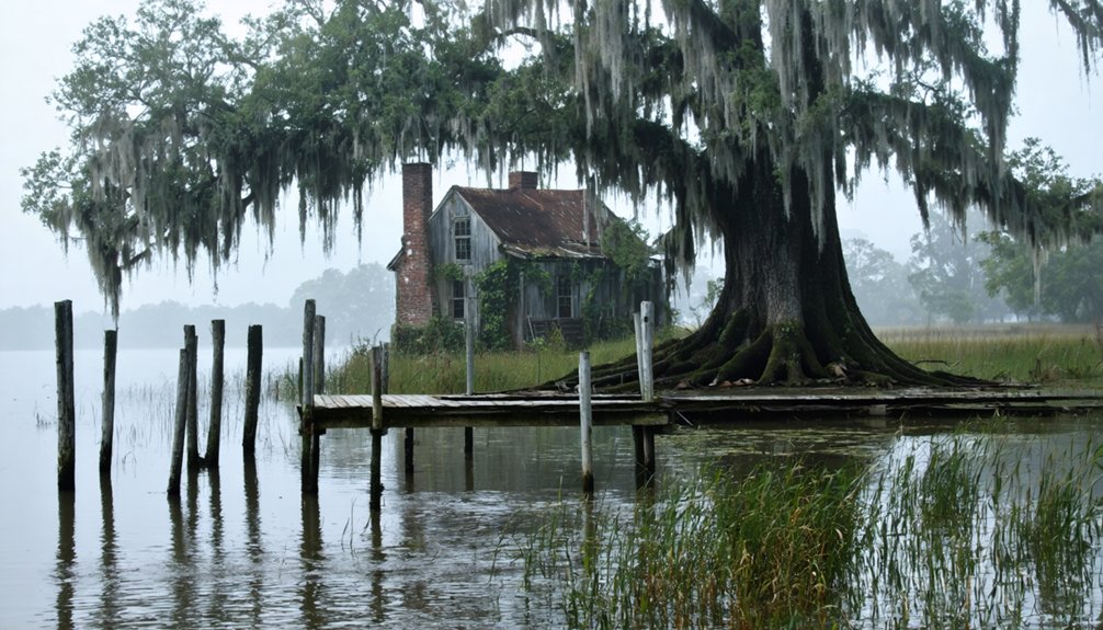
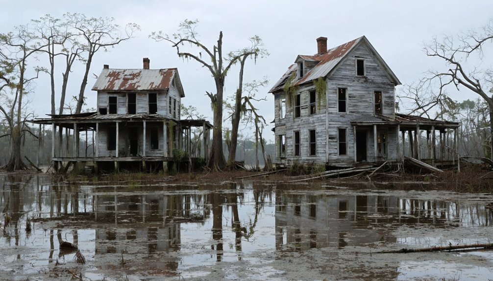
Waterloo: From Sugar Cane Hub to Buried Ruins
Founded around 1820 along the western bank of the Mississippi River, Waterloo emerged at the strategic upriver juncture of the False River oxbow in Pointe Coupee Parish. You’ll find this once-thriving export center shipped sugar cane and cotton from surrounding plantations, protected by dual levee systems. The 1884 Mississippi River flood breached both barriers, devastating Waterloo alongside neighboring settlements Anchor and Cook’s Landing.
Mid-1890s arson consumed structures that survived the deluge, erasing physical evidence of the town’s existence. Community resilience proved insufficient against agricultural decline and catastrophic losses. Families relocated to New Roads, leaving Waterloo’s ruins buried between the Mississippi and modern levees.
Today, subdivision street names preserve these ghost towns’ memory, while 144 households occupy land where 332 residents occasionally unearth historical fragments during excavations.
Frenier: The Cursed Town of Lake Pontchartrain
Twenty-five miles west of New Orleans, Frenier occupied a precarious isthmus between Lake Pontchartrain and Lake Maurepas, existing in near-total isolation from modern infrastructure. Without roads, electricity, or medical facilities, residents maintained agricultural independence through railroad connections alone.
Julia Brown embodied this self-reliant spirit—a literate Black landowner who inherited a 40-acre homestead and served as the community’s traiteuse. Yet after her husband’s death, she transformed into a mythical spiritualist figure, allegedly singing: “One day I’m going to die and take the whole town with me.”
September 29, 1915, proved prophetic:
- Julia died at age 70
- Category 4 hurricane struck simultaneously
- 13-foot storm surge obliterated Frenier
- 60 residents perished, buried in mass graves
Her cemetery endures—testament to how legend preserves lost communities.
Ruddock: Hurricane Devastation on the Lakeshore
Just ten miles north of LaPlace, you’ll find what remains of Ruddock, a once-thriving cypress lumber town that William Burton and C. H. Ruddock established in 1892 on the isthmus between Lakes Maurepas and Pontchartrain.
The September 1915 hurricane—a Category 4 storm with 145 mph winds and 15-foot storm tides—killed 58 residents and obliterated every structure save one, ending the community’s existence in a single catastrophic night.
Today, the swamp-covered site requires boat access to reach its scattered wood remnants, though Interstate 55 still marks the exit where this doomed settlement once stood.
The Fatal 1915 Storm
When the Category 4 hurricane roared toward Louisiana’s coast in late September 1915, few residents along Lake Pontchartrain’s shore could have imagined the complete obliteration awaiting their communities. Despite storm warnings, many remained in their wooden homes.
The hurricane made landfall near Grand Isle on September 29 with 145 mph winds, then discharged devastating forces across the region.
The storm’s catastrophic impact included:
- 13-foot storm surges inundating lakeside communities
- 275-280 total deaths across affected areas
- $13 million in damages (1915 USD)
- Complete destruction of multiple towns including Ruddock and Frenier
Survivor stories reveal desperate shelter-seekers crowding into a steel railroad caboose and the local schoolhouse. In Ruddock alone, 58 residents perished as their town vanished within hours, never to be rebuilt.
Haunting Ruins Today
Today’s visitor to Ruddock finds virtually nothing of the bustling lumber town that once housed 900 residents. You’ll discover only decayed wood fragments swallowed by encroaching marsh at exit 15 off Interstate 55. The swampland preservation has reclaimed everything—even the heavy steel caboose and schoolhouse that once provided hurricane shelter have vanished.
What remains speaks to absent community resilience: an abandoned cemetery three and two-thirds miles north holds up to 100 burials, including storm victims, its headstones ruined by vandals and time. Dark tourists can explore artifacts divers have recovered from surrounding swamps, visceral evidence of a town that peaked before 1915’s devastation. Rebuilt railroad tracks pass nearby, contrasting sharply with the obliterated settlement that survivors refused to restore.
Exploring Louisiana’s Lost Communities and Their Tragic Legacies
Louisiana’s ghost towns stand as stark reminders of nature’s devastating power and humanity’s precarious relationship with the Gulf Coast landscape. You’ll discover communities erased by catastrophic forces that reshaped entire regions.
Louisiana’s abandoned settlements reveal the brutal truth: even established communities proved powerless against the Gulf Coast’s relentless natural forces.
These settlements met their end through:
- Catastrophic hurricanes – Cheniere Caminada lost 1,500 residents in 1893, while Ruddock’s population was nearly obliterated in 1915
- Devastating floods – The 1912 Mississippi River flood wiped out Torras, forcing complete abandonment after railroad relocation
- #VernonsawmilltownsAbandon – Alco, Barham, Kurthwood, and Neame vanished when timber resources depleted
- #DesotoParishshiftingindustry – Kingston disappeared as economic foundations crumbled
Bayou Chene’s forced evacuation and Waterloo’s 1884 destruction demonstrate how environmental forces ultimately dictated settlement survival. You’re witnessing legacy to communities that couldn’t withstand Louisiana’s unforgiving landscape.
Frequently Asked Questions
Are Any Louisiana Ghost Towns Accessible for Public Visits Today?
You’ll find several accessible Louisiana ghost towns with historical significance and tourism potential. Visit Longleaf’s Southern Forest Heritage Museum, explore Laurel Valley Village’s preserved structures, attend Fisher’s annual festival, or tour Alma’s operational sugar mill and country store.
What Artifacts Have Been Recovered From These Abandoned Louisiana Communities?
You’ll find recovered artifacts include stone tools, pottery sherds, and spearpoints spanning 12,000 years, revealing the historical significance of artifacts through continuous occupation. Local folklore surrounding artifacts connects ancient hunting implements to indigenous traditions, preserving Louisiana’s cultural freedom.
Do Descendants of Former Residents Still Hold Reunions or Commemorations?
Can you imagine reconnecting after fifty years apart? Yes, descendants actively organize family gatherings to preserve their cultural traditions. You’ll find communities like Weeks Island hosting reunions where over 200 former residents honor their displaced ancestors’ legacies.
Which Ghost Town Had the Largest Population Before Abandonment?
Ruddock had the largest population, reaching approximately 700 residents by 1910. Historical population data shows economic factors behind abandonment weren’t gradual decline—the 1915 hurricane catastrophically destroyed everything, killing dozens and displacing nearly all survivors instantly.
Are There Preservation Efforts Underway for Any Louisiana Ghost Towns?
Yes, you’ll find preservation efforts like the Troyville Site initiative, where archaeologists are acquiring land and managing current land ownership status. Louisiana’s Trust coordinates community revitalization initiatives, though many ghost towns lack formal protection programs.