You’ll find North Carolina’s ghost towns scattered from the coast to the mountains, each abandoned for distinct reasons. Brunswick Town became Revolutionary War ruins after British forces burned it in 1776. Diamond City’s 500 residents evacuated following the devastating 1899 San Ciriaco Hurricane. Henry River Mill Village closed in the 1960s before gaining fame as District 12 in “The Hunger Games.” Mortimer suffered catastrophic floods that killed 80 people in 1916. Portsmouth Village and Lost Cove offer additional glimpses into the state’s forgotten settlements and the forces that erased them.
Key Takeaways
- Brunswick Town (1725-1726) served as colonial capital before British forces burned it in 1776, leaving Revolutionary War ruins along Cape Fear River.
- Diamond City’s 500 residents evacuated by 1902 after the 1899 San Ciriaco Hurricane destroyed the Outer Banks settlement completely.
- Henry River Mill Village operated from 1905 until the 1960s, later serving as District 12 in “The Hunger Games” film.
- Mortimer mill town housed 800 residents before devastating floods in 1916 and 1940 killed 80 people and destroyed infrastructure.
- Portsmouth Village was North Carolina’s largest Outer Banks settlement from 1770, with last residents departing in 1971; now preserved by volunteers.
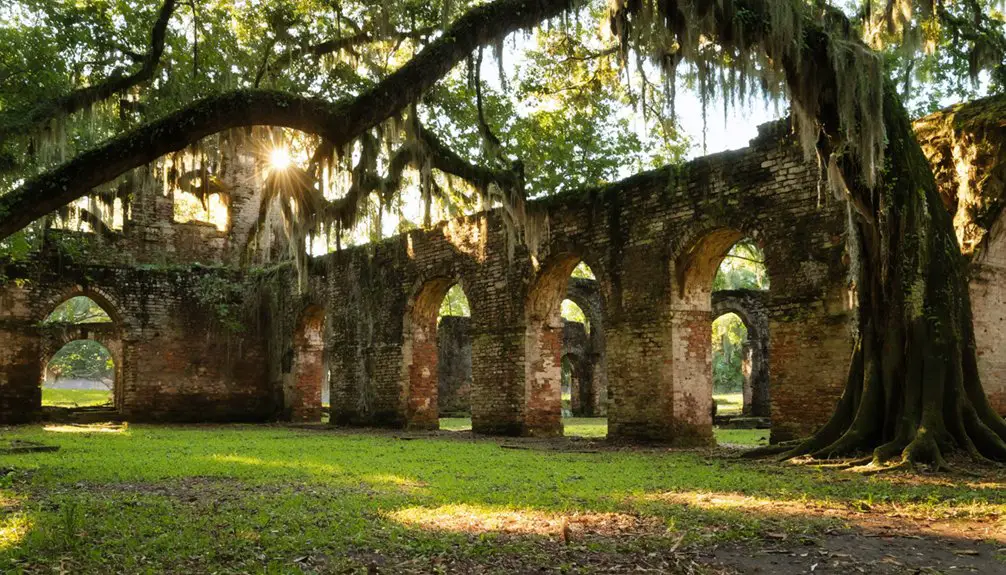
Brunswick Town: From Colonial Capital to Revolutionary War Ruins
When Colonel Maurice Moore established Brunswick Town between 1725 and 1726 on a 1,500-acre grant along the Lower Cape Fear River, he positioned what would become North Carolina’s third colonial capital on a low bluff twenty miles from the river’s mouth.
Named after King George I’s House of Brunswick-Hanover, the settlement achieved colonial prominence through royal governors’ residency and mercantile importance as a major naval stores exporter. You’ll find its legacy defined by shipping tar, pitch, and turpentine from longleaf pine forests to the Royal Navy.
The town’s defiant spirit emerged in February 1766 when residents peacefully stormed Governor Tryon’s home opposing the Stamp Act. British forces partially burned Brunswick after 1776, and by 1783, the town lay ruined—never rebuilt as a political center.
Diamond City: The Outer Banks Settlement Erased by Hurricane
The San Ciriaco Hurricane of August 18, 1899, stands as the most powerful storm to strike North Carolina’s Outer Banks, and it delivered a death blow to Diamond City‘s 500 residents. You’d witness complete devastation—houses destroyed, boats splintered, wells flooded with saltwater, and soil so saturated with brine that nothing could grow.
Within three years, every last resident evacuated to mainland communities like Harkers Island and Morehead City, many dismantling their homes board-by-board and rebuilding them on safer ground.
Hurricane Devastation in 1899
On August 17, 1899, Diamond City faced its final chapter when the San Ciriaco Hurricane slammed into North Carolina’s Outer Banks as a Category 3 storm. Wind gusts reached 140 mph while a 10-foot storm surge swept nearly every house from Shackleford Banks. The hurricane lingered for two days, turning the 500-person maritime community into rubble.
Storm surge covered Ocracoke with 4 to 5 feet of water, destroying over 30 homes and demolishing two churches. The impact on maritime activities was devastating—ships sank at their moorings, claiming two lives, though Surfman Rasmus Midgett heroically rescued 10 people from the wrecked barkentine *Priscilla*. At least 20 North Carolinians perished. The fate of displaced residents was abandonment—they packed up and left their shattered settlement forever.
Complete Abandonment by 1902
After the San Ciriaco Hurricane‘s devastating blow, Diamond City’s residents scattered across the North Carolina coast in a mass exodus that unfolded over the next three years. Resident relocation patterns centered on three main destinations: Harkers Island, communities along Bogue Sound, and “The Promise Land” district between 10th and 20th Streets in Morehead City.
You’ll find that families didn’t simply abandon their heritage—they dismantled their homes board by board, transporting entire structures to new locations. Post abandonment community ties remained remarkably strong through generations.
Former residents maintained primitive fishing camps along Shackleford Banks’ shores, returning for extended periods to fish and hunt until the mid-1980s. The National Park Service’s incorporation of the property into Cape Lookout National Seashore finally ended this century-long tradition of seasonal homecoming.
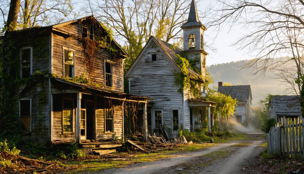
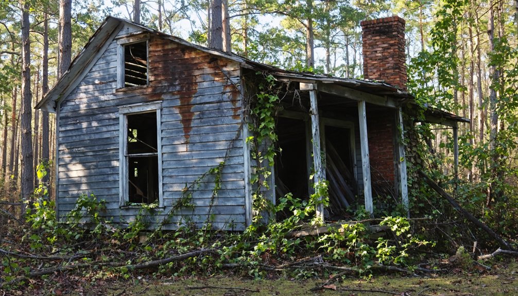
Henry River Mill Village: The Textile Town That Became District 12
You’ll find Henry River Mill Village nestled along the banks of the Henry River in Burke County, where Michael Erastus Rudisill established a water-powered cotton mill and company town in 1905.
The village thrived for six decades before overseas competition forced the mill to close in the late 1960s, and the last residents departed by the early 2000s after years without running water or sewage systems.
This abandoned textile settlement gained unexpected fame in 2011 when filmmakers transformed its weathered buildings into District 12 for “The Hunger Games” movie.
Mill Village Origins 1905
The Henry River Mill Village emerged from ambitious industrial planning when Michael Erastus Rudisill laid out the mill and village in 1904 on a 1,500-acre tract he’d selected specifically for its hydroelectric power potential. He partnered with his brother Albert Pinkney Rudisill and the Aderholdt family to establish the Henry River Manufacturing Company.
Construction began in 1905 with a 30-foot reinforced concrete dam and three-story brick mill building.
The planned infrastructure created a self-contained community featuring approximately 35 small worker cottages—1½-story duplex houses positioned along the Henry River’s steep northern bank. Worker living conditions reflected typical mill village arrangements: company-owned housing leased at nominal fees, a company store, boarding houses, and terraced green spaces.
Meanwhile, the four mill owners built their private residences separately in 1907, maintaining clear class boundaries.
Decline and Abandonment
Henry River Mill Village’s prosperity proved short-lived as financial troubles emerged by the late 1920s. A court-ordered sale in December 1928 liquidated the mill and 700 acres for $151,000, despite a $90,000 investment in electric power just two years earlier.
Sustained economic decline accelerated through the 1960s when American textile manufacturers couldn’t compete with low foreign labor costs. The mill officially closed in 1970, with operations fully ceasing by 1973.
Infrastructure deterioration drove residents away steadily. Wade Shepherd purchased the property in 1976, hoping to revive textile manufacturing, but a 1977 fire destroyed the mill. The last eight families endured homes without modern wiring, plumbing, or insulation until 1987, when the final resident departed. Only 20 of 35 original structures survived the abandonment.
Hunger Games Film Location
Abandoned textile cottages transformed into a cinematic phenomenon when Lionsgate selected Henry River Mill Village as the primary filming location for District 12 in the 2011 blockbuster “The Hunger Games.” Production crews arrived in 2011 to capture the authentic decay and Appalachian character that perfectly matched Suzanne Collins’ dystopian coal-mining community.
The village’s weathered structures along Henry River gorge required minimal set dressing, offering production teams genuine architectural remnants from Burke County’s industrial past.
Post-filming, you’ll find the site balances filming location preservation with tourism accessibility. The blockbuster’s success generated significant impact on local economy, drawing fans and history enthusiasts to this once-forgotten settlement.
Today’s guided tours showcase both textile heritage and cinematic significance, while the 2019 National Register designation guarantees continued protection of these culturally significant structures.
Mortimer: A Mill Town Devastated by Catastrophic Flooding
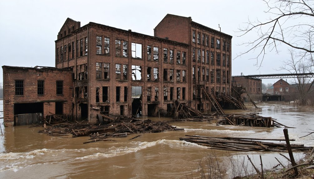
Nestled deep in the Appalachian wilderness along Wilson Creek, Mortimer sprang to life in 1904 when the Ritter Lumber Company purchased vast tracts of timberland and constructed a complete mill town virtually overnight. At its peak, 800 residents enjoyed amenities including a movie theater and the Lauren Inn, which hosted President Teddy Roosevelt. Incorporated in 1907, Mortimer’s prosperity proved short-lived.
Catastrophic Events That Sealed Mortimer’s Fate:
- 1916 flood and fire killed 80 people, destroying infrastructure
- Ritter Lumber Company abandoned operations after disaster
- 1940 hurricane swelled Wilson Creek to 94 feet deep
- Final flood wrecked remaining cotton mill, ending recovery hopes
Today’s ruins within Pisgah National Forest hold historical significance, with restoration efforts preserving the CCC headquarters building as record/chronicle/account/documentation to this vanished community.
Lost Cove: The Forgotten Mountain Community of Pisgah National Forest
During the Civil War era, Morgan Bailey, a soldier with the 3rd North Carolina Mounted Infantry, established what would become one of Appalachia’s most isolated communities in the rugged terrain where the North Carolina-Tennessee border blurred into uncertainty. You’ll find Lost Cove’s cultural history shaped by fierce independence—residents thrived for nearly a century without electricity, bartering crops and moonshine while living beyond government reach.
The settlement’s natural resources sustained 100 residents at its peak: timber fueled sawmills and railroads, while farms produced everything from hogs to herbs. When timber depleted around 1910, isolation became unbearable. Legislators denied road access, forcing abandonment by 1957.
Today, you can hike Trail 196 through this legendary ghost town in Pisgah National Forest, where three houses and a cemetery remain.
Submerged Towns Beneath North Carolina’s Hydroelectric Lakes
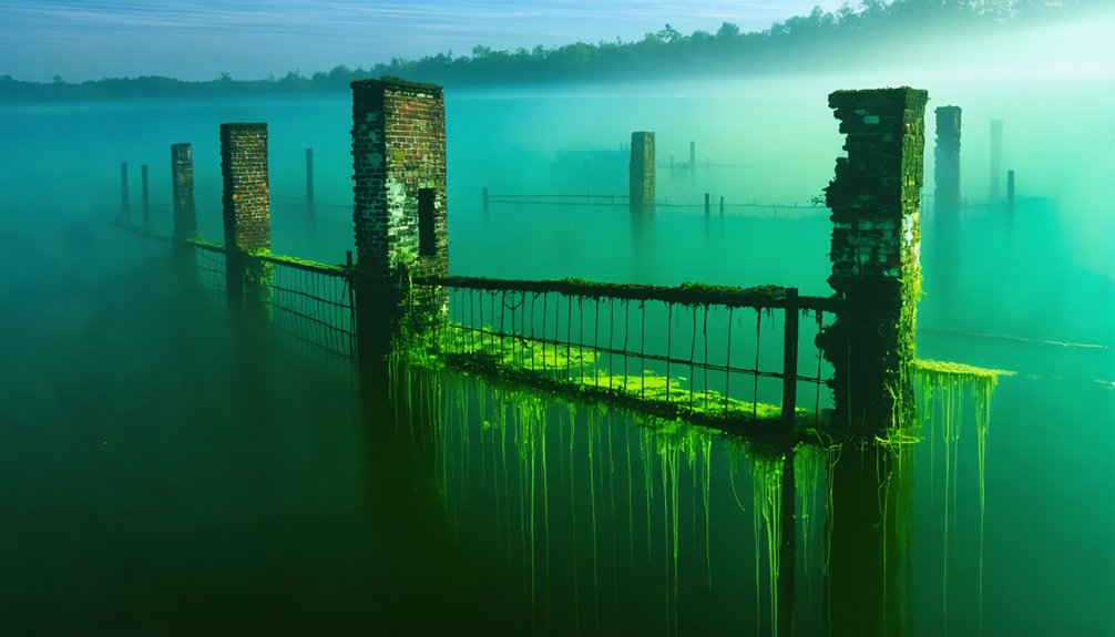
While Lost Cove’s residents chose isolation, thousands of North Carolinians in the 1940s had their homes forcibly claimed by rising waters. When the Tennessee Valley Authority completed Fontana Dam in 1944, entire communities vanished beneath what became North Carolina’s largest lake. This community displacement affected four towns, in particular Proctor and Judson.
What was lost beneath the surface:
- 50% of Swain County’s homes and jobs
- 33 schools and 37 churches
- Historic Cherokee townsites including Chota and Tanasi
- Thousands of acres of farmland and cemeteries
Today, archaeological explorations occur during extreme drawdowns when foundations and graves emerge. The government’s promised 30-mile replacement road became the infamous “Road to Nowhere”—only six miles completed before abandonment, finally settled with a $52 million payment in 2018.
Portsmouth Village: A Preserved Island Community Frozen in Time
Unlike the drowned communities beneath Fontana Dam, Portsmouth Village stands remarkably intact—a windswept ghost town accessible only by boat across the shallow waters separating it from the mainland. You’ll discover North Carolina’s largest Outer Banks settlement from 1770, where over two-thirds of the state’s imported goods once passed through by 1852. The last residents departed in 1971, leaving behind twenty weathered structures protected within Cape Lookout National Seashore‘s 250-acre historic district.
You can explore the Methodist Church, post office, and decaying homes during summer long tours. Friends of Portsmouth Island operates a volunteer maintenance program under special permits, preserving these buildings through careful painting and historic fabric replacement. Descendants gather for biennial Homecomings, maintaining connections to this isolated community frozen in time.
Exploring North Carolina’s Abandoned Ghost Town Heritage
North Carolina’s abandoned settlements reveal distinct patterns of destruction—from colonial warfare to natural disasters to economic collapse. You’ll find these ghost towns scattered across diverse landscapes, from Appalachian frontier communities to coastal barrier islands. Each site tells a unique story of adaptation and survival before ultimate abandonment.
Key preservation categories include:
- War-ravaged colonial ports like Brunswick Town, where British forces decimated infrastructure in 1776
- Hurricane-destroyed coastal settlements such as Diamond City, requiring seasonal village relocations after the 1899 storm
- Flood-devastated mill towns like Mortimer, where catastrophic water damage ended industrial operations
- Economic ghost towns including Lost Cove and Henry River Mill Village, abandoned when resources depleted
These sites offer tangible connections to North Carolina’s settlement patterns, industrial heritage, and the environmental forces that shaped community survival across centuries.
Frequently Asked Questions
Are Visitors Allowed to Explore North Carolina’s Ghost Towns on Their Own?
You’ll find self-guided exploration varies markedly by location. Many North Carolina ghost towns sit on private property, creating serious trespassing concerns. You’ll need advance reservations for some sites, while state historic locations offer structured tours with specific operating hours and access restrictions.
What Safety Precautions Should I Take When Visiting Abandoned Town Sites?
Wear sturdy boots, pack emergency supplies, and bring a buddy. Be cautious of unstable structures like rotting floors and collapsing roofs. Watch out for wildlife, including snakes and insects. Always notify someone of your exploration plans beforehand.
Can I Take Artifacts or Souvenirs From Ghost Town Locations?
No, you can’t legally take artifacts from North Carolina ghost towns. Taking artifacts without permission violates state law, and damaging historic structures risks Class 3 misdemeanor charges. Items on public lands remain state property requiring permits for removal.
Which North Carolina Ghost Towns Are Best for Photography Enthusiasts?
Picture yourself capturing Henry River Mill Village’s decaying porches and unique architectural features, or Brunswick Town’s colonial ruins. Both offer historical significance of sites with unrestricted exploration, perfect lighting conditions, and dystopian atmospheres that’ll elevate your portfolio.
Do Any Ghost Towns Offer Guided Tours or Educational Programs?
North Carolina’s ghost towns don’t typically offer formal guided tours, but you’ll find self-guided tours at some locations. Educational workshops focusing on historical preservation and mining heritage occasionally occur at sites like Reed Gold Mine, preserving your exploration freedom.