You’ll find Onoville, New York, beneath the waters of the Allegheny Reservoir, where it was submerged in 1965 during the Kinzua Dam project. This 19th-century mill town once thrived along the Allegany River, supporting lumber operations and farming communities. The flooding displaced over 600 families and claimed 10,000 acres of Seneca Nation land. Today, underwater archeological sites and local legends tell haunting tales of church bells that still ring from the depths.
Key Takeaways
- Onoville was a thriving 19th-century mill town along the Allegany River that now lies submerged beneath the Allegheny Reservoir.
- The town disappeared in the 1960s due to the Kinzua Dam project, which flooded multiple communities and displaced hundreds of families.
- Underwater archaeological remains include building foundations, roadways, and artifacts preserved by the reservoir’s anaerobic environment.
- Local folklore includes reports of mysterious church bells ringing and ghostly apparitions appearing during reservoir water level changes.
- Walking tours with historical photographs and digital reconstructions allow visitors to explore Onoville’s history and original layout.
The Birth and Early Years of Onoville
During the 19th century, Onoville emerged as a strategic settlement along the banks of the Allegany River in western New York, where abundant natural resources and waterways created ideal conditions for milling operations.
Onoville’s prime location along the Allegany River made it a natural hub for 19th-century milling and industrial development.
The settlement dynamics revolved around the river’s power, which early settlers harnessed to establish mills that processed timber and agricultural goods from the surrounding region. Similar to the nearby town of Red House, the community established itself along the Allegany River, taking advantage of its prime location. The area’s development pattern closely mirrored that of other settlements like railroad towns that thrived during the 1800s.
You’ll find that Onoville’s early industry quickly attracted workers and their families, leading to the development of essential infrastructure.
The town grew organically around these industrial operations, with homes, churches, and schools springing up to support the burgeoning community.
Multi-generational families formed the backbone of this riverside settlement, creating a close-knit society where civic groups and religious organizations fostered a strong sense of community among the hardworking mill workers and farmers.
Life Before the Flood
While the lumber industry drove Onoville’s prosperity in the late 19th century, you’d find the town’s daily life centered around both timber operations and agricultural pursuits along the Allegheny River. Quaker missionaries first established the local community in 1798, setting the foundation for future development.
The community dynamics reflected a close-knit society where economic foundations rested on natural resource extraction and farming. Similar to many ghost towns in New York, Onoville’s story reflects the changing economic landscape that ultimately led to its abandonment.
- You’d spot railroad cars arriving at the station, connecting Onoville’s 1,000+ residents to regional markets and trade networks.
- Local farmers worked the fertile riverside soil while lumberjacks harvested timber from the surrounding forests.
- The town’s economic significance peaked before the Panic of 1893, with bustling stores and businesses serving daily needs.
- Residents shaped their unique identity through shared experiences, exemplified by their rejection of the “Jugville” nickname in favor of “Onoville.”
The Kinzua Dam Project and Community Displacement
The construction of Kinzua Dam in the 1960s marked the end of Onoville’s riverside existence and devastated the neighboring Seneca communities. Built by the U.S. Army Corps of Engineers between the late 1950s and 1966, the massive 1,877-foot-long, 179-foot-high structure forever changed the landscape you’d once known.
The displacement impacts were staggering – 600 to 700 Seneca people were forcibly relocated from their ancestral lands. Nine communities and 10,000 acres of the Allegheny Reservation vanished beneath the rising waters. The Treaty of Canandaigua had promised protection of these lands in 1794, but the federal government broke this agreement. The project was initially authorized by Congress in flood control legislation of 1936 following severe flooding in Pittsburgh.
The cultural loss was profound as traditional homes, farms, and burial grounds were submerged. Towns like Red House and Coldspring were burned to prevent reoccupation, and residents were moved to a new development split by a highway, fracturing their once-tight community bonds.
Native American Heritage and Historical Ties
Nestled within ancestral Seneca territory, Onoville’s rich indigenous heritage traces back to one of the original Five Nations of the Iroquois Confederacy.
You’ll find deep connections to influential Seneca leaders like Cornplanter and Handsome Lake, who fought to maintain Seneca sovereignty throughout the late 1700s and early 1800s.
- Quaker relations began in 1798 when missionaries established schools and sawmills, creating a complex dynamic of cooperation and cultural tension.
- The Seneca successfully defended their land rights during the 1838 Treaty of Buffalo Creek, securing a new agreement in 1842.
- Local waterways still carry indigenous names like Alligewinenk, meaning “land into which something flows.”
- The region’s heritage reflects ongoing struggles for native sovereignty, from early Quaker interventions against the Ogden Land Company to 20th-century dam displacement.
The construction of the Kinzua Dam in 1965 forced the evacuation of the entire community, forever changing the landscape of this historic area.
Originally named Jugville, the settlement underwent a name change to Onoville following a humorous suggestion from local resident William Webber.
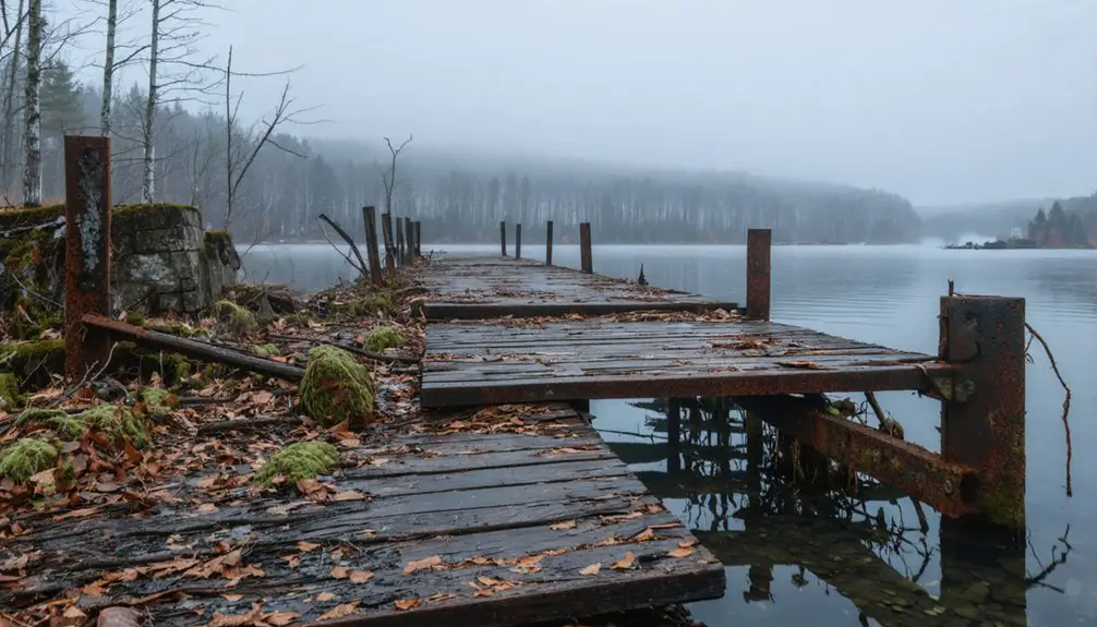
What Lies Beneath the Allegheny Reservoir
Since 1965, when the U.S. Army Corps of Engineers completed Kinzua Dam, the waters of the Allegheny Reservoir have concealed a hidden world beneath its surface.
You’ll find the remnants of Onoville and other communities frozen in time under approximately 12,000 acres of water spanning New York and Pennsylvania. The Pennsylvania Railroad station once served as a vital transportation hub for the area until operations ceased in 1962. Like the train services that stopped in Parksville in the late 1950s, this marked the beginning of decline for many small towns. Underwater archaeology reveals building foundations, old roadways, and artifacts from both pioneer settlements and Native American sites.
The reservoir’s sediment analysis shows ongoing geological changes as layers continue accumulating over these submerged features. While some historical structures have deteriorated, the reservoir’s anaerobic environment actually preserves many artifacts.
Time stands still beneath the reservoir’s depths, where sediment blankets history and oxygen-free waters preserve our past.
Remote sensing technology helps document what remains of these communities, though most are now inaccessible except to specialized research teams studying the transformed valley floors and archaeological sites that rest eternally beneath the water’s surface.
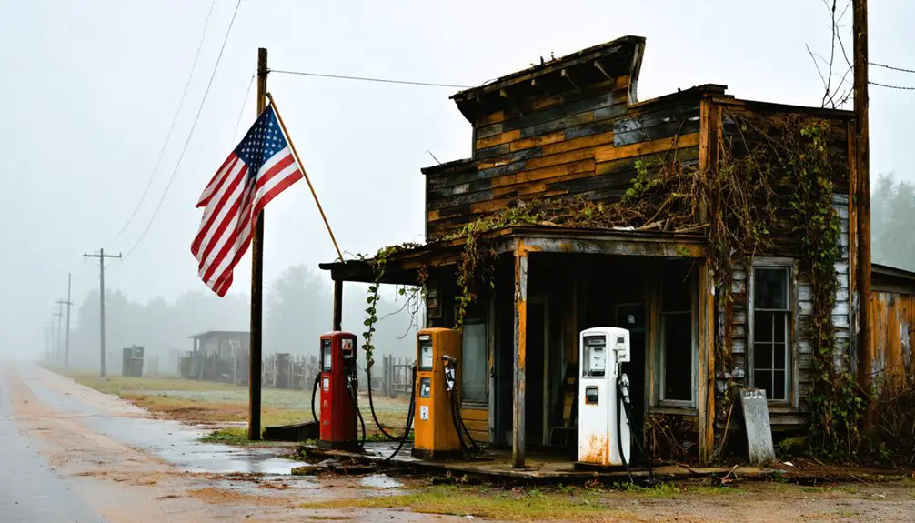
Ghost Town Tourism and Local Legends
If you’re intrigued by local folklore, you’ll find fascinating tales about structures and artifacts that now rest beneath the Allegheny Reservoir’s waters since the 1962 flooding of Onoville.
The area’s hidden history walking tours take you along shoreline paths where guides share stories of William Webber’s humorous “Oh no ville” naming incident and reported ghost sightings near old foundations.
You can explore remnants of the town’s railroad-era prosperity while learning about displaced residents who left behind homes, churches, and businesses when the Kinzua Dam project transformed their thriving community into a ghost town.
The history of Riceville, Maine ghost town reveals a fascinating tale of resilience and loss. As you wander through the overgrown pathways, you can imagine the vibrant life that once filled the streets, with families participating in local festivities. Each dilapidated building tells a story of the past, inviting visitors to reflect on the impact of the Kinzua Dam project on this forgotten community.
Reservoir Folklore Lives On
Although Onoville’s physical structures vanished beneath the Allegheny Reservoir’s waters decades ago, the town’s spirit lives on through a rich tapestry of local legends and folklore that continue to draw visitors from across the region.
You’ll hear tales of supernatural experiences from displaced residents and their descendants, who’ve reported lingering spirits near the water’s edge.
- Church bells ring mysteriously from beneath the reservoir’s surface
- Ghostly apparitions appear during seasonal water level changes
- Unexplained phenomena reported by anglers and campers
- Objects from the submerged town occasionally surface during droughts
Local museums preserve these stories through oral histories and artifacts, while seasonal tours let you explore the haunted reservoir’s edge.
You’ll find interpretive markers that detail both historical facts and the eerie legends that have become inseparable from Onoville’s legacy.
Hidden History Walking Tours
Walking tours of Onoville’s submerged history offer you a unique glimpse into life before the Allegheny Reservoir claimed the town.
You’ll discover hidden stories along remnants of old railroad tracks and crumbling foundations, while expert guides share historical narratives backed by archived photos and firsthand accounts from former residents.
As you explore the site, you’ll trace the paths of early settlers through what was once a thriving community.
Digital reconstructions help you visualize the town’s original layout, showing where hotels, churches, and homes once stood.
Your guide will point out surviving infrastructure that tells the tale of Onoville’s evolution from settlement to abandonment.
You’ll learn how economic shifts, including changes in railroad routes and tourism patterns, ultimately led to the town’s flooding and transformation into the mysterious site you see today.
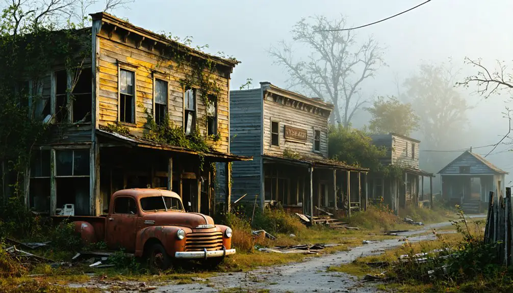
Legacy and Lessons From a Lost Town
When you visit the Allegheny Reservoir today, you’ll find it hard to imagine that the thriving community of Onoville once stood where water now flows, though local historians maintain detailed records of the town’s pre-1960s existence.
The creation of the Kinzua Dam in 1965 submerged Onoville and displaced its residents, serving as a stark reminder of how large-scale infrastructure projects can permanently alter communities in the name of regional flood control.
You’ll discover that while the physical town may be lost, Onoville’s story continues through preserved photographs, oral histories, and artifacts at the Seneca-Iroquois National Museum, teaching valuable lessons about balancing progress with preservation.
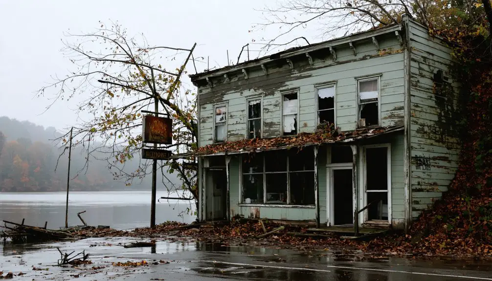
Preserving Historical Memory
Through crumbling foundations and weathered limestone blocks, Onoville’s physical remnants tell a compelling story of 19th-century settlement and decline.
You’ll find these historical preservation efforts essential to maintaining community identity, as they provide tangible connections to the region’s railroad-driven past. Local historians and archaeologists work tirelessly to document these invaluable sites before time claims them completely.
- Railroad infrastructure remnants mark the town’s economic lifeline
- Cemetery records preserve details of early settlers and Civil War veterans
- Documented oral histories capture tales of daily life and local traditions
- Archaeological surveys map building foundations and settlement patterns
You’re witnessing more than just abandoned structures – these are windows into a pivotal era of American expansion and the harsh realities of economic change that shaped rural New York’s landscape.
Flood Control’s Human Cost
Despite noble intentions to protect downstream communities, the Kinzua Dam’s construction in the mid-20th century exacted a devastating human toll on the region’s inhabitants.
The flood mitigation impacts came at an enormous social cost: over 600 families lost their homes, and the Seneca Nation saw 10,000 acres of their ancestral lands submerged beneath reservoir waters, violating the 1794 treaty that had guaranteed their sovereignty.
You can trace the stark reality of community resilience in how the displaced populations faced their losses.
Seneca villages were deliberately burned before flooding, erasing centuries of cultural heritage.
While the dam succeeded in controlling floods and generating power, it’s a sobering reminder of how infrastructure projects often sacrificed indigenous rights and established communities for the perceived greater good.
Frequently Asked Questions
Are There Any Surviving Photographs of Onoville Before the Flooding?
Time fades all memories. You’ll find few surviving photos, though historical records suggest some may exist in local archives, particularly railroad collections, but they’re not readily accessible to the public.
What Was the Total Population of Onoville at Its Peak?
You won’t find exact peak population records for Onoville’s history, but as part of South Valley’s 1,000+ residents in 1890, this ghost town likely housed no more than a few hundred people at most.
Did Any Original Buildings Get Relocated Before the Flooding?
Yes, you’ll find several buildings were relocated for historical preservation before the 1965 flooding, including residential homes and community structures that held significant importance to Onoville’s heritage and cultural identity.
Can Visitors Dive to See Underwater Remnants of the Town?
You can’t dive to explore the underwater remnants. Diving conditions are strictly prohibited since the reservoir serves as a protected water supply, and underwater exploration would risk contamination and legal consequences.
Were There Any Cemeteries That Needed to Be Moved?
Several cemeteries faced grave relocations during the 1950s reservoir project. You’ll find many of these respectfully moved burial grounds on higher ground today, preserving the cemetery history of displaced families.
References
- https://www.thetravel.com/abandoned-towns-in-upstate-new-york/
- https://hudsonvalleypost.com/new-york-state-is-home-to-nearly-20-ghost-towns/
- https://943litefm.com/abandoned-ghost-towns-new-york/
- https://en.wikipedia.org/wiki/List_of_ghost_towns_in_New_York
- https://991thewhale.com/upstate-ny-town-avoids-becoming-a-ghost-tow/
- https://www.youtube.com/watch?v=w9lz0PT8K4I
- https://wrrv.com/have-you-heard-of-this-hidden-hudson-valley-ghost-town/
- https://southvalleyny.com/?page_id=315
- https://nyrails.org/places/onoville-ny/
- https://www.youtube.com/watch?v=NSUaeKb3SMM