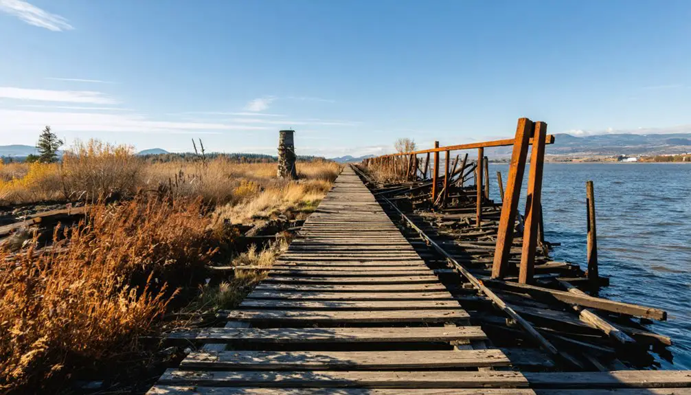
You’ll find Osceola two miles southeast of Enumclaw, where a thriving logging community once stood in the early 1900s. The settlement, named after the Native American leader, featured boarding houses, a post office, and a doctor’s office. While most buildings are gone, the historic schoolhouse still stands as the Osceola Community Club, preserving local heritage. The area’s dramatic past includes an ancient mudflow that reshaped the entire landscape, leaving fascinating stories beneath the surface.
Key Takeaways
- Osceola was a logging town established around 1900 in King County, Washington, located two miles southeast of present-day Enumclaw.
- The town’s infrastructure included boarding houses, homes, a post office, doctor’s office, commissary, and a one-room schoolhouse.
- Rapid decline began in the 1910s-1920s when the Osceola Cypress Company relocated, leading to complete abandonment by 1940.
- Only the schoolhouse remains standing today, now serving as the Osceola Community Club for local gatherings and heritage preservation.
- The area’s history is deeply connected to the ancient Osceola Mudflow, which reshaped the region approximately 5,600 years ago.
Origins of a Forgotten Settlement
When pioneers first established Osceola around 1900 in King County, Washington, they joined a wave of settlers founding small communities throughout the state during its economic boom years. The town’s name honored Native American leader Osceola who famously led Seminole resistance against U.S. forces in Florida.
Like many frontier settlements of its time, you’ll find that Osceola’s history was closely tied to the region’s natural resources, likely centered around logging operations that dominated the local economy. Similar to what happened in Oola, the town saw its population decline rapidly as industry conditions changed.
Frontier towns like Osceola depended heavily on logging, their fates intertwined with the mighty forests they harvested.
The town followed a pattern you’d recognize in many Washington communities – rapid growth followed by swift decline.
While detailed records are scarce, you can trace Osceola’s brief existence through the essential infrastructure it once maintained, including boarding houses and basic services that supported its working population.
Sadly, the town couldn’t survive the economic decline that struck when resource depletion and changing transportation routes left it isolated.
The Legacy of the Osceola Mudflow
When you look east toward Mount Rainier today, you’re seeing a landscape forever altered by one of the region’s most dramatic geological events – the massive Osceola Mudflow that occurred roughly 5,600 years ago.
The destructive flow created a horseshoe-shaped crater at the mountain’s summit that stretches nearly two kilometers wide.
This massive flow traveled at speeds of 19 meters per second, leaving an indelible mark on the surrounding terrain.
The catastrophic collapse of Mount Rainier’s summit sent nearly 4 cubic kilometers of mud and debris racing through our valleys, reshaping the entire White River system with deposits up to 100 meters deep.
Your daily drive through these ancient mudflow plains, which stretch more than 120 kilometers from the mountain to Puget Sound, crosses the same paths where this prehistoric disaster transformed our region’s geography.
Mount Rainier’s Ancient Impact
About 5,600 years ago, a catastrophic event forever changed the face of Mount Rainier and left an indelible mark on our region’s landscape. The massive mudflow dynamics released when the mountain’s summit collapsed sent an estimated 3.8 cubic kilometers of debris racing down the slopes at speeds up to 19 meters per second.
You can still witness the geological transformation today. The mountain lost roughly 1,000 feet of elevation when its weakened summit gave way, creating the dramatic amphitheater now home to Emmons Glacier.
The mudflow carved valleys over 100 meters deep and spread across more than 200 square kilometers of lowland, reaching all the way to Puget Sound. What you’re seeing today is nature’s raw power – a reminder of how one ancient event reshaped our entire landscape.
Reshaping Regional Geography
The massive Osceola Mudflow reshaped our region’s geography in ways you can still see today. When it roared down from Mount Rainier 5,600 years ago, it transformed our landscape by removing 2,000 feet of the mountain’s summit and creating the crater we’re familiar with now.
You’ll notice unique geological formations throughout the White River Valley, where the mudflow deposited material up to 300 feet deep. The mud waves reached up to 600 feet as they destroyed everything in their path.
The flow’s impact reached all the way to Puget Sound, where it dramatically altered sediment patterns underwater. If you explore the area, you’ll find massive hummocky mounds – evidence of giant blocks transported by the flow.
These deposits stretch across 200 square kilometers, and they’ve influenced how our rivers flow and valleys form ever since.
Life in Early 20th Century Osceola
Life in early 20th century Osceola reflected the rugged spirit of Pacific Northwest pioneers who carved out an existence on the Enumclaw plateau.
You’d find families making their living through timber harvesting and small-scale farming, facing the daily rural challenges of limited infrastructure and sparse amenities. During this time, cotton and timber were major economic drivers, similar to many other frontier communities. Like many pages from The History Museum, access to detailed records of daily life remains restricted.
The community’s heart was its one-room schoolhouse, which later became the Osceola Community Club – a representation of the pioneer lifestyle where neighbors relied on each other.
You’d need to travel to Enumclaw, about two miles away, for supplies and essential services. Without paved roads or modern utilities, you’d make your way by foot or horse through the densely forested terrain.
Despite these hardships, the tight-knit community maintained strong social bonds through local gatherings and shared determination.
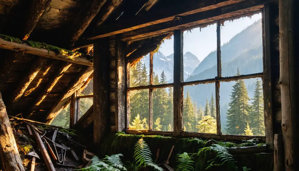
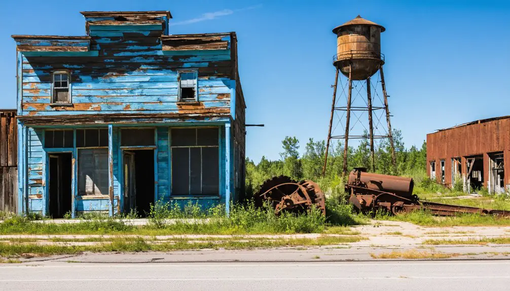
The Last Standing Schoolhouse
Standing as a silent sentinel to Osceola’s past, one historic schoolhouse remains where a thriving community once stood.
You’ll find this one-room schoolhouse design perfectly captures rural education in early 20th century Washington. Originally built as a cedar shack in 1884, the permanent structure was completed in 1890. As the town’s primary center for community education, it served multiple grade levels until 1937, when the district merged with Enumclaw.
- Simple wooden construction with basic amenities typical of rural schools
- Single classroom that accommodated children of all ages
- Central gathering space that later became the Osceola Community Club
The building’s journey from schoolhouse to social club reflects the area’s changing needs. After serving as the women’s club headquarters until 1972, it passed into private ownership, preserving a tangible piece of Osceola’s educational heritage.
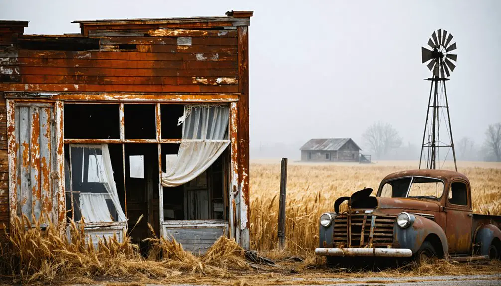
From Thriving Community to Ghost Town
Once a bustling logging town near Mount Rainier, Osceola flourished in the early 1900s as an essential timber processing center just two miles southeast of Enumclaw.
You’d have found a vibrant community built around the logging industry, complete with homes, a post office, doctor’s office, and a commissary to serve the hardworking residents.
The railroad grade transported massive cypress logs to the bustling sawmill operation.
The name honors the Seminole warrior who led Native American resistance in Florida during the 1830s.
The town’s decline began in the 1910s and 1920s as transportation and technology evolved.
As logging operations modernized and railways expanded, Osceola’s strategic importance faded into the mists of time.
When the Osceola Cypress Company relocated its operations to Port Everglades, the community’s fate was sealed.
The exodus accelerated through the 1930s until the last residents departed in 1940, leaving behind empty buildings and forgotten dreams.
Today, only the old schoolhouse remains, transformed into a community club – a lone sentinel preserving memories of Osceola’s glory days.
Natural Forces That Shaped the Land
Long before Osceola became a logging town, the powerful Osceola Mudflow reshaped the entire region when Mount Rainier erupted around 5,600 years ago. The massive lahar deposited hundreds of feet of volcanic material, creating the Enumclaw Plain where you’ll find traces of our town’s history today.
Natural erosion processes have continuously sculpted the landscape, while geological formations tell the story of both volcanic and glacial influences.
- Streams and rivers have carved through the ancient mudflow deposits, revealing layers of volcanic rock and sediment.
- Dense forests now blanket the volcanic soil, masking the catastrophic events that created this land.
- The combination of weathering, freeze-thaw cycles, and plant growth continues to transform the rugged terrain that once drew settlers here.
Preserving Local Heritage Through the Community Club
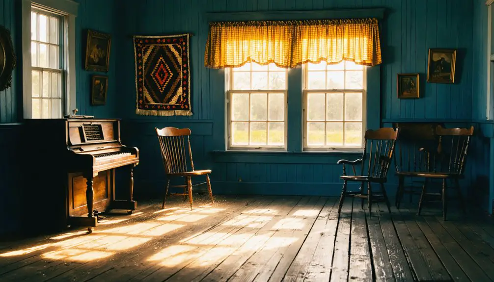
The Osceola Community Club stands as a symbol of local resilience, operating from the last surviving one-room schoolhouse on the Enumclaw plateau. You’ll find this women’s social club has transformed the historic building into a vibrant center for community engagement, hosting gatherings that keep local traditions alive despite the town’s ghost status.
Through dedicated heritage preservation efforts, the club serves as more than just a meeting place – it’s your connection to Osceola’s rich past. You can participate in social events and cultural activities that help counter rural isolation while preserving cherished memories.
Though the club faces challenges with funding and maintenance, its volunteers work tirelessly to guarantee this piece of history remains relevant for future generations, creating a lasting bridge between Osceola’s past and present.
Osceola’s Place Among Washington Ghost Towns
Among Washington’s diverse collection of ghost towns, Osceola stands as a subtle reminder of King County’s rural past, situated just two miles southeast of present-day Enumclaw.
The history of Loomis, Washington, offers a glimpse into the early 20th-century gold rush era that attracted many hopeful prospectors. Although it may not be as renowned as other towns, its remnants tell stories of ambition, hardship, and community spirit. Visitors can explore the remnants of this once-thriving settlement, which serve as a testament to the tenacity of those who once called it home.
Unlike many of the state’s more prominent ghost town tourism destinations, you’ll find Osceola’s historical significance lies more in its geological connection to the Osceola Mudflow than in preserved structures.
While other Washington ghost towns boast multiple buildings and visible ruins, Osceola’s physical legacy is strikingly sparse.
- The lone surviving schoolhouse, now the Osceola Community Club, serves as the town’s primary historical anchor.
- The site’s connection to the ancient Osceola Mudflow adds a unique dimension to its story.
- Unlike mining boom towns that dominate Washington’s ghost town landscape, Osceola represents the quieter dissolution of rural community life.
Frequently Asked Questions
What Happened to the Original Residents of Osceola?
You’ll find the original residents dispersed to nearby towns like Enumclaw when economic opportunities dwindled. Town history shows they moved for better jobs and services, while maintaining community ties through the schoolhouse.
Are There Any Archaeological Artifacts Found in the Osceola Area?
You’ll find over 13,000 stone artifacts dating back 6,850 years, including projectile points and tools. They’ve preserved ancient rock art sites near mountain lakes, along with hunting blinds and food storage pits.
When Was the Last Time the Schoolhouse Operated as a School?
You’ll find the schoolhouse’s educational significance ended around 1937 when it merged with Enumclaw School District, though the building’s rich history continued as a community club until 1972.
What Native American Tribes Originally Inhabited the Osceola Region?
You’ll find that Coast Salish peoples originally inhabited this region. Their tribal history and cultural significance are deeply rooted here, long before European settlers named the area after the Seminole leader Osceola.
Does Anyone Still Own Private Property Within the Ghost Town Boundaries?
Patiently preserved properties persist, as you’ll find private ownership within the ghost town boundaries today. While specific details aren’t publicly available, local landowners maintain parcels and carefully control visitor access.
References
- https://www.shakaguide.com/tours/nevada/great-basin-national-park-tour/stops/osceola-ghost-town
- https://en.wikipedia.org/wiki/Osceola
- http://www.gribblenation.org/2018/03/ghost-town-tuesday-osceola-fl.html
- https://floridatrailblazer.com/2018/01/26/osceola-ghost-town-in-seminole-county/
- https://stateofwatourism.com/ghost-towns-of-washington-state/
- https://www.youtube.com/watch?v=QrjcjYBw1NY
- https://en.wikipedia.org/wiki/List_of_ghost_towns_in_Washington
- https://www.morageology.com/pubs/59.pdf
- https://pubs.geoscienceworld.org/gsa/gsabulletin/article/109/2/143/183195/The-Osceola-Mudflow-from-Mount-Rainier
- https://en.wikipedia.org/wiki/Osceola_Mudflow