
Plan your ghost town adventure to Andrews by departing Harrison on Highway 20, where you’ll navigate 15 miles of gravel roads through rolling Sandhills grasslands—though conditions shift dramatically with weather. Visit between May and October when roads are passable, packing recovery gear, layers, and ample supplies since civilization fades quickly beyond Morgan Store in Ellsworth. You’ll discover a crumbling schoolhouse, weathered cemetery headstones, and stone foundations reclaimed by prairie grass, with nearby attractions and historic sites extending your exploration.
Key Takeaways
- Andrews lies 35 miles from Harrison via Highway 20, requiring roughly 50 minutes of driving through remote grasslands and Pine Ridge Escarpment.
- Visit between May and October for passable roads; fall offers ideal conditions with spectacular foliage and minimal rainfall for photography.
- Gravel roads dominate the route and become treacherous in rain or snow; pack recovery gear and monitor Nebraska 511 before departing.
- The abandoned railroad siding features a crumbling schoolhouse, weathered cemetery headstones, and nature-reclaimed foundations from the early 1900s cattle era.
- Resupply at Morgan Store in Ellsworth before departure; bring layers, waterproof boots, food, water, and respect private land boundaries when exploring.
The History of Andrews: From Railroad Siding to Ghost Town
The Chicago, Burlington and Quincy Railroad punched its line through northwest Nebraska in 1889, laying steel that would connect Alliance to Edgemont, South Dakota. You’ll find Andrews marked on a 1915 railroad map—a simple siding near Fort Robinson where ranchers could load cattle without paying Wyoming’s steep freight rates. This geographic location made perfect sense for railroad operations serving Sioux County’s expanding cattle empire.
Picture those days: herds grazing along the Niobrara River, then driven to Andrews’ loading pens. The siding hummed with activity until trucks started stealing rail’s thunder in the late 1950s.
When Burlington Northern absorbed the line in 1970, Andrews’ fate was sealed. The coal boom briefly延ed life, but eventually the rails fell silent, leaving behind another High Plains ghost town.
What Remains at Andrews Today
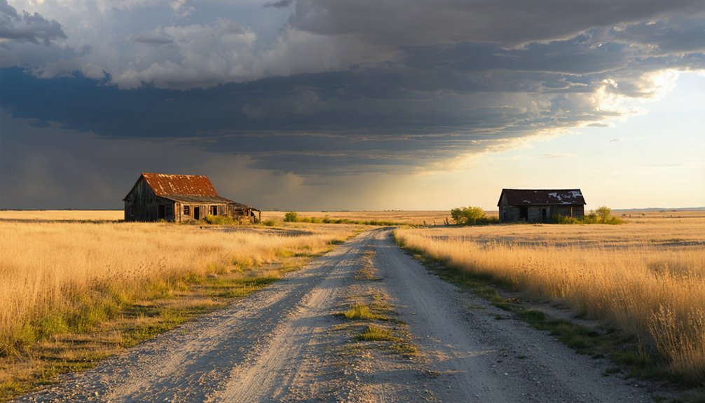
Standing where Andrews once bustled, you’ll strain to imagine the cattle cars and shouting stockmen. Today, nature’s reclaiming what settlers built—tall grasses swallow foundations while trees push through collapsed rooftops.
Where cattle once thundered and commerce thrived, silence now reigns—grass erasing history one blade at a time.
The schoolhouse shell stands defiant, though partially crumbled, and stone bases mark where storefronts once thrived. You’ll find the cemetery’s weathered headstones telling stories from the early 1900s, while wildflowers bloom between structural remnants.
Access requires respecting private land boundaries, as no formal local preservation efforts protect the site. After rains, erosion reveals buried artifacts—tangible connections to vanished lives.
Watch for wildlife sightings among the ruins; deer and birds now own this territory. The railroad siding near abandoned tracks reminds you that progress doesn’t always mean permanence, and sometimes freedom means letting go.
How to Get There: Driving Directions From Harrison
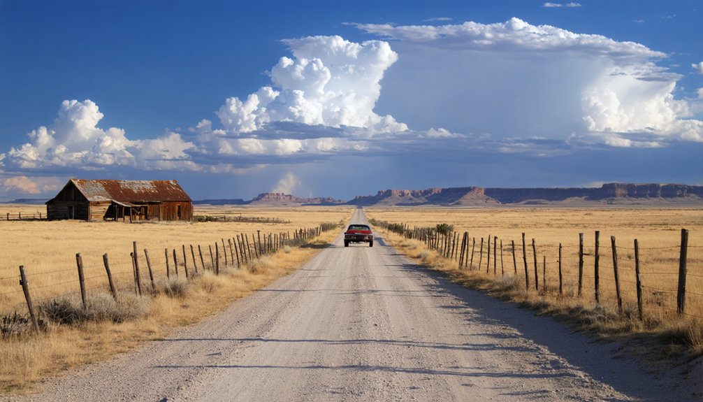
You’ll leave Harrison heading south on Highway 20, watching the Panhandle’s rolling grasslands stretch toward the horizon as scattered pines dot the hillsides. The 15-mile drive takes roughly twenty minutes in good weather, though spring mud and winter snow can turn these gravel county roads into challenging passages that’ll test your vehicle’s clearance.
Keep your eyes sharp for the unmarked turnoff—I nearly missed it twice before spotting the faint cattle trail that leads to what’s left of Andrews.
Highway 20 South Route
From Harrison’s quiet main street, Highway 20 stretches eastward like a ribbon of asphalt through Nebraska’s rugged northwest corner, connecting you to one of the state’s most remote ghost town sites.
You’ll climb 400 feet through Pine Ridge Escarpment, where scenic views unfold—Beaver Wall’s weathered face, Crawford’s sentinel buttes, and the distant Black Hills silhouette.
Past Fort Robinson, watch for White River Road heading south. Follow it thirteen miles west along the valley, where regional history whispers from every bend.
Near the headwaters and natural springs, fork north onto Andrews Road. This backcountry route loops you back to Highway 20, delivering you to Andrews’ skeletal remains—a water tower, crumbling depot, and memories of the F.E.&M.R.R. Cowboy Line’s glory days.
Distance and Travel Time
The journey between Harrison and Andrews spans approximately 35 miles of northwestern Nebraska backcountry, requiring about 50 minutes when you navigate the combination of paved highway and gravel roads. You’ll leave civilization behind as Highway 20 shifts into County Road 61, where cell service becomes spotty at best.
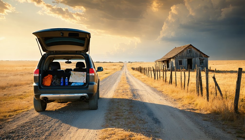
These scenic backroads demand respect—dust plumes trail behind your vehicle for miles, and wildlife appears without warning. Pack accordingly: extra water, a full tank of gas, and a physical map prove essential when GPS fails. The remoteness amplifies your sense of adventure, though packing considerations extend beyond typical road trips.
Bring spare tire equipment and emergency supplies. Summer thunderstorms transform these routes quickly, making timing critical for safe passage through Nebraska’s unforgiving plains.
Road Conditions to Expect
Before setting out on this ghost town expedition, gravel dominates your route once you leave Harrison’s pavement behind. You’ll navigate unpaved county roads where conditions shift dramatically with weather—spring rains transform surfaces into slick mud traps, while winter snowdrifts can obscure the entire path.
Check Nebraska 511’s real-time cameras and current winter road impacts before departing. The app’s plow tracker shows which routes crews have cleared, essential intelligence when storms roll through. Download up to date weather forecasts since you’re venturing beyond regular patrol zones.
Summer brings its own challenge: washboard surfaces that rattle your vehicle mercilessly. Local ranchers maintain these roads sporadically, so expect the unexpected. Your best defense? Monitor NDOT’s live conditions, pack recovery gear, and embrace the wild isolation that makes Andrews worth discovering.
Best Time to Visit and What to Bring
You’ll want to time your Andrews adventure between May and October when dirt roads stay passable and temperatures hover in that sweet spot of 50°F to 78°F—I learned the hard way that spring thunderstorms can turn the route from Highway 20 into a muddy mess.
Pack layers since mornings might greet you at 50°F while afternoons climb toward the mid-70s, and don’t forget waterproof boots for traversing the ghost town’s overgrown paths.
Fall offers the ultimate experience with spectacular foliage, minimal rainfall, and seven hours of daily sunshine perfect for photographing crumbling homesteads and weathered structures.
Optimal Seasonal Visiting Windows
Timing your visit to Andrews can make the difference between squinting through a blizzard at empty prairie and standing comfortably among wildflowers with perfect light for photography. You’ll find late spring (May-June) offers mild 68-71°F temperatures and blooming landscapes without mid summer crowds.
Early fall (September-October) delivers the ultimate experience—vibrant foliage, 62-78°F days, and seven hours of intense sunshine for exploration. April brings unpredictable shifts with both Sandhill Crane migrations and sudden thunderstorms, creating windiest weather conditions that test your adaptability. Skip December through February entirely unless you’re prepared for sub-zero temperatures and impassable snow-covered roads.
The ghost town’s minimal remains—just one building—demand dry conditions for your short visit along those 2WD-accessible routes off Highway 20.
Essential Gear and Supplies
Packing for Andrews requires a different mindset than most ghost town visits—you’re heading to a place where convenience stores never existed and the nearest supplies sit 23 miles away in Ellsworth. Load your vehicle like early settlers did their wagons: multiple gallons of water per person (no reliable water sources exist), substantial food delivery from your last town stop, and layers for the Sandhills’ schizophrenic weather—mornings demand hoodies while afternoons strip you down to t-shirts.
Morgan Store in Ellsworth stocks essentials alongside western gear and tack, your final resupply point before the prairie swallows you. Toss extra snacks under your back seat, fill every water bottle you own, and pack like you’re three hours from help—because you are. Freedom here means self-sufficiency.
Weather and Road Conditions
The Sandhills don’t forgive poor planning, and Andrews sits exposed to Nebraska’s full temperamental sweep—I learned this the hard way during an April visit when morning frost gave way to 70-degree sunshine, then collapsed into evening sleet that turned the two-track access roads into chocolate pudding.
Seasonal timing matters:
- Summer (June-August) offers the clearest access, though afternoon thunderstorms still threaten
- Fall (September-October) provides stable conditions before wintertime snowplowing challenges make routes impassable
- Spring (March-May) brings potential spring flooding risks and unpredictable swings between freezing nights and 70-degree days
Pack layers regardless of season. Winter demands four-wheel drive and recovery gear. Summer requires storm awareness. Nebraska’s continental climate respects no calendar—only the prepared explorers who acknowledge its sovereignty.
Exploring the Upper White River Valley
Winding through the Upper White River Valley, you’ll discover a landscape carved by millions of years of relentless erosion, where the river originates at 4,861 feet on the Pine Ridge Escarpment near Harrison before threading southeast past Fort Robinson‘s historic grounds.
The pine ridge escarpment geology reveals dramatic badlands formations—pinnacles and labyrinthine valleys sculpted from soft clay by intermittent tributaries. You’re traversing 10,200 square miles of the white river drainage basin, where sparse vegetation punctuates semiarid high plains.
Deep canyons plunge 200-300 meters into ancient sediments, exposing the Chamberlain Pass and Chadron formations. This sparsely populated terrain offers unobstructed views across rolling plateaus and twisted rock formations. Plan for primitive conditions—few services exist between scattered ranches. Bring plenty of water and fuel for genuine backcountry exploration.
Nearby Ghost Towns and Historic Sites Worth Visiting
Beyond Andrews’ weathered ruins, Nebraska’s high plains conceal dozens of ghost towns where you’ll find crumbling foundations poking through prairie grass and lone chimneys standing sentinel over vanished communities.
Three Must-Visit Ghost Towns Near Andrews:
- Brocksburg – Navigate rugged roads north to discover family homesteads shrouded by mature trees, with several buildings still standing near the Keya Paha River.
- Dobytown – Follow Highway 50A to Kearney County where adobe-style earthen structures once stood near Fort Kearny; only a roadside marker remains.
- St. Deroin – Trek to Indian Cave State Park’s northern edge to explore this abandoned 1920s trading post where Missouri River ferry operations thrived.
Each site offers unique access to Nebraska’s frontier past, rewarding those willing to venture off-grid.
Agate Fossil Beds National Monument and Other Area Attractions
Just an hour’s drive northwest of Andrews, prehistoric fossil deposits emerge from the earth at Agate Fossil Beds National Monument, where 20-million-year-old bones tell stories far older than Nebraska’s homesteading days. You’ll walk exposed prairie trails to witness Dinohyus (terrible pig) and bear-dogs frozen in ancient drought. The visitor center houses Chief Red Cloud’s gifted collection of 500+ Lakota artifacts, weaving Native American cultural history alongside paleontology.
Two trails let you explore at your own pace—the paved Fossil Beds Trail reaches primary dig sites, while Daemonelix Trail reveals spiral burrows preserved in stone. No camping’s allowed here, but Fort Robinson State Park offers full hookups and museums documenting the late 1800s frontier. Pack water; this treeless grassland shows no mercy under summer sun.
Tips for a Safe and Respectful Ghost Town Adventure
While Andrews’ weathered storefronts and abandoned homesteads beckon with the romance of frontier history, they’re also collapsing structures where rotted floorboards hide beneath dust and rusted nails wait in shadowed doorways. Your adventure requires smart preparation:
Romance and ruin walk hand-in-hand through Andrews’ crumbling structures—preparation separates memorable exploration from dangerous trespassing.
- Gear up properly with sturdy boots, headlamp, dust mask, and first aid kit—abandoned buildings harbor asbestos and unstable surfaces
- Respect legal concerns by obtaining landowner permission and never entering locked or posted structures
- Support preservation efforts by leaving artifacts untouched and photographing instead of collecting
I learned this watching floorboards crack beneath my friend’s boot in a Montana ghost town. Bring companions who’ll help scout hazards, and inform someone of your location. These decaying monuments deserve your respect, not just your Instagram feed.
Frequently Asked Questions
Is Camping Allowed Near the Andrews Ghost Town Site?
No designated camping exists at Andrews ghost town itself. You’ll need to explore public camping options at nearby Nebraska WMAs or state recreation areas. Check surrounding counties for nearby accommodation availability, including primitive dispersed sites that honor your independent spirit.
Are There Any Guided Tours Available for Andrews and Surrounding Ghost Towns?
No guided tours of historical buildings exist for Andrews or nearby ghost towns. You’ll explore independently, discovering remnants at your own pace. Indian Cave State Park offers informative cultural exhibits about St. Deroin, blending history with self-directed adventure through Nebraska’s forgotten settlements.
What Cell Phone Coverage Can I Expect in This Area?
You’ll face spotty signal strength in Andrews since Nebraska ranks 51st for coverage. Verizon and AT&T offer your best bet with stronger cell tower availability in remote areas, though you shouldn’t count on reliable 5G service here.
Can I Metal Detect or Collect Artifacts at the Site?
You’ll face strict metal detecting restrictions at Andrews due to historical preservation concerns. You must obtain written permission from landowners and verify the site isn’t federally protected. Unauthorized detecting risks hefty fines and equipment confiscation—research ownership first.
Are There Any Restaurants or Gas Stations Between Harrison and Andrews?
You’ll find slim pickings on this lonesome stretch—Harrison’s your best bet for fuel and grub before heading out. The nearest grocery stores and local roadside attractions cluster there, so stock up and fuel your adventurous spirit beforehand.


