Your ghost town road trip to Aurora begins along Highway 31 just north of 60th Street in Kenosha County, where Willis Tavern once anchored this 1830s settlement. You won’t find structures or commemorative markers—Aurora vanished completely after its post office closed in 1843. The site follows the historic Green Bay Trail corridor, requiring archival knowledge and spatial understanding of territorial-era geography to locate. Within 90 miles, you’ll discover 47 documented Wisconsin ghost towns for expanded exploration opportunities.
Key Takeaways
- Aurora is located just north of 60th Street along Highway 31 in Kenosha County, following the historic Green Bay Trail corridor.
- No structures, plaques, or buildings remain at the site; the settlement vanished completely after its 1843 post office closure.
- Willis Tavern’s original location on the trail’s west side served as Aurora’s central gathering point during the 1830s stagecoach era.
- The site lies within 90 miles of 47 documented Wisconsin ghost towns, enabling clustered regional visits for road trip planning.
- Research Aurora’s history through Kenosha County Historical Society archives and Green Bay Trail Archives before visiting the unmarked location.
Aurora Wisconsin: A Vanished Settlement in Kenosha County
In the early 1830s, Aurora emerged as one of Kenosha County’s pioneering settlements, establishing itself along the Green Bay Trail before Wisconsin achieved statehood in 1848. You’ll find that Willis Tavern anchored this community, serving as both social center and post office from the settlement’s inception.
The strategic junction point attracted travelers and residents alike during Wisconsin’s territorial period. However, when the post office closed in 1843, Aurora’s fate was sealed. The stagecoach route decline eliminated the economic foundation supporting this waypoint community.
Residential population erosion followed steadily rather than catastrophically. By April 30, 1891, historical records documented Aurora as completely barren—no structures, no residents, nothing remained. Today, you can’t locate any physical evidence of this settlement within Kenosha’s modern boundaries near 60th Street.
The Willis Tavern and Green Bay Trail Stagecoach Era
The Willis Tavern stood on the west side of Green Bay Trail just north of present-day 60th Street, functioning as Aurora’s central gathering point where residents obtained mail from one of Kenosha County’s first post offices in the early 1830s. When the Chicago-to-Milwaukee stagecoach line began operations through Aurora in 1836, the tavern became a crucial stopover where passengers could rest, eat, and exchange correspondence along this indispensable transportation corridor.
This convergence of the ancient Green Bay Trail route and regular stagecoach service transformed Willis Tavern from a simple drinking establishment into the community’s primary connection to the broader Wisconsin Territory.
Willis Tavern Community Hub
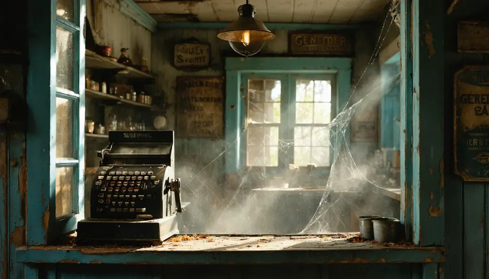
Standing on the west side of the old Green Bay Trail, Willis Tavern served Aurora’s pioneer community as both waystation and social nexus during the stagecoach era. You’ll find this historic structure today along Highway 31 just north of 60th Street in Kenosha County, where it’s transformed into Willis Tavern Community Hub.
The original building preserves its tavern interior features while hosting community event programming that honors its legacy as Aurora’s gathering place. Referenced on page 336 of historical volumes documenting the Chicago road, this site connected early Wisconsin pioneer networks.
You can access this public landmark to experience how adaptive reuse maintains stagecoach-era significance while serving modern community needs, bridging Aurora’s ghost town past with present-day engagement.
Stagecoach Line Operations 1836
When stagecoach service launched along the Chicago-Milwaukee line in 1836, Aurora’s position on the Green Bay Trail transformed this territorial settlement into an essential waystation twelve years before Wisconsin achieved statehood.
Stagecoach Business Competition and Operations:
- Multiple operators competed fiercely—John T. Temple & Co. held the lucrative mail contract on the Chicago-Peoria route, while John D. Winters operated without government backing, relying solely on passenger travel experiences from his 1820s operations.
- Departure schedules demanded early rising—stages left Chicago at 4 a.m., with Frink Walker lines advertising Tuesday and Saturday 6 a.m. departures from their State Street office.
- Fares reflected distance and duration—the 160-mile Chicago-Galena journey cost $12.50 across five days.
- The 1832 Black Hawk War temporarily halted all territorial stagecoach movements, disrupting mail delivery and territorial expansion.
Locating the Aurora Site Along Highway 31
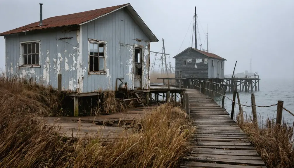
Finding Aurora’s exact location requires understanding its position relative to modern Kenosha’s street grid. You’ll search for the site just north of 60th Street along Highway 31, which follows the historic Green Bay Trail corridor. Willis Tavern stood on the trail’s west side, serving as Aurora’s central point from the early 1830s until 1843.
Aerial imagery analysis reveals no remaining structures marking this settlement. Historical land records document the post office’s establishment and closure, providing the primary evidence of Aurora’s existence. You won’t find commemorative plaques or preserved buildings—the community vanished completely after losing its postal services. Your investigation relies entirely on archival references and spatial relationships to modern infrastructure, making this ghost town’s discovery dependent on understanding territorial-era Wisconsin geography rather than visible landmarks.
What Remains of Aurora Today
Unlike the Kenosha Aurora discussed earlier, Waushara County’s Aurora presents a different archaeological landscape in central Wisconsin. You’ll find minimal preservation but significant abandoned infrastructure remnants scattered across 1.2 square miles near Highway 152. The seasonal visitor presence peaks during September’s annual ghost town tours, though vegetation now obscures 80% of historical markers.
Surviving structures include:
- 1885 brick schoolhouse – The only intact two-story building remaining from Aurora’s limestone quarry heyday
- 40-foot church steeple – Standing isolated among overgrown foundations of 15 former homes
- Three 30-foot lime kilns – Derelict units marking the 20-acre quarry pit that employed 850 residents
- 1870s railroad siding tracks – Overgrown remnants connecting to the collapsed general store and barn frameworks
Private property restrictions limit access to 70% of grounds.
Combining Your Visit With Other Wisconsin Ghost Towns
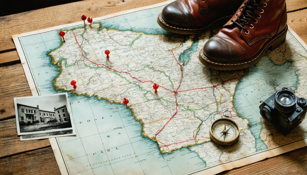
Since Aurora sits within 90 miles of 47 documented Wisconsin ghost towns, you’ll maximize your road trip by clustering visits regionally. Victor Bates’s pre-1969 indexed map provides essential coordinates for northern sites like Marble (44°33′45″N 88°52′15″W) and Little Wolf in Waupaca County.
Ghost town site features vary dramatically—from Maribel Caves Hotel’s stone ruins to Clark County’s documented cemeteries and plat maps accessible through electronic bookshelves. You’ll find ghost town preservation efforts concentrated in areas with veteran records and school histories.
Plan routes using the 1-inch-to-10-miles scale maps connecting mining towns via old railroad corridors. Strategic clustering lets you document multiple sites daily while accessing archival materials linking abandoned settlements to their operational pasts.
Tracing the Chicago-Milwaukee Stagecoach Route
The Chicago-Milwaukee stagecoach corridor passed directly through Aurora, Wisconsin, forming part of a pivotal 19th-century transportation artery that connected Lake Michigan settlements before railroad dominance. You’ll find remnants of this historic pathway threading through the countryside, where travelers once endured 12-hour journeys in crowded four-horse coaches.
The Aurora stagecoach corridor linked Lake Michigan settlements through rugged 19th-century travel before railways transformed regional transportation networks.
Key Historical Markers Along the Route:
- Milwaukee-Watertown Plank Road (1847) – Original roadbed sections still visible near Aurora’s town boundaries
- Pioneer lodging amenities – Foundation stones mark former inn sites where passengers rested between Chicago and Milwaukee connections
- Stagecoach route signage – Contemporary historical markers identify the original corridor alignment through rural Wisconsin townships
- Indian Boundary traces – The route paralleled ancient trails, following natural landscape corridors that preceded European settlement
Railroad expansion after 1854 rendered these stagecoach paths obsolete.
Best Resources for Aurora Historical Information

You’ll find the most detailed Aurora records at the Kenosha County Historical Society, which maintains archival documents from the settlement’s pre-1843 era through its 1891 official closure.
The Green Bay Trail Archives preserve original stagecoach route maps and station logs that pinpoint Aurora’s exact location along the Chicago-Milwaukee corridor.
Wisconsin’s State Historical Society holds additional stagecoach route records, including postal service documentation that details why Aurora’s post office closed in 1843 and how this triggered the community’s abandonment.
Local Kenosha History Centers
- Archives containing settlement patterns and regional development materials (9am-4pm weekdays, curator availability required)
- Lost Industry digitized collection featuring photographs and corporate records accessible online without appointments
- Research request protocols requiring 24-hour advance curator submission
- Southport Light Station Museum operating mid-May through October, preserving maritime history documentation
You’ll need to sign in with the curator and follow archive protocols. Admission remains free, though donations support collection preservation.
Green Bay Trail Archives
Since Aurora sits along the Green Bay Trail‘s historic route, researchers can access migration and settlement records through the Chicago History Museum‘s extensive manuscript collections (312-642-4600, Tuesday-Saturday 9:30am-4:30pm).
You’ll find documentation of indigenous tribe networks dating to Potawatomi and Algonquin family movements from 11,000 BCE through early 19th century settlements. The Wisconsin Historical Society maintains American Fur Company records detailing fur trade geographic expansion, including Jacques Vieau Sr.’s 1792 Skunk Grove trading post establishment.
Military road surveys from 1835 and postal route documentation from 1832 provide settlement pattern analysis. The Green Bay Trail Committee preserves trail tree markers and route maps showing wet and dry path variations. Original stagecoach schedules from 1836 reveal intermediate stops along the 250-mile wilderness corridor.
Wisconsin Stagecoach Route Records
The Wisconsin Historical Society‘s archives preserve Theodore T. Brown’s 1930 pen and ink map showing historical route documentation across Wisconsin and northern Illinois. You’ll find stagecoach lines marked in red, connecting Lake Michigan to the Mississippi River with detailed notation of tavern accommodation infrastructure throughout the region.
Essential Archive Resources:
- Original Maps (4th Floor, Madison) – Access requires written permission from Collections Division staff for examining circa-1930 railway company documentation
- Sauk County Records – Eight stages departed from Sauk villages, with the Spring Green-Portage line serving Prairie du Sac’s hub operations from 1870-1882
- Tavern Infrastructure Documentation – Cabin structures and accommodation stops established at strategic intervals, including the praised Menomonee facilities
- Military Road Integration – War Department construction records connecting mining regions and passenger routes
Frequently Asked Questions
When Did Aurora, Wisconsin Officially Become Part of Kenosha City Limits?
Aurora officially became part of Kenosha city limits on March 19, 1990, certified by City Clerk Gail F. Procarione. You’ll find this documented as ID 00019065, though population decline and economic factors aren’t specifically recorded in municipal annexation archives.
Are There Any Walking Tours Available Covering the Former Aurora Site?
No walking tours specifically cover Aurora’s former site. You’ll find the Aurora Historical Shiver Tour offers guided history walks exploring the town’s past generically, though self guided tours let you independently explore remaining streets and historical markers at your own pace.
What Caused Aurora’s Post Office to Close in 1891?
Aurora’s post office closed when declining population caused mail volume to plummet below viability thresholds. Economic hardship from timber depletion meant quarterly revenue hit just $23 against $150 costs, prompting the Postmaster’s resignation and federal revocation on July 15, 1891.
How Long Does a Typical Visit to the Aurora Site Take?
You’ll need an epic 90 minutes to 2 hours for your estimated visitor duration at Aurora’s haunted sites. The ghost tours follow minimal site accessibility requirements—just bring comfortable walking shoes and your EMF detector for ideal paranormal investigation freedom.
Is There Parking Available Near the Highway 31 Historical Location?
Specific parking availability near Highway 31’s historical location isn’t documented in available records. You’ll find highway accessibility details through Antigo Police at (715)627-6411, where overnight permits and street-specific regulations are verified for your independent exploration needs.