You’ll find Bayport along Florida’s Gulf Coast where Weeki Wachee River meets the sea—a Confederate shipping port turned Prohibition smuggling haven. The seven-acre Bayport Park preserves earthwork batteries from the 1863 Union raid, while beneath the 144-foot fishing pier lies a sunken blockade runner documented during 2017 reconstruction. The vandalized cemetery reveals preservation’s limits through stolen headstones and unmarked graves. Census records, battle reports, and archaeological surveys transform this remote settlement into something beyond typical ghost town tourism—physical evidence of strategic isolation’s double-edged legacy.
Key Takeaways
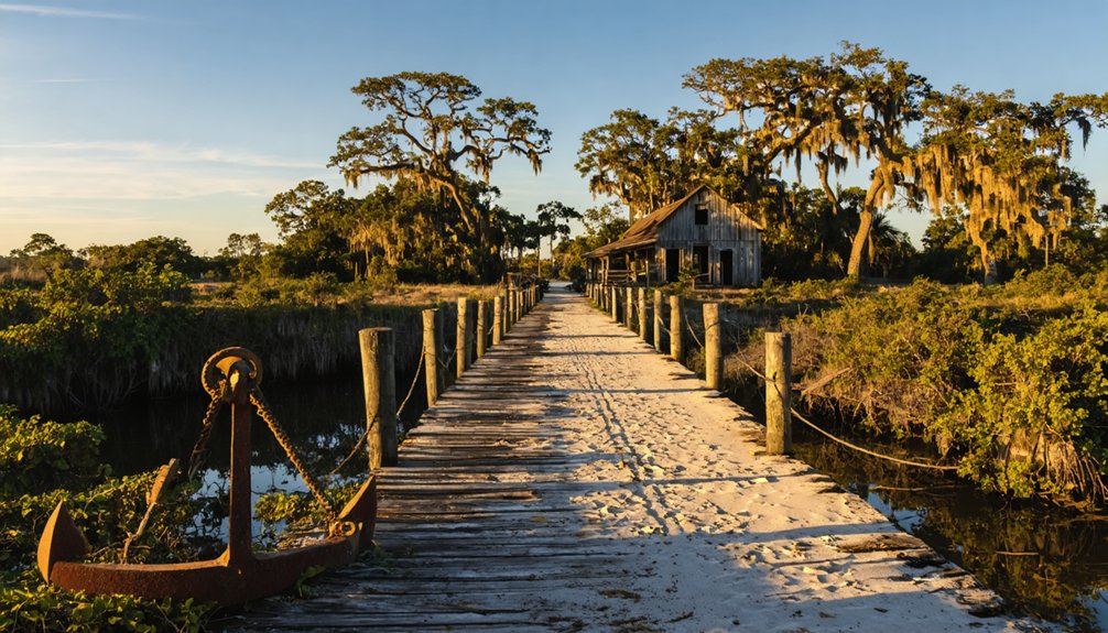
- Bayport Park features a 144-foot boardwalk, fishing pier, Civil War battery site, and nature trails across seven acres of Florida Heritage Site.
- Visit the historic cemetery where ground-penetrating radar searches for unmarked graves after 1970s gravestone theft left only burial plot bases.
- Explore Confederate shipwreck remains beneath the fishing pier, preserved since the April 1863 Union raid during the Battle of Bayport.
- Interpretive markers detail Bayport’s history as a blockade-running port and Prohibition-era smuggling hub with strategic Gulf Coast access.
- Nearby attractions include Coogler’s Beach, Pine Island Park, and the Weeki Wachee River for extended Gulf Coast exploration.
From Bustling Port to Forgotten Settlement: The Story of Bayport
When Thomas Henry Parsons purchased property along Florida’s Gulf Coast on August 12, 1852, he formalized what would become one of the region’s most significant—and ultimately forgotten—maritime settlements. You’ll discover Bayport’s strategic location at the confluence of Weeki-Wachee River and Mud Creek provided essential access to Gulf shipping routes. The port shipped cotton, citrus, and meats before the Civil War, later attracting blockade runners during the conflict. Confederate battery remains mark this era at present-day Bayport Park.
Post-war prosperity transformed the settlement into a winter resort while maintaining its fishing heritage. Frances Goethe operated commercial fishing operations, with the marshland ecosystem supporting abundant marine resources. After John Parsons’ death in 1888, economic decline proved irreversible. The Bayport Hotel burned spectacularly in 1942, ending the town’s final chapter.
The Battle of Bayport: Confederate Blockade Runners and Union Surprise Attack
Throughout the Civil War, Bayport’s strategic position along Florida’s Gulf Coast made it an essential hub for Confederate blockade running operations between 1862 and 1865. You’ll find that vessels transported salt, beef, cotton, and corn to Cuba, sustaining the Confederate war effort despite Union interception of eleven runners.
The strategic significance of Bayport prompted Union commanders to launch a decisive raid on April 2-3, 1863. Seven boats from the warships St. Lawrence, Sagamore, and Fort Henry attacked the port, facing resistance from approximately 60 Confederate defenders led by Captain Leroy G. Lesley. The impact on Union blockade efforts proved substantial—though Federal forces captured and burned the schooner Helen and disabled Confederate vessels, the port’s usefulness temporarily ended only after persistent military pressure forced its abandonment.
Prohibition’s Hidden Harbor: Rum Runners and Bootleggers
Following the Civil War’s conclusion, Bayport’s strategic isolation transformed from military liability to criminal asset. During Prohibition, you’d find Cuban boats approaching shore while local organizer Henry coordinated fishermen and relatives, earning two dollars per case. They’d signal with palmetto brush by day, matches by night, guiding barges through marsh islands like Drunkard’s Rest. Bottles wrapped as “hams” moved through a great cave storage facility before distribution.
This wasn’t petty crime—the Coast Guard seized $40,000 worth of liquor from the Sadell in 1931. Even prominent prohibitionists participated, their payoffs frustrating federal agents.
The hotel’s 1942 fire, visible from Brooksville, ended this era. This coastal tourism impact reshaped Bayport’s evolving community identity, demonstrating how freedom’s interpretation varies when economic survival demands adaptation.
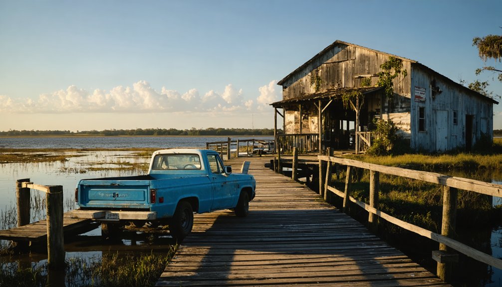
What Remains: Exploring Bayport Park and the Old Battery Site
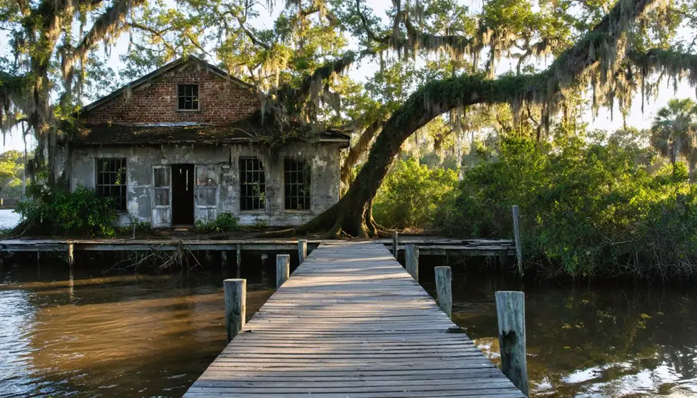
At the terminus of State Road 50, where the Weeki Wachee River dissolves into the Gulf of Mexico, Bayport Park‘s seven acres preserve what census records and battle reports couldn’t capture. You’ll find the 144-foot boardwalk overlooking waters that claimed three Confederate vessels in 1863—sunken ship investigations delayed the pier’s 2017 reconstruction when archaeologists discovered mid-19th century remains beneath the surface.
The fishing pier itself holds Florida Heritage Site designation, marking where Union blockades clashed with Confederate Home Guard. You’re free to explore unseen military relics through interpretive markers detailing the April 1863 battle. The old battery site remains accessible via nature trails connecting parking areas to coastal forest, where trampled terrain has since recovered, revealing landscape unchanged since settlement days predating the Civil War.
Cemetery Secrets: Stolen Headstones and Ancient Burial Grounds
Beyond the interpretive markers and archaeological discoveries at the waterfront, Bayport’s darkest chapter unfolded in its cemetery during the 1970s, when thieves systematically looted gravestones for quick cash. Desecrators pawned marble markers from abandoned graves, leaving only three headstones too heavy to steal. You’ll find stolen markers at the May-Stringer House museum in Brooksville, court-ordered there after recovery from a pawn shop.
Ground-penetrating radar now searches for unmarked burials on the May-Stringer property, where plantation owners once buried family members near their house as theft deterrent. The 1860 tax records document 56 enslaved people—their graves likely among the forgotten. Remaining bases mark where headstones once stood, including markers for William D. and Danish-born Marie Nissen. The curator plans memorial plaques for any discovered graves.
Archaeological Treasures: Uncovering Ships and Native American Cultures
Beneath Bayport’s modern pier lies a Confederate shipwreck that halted reconstruction efforts when discovered during underwater assessments. You’ll find this vessel preserved where it sank during the 1863 Battle of Bayport, when Union forces clashed with Confederate blockade runners in these shallow waters.
The Historic Hernando Preservation Society documents multiple wrecks through Official Records and Coastal Survey Reports, enabling precise battle reconstructions. Artifacts recovered include portholes and distinctive H-to-deck joints from steamers.
While native american settlements predated these Civil War engagements, the area’s strategic value transformed it into abandoned naval facilities after 1865. The $75,000 assessment protects these archaeological resources during pier reconstruction, keeping history submerged where salt water best preserves wooden hulls that once challenged federal blockades.
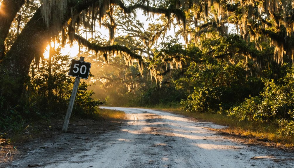
Your journey to Bayport begins where Highway 50 (Cortez Boulevard) meets Highway 19 at Weeki Wachee, following the westward route that once connected inland communities to this strategic port. Mapping Bayport’s boundaries reveals a townsite largely reclaimed by nature, where winding streets descend through hills toward coastal marsh.
The Southwest Florida Water Management District’s park marks the terminus—your gateway to exploration.
Evaluating accessibility challenges requires preparation:
- Overgrown streets barely discernible beneath vegetation demand careful navigation
- Dirt and gravel paths wind through remnants of early 20th-century dwellings
- Interactive satellite maps prove essential for locating barely-visible historical traces
- Limited infrastructure guarantees solitude but demands self-reliance
Document coordinates at 28°30’N 82°40’W. The boat ramp and park entrance provide access to what commercial interests couldn’t preserve—authentic wilderness history.
Coogler’s Beach and Other Nearby Points of Interest
The scattered remnants of Coogler’s Beach occupy a modest hill seven-tenths of a mile northwest of Bayport proper, where coordinates N28 33.195′, W82 39.014′ mark what classification systems identify as a hamlet—though precious little remains to justify even that designation. The Coogler family acquired this land after 1888, following the port’s decline.
One Theodore Coogler house still stands among winding streets descending toward marsh. Low-lying wetlands provide nearby wildlife habitats sheltering wading birds and manatees. Off the beaten path fishing spots line Mud Creek and the Weeki Wachee River confluence.
Bayport Park preserves Confederate battery earthworks and boiler tubes, while the cemetery’s weathered markers date to 1857. Pine Island Park and Rock Island offer additional exploration sites beyond these ghost town boundaries.
Making the Most of Your Visit: Combining Bayport With Regional Historic Sites
While Bayport’s Confederate earthworks and weathered cemetery markers anchor your exploration of this Gulf Coast ghost town, archival records reveal a broader network of abandoned settlements within a two-hour radius that share parallel narratives of boom-era optimism and precipitous decline.
Documentary evidence supports linking Bayport with Bulow Plantation Ruins’ crumbling sugar mill and Otter Creek’s forgotten structures. These sites demonstrate natural land restoration reclaiming failed settlements while creating ecotourism opportunities for independent travelers.
Strategic combinations include:
- Bulow’s 1830s plantation records documenting 193 enslaved workers before Second Seminole War destruction
- Cross Creek’s preserved steam locomotive from 1915 logging operations, donated 1969
- St. Francis Trail access through Ocala National Forest to scenic ghost town remnants
- Bayport Cemetery’s transported tombstones from unknown origins per H.C. Mickler documentation
You’ll discover freedom in landscapes where human ambition yielded to wilderness.
Frequently Asked Questions
Are There Any Restaurants or Facilities Available in Bayport Today?
You’ll find limited amenities available today in historic Bayport. The waterfront Bayport Inn offers local food options specializing in seafood and prime rib. Most nearby establishments aren’t open, so you’ll want to plan accordingly for your visit.
Is Swimming Allowed at Bayport Park or Coogler’s Beach?
Swimming’s permitted at your own risk at Bayport Park’s 1.5-acre historic site, though there aren’t lifeguards or designated swim areas. You’ll find no water quality monitoring or recreational facilities beyond the boat launch accessing Gulf waters—pure unregulated freedom.
What Are the Operating Hours for Bayport Park?
Bayport Park operates 24 hours daily year-round, granting you unrestricted access without seasonal schedule variations. Historical records confirm continuous park hours for boat launches, fishing piers, and trails, though you’ll find conflicting documentation suggesting daytime-only facility operations.
Do I Need Permits to Visit the Cemetery or Burial Mound?
You’ll absolutely love this: no permits needed! Florida’s easement laws guarantee your freedom to visit. The historical significance of cemetery sites and local regulations regarding burial mounds protect access rights while preserving these invaluable documentary records for all descendants.
Are There Guided Tours Available for the Ghost Town?
No guided tours operate in Bayport’s ghost town. You’ll explore independently, discovering the historical significance of ghost town remnants and local legends surrounding ghost town mysteries yourself—experiencing authentic freedom to uncover preserved sites at your own pace.