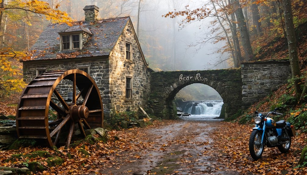
Start your ghost town adventure at Landrus, site of the world’s first electric coal mine, by parking at coordinates 41.641848, -77.207233 along narrow Landrus Road. You’ll find a 1994 commemorative plaque marking the 1882-1915 village before following red blazes on the 1.8-mile trail. Download offline maps since cell service disappears completely in this remote terrain. Winter requires tire chains for unmaintained roads. Nearby abandoned settlements like Centralia, Rausch Gap, and Concrete City offer additional exploration opportunities that reveal Pennsylvania’s forgotten industrial past.
Key Takeaways
- Navigate to trailhead parking at coordinates 41.641848, -77.207233 on Landrus Road; winter access requires chains or winter tires.
- Hike the 1.8-mile red-blazed Bear Run Trail to explore Landrus ghost town foundations and the world’s first electric coal mine.
- Download offline maps before arrival, as cell service is nonexistent in remote Tioga State Forest ghost town areas.
- Extend your trip to nearby abandoned sites including Centralia, Rausch Gap, and Concrete City for additional ghost town exploration.
- Visit during winter for frozen waterfall spectacles, but expect hazardous conditions on unmaintained roads and icy trails.
The Rise and Fall of Landrus: Pennsylvania’s First Electric Coal Mine
When the Arnot and Pine Creek Railroad punched through to Hoytville in 1882, it opened a forested valley that would soon witness a pioneering chapter in American mining history. You’ll find Landrus emerged around Babb’s Creek, where Henry J. Landrus managed operations for Blossburg Coal Mining and Railroad Company.
By 1888, Bear Run Mine opened with 272 men extracting coal from the “B” and “C” veins. What made this site remarkable was its innovative mining equipment—the world’s first electric-powered coal mine featured a 60-horsepower locomotive hauling cars through underground passages. Advanced processing capabilities enabled 625 tons daily output by 1891, totaling 86,871 tons in 1894. At its peak in 1890, the village had 644 residents.
Yet strikes, depression, and Clearfield County‘s cheaper operations doomed these operations. Between 1910 and 1915, Landrus vanished completely. The name Landrus now appears on disambiguation pages that help direct researchers to information about the mining community versus other uses of the term.
Accessing Bear Run Trail and the Landrus Ghost Town Site
The journey to Bear Run Trail begins along Landrus Road in Tioga State Forest‘s eastern section, where coordinates 41.641848, -77.207233 mark a small turnout serving as trailhead parking. You’ll navigate a skinny mountainside road featuring steep drop-offs and vehicle turnouts. Cell service limitations near trailhead extend for miles, requiring self-reliance.
Remote trailhead parking sits at precise coordinates along narrow Landrus Road, where mountain drop-offs and absent cell service demand careful preparation and self-sufficiency.
Trail conditions in winter demand winter tires or chains due to unmaintained roads. Consider these access factors:
- The parking area features a 1994 stone plaque commemorating Landrus Village (1882-1915), site of the world’s first electric coal mine
- Red blazes mark the 1.8-mile out-and-back route starting directly from Landrus Road
- Dogs are permitted on-leash throughout this historic terrain
The trailhead sits near Arnot and Wellsboro, providing direct access to both natural waterfalls and mining town remnants. Despite the trail being well established, blazes are infrequent along the route, so hikers should pay careful attention to markings. The trail traverses pristine forest that provides opportunities to observe various plant species and diverse forest habitats.
Other Abandoned Towns Near Bear Run Worth Exploring
Pennsylvania’s anthracite coal region harbors dozens of abandoned mining settlements within a 50-mile radius of Bear Run, each preserving distinct chapters of industrial decline. Aristes stands north of Bear Run with decaying industrial infrastructure documenting Schuylkill County’s extraction economy.
Centralia, four miles west of Ashland, remains accessible despite its underground fire burning since 1961—only five structures survived from a community of thousands. Rausch Gap, established in 1828 near the Appalachian Trail, features documented foundations and a cemetery from its thousand-resident peak before 1910 abandonment.
Revelton presents hazardous terrain dangers along Tangascootac Creek, where unmarked hand-dug wells threaten explorers examining 1850s German, Scotch, and English immigrant settlements. Concrete City in Luzerne County features 20 abandoned duplexes constructed as company housing for DL&W Railroad workers in the early 20th century. The Ghost Town Trail in Indiana County provides access to several abandoned coal mining towns for historical exploration. These sites offer unrestricted documentation opportunities for those accepting responsibility for traversing Pennsylvania’s most challenging historical landscapes.
What Remains: Foundations, Cemeteries, and Historical Artifacts
Amid the forested slopes and creek valleys surrounding Bear Run, tangible remnants of industrial abandonment persist in varying states of decay and accessibility. You’ll discover foundations from Sidney and Lochvale near mine portals, while industrial contamination effects remain visible through acid mine drainage scarring the west branch. The underground fire at Laurel Run has burned since 1915, contaminating the cemetery above.
Industrial ruins emerge through Pennsylvania woodland—mine portals, acid-scarred streams, and a century-old underground fire still burning beneath forgotten graves.
Three primary artifact categories await exploration:
- Mine infrastructure: Room-and-pillar workings mapped west of Lochvale, abandoned Superior #3 portal, and sealed entries
- Immigrant burial grounds: Fall Brook’s scarlet fever victims, Revelton’s unmarked German and Scotch graves, Alvira’s six cemeteries
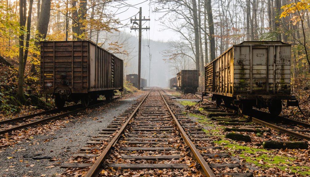
- Industrial remnants: Railroad grades, rusted furnace components, oil well casings, concrete bunkers
At Revelton, only crumbling foundations and an impressive furnace stack survive after forest fires erased most traces of the once-prosperous mining town. Near Sidney, the #2 Drift mine features extensive room-and-pillar workings where mules once hauled coal through horizontal mine entrances. You’ll find authenticity in these unrestored sites.
Planning Your Tioga State Forest Ghost Town Adventure
Before venturing into Tioga State Forest‘s abandoned mining settlements, you’ll need to reconcile your expectations with the reality of unmarked trailheads and deteriorating infrastructure. Enter via River Road near Fall Brook Cemetery, where Scottish immigrants’ 1881 tombstones document historic mining disputes that mirrored Morris Run’s Civil War veteran evictions.
Park along Landrus Road for ghost town explorations, following GPS to Anna S. Mine Vista’s panoramic views. The Haunted Mine Trail begins at an overgrown stone wall off Route 287, leading to 400-foot cascades and bucket tram ruins. Download offline maps—cell service vanishes here. Verifying the user’s connection becomes impossible in these remote areas, where digital navigation tools fail completely.
In addition to immersing yourself in history, there are numerous ghost towns to explore in Pennsylvania that offer unique stories and haunting remnants of the past. Each site reveals layers of local lore, from abandoned buildings to eerie landscapes that evoke a sense of nostalgia and curiosity. Make sure to pack your camera, as the haunting beauty of these forgotten places makes for stunning photographs and unforgettable memories.
Winter transforms northern waterfalls into frozen spectacles, though treacherous ice complicates navigation. These sites predate European settlement; native american folklore infuses the landscape, layering centuries of human occupation beneath Pennsylvania’s coal-extraction history. At its peak, Fall Brook’s population reached 2,500 residents, supported by two schools, three churches, and a hotel before the coal played out and the entire borough vanished.
Frequently Asked Questions
Are There Camping Facilities Near the Bear Run Ghost Town Sites?
You’ll find camping availability at Bear Run Nature Reserve’s five backcountry sites, located 1-2.1 miles from ghost town trails. Nearby accommodation options include Bear Run Campground in Portersville, offering modern amenities sixty miles northwest for your adventure base.
Do I Need Permits to Explore Landrus Ruins in Tioga State Forest?
You don’t need permits for hiking Tioga State Forest’s ruins, but respect private landowner permissions near boundaries. Historical preservation concerns mean you shouldn’t disturb artifacts. The forest spans 161,890 acres, offering unrestricted exploration beyond standard camping regulations.
What Wildlife Might I Encounter While Hiking to the Ghost Towns?
You’ll likely encounter white-tailed deer, black bears, and bobcats in wooded areas. Red-tailed hawks hunt overhead while meadow voles scurry through grasslands. Fisher, river otters, copperheads, and timber rattlesnakes also inhabit these historically significant forest corridors.
Are Guided Tours Available for Bear Run Area Ghost Towns?
No guided tours exist for Bear Run’s ghost towns—you’ll explore independently using trail maps and occasional interpretive signs. The reserve’s 28 miles of rugged trails offer freedom to discover historic mining and logging remnants at your own pace.
Can I Metal Detect or Collect Artifacts From the Sites?
No, you can’t metal detect or collect artifacts—even from seemingly abandoned sites. Prohibited areas include state forests and federal lands, while private property concerns demand explicit owner permission, plus violations risk $10,000 fines under archaeological protection laws.
References
- https://centralpahistory.blogspot.com/2021/02/revelton-ghost-town-clinton-county.html
- https://en.wikipedia.org/wiki/List_of_ghost_towns_in_Pennsylvania
- https://uncoveringpa.com/ghost-towns-in-pa
- https://www.youtube.com/watch?v=_u5MUuwynhw
- https://en.wikipedia.org/wiki/Landrus
- https://ironequine.com/history-bits/history-of-sidney-keal-run-lochvale-pennsylvania/
- https://joycetice.com/1897/ch52.htm
- http://amrclearinghouse.org/Sub/SCARLIFTReports/BabbCreek/GeologyMining.pdf
- https://www.youtube.com/watch?v=DNDxMQYC-Qo
- https://archive.org/download/historicalsketch00unse_18/historicalsketch00unse_18.pdf


