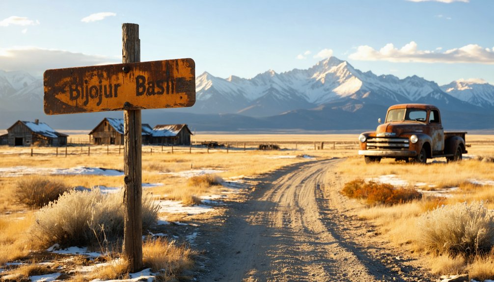
You’ll find Bijou Basin at coordinates 39.1234°N, 104.4602°W, accessible via Peyton Highway from Highway 24—just follow the pavement until it turns to dirt. This haunting ghost town, established in 1860, thrived with a post office, school, and cheese factory until the catastrophic 1935 Memorial Day flood destroyed everything. Today, you can explore Fremont’s Fort geological formations, the cone-shaped Breathing Butte, and scattered ranch remnants at 6,398 feet elevation. The complete story of what happened here reveals why eighteen lives were lost in just four hours.
Key Takeaways
- Access Bijou Basin by turning left from Highway 24 onto Peyton Highway, continuing past pavement’s end onto dirt roads.
- The ghost town site sits at 6,398 feet elevation near Peyton and Falcon, with coordinates 39.1234°N, 104.4602°W.
- Explore Fremont’s Fort geological formation and Breathing Butte, a cone-shaped hill with unusual pulsating rock.
- The 1935 Memorial Day flood destroyed 70 homes and killed 18 people, ultimately abandoning the settlement.
- Historical remnants include old trails and ranch structures from the 1860s settlement and 19th-century cheese factory era.
Getting to Bijou Basin: Coordinates and Access Routes

Several centuries of Colorado history converge in Bijou Basin, a high-plains depression cradled between pine-dotted bluffs approximately seven miles north of Peyton in El Paso County. You’ll find the extinct town site at 39.1234°N, 104.4602°W, while the basin center rests at 39.1622116°N, -104.4241331°W at 6,398 feet elevation.
Your primary access route details begin at Highway 24—turn left onto Peyton Highway and head north. The pavement ends where Peyton Highway curves sharply right at Steeplechase Drive, transforming into dirt road that cuts through the basin’s heart.
For directions to basin location variations, you can loop back south or continue until the road dead-ends at an old homestead, then bear left to reach Elbert Road, completing a circuit that reveals the basin’s full character.
The Story Behind the Name: John Fremont’s 1840s Expeditions
Long before Bijou Basin earned its cryptic French name, John Charles Frémont carved exploration routes through this very terrain during his legendary 1840s expeditions. You’re standing where the original Pathfinder himself trekked through Colorado’s untamed wilderness, mapping routes that would liberate thousands from eastern constraints.
Fremont’s Rocky Mountain mapping transformed abstract territory into navigable reality. His 1842 journey through the Platte Valley and subsequent 1843-1844 expedition departing Westport Landing placed these wild spaces onto paper for the first time. Working for the US Topographical Engineers, Fremont’s role as pathfinder wasn’t mere romantic notion—his meticulous reports guided Mormon pioneers and gold-seekers westward. When you visit Bijou Basin today, you’re tracing paths he mapped, following footsteps that opened an entire continent.
Early Settlement and the Post Office Era (1860-1907)
When Lewis Haden and the Holden brothers—D.M. and Steven—stepped onto Bijou Basin’s windswept grasslands in 1860, they became the first documented settlers to stake claims in this remote valley where East and West Bijou Creeks carved through the prairie. Within years, fellow pioneers like Jim Johnson, Dan Maxon, and blacksmith Peterfish transformed the basin into a self-reliant outpost seventy miles from Denver’s constraints.
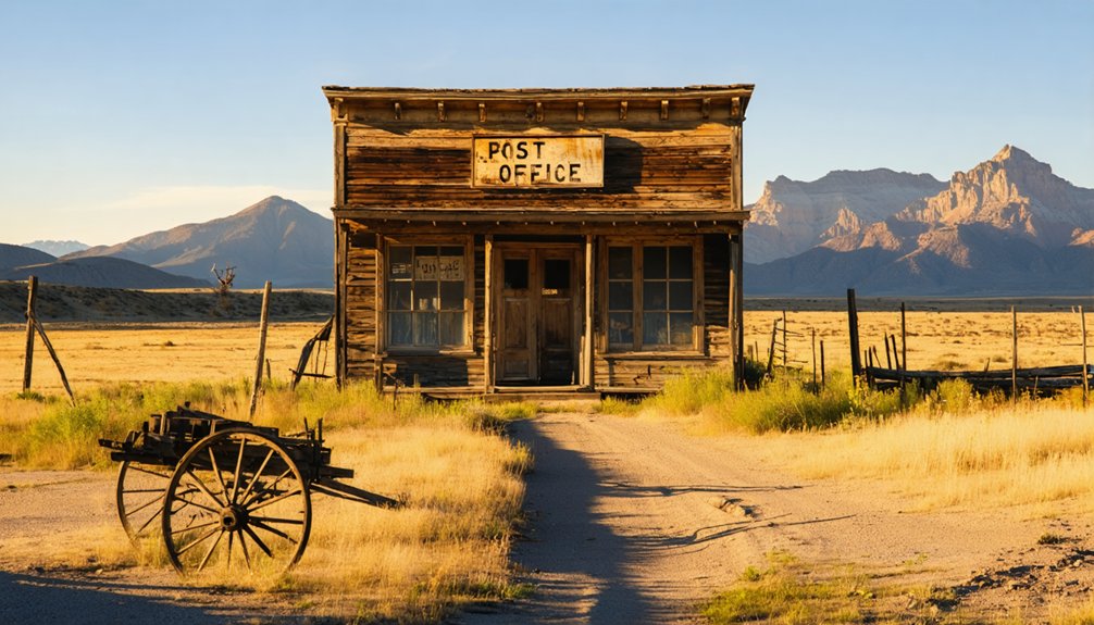
You’d have found community institutions flourishing by 1869, when D.M. Holden became postmaster. A log schoolhouse rose in 1874, while a cheese factory, tavern, and blacksmith shop served families running agricultural operations—raising livestock, cultivating vegetables, and ordering thousand-pound flour shipments.
For forty-eight years, Bijou Basin thrived through determination alone. Then the railroads bypassed it, spawning Falcon and Peyton nearby. The post office closed March 30, 1907, and settlers scattered toward easier lives.
Dramatic Moments in Bijou Basin History
Before ordinary hardships of drought and isolation could define Bijou Basin, extraordinary violence shaped its earliest chapters. You’ll discover settler conflicts that turned this prairie into contested ground—like the Hungate Massacre of 1864, where attackers killed an entire family on Running Creek. Their bodies reached Denver, publicly displayed to inflame territorial tensions.
Native American encounters weren’t always fatal but carried constant danger. Daniel Alexander survived discovery by Arapaho Indians near station 25 after his brothers perished within days of arrival. Even John Fremont’s scouts faced ambush at what became Fremont’s Fort, forcing one man to trek sixty miles through darkness for rescue.
These violent episodes reveal the basin’s blood-soaked foundation—freedom’s price measured in graves dotting endless grassland.
What Remains: Exploring the Ghost Town Site Today
When you navigate the sharp right onto Steeplechase Drive, pavement gives way to dirt as you enter the basin where a thriving settlement once stood at 6,400 feet.
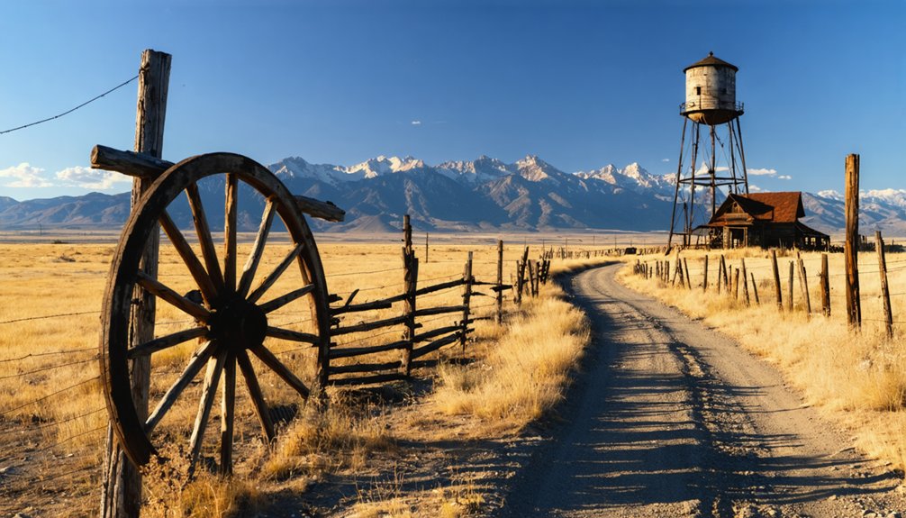
Scattered newer houses dot the western hillside above weathered ranch homes and the occasional old homestead structure—fragile echoes of the community that operated a post office, school, and cheese factory before 1907.
The most dramatic remnant rises on the eastern side: Fremont’s Fort, a commanding geologic formation that towers over the ghost town site just as it did when Kit Carson and Chief Black Kettle passed through this landscape.
Physical Remnants and Landmarks
Standing at coordinates 39°08′08″N 104°27′25″W in El Paso County, you’ll find precious little remains of Bijou Basin’s once-thriving community. The ghost town’s elevation of 6,398 feet marks where schools, taverns, and a cheese factory once buzzed with frontier life from 1869 to 1907.
The history of bijou basin ghost town is rich with stories of resilience and hardship. Despite its decline, remnants of old structures still whisper tales of the past, inviting adventurous souls to explore. As you wander through the dusty remnants, it’s easy to imagine the lively gatherings that once took place in this now-desolate landscape.
You’ll spot Fremont’s Fort, a striking rocky outcrop that commanded the eastern landscape. The geology of Breathing Butte delivers something extraordinary—a cone-shaped hill where the top rock once pulsated at half-minute intervals, driven by subterranean water flows below.
Search carefully for dirt mounds marking old trail paths, though buffalo herds trampled much evidence into obscurity. The remnants of blacksmith shop operations and other settlement structures have largely vanished, leaving only whispers of ranching days across this windswept basin.
Accessing the Historic Site
How do you reach a place that’s barely more than memory and windswept prairie? You’ll navigate seven miles north of Peyton through El Paso County’s open terrain, following coordinates 39°07′24″N 104°27′37″W into East Central Colorado’s broad valley. The route demands self-reliance—there aren’t visitor facilities or marked trails leading you there.
What you’ll find is absence itself: scattered traces where the 1935 Memorial Day flood erased buildings, the train station, and settlement dreams. East and West Bijou Creeks still carve through the basin where ranchers once prospered.
Before venturing out, consider visiting local museums in nearby communities for historical context. The surrounding landscape offers nearby hiking trails through similar terrain. You’re exploring what remains when civilization retreats—just wind, creek water, and stories preserved in county heritage collections.
The Memorial Day Flood of 1935: Destruction and Abandonment
The drought-stricken landscape of Bijou Basin had no chance against the deluge that arrived on Memorial Day 1935. Twelve inches of rain hammered down in four hours, transforming West Bijou Creek into a wall of water that swept through the Welker Ranch. The flood buried hay fields under four feet of sand, ripped away bedrooms, and deposited debris to the ceiling.
You’ll understand why families abandoned this place when you learn every bridge washed out and 275 residents needed emergency shelter. The economic impact devastated the region—over $1.7 million in damages, eighteen lives lost, and seventy homes destroyed. Resettlement challenges proved insurmountable for most. The basin became a ghost of its former self, forever marked by nature’s fury.
Life in a 19th Century Ranching and Railroad Town
Long before the catastrophic flood erased this settlement from Colorado’s maps, Bijou Basin thrived as a frontier crossroads where fur trappers, ranchers, and railroad ambitions collided on the eastern plains.
You’d have witnessed economic diversification firsthand—cheese wheels rolling from the factory toward distant markets, cattlemen driving herds across dryland wheat fields, blacksmiths hammering iron beside irrigated benchlands fed by ambitious ditch systems. The 1874 schoolhouse echoed with children’s voices while their parents built something independent and enduring.
Social dynamics centered on self-reliance: the tavern served as informal courthouse, the post office connected isolated homesteads to civilization beyond the horizon. Kit Carson’s expeditions had mapped these routes decades earlier, but you settlers transformed untamed grasslands into productive rangeland, proving freedom-seekers could forge communities where bison once thundered and Cheyenne camps dotted the basin.
Nearby Attractions: Eastonville and Historical Sites
Just twenty miles northeast of Bijou Basin’s vanished streets, Eastonville’s surviving remnants offer you tangible proof that not every frontier settlement disappeared completely into Colorado’s unforgiving plains. You’ll find the 1880s Presbyterian church still anchoring the landscape, now repurposed as a community gathering space.
The active cemetery holds over 500 souls who gambled everything on this “Potato Capital of the World.” An abandoned Cog Railway car rusts along the old Colorado & Southern railbed, while nearby equipment rentals serve today’s equestrian community that’s claimed this territory.
Historical reenactment events occasionally breathe life into these grounds, letting you witness what pioneer determination looked like before drought, blight, and economic collapse forced settlers to literally dismantle their dreams and haul them elsewhere.
Essential Tips for Your Ghost Town Adventure
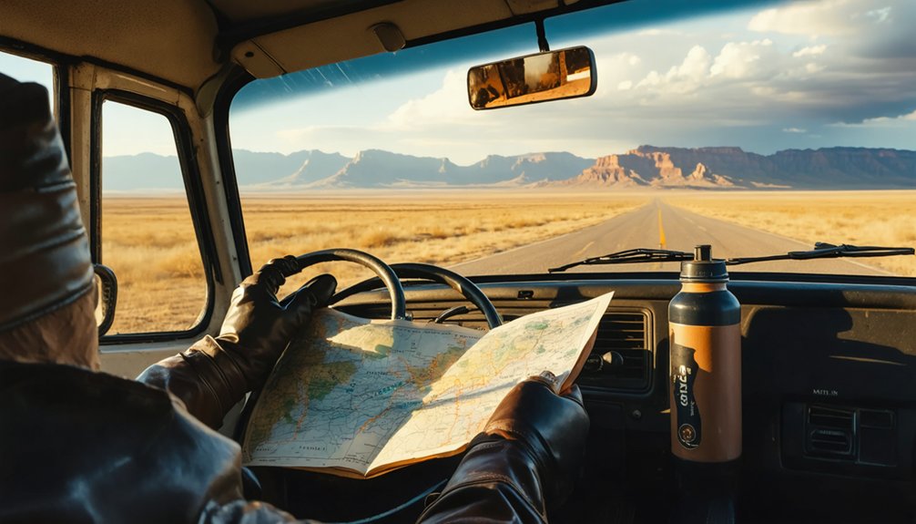
Before you point your vehicle toward Bijou Basin’s windswept emptiness, you’ll need to prepare for Colorado’s eastern plains—a landscape where the nearest gas station might be forty miles behind you and cell towers exist only as distant memories.
Off road vehicle readiness starts with high-clearance capabilities and a basic repair kit stashed in your trunk. Download offline maps before leaving civilization, and pack paper backups for when technology fails you completely.
Remote camping considerations demand careful planning: load extra water for desert-like stretches, fuel up in the last real town, and share your route with someone who’ll notice if you don’t return. Pack layers for dramatic temperature swings and carry cash—these forgotten places don’t accept cards. Weather changes rapidly out here, so check forecasts and respect nature’s warnings.
Frequently Asked Questions
Are There Any Camping Facilities Near Bijou Basin for Overnight Stays?
Nearby campgrounds are limited around Bijou Basin, but you’ll find primitive camping options in surrounding public lands. Colorado Springs and Peyton offer established facilities, though dispersed camping on BLM land provides the freedom you’re seeking.
What Wildlife Might Visitors Encounter in the Bijou Basin Area?
Like Thoreau’s wild wanderings, you’ll encounter elk roaming ridges, mule deer in grasslands, and diverse bird species soaring overhead. Bighorn sheep navigate granite outcrops while wildflower blooms attract monarchs and bees through untamed basin landscapes.
Is Four-Wheel Drive Necessary to Reach the Ghost Town Site?
No, you won’t need four-wheel drive to explore this ghost town. The road conditions shift to dirt at Steeplechase Drive, but access requirements remain minimal—your standard vehicle handles the route just fine during summer and fall.
Are There Any Guided Tours Available for Bijou Basin History?
Looking for structured experiences? You won’t find guided tours of historic mining sites here. Instead, you’ll discover pure opportunities to explore abandoned structures independently—just you, open prairie, and forgotten remnants calling adventurous souls forward.
What Is the Best Season to Visit Bijou Basin Ghost Town?
You’ll find spring through fall ideal for exploring Bijou Basin’s ruins. May brings wildflower blooms across prairie grasslands, while September offers stunning autumn foliage. Summer provides unrestricted access, though you’ll escape crowds during shoulder seasons.


