Bismuth, South Dakota, is a forgotten Black Hills ghost town that’s been quietly fading since its early 1900s boom days. You’ll find gaping mine shafts, waste rock piles, and crumbling remnants of a feldspar mining operation buried among the ponderosa pines of Custer County. There’s even a Forest Service campground and a picnic area beside a manmade lake if you want to linger. Keep exploring, and you’ll uncover everything you need to plan your trip.
Key Takeaways
- Bismuth, established around 1901 in Custer County, South Dakota, is one of over 600 ghost towns in the Black Hills region.
- Use GPS coordinates (Latitude N 43° 51′ 00″, Longitude W 103° 23′ 50″) for accurate navigation to this remote Black Hills destination.
- Summer (June–August) is the best time to visit, offering dry trails, reliable road access, and long daylight hours for exploration.
- The site features a Forest Service campground, picnic area, and manmade lake, providing ideal overnight and rest stops during your road trip.
- Visible mine shafts, waste rock piles, and crumbling foundations reward curious explorers seeking authentic connections to Black Hills boom-era history.
What Was Bismuth, South Dakota?
Tucked into the Black Hills of South Dakota, Bismuth was a small community that sprang to life around 1901. Its historical significance lies in its role during the region’s boom-and-bust era, when dozens of similar settlements rose and fell across the Hills.
At its peak, Bismuth featured just a handful of houses, a store, and even a local baseball team. That community evolution never went far, though — the town remained modest, never expanding beyond about a half dozen homes before fading into history.
Today, Bismuth is one of over 600 ghost towns scattered across the Black Hills. If you’re drawn to places where freedom meets forgotten history, Bismuth offers a compelling glimpse into the rugged, fleeting ambitions of early South Dakota settlers.
How to Get to Bismuth: GPS Coordinates and Directions
To reach Bismuth, plug these GPS coordinates into your device: Latitude N 43° 51′ 00″ (43.8500) and Longitude W 103° 23′ 50″ (-103.3975), with UTM 13N 628803 4856461 as a backup reference.
You’ll find the site in Custer County, South Dakota, accessible via Black Hills ATV trails that wind through the surrounding region.
Once you’re close, look for the Forest Service Picnic Ground and the manmade lake, which now mark the spot where Bismuth’s handful of homes and stores once stood.
GPS Coordinates For Bismuth
Planning your route to Bismuth starts with locking in these coordinates: Latitude N 43° 51′ 00″ (decimal 43.8500) and Longitude W 103° 23′ 50″ (decimal -103.3975).
For GPS navigation, you can also use W 103° 23′ 850″ or the UTM reference 13N 628803 4856461. Bismuth sits in Custer County, South Dakota, deep within the Black Hills region.
Punching these coordinates into your device connects you to a site carrying real historical significance — one of over 600 ghost towns scattered across the Black Hills.
Once a small community with homes, a store, and even a baseball team, Bismuth now hosts a campground and manmade lake.
Having exact coordinates means you won’t miss it, because nothing marks this forgotten town from the road.
Driving Directions To Bismuth
Reaching Bismuth means traversing the winding roads of Custer County, South Dakota, where the Black Hills terrain shifts between dense ponderosa pine forests and open ridgelines.
Use these coordinates to navigate your Black Hills exploration confidently:
- GPS Coordinates: N 43°51.000′ / W 103°23.850′
- UTM Reference: 13N 628803 4856461
- Decimal Degrees: Latitude 43.8500 / Longitude -103.3975
Plug these into your GPS device before hitting the trail. The site’s campground and Forest Service Picnic Ground serve as reliable landmarks once you’re close.
Because no visible structures remain, you’ll rely heavily on coordinates to locate this piece of ghost town history. Cell service can be spotty, so download offline maps before you leave.
Nearby Landmarks And Access
Once you’ve locked in your GPS coordinates, knowing what’s around Bismuth helps you navigate the final stretch with confidence. The site sits in Custer County, placing you squarely within the Peter Norbeck Preserve, established in 1920 and named after the influential politician.
This preserve carries real historical significance, connecting Bismuth’s ghost town story to the broader Black Hills boom-and-bust era.
You’ll find a Forest Service Picnic Ground and campground on-site, making overnight stays or midday breaks straightforward. The manmade lake offers a natural gathering point where local wildlife frequently appears, rewarding patient observers.
Black Hills ATV trails also intersect this area, giving you flexible access from multiple directions. Use UTM 13N 628803 4856461 or GPS coordinates N 43 51.000, W 103 23.850 to pinpoint your arrival precisely.
What’s Left at the Bismuth Ghost Town Site Today?
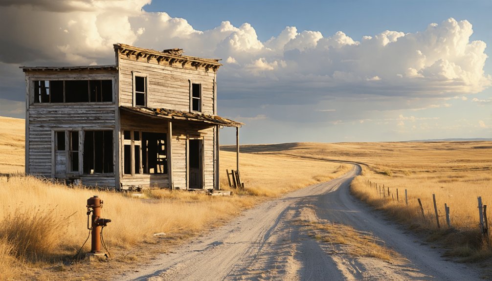
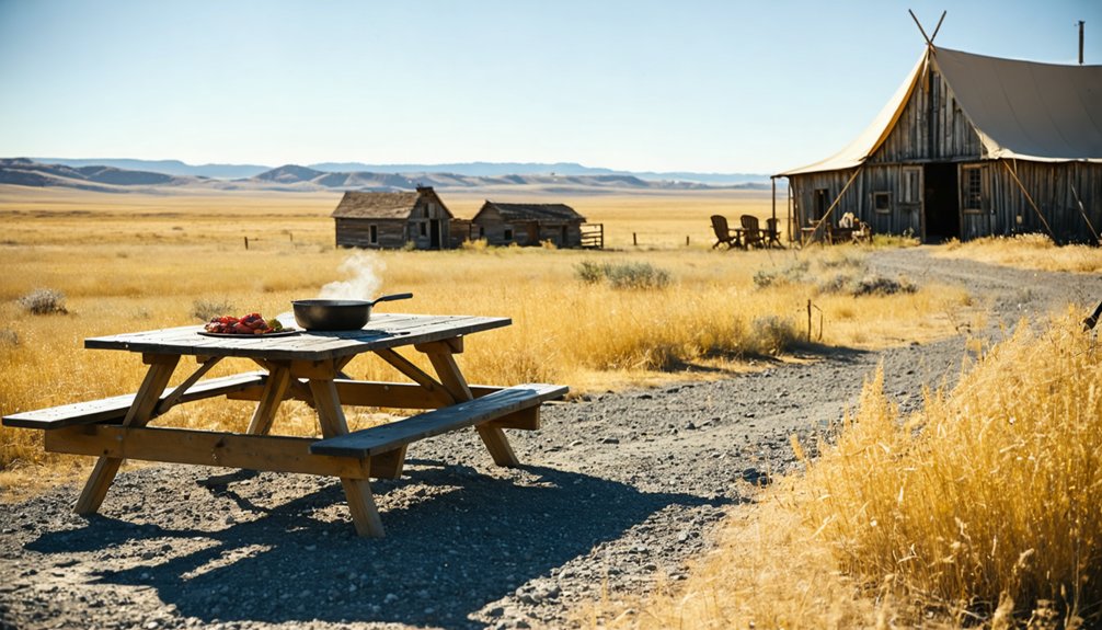
When you arrive at the Bismuth site today, you won’t find a single standing structure from the original settlement. The town’s gone, but you’ll discover a campground, a manmade lake, and a Forest Service Picnic Ground in its place.
A mine structure documented in 1974 hints at Bismuth’s industrial past, though whether it served as a working feldspar mine or a tourist attraction remains uncertain.
No Structures Remain
Although Bismuth once buzzed with homes, a store, and even a baseball team, you won’t find a single standing structure when you visit today. Time and nature have reclaimed everything, leaving behind only the land’s quiet historical significance for ghost town exploration enthusiasts like you.
Here’s what you’ll discover on-site instead:
- A campground — pitch your tent and sleep where settlers once built their lives
- A manmade lake — offering peaceful recreation amid the ghost town’s forgotten footprint
- A Forest Service Picnic Ground — a perfect rest stop during your Black Hills adventure
Don’t let the absence of buildings discourage you. The open landscape carries its own story, inviting you to imagine what once stood there and why it disappeared.
Campground And Lake
What greets you at Bismuth today isn’t a ghost town frozen in time — it’s a living recreational space that has quietly taken root where settlers once built their community. A manmade lake now reflects the pines, and a Forest Service picnic ground invites you to pause.
If you’re planning an overnight stay, the campground gives you a solid base for exploring the broader Black Hills region.
For lake activities, you’ll find quiet waters ideal for relaxing after miles on the trail. Keep your camping tips practical — arrive early to secure a good spot, pack out everything you bring in, and respect the land’s history.
Bismuth may be gone, but the site rewards those who show up with curiosity and a willingness to slow down.
Mine Remnants Documented
Beyond the campground and lake, scattered evidence of Bismuth’s industrial past still clings to the landscape. This ghost town’s mine history remains partially visible, giving you a real connection to the Black Hills boom era.
Researchers documented a mine structure here in 1974, possibly a feldspar operation, though nobody’s certain whether it was ever fully operational.
Here’s what you might encounter on-site:
- Gaping mine shafts dropping into darkness beneath the hillside
- Waste rock piles marking where miners once extracted minerals
- A documented mine structure captured in 1974 photographs
Approach these remnants carefully. Abandoned shafts demand respect.
You’re standing where workers once carved their livelihoods from the earth, making Bismuth’s ghost town mine history genuinely worth exploring.
What the Old Feldspar Mine Site Looks Like Now
Today, the old feldspar mine site at Bismuth looks nothing like the bustling little community it once was. No structures remain standing, and the landscape has transformed entirely.
You’ll find a campground, a manmade lake, and a Forest Service Picnic Ground where homes and a store once stood.
Yet beneath this peaceful surface, ghost town legends live on. Gaping mine shafts and scattered waste piles still hint at the feldspar history buried here, reminding you that people once worked this land hard.
Gaping mine shafts and waste piles remain, whispering of the hard feldspar work that once defined Bismuth.
The Black Hills boom era left its mark, even if nature has quietly reclaimed most of it.
Bring your GPS coordinates, explore freely, and let the silence tell its own story about what Bismuth once was.
Where to Camp and Eat Lunch Around Bismuth
Luckily, you won’t need to drive far after exploring Bismuth’s ghostly remnants, because the site itself offers real camping and picnic options.
The Forest Service developed this land into a functional outdoor destination, giving you everything you need to stay awhile.
Here are three practical camping tips and picnic spots to maximize your visit:
- Set up camp at the on-site campground, tucked within the Black Hills’ ponderosa pines.
- Eat lunch at the Forest Service Picnic Ground, where shaded tables sit beside a manmade lake.
- Spend the afternoon fishing or relaxing at the lake before heading deeper into ghost town country.
You’re not just passing through Bismuth — you’re actually living the freedom of Black Hills exploration.
Other Black Hills Ghost Towns Near Bismuth
Once you’ve finished exploring Bismuth, the Black Hills opens up an entire network of ghost towns worth chasing — over 600 of them, scattered across Custer County and beyond.
Each site carries its own historical significance, telling the raw story of boom-and-bust mining culture that shaped this region. Ghost town exploration here rewards curiosity — you’ll stumble across gaping mine shafts, crumbling foundations, and weathered waste piles that no museum can replicate.
Watson Parker’s research gives you a solid starting point for identifying which towns deserve your time. The Peter Norbeck Preserve, established in 1920, also anchors the surrounding landscape, connecting history to wilderness.
Pack your GPS coordinates, load your route, and let the Black Hills reveal its forgotten communities on your own terms.
Road Conditions and Best Time to Visit Bismuth
Most of the roads leading into Bismuth run through Black Hills ATV trail networks, so your vehicle choice matters before you commit to the route.
Seasonal weather shapes road safety dramatically here, so plan accordingly:
Seasonal weather can make or break your trip to Bismuth — always check conditions before you hit the trail.
- Summer (June–August) offers the most reliable access, with dry trails and long daylight hours perfect for exploration.
- Spring and fall bring unpredictable mud and early snow, which can turn forest roads into slick, impassable routes fast.
- Winter visits are strongly discouraged unless you’re equipped for deep snow and near-zero temperatures.
You’ll want high clearance, solid tires, and a downloaded GPS coordinate before heading out.
The campground and Forest Service Picnic Ground give you flexible stopping points, making overnight trips both practical and rewarding.
Frequently Asked Questions
Was Bismuth Ever Officially Incorporated as a Town in South Dakota?
There’s no record showing Bismuth was ever officially incorporated. It’s part of South Dakota ghost towns history, emerging around 1901 as a small Bismuth history community with just a few homes, a store, and a baseball team.
How Many People Lived in Bismuth at Its Peak Population?
You won’t find exact peak population figures in Bismuth’s history, but mining impact kept it small — just a handful of families in a few dozen homes, embodying the Black Hills’ boom-and-bust spirit you’d love exploring.
Are There Any Photographs of Bismuth From Its Early 1900S Days?
Wouldn’t it be amazing to glimpse Bismuth’s past? Unfortunately, no known photographs of early settlers or historic landmarks from the early 1900s days have surfaced, leaving you to imagine this once-bustling community’s vibrant beginnings.
Who Owns the Land Where Bismuth Ghost Town Once Stood?
The Forest Service owns the land where Bismuth’s historical significance lives on. You’ll find its land ownership transformed into a campground and picnic ground, letting you freely explore this once-bustling ghost town’s fascinating past.
Did Bismuth Have a Post Office During Its Years of Operation?
The knowledge doesn’t confirm Bismuth’s postal history, but you’ll find the town’s amenities included a store and baseball team. It’s a small, freedom-loving community that thrived briefly during the Black Hills’ exciting boom era.
References
- https://kids.kiddle.co/Bismuth
- https://explore.digitalsd.org/digital/collection/WPGhosttown/id/773/
- https://www.loquis.com/en/loquis/6583314/Bismuth+South+Dakota
- https://blackhillsatvdestinations.com/bismuth-ghost-town/
- https://www.youtube.com/watch?v=ixU9RtyCThg&vl=ar
- https://www.sdhspress.com/journal/south-dakota-history-2-2/some-black-hills-ghost-towns-and-their-origins/vol-02-no-2-some-black-hills-ghost-towns-and-their-origins.pdf
- https://en.wikipedia.org/wiki/List_of_ghost_towns_in_South_Dakota


