You’ll need to navigate by landmarks rather than signs when visiting Blakeman’s townsite, located where Middle and North Beaver Creeks converge near Atwood in Rawlins County. The railroad depot, post office, and commercial buildings that briefly existed in the 1880s disappeared completely when W.E. Thompson plowed the failed town under in 1910. Today, you’ll find only cropland covering the former street grid, with no archaeological traces remaining. The junction of creeks marks where ambitious speculators once challenged Atwood for county seat supremacy before their entire town literally rolled back east. Discovering what happened here reveals fascinating insights into railroad-era rivalries.
Key Takeaways
- Blakeman is now completely agricultural land with no buildings, structures, or archaeological remains visible at the former townsite.
- The junction of Middle and North Beaver Creeks marks the historical location where the town briefly existed from 1886.
- No railroad infrastructure remains after the last train passed in 2015, ending 128 years of service on the route.
- W.E. Thompson plowed under the entire townsite in 1910, erasing all traces of commercial buildings and the depot.
- Expect only farmland and crops where Blakeman once stood as a competing town to Atwood, Kansas.
The Rise and Fall of a Railroad Town
When the Burlington and Missouri River Railroad punched its tracks north of Atwood in 1886, the competing visions of two towns collided on the Kansas prairie.
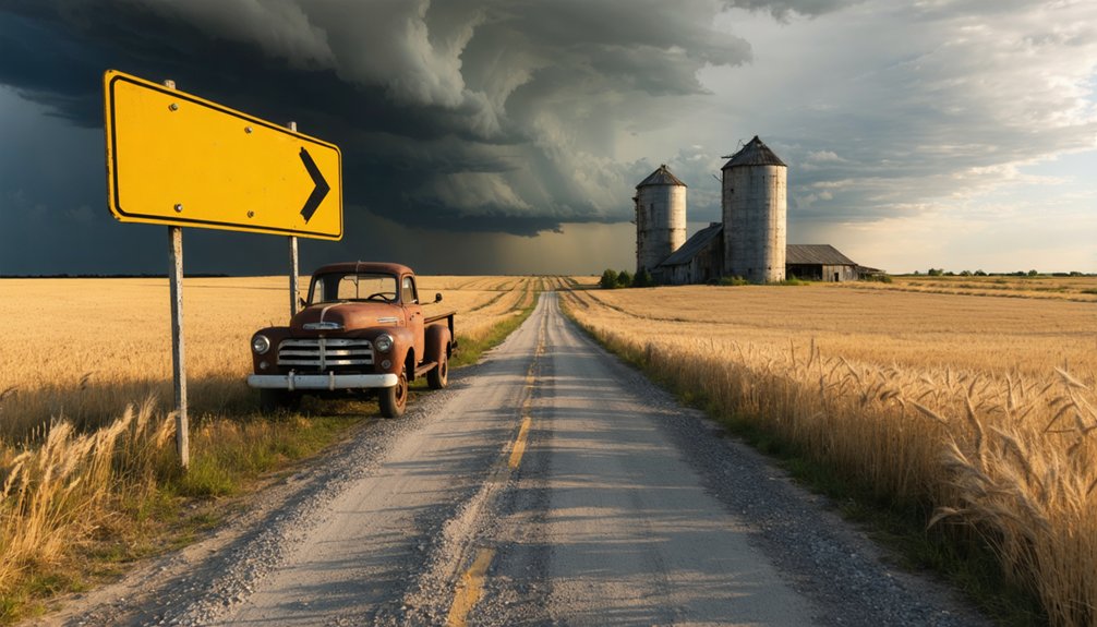
You’ll find Blakeman’s story etched in the windswept landscape five miles west, where the railroad’s Lincoln Land Company platted a rival townsite along Beaver Creek. They controlled the natural resources—the land, the water, the transportation lifeline. Economic factors drove every decision: a grand depot rose from the soil, buildings migrated from Atwood, and the railroad even petitioned to relocate the county seat.
What Remains at the Blakeman Townsite Today
When you arrive at the Blakeman townsite five miles west of Atwood, you’ll find nothing but working farmland stretching across the former town grid—W.E. Thompson plowed it all under in 1910, erasing every street and lot line.
The only landmark anchoring this ghost town to its location is the junction of Middle and North Beaver Creeks, the same natural feature that drew the Chicago, Burlington & Quincy Railroad here in 1886-1887. You can still trace the former railroad corridor that once brought life to this spot, though the tracks fell silent in 2015 and now blend into the agricultural landscape.
Agricultural Land Only
Standing at the junction of Middle and North Beaver Creeks today, you’ll find nothing but rolling farmland where Blakeman once thrived. When W.E. Thompson bought the townsite from Lincoln Land Company in 1910, he plowed every trace of civilization under.
For over a century, crops have grown where a hundred residents once conducted their daily business at the money order post office, telegraph office, and railroad depot.
You won’t discover any archaeological remains—Thompson’s plow eliminated them all. The complete loss of commercial viability following the failed county seat campaign left nothing worth preserving. This fertile ground five miles west of Atwood simply returned to its agricultural roots, erasing Blakeman’s brief existence as a Chicago, Burlington & Quincy Railroad shipping point.
Creek Junction Landmark
Looking for Blakeman today? You’ll find the creek junction where Middle and North Beaver Creeks converge—the defining landmark that drew railroad developers here in 1886. This natural meeting point made perfect sense for regional transportation context, offering water access and strategic positioning.
The creek alignment significance becomes clear when you trace where those abandoned tracks once ran, following the waterways north of Atwood. Stand at this junction five miles west of the county seat, and you’re experiencing the exact geography that sparked a bitter county seat war.
No depot, no buildings, no town remains—just agricultural fields and flowing water. Yet these creeks still mark precisely where ambitious Nebraska corporations once envisioned their rival to Atwood, before defeat sent those structures rolling back east.
Former Railroad Route
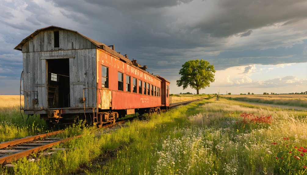
The railroad’s physical presence has vanished so completely that you’d never guess trains once rolled through these fields. Where the Burlington and Missouri River Railroad once connected this land to a vast regional rail network impact stretching from Nebraska to Kansas, you’ll find only wheat and pasture. The last train rumbled past in 2015, ending 128 years of service.
I’ve walked these grounds searching for any trace of the depot that once bustled with grain shipments and livestock. Nothing remains—no platforms, no rails, no telegraph poles. The depot restoration potential is zero; Thompson saw to that when he plowed everything under in 1910.
The creek junction marks where civilization briefly flourished, then retreated without ceremony.
Getting to the Former Townsite: Directions and Access
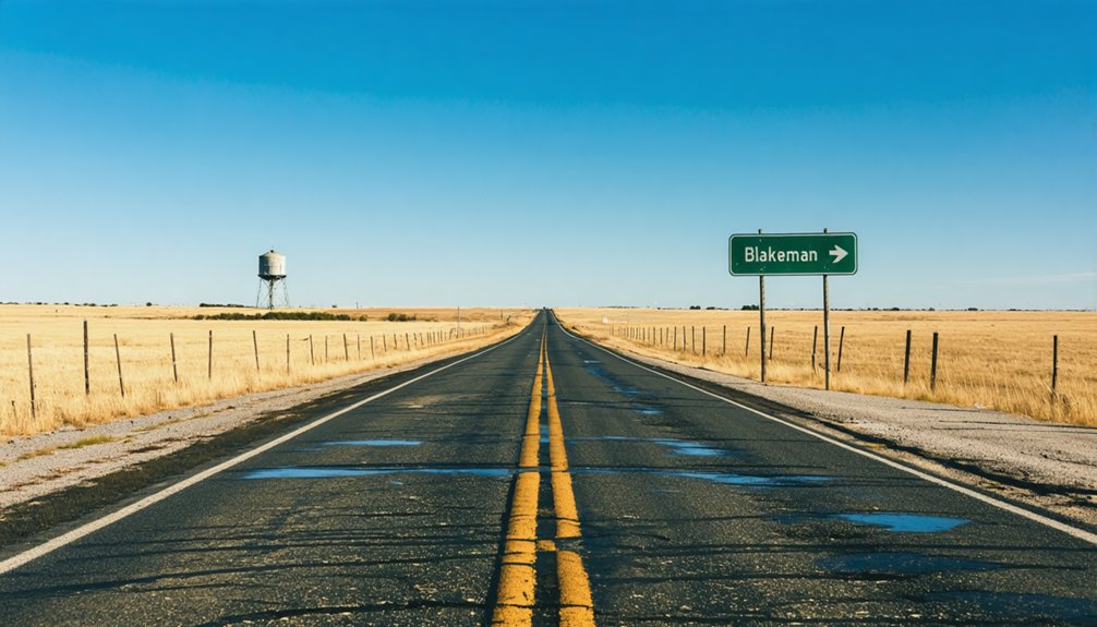
You’ll find Blakeman roughly fifteen miles northwest of Atwood along the grid of gravel roads that cross Rawlins County‘s open wheat fields. Take U.S. Highway 36 west from the county seat, then head north on Kansas Highway 25 before cutting west onto county roads—your GPS coordinates will read near 39°48′N 101°06′W when you arrive.
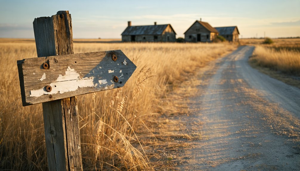
The townsite sits unmarked among active farmland, so you’ll need to watch for the subtle breaks in cultivation where foundations once stood, keeping an eye out for the occasional rusted farm implement or weathered fence post that hints at human habitation.
Location and Regional Context
Nestled in the windswept high plains of northwest Kansas, Blakeman occupies a remote corner of Rawlins County at approximately 39°48′N 101°06′W—a landscape where endless wheat fields meet vast skies and the Nebraska border looms just miles to the north. This location context defines your journey: you’re venturing into genuine frontier territory, far removed from Kansas City’s urban sprawl 250 miles east.
Regional isolation shapes everything here—Atwood, the county seat with just 2,561 residents, stands as your nearest supply hub. You’ll find Blakeman clustered among fellow ghost towns like Ludell and Union, each a memorial to failed homesteading dreams. The high plains terrain demands respect: carry extra water, fuel up beforehand, and embrace the solitude that drew settlers here generations ago.
Road Access and Routes
How do you reach a town that vanished over a century ago? You’ll start from Atwood, heading west along Rawlins County’s rural roads. Five miles of open Kansas prairie stretch before you, where the junction of Middle and North Beaver Creeks marks your destination. Don’t expect minimal signage to guide you—there won’t be any.
The former railroad corridor that once carried the Burlington and Missouri River tracks is now absorbed into farmland. You’re traversing by creek coordinates and property lines rather than street addresses. Local county roads provide access, though the exact townsite was plowed under in 1910. Bring GPS coordinates, detailed maps, and respect for private property. This isn’t a marked tourist attraction—it’s authentic exploration territory where history dissolved into wheat fields.
With coordinates 39°48′N 101°06′W programmed into your GPS, you’re heading toward a landscape where wheat has erased every trace of civilization. The former townsite sits on private property concerns now, so you’ll need to respect boundaries while exploring this ghost town from public roads.
Look for these remnants marking Blakeman’s footprint:
- The old railroad alignment running along the creek
- A weathered grain elevator standing sentinel over fields
- Blakeman Cemetery serving as your primary landmark
You won’t find historical markers commemorating the town’s brief existence. Instead, the junction of Middle and North Beaver Creeks guides you to where a hundred souls once lived. Park along county roads and photograph from accessible vantage points, letting your imagination reconstruct what Thompson’s plow destroyed.
Best Time to Visit and What to Bring
Planning your ghost town adventure to Blakeman requires careful consideration of Kansas’s temperamental prairie weather. Target late May through early June when blooming prairies paint the landscape golden, or early September when crisp 60°F mornings make exploration comfortable. Weather patterns dictate your experience—spring thunderstorms transform gravel roads into muddy traps, while winter snow buries what little remains of this forgotten townsite.
Road conditions demand a high-clearance vehicle and dry ground. Pack sturdy boots for traversing the old grain elevator’s uneven terrain, plenty of water (Atwood’s 15 miles away), and sunscreen against relentless UV exposure. Don’t forget your camera for capturing weathered ruins against endless sky. Wind gusts hit 40 mph here—you’ll feel genuinely untethered from civilization. Download offline maps; cell service vanishes where freedom begins.
Exploring Atwood: The Town That Outlasted Blakeman
While Blakeman surrendered to the prairie decades ago, Atwood dug in its heels fifteen miles west and became the stubborn survivor of Rawlins County’s settlement era. You’ll find a town that earned its county seat history through sheer persistence, relocating in 1880 when bureaucrats demanded it and dropping a “t” from its name when Washington postal clerks requested it.
Today’s Atwood offers tangible remnants of frontier grit:
- Rawlins County Historical Museum at 308 State Street houses artifacts from the 1878 Cheyenne raid
- Shirley Opera House stands preserved on the National Register at 503 Main Street
- July’s County Fair continues traditions dating back generations
Despite natural disaster impacts and depopulation reducing its 1960 peak of 1,906 to 1,290 residents, Atwood refuses ghosthood—a living chronicle to those who stayed when others abandoned hope.
Other Abandoned Towns to Discover in Northwest Kansas
Northwest Kansas stretches across a landscape where dozens of abandoned settlements mark the graves of frontier ambitions—each town a monument to dreams that couldn’t outlast drought, failed railroads, or simply the brutal mathematics of distance.
You’ll find Densmore’s crumbling storefronts near the Solomon River, where Norton County’s ghost town landscapes cluster together like forgotten siblings. Nekoma’s post office held out until 2008—one of the last to surrender. Ludell still clings to existence since 1881, its scattered population refusing complete erasure.
Head to Hoge in Ness County, where modern homesteading challenges defeated settlers before they started—the soil never cooperated. Ransomville’s coal mines birthed and buried it within decades. These aren’t museum pieces. They’re raw evidence of what happens when isolation meets determination, and isolation wins.
Capturing Your Ghost Town Experience: Photography Tips
Camera in hand, you’re standing before weathered clapboard and collapsing rafters—but the story you’ll carry home depends entirely on how you shoot it. Northwest Kansas ghost towns like Blakeman offer unfiltered access to historic architecture and local narratives waiting to be documented.
Every frame you compose becomes a choice—document the decay as testament, or romanticize ruins into something they never were.
Capture these moments effectively:
- Golden hour lighting transforms rusted surfaces and crumbling facades into textured masterpieces
- Wide-angle lenses frame entire structures and main streets in single compositions
- Long exposures during dusk reveal star trails above abandoned homesteads
Pack your tripod for low-light interiors and a headlamp to illuminate hidden corners. Search for leading lines—old railway tracks, fence posts, dirt roads—that pull viewers into forgotten stories. Don’t just photograph buildings; capture the freedom these places represent. Remove modern clutter from your frame, adjust your angle, and let Blakeman’s authentic decay speak.
Frequently Asked Questions
Are There Any Safety Concerns When Visiting Abandoned Town Sites in Kansas?
You’ll face real dangers exploring abandoned Kansas towns—structural collapse threatens from deteriorating buildings with unstable walls and roofs, while the presence of hazardous materials like lead contamination and asbestos lurks unseen. Tread carefully; your safety depends on constant vigilance.
Do I Need Permission to Access the Blakeman Farmland Property?
Yes, you’ll need permission since Blakeman sits on private farmland. Trespassing concerns are real here—respectful explorers always ask landowners first. Private property access isn’t just courteous; it’s essential for preserving your freedom to explore Kansas’s hidden histories.
What Happened to Residents When Blakeman Was Plowed Under in 1910?
You’d witness a “going out of business” sale as residents scattered like tumbleweeds. Former residents’ livelihoods disrupted overnight—farmers, merchants, families forced elsewhere. The economic impact on nearby communities rippled outward as Atwood absorbed Blakeman’s displaced souls seeking fresh starts.
Can Artifacts Still Be Found at the Former Blakeman Townsite?
Finding hidden artifacts at Blakeman’s plowed-under townsite proves challenging since Thompson converted everything to farmland in 1910. You’d need excavation equipment and landowner permission to uncover undiscovered relics buried beneath decades of agricultural cultivation.
Which Nearby Town Has Amenities Like Gas Stations and Restaurants?
Atwood’s your best bet, just 4-5 miles east. You’ll find gas stations, restaurants, and essential services there. It’s the primary hub for Rawlins County, offering convenient nearby town amenities and easy visiting town accessibility for ghost town explorers.


