You’ll drive east from Burns on Highway 78, then turn south onto Oregon Route 205 for 35 miles along Catlow Rim’s stunning landscape. Navigate through multiple ranch gates on Roaring Springs Ranch property—closing each behind you—until you reach Blitzen’s scattered remains. Expect foundation outlines and 2-3 weathered structures amid reclaiming sagebrush, with the Steens Mountains dominating your view. This ghost town demands respect for private property and careful preparation, as the complete story of Blitzen’s rise and fall reveals why this remote settlement couldn’t survive the changing American West.
Key Takeaways
- From Burns, drive east 1.2 miles on Highway 78, then south 35 miles on Route 205 before turning east.
- Close all ranch gates behind you while crossing through Roaring Springs Ranch property with permission.
- Expect minimal remains: 2-3 salvageable structures, foundation outlines, and debris fields reclaimed by sagebrush.
- Visit nearby Paisley Caves to see archaeological evidence of 14,200-year-old human settlement in the region.
- Bring supplies and navigate carefully—this remote high desert location offers unobstructed Steens Mountains views but limited amenities.
Getting to Blitzen: Routes and Access Through Catlow Valley
The ghost town of Blitzen waits in Oregon’s Catlow Valley, a vast 1,300-square-mile basin carved between the massive fault blocks of Hart Mountain and Steens Mountain. You’ll begin your journey from Burns, the county seat 65 miles north, where you’ll stock up on fuel and supplies—economic challenges of remoteness mean no services await ahead.
Head east 1.2 miles on Highway 78, then turn south on Oregon Route 205. This paved corridor follows the High Desert Discovery Scenic Byway through terrain shaped by seasonal precipitation patterns that create temporary marshes in the interior-drainage basin.
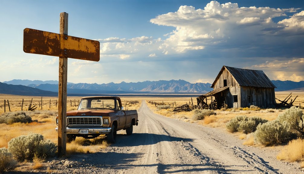
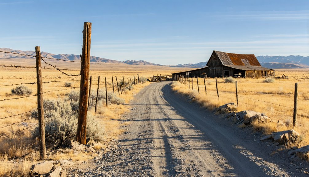
The highway winds 35 miles along Catlow Rim before turning east. You’ll pass through multiple ranch gates—close them behind you—crossing high-desert country where Blitzen’s weathered remnants mark the Roaring Springs Ranch.
What Remains: Exploring the Deteriorated Town Site
When you arrive at Blitzen’s coordinates, you’ll find sagebrush reclaiming what scant evidence remains of this once-hopeful settlement. The landowner bulldozed most structures in recent decades after collapsing floors endangered livestock and increasing visitor traffic became problematic. What architectural significance once stood—post office, store, school, saloon—now exists primarily through photographic documentation.
Time and intention erased this settlement—only photographs preserve what deliberate bulldozers removed to protect cattle from crumbling floors.
If you’re lucky, you might encounter:
- Two to three potentially salvageable structures scattered across the landscape
- Foundation outlines and debris fields marking where buildings once anchored community life
- Unobstructed views of the Steens Mountains stretching across desert emptiness
Navigate carefully through multiple fence gates, closing each behind you. The site offers minimal shelter but maximum solitude—exactly what freedom-seekers crave in Oregon’s remote Catlow Valley.
The Rise and Fall of a Ranching Community
Long before Blitzen’s name appeared on any map, the thundering hooves of cattle herds echoed across these high desert valleys. You’re standing where the Riddle Brothers built an empire controlling 1,120 acres and every water source around 1900. They raised mules for the military until mechanization changed everything after World War I.
The decline of cattle operations began when the Taylor Grazing Act of 1934 redrew boundary lines and federal agencies started managing these wild lands. What thrived as open range—where 100,000 head once grazed freely—became regulated territory. The changing economics of ranching couldn’t sustain small operations anymore.
Understanding the Roaring Springs Ranch Property
Scale transforms everything in this unforgiving landscape, and nowhere is that more apparent than at Roaring Springs Ranch. When you’re exploring Blitzen’s eastern boundary, you’re standing at the edge of one of Oregon’s most formidable cattle operations—1.2 million acres stretching across Catlow Valley.
The ranch operations reveal an empire built through determined land ownership transfers:
- 254,000 acres of owned private land—roughly the size of Clackamas County
- 980,000 acres of leased BLM grazing permits interspersed with private holdings
- 3,200 acres of irrigated hay meadows carved from unforgiving desert
From Pete French’s original 1872 P Ranch through a dozen title transfers to the Sanders family, this territory embodies frontier tenacity. You’ll find no apologies here—just authentic ranching heritage spanning 150 years.
Ancient History: From Ice-Age Caves to Northern Paiute Territory
Fourteen thousand years before ranchers carved empires from Catlow Valley, hunter-gatherers sought shelter in the same rock overhangs you’ll find scattered across this high desert terrain. At nearby Paisley Caves, archaeologists discovered 14,200-year-old coprolites with human DNA—direct evidence of ancestors who hunted now-extinct horses and camels using sophisticated stone tool technology.
These early inhabitants crafted obsidian blades for butchering, polished rocks for grinding plants, and bone needles for sewing rabbit pelts into cold-weather garments. Their meat processing methods left telltale marks on pronghorn bones and rabbit remains.
The Lost Architecture: Buildings That Once Defined Blitzen
When optimistic homesteaders filed their claims in Catlow Valley during the 1910s, they built Blitzen the way frontiersmen built every settlement that preceded it—with weathered lumber, determination, and assumptions about rainfall that the high desert would systematically disprove.
The settlement’s early construction methods reflected classic Western frontier pragmatism:
- Post office and general store served rye farmers from April 1915 through February 1943
- Dugout homes carved into sagebrush prairie sheltered three families maximum by 1924
- Saloon and school building completed the community’s architectural innovations
Best Practices for Visiting Private Ranch Land
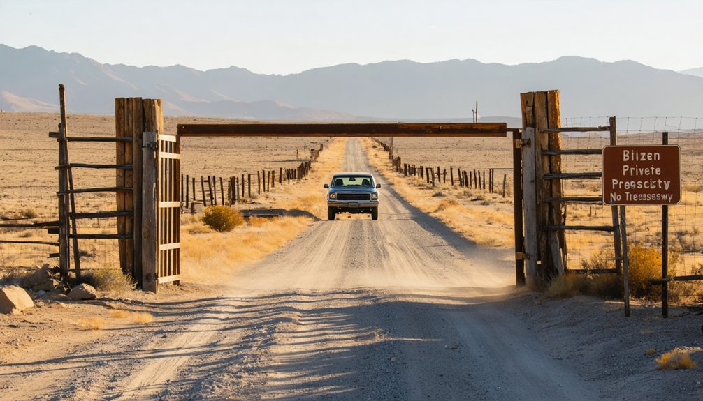
The remnants of Blitzen sit on private ranch land where cattle now graze across the same alkaline flats that defeated wheat farmers a century ago. Before you venture out, understand that landowner permission requirements aren’t bureaucratic hurdles—they’re the foundation of access. Posted gates mean what they say, and Oregon law backs that with $1,000 penalties for trespassers. An open gate doesn’t grant entry.
Motorized vehicle restrictions keep you on designated roads only. Fields and trails are off-limits to trucks and ATVs—this is walk-in territory. Leave gates as you found them, pack out every trace, and remember you’re a guest on working land. Respecting these boundaries guarantees future explorers can follow your tracks across this windswept ghost of settlement.
Nearby Ghost Towns and Historical Sites in Harney County
Blitzen doesn’t stand alone in Harney County’s vast emptiness—it’s one ghost among many scattered across these high desert rangelands. The vanishing industry of cattle operations and a shrinking rural population left behind weathered structures that mark where communities once thrived.
Harney County’s silent monuments—weathered wood and scattered stone—whisper of vanished communities claimed by sagebrush and time.
Within driving distance, you’ll find remnants worth exploring:
- Van – An abandoned ranching settlement where corrals and outbuildings slowly surrender to sagebrush
- Narrows – Historic district along the Malheur River where stone foundations hint at frontier commerce
- Scattered homesteads – Lone cabins accessible via unmarked two-tracks across BLM land
Pack plenty of water and fuel—services are scarce. These sites reward self-reliant travelers who appreciate solitude over signage, where discovering history means reading the landscape itself.
Frequently Asked Questions
What Accommodations Are Available Near Blitzen for Overnight Stays?
You’ll find cozy bed and breakfast options at Frenchglen Hotel, plus camping opportunities at Page Springs Campground along the Blitzen River. Steens Mountain Wilderness Resort offers cabins and RV sites with sweeping views of wild, open country.
When Is the Best Season to Visit Ghost Towns in Harney County?
Why brave winter’s unpredictable storms when spring through fall offers freedom? You’ll find ideal weather conditions from April through October, ensuring seasonal accessibility to remote ghost towns. Warm days, minimal rainfall, and passable roads make exploring Harney County’s abandoned treasures effortless.
Are There Gas Stations or Services Along the Route to Blitzen?
Fuel availability remains scarce along remote routes—you’ll find limited roadside infrastructure near Blitzen. Plan ahead by filling up in Frenchglen, Fields, or Crane before venturing into the wild backcountry where freedom meets isolation.
What Supplies Should I Bring for a Remote Ghost Town Visit?
You’ll want to bring emergency supplies including first aid kits, navigation tools, and communication devices. Pack non-perishable food, multiple water containers with purification systems, sturdy boots, protective clothing, and fire starters for your desert adventure.
Can I Take Photographs of the Remaining Structures at Blitzen?
You can photograph Blitzen’s haunting structures, but you’ll need to obtain permission from landowners first. Respect the historical significance of these weathered remnants while capturing their stories through your lens, preserving freedom and integrity.


