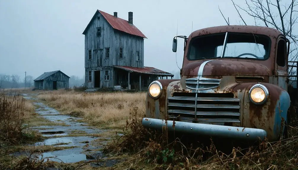
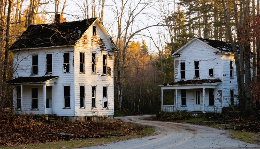
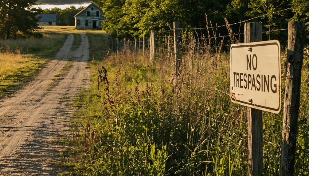
You’ll find Branch’s ghost town remains in Branch Township, Mason County, about three miles southwest of Coldwater along the historic Sauk Trail route. Navigate back roads and dirt paths near the old Flint & Pere Marquette Railroad tracks to discover a handful of homes, an operating motel, and weathered timber buildings—including an abandoned Gould National Battery shop. What once bustled with three general stores and two sawmills now sits quietly among farmland, a memorial to how choosing profit over progress erased Michigan’s 1831 county seat from history.
Key Takeaways
- Branch is located in Branch Township, Mason County, approximately 3 miles southwest of Coldwater along historic Sauk Trail routes.
- The former county seat features scattered homes, an operating motel, small grocery, and abandoned Gould National Battery building.
- Navigate back roads and dirt roads following old Flint & Pere Marquette Railroad tracks to locate remaining structures.
- Once a thriving settlement with three general stores and two sawmills, Branch collapsed after losing county seat status in 1842.
- The ghost town lost to Coldwater due to poor location strategy and landowners demanding inflated prices instead of offering free land.
The Rise and Fall of Michigan’s First County Seat
When the Michigan Territorial Legislature carved out thirteen new counties in 1829, they turned to President Andrew Jackson’s cabinet for namesakes, honoring his Secretary of the Navy, John Branch, with a sprawling territory in south-central Michigan. After two false starts with Mason and Masonville—both voided by procedural mishaps—properly sworn commissioners designated Branch as county seat in 1831.
Located three miles southwest of Coldwater, the site was nothing but empty countryside near the Coldwater River. Yet branch town planning moved swiftly: Mr. Warren platted the village, and by 1837, a thirty-foot log courthouse doubled as jail. The settlement’s name followed the common practice where a branch of a specific tree—in this case honoring Secretary Branch—would simply be called by that namesake.
You’ll find echoes of municipal financial troubles in Branch’s story—when the state legislature relocated the county seat to Coldwater in 1842, Branch collapsed almost overnight, joining Masonville in obscurity. The first permanent courthouse in Coldwater was built in 1848 at a cost of $5,000.
Why Branch Lost to Coldwater in the Battle for Supremacy
Branch’s fatal disadvantage wasn’t just about geography—it sat half a mile north of the main Sauk Trail while Coldwater occupied the trail itself, making it the natural stopping point for travelers crossing Michigan Territory.
When Coldwater’s founders offered free land to attract businesses and Branch’s landowners demanded top dollar, the economic die was cast. The 1837 census revealed Coldwater Township had grown to contain nearly one-fourth of the county’s population, giving reformers the votes they needed to relocate the county seat in 1842.
The bitter contest between the two settlements dragged on for 10 years before the legislature finally passed the definitive act in 1840 to remove the county seat to Coldwater, sealing Branch’s fate as a forgotten settlement. The county, founded in 1829, had been organized just four years before the battle for the county seat began in earnest.
Location on Sauk Trail
Although Branch sat directly along the historic Sauk Trail—that ancient Native American path connecting Detroit to the prairies beyond Lake Michigan—its prime location couldn’t save it from obscurity.
You’ll find that Sauk Trail infrastructure evolved dramatically between 1829 and 1836, transforming from Henry Schoolcraft’s “plain horse path” requiring guides into an $87,000 wagon road. This Sauk Trail evolution brought stagecoaches and commerce, but Branch couldn’t capitalize on the improvements.
When Coldwater secured the county seat designation, administrative functions and business opportunities shifted away. The route gained multiple names over time, becoming known as the Chicago Road, Chicago Turnpike, and Chicago Pike. By 1943, the 1.477-mile US-112 segment southwest of Bronson bypassed Branch entirely. The trail became Chicago Pike, then US 12, leaving Branch as merely a faded waypoint while nearby towns thrived along the modernized route. Before 1962, U.S. 112 was the roadway along this historic route through Michigan.
Free Land Business Strategy
The proprietors of Branch made a fatal miscalculation that would seal their village’s fate. While you’d expect savvy businessmen to encourage growth, they held their land at inflated prices, effectively choking off industrial development. Their land pricing tactics stood in stark contrast to what was happening just miles away in Coldwater.
When Elisha Warren offered $75 for half interest in Branch property to build a mill, the proprietors’ rejection sent Warren to Coldwater—where he found willing partners. This single transaction marked Branch’s death blow. Coldwater’s strategic land acquisition approach welcomed manufacturers with open arms, transforming it into the region’s industrial powerhouse. The city that became incorporated in 1861 would leverage its position along the Old Sauk Trail to attract the businesses that Branch had turned away. Today, the Branch County Economic Growth Alliance markets industrial parks in Coldwater alongside Bronson, Quincy, and Union City, continuing the county’s legacy of business development. Branch’s proprietors chose short-term profit over long-term prosperity, and their village paid the ultimate price: extinction.
Population Shift Enabled Relocation
Victory in the county seat battle of 1842 didn’t happen by chance—Coldwater’s triumph emerged from unstoppable demographic momentum that Branch couldn’t match. By 1837, Coldwater township commanded nearly a quarter of Branch County’s population with 960 residents, establishing population centralization trends that Branch’s ambitious village couldn’t counter.
You’ll understand why Coldwater won when you consider the economic shift dynamics at play—American settlers flooding in from New York and New England naturally gravitated toward Coldwater’s strategic location. Meanwhile, the Potawatomies’ removal to Kansas in 1840 catalyzed unprecedented growth potential. Branch held the honor from 1831 to 1842, but Coldwater’s village gradually overshadowed its rival through sheer numbers and geographic advantage. Today, Coldwater spans 9.425 square miles as the established county seat, a footprint that reflects its enduring dominance. The historic 1887 courthouse that would eventually rise in Coldwater symbolized the city’s lasting victory, standing for 85 years before fire claimed it in 1972. Freedom-seeking settlers voted with their feet, sealing Branch’s fate.
Locating the Remains of Branch Today
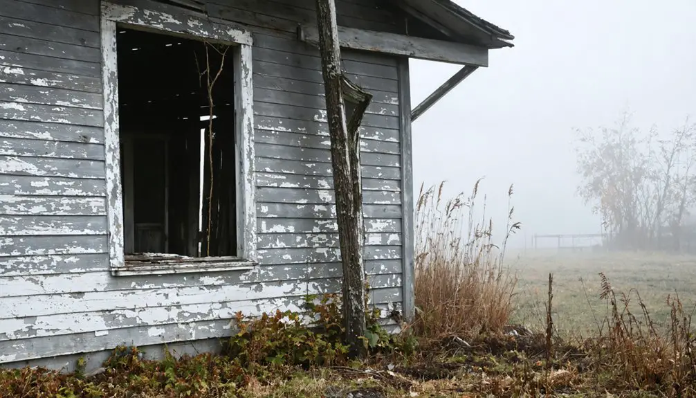
Finding Branch today requires traversing to the intersection of US-10 and Tyndall Road in Branch Township, Mason County—a location that shouldn’t be confused with Michigan’s other similarly named communities like West Branch or North Branch. You’ll discover a handful of homes, an operating motel, and a small grocery serving the area’s sparse population.
South of town stands the empty Gould National Battery shop building, now for sale among the abandoned buildings that mark timber’s environmental impact on this former lumber hub. Navigate the back roads and dirt roads following the old Flint & Pere Marquette Railroad tracks to uncover interesting remnants along side routes.
What once hosted three general stores, two sawmills, and bustling commerce has returned to quiet rural existence—perfect for independent explorers seeking authentic history.
What You’ll Find at the Historic Cemetery

You’ll discover headstones dating back to the 1830s, marking the final resting places of Branch County’s earliest pioneers who built this short-lived county seat.
Among the weathered markers lie notable settlers like Elisha Warren, who purchased village lots when Branch seemed destined for prosperity. The cemetery remains in modest condition, its stones standing as quiet sentinels over buried building foundations that once formed the heart of this vanished community.
Graves From 1830S Era
When you step into the Congregational Cemetery in East Leroy, you’re walking among graves that date back to 1832, the year this burial ground was established. Marsha Bushnell’s marker represents the earliest documented burial here. You’ll discover unique headstone designs that reflect the settlers’ traditions—some homemade, others mail-ordered, all less ornate than their urban counterparts. The stones tell stories through inscriptions revealing names, dates, origins, and religious affiliations of Branch’s pioneers.
Multi generational family plots dominate the landscape, with the Atwood family spanning over six generations in a single plot. Rev. James and Elizabeth Varney rest here alongside Zachariah and Minnie Mohler, Nancy Bigelow, and the Doubleday family. These multi-generational clusters demonstrate the deep roots families established in Leroy Township’s untamed territory.
Notable Pioneer Settlers Buried
Among the weathered headstones at East Leroy’s Congregational Cemetery, you’ll encounter the final resting places of Branch County’s earliest settlers—individuals who transformed Michigan’s wilderness into thriving communities.
Notable burial sites include:
- Israel Bell – The 1818 settlement founder and Pekin Village commissioner who donated cemetery land in 1831, though he’s actually buried at Redford Cemetery
- Revolutionary War veteran Ensign John Terhune (1759-1839) – Rests alongside wife Sarah Vreeland Terhune in Kalamazoo Pioneer Cemetery, established 1833
- Anonymous Kalamazoo pioneer – White male settler born post-Revolutionary War, discovered near Park Place; pathology revealed settler health conditions including altered gait
These hardy farmers, representing French, German, Polish, Irish, English, and Swedish heritage, rarely exceeded age fifty. Their sacrifices forged your freedom on untamed frontier soil.
Cemetery’s Current Physical Condition
Time has claimed this forgotten burial ground with relentless determination. You’ll discover 50-100 graves disappearing beneath dense weed cover, poison ivy, and wildflowers that dominate the abandoned landscape.
Seasonal plant growth patterns obscure low-lying fieldstones throughout spring and summer, while fallen leaves bury markers each autumn. Most headstones have tilted or subsided into Michigan soil, their inscriptions weathered beyond recognition. Wooden crosses have rotted completely, metal markers rust in twisted angles, and collapsed iron gate posts mark former entrances.
No maintained pathways exist—you’ll navigate through overgrown brush and encroaching forest. The site lacks fencing, signage, or any visitor amenities. For those considering marker restoration considerations, you’ll face challenges from root systems and decades of elemental damage. This cemetery embodies true abandonment, untouched since the early 1900s, gradually reclaimed by wilderness.
Best Times to Visit Branch Ghost Town
Each season paints Branch Ghost Town in distinct colors and moods, transforming this 19th-century townsite into an ever-changing portal to Michigan’s past. You’ll find the park accessible year-round from 8 a.m. to 10 p.m. ET, though townsite buildings open mid-May through mid-October.
As you wander through the remnants of this historic place, you may come across tales of the ghost towns in Branch, Michigan, where echoes of the past linger. Each dilapidated structure tells a story, inviting visitors to connect with the history of the area. The atmosphere becomes especially enchanting during the fall, when the leaves dance in vibrant hues, further adding to the mystique of these forgotten spots.
Consider these prime visiting windows:
- Spring (May-June): Experience fewer crowds, spring blossoms, and crisp air as historic structures reopen mid-May.
- Fall (September-October): Discover ideal conditions for fall foliage peaking late September through mid-October, plus the spooky atmosphere of the paranormal event mid-September and Fall Fest’s hayrides in early October.
- Summer (July-August): Enjoy Heritage Day’s archaeological excavations and 1800s baseball demonstrations in early August.
Book accommodations early for September-October visits. You’ll need a Michigan Recreation Passport for vehicle entry.
Combining Your Trip With Other Michigan Ghost Towns
Your journey through Branch’s weathered buildings becomes even richer when you weave it into a broader exploration of Michigan’s 73 documented ghost towns—abandoned remnants of the state’s logging, railroad, and mining eras that once pulsed with frontier life.
as you continue your adventure, exploring emerson’s ghost town attractions reveals the unique stories of those who once called this desolate landscape home. each building and artifact tells a tale of resilience and hardship, offering visitors a glimpse into the past. wandering through these forgotten places, you can almost hear the echoes of laughter and labor that filled the air long ago.
You’ll find the Upper Peninsula particularly dense with abandoned sites, where the history of logging industry and copper mining created booms that inevitably went bust. Plan your route using EagleEyeExplorer’s map, which pinpoints each location with histories gathered from personal visits.
You’ll discover remnants of railroad infrastructure threading through Keweenaw Peninsula towns like Mandan and Central Mine, while Craig’s 1893 Soo Line Railroad foundations still mark southeastern routes. BatchGeo’s interactive tool helps you plot the nearest ghost towns from Branch, maximizing your expedition through Michigan’s forgotten landscapes.
Photography Tips for Capturing Abandoned Settlements
Capturing Branch’s decaying structures calls for technical precision that matches the historical weight these abandoned settlements carry. You’ll need vintage lighting techniques like bracketing multiple exposures—shoot at 1/100, 1/50, and 1/25 for bright areas, then 1/400 and 1/800 for shadow details. This reveals impactful architectural details that single exposures miss.
Bracket your exposures across five shutter speeds to capture Branch’s forgotten architecture with the technical precision its haunting history demands.
Essential gear for unrestricted exploration:
- Wide-angle 24mm lens to emphasize emptiness in tight spaces
- Sturdy tripod for 30-second exposures at f/8
- Small LED light for traversing electricity-free buildings
Focus on weathered doors, rust patterns, and discarded relics that tell Branch’s story. Shoot from disorienting low angles to amplify the foreboding atmosphere. Desaturate in post-processing for contemplative ambiance, but don’t over-edit—let decay’s complex tones speak authentically.
Essential Supplies for Your Ghost Town Exploration
Before you venture into Branch’s hollow structures where time stopped decades ago, assembling the right supplies separates memorable exploration from dangerous misadventure. Personal safety considerations start with sturdy boots, cut-resistant gloves, and respirator masks protecting against airborne toxins lurking in collapsed interiors.
You’ll need a primary flashlight plus headlamp for hands-free navigation through pitch-black corridors, backed by spare batteries and emergency glow sticks.
Packing essential tools means your durable backpack should carry a multi-tool, pruners for overgrown vegetation, and duct tape for quick fixes. Don’t overlook your first-aid kit, water purification tablets, and energy bars for sustained exploration.
A GPS device with offline maps, compass, and physical route markers guarantee you’ll navigate Branch’s forgotten streets without modern signal dependency—freedom requires preparation.
Respecting Historic Sites and Private Property
When you step onto Branch’s weathered grounds—where buried foundations and crumbling headstones mark what remains of this Mason County settlement—you’re entering a landscape governed by both legal obligation and moral duty. Ethical stewardship means preserving these historic stories for future generations while respecting boundaries.
Your responsibilities include:
- Secure private landowner consent before accessing cemetery sites or ruins not designated as public parks
- Preserve artifacts in place—disturbing headstones or removing materials damages irreplaceable historical evidence
- Document without altering—photograph deteriorating features but leave restoration to designated preservation professionals
Navigate back roads and railroad tracks south of Branch freely, but remember: true exploration honors what remains. These ghost town remnants represent Township and County responsibilities under MCL 45.515, deserving protection rather than exploitation.
Frequently Asked Questions
Are There Any Guided Tours Available for Branch Ghost Town?
Guided tours aren’t offered at Branch—these weathered remnants stand as silent sentinels of freedom. You’ll explore independently using self-guided maps while volunteer preservation efforts ongoing keep history alive. Purchase driving tour books ($10) for detailed historical context and directions.
What Safety Precautions Should I Take When Exploring Abandoned Structures?
You’ll need proper protective gear before stepping into history’s forgotten corners. Wear sturdy boots to navigate debris-strewn floors, bring portable lighting for dark spaces, and always tell someone your location. Never enter structurally compromised buildings alone.
Can I Access Historical Records About Branch Residents at Local Archives?
You’ll discover treasure troves of historical archives waiting at Branch County’s repositories. The County Clerk’s office, Branch District Library’s Heritage Room, and Archives of Michigan preserve essential records, photographs, and local history resources documenting residents from 1833 onward.
Are There Nearby Accommodations for Overnight Stays During My Visit?
You’ll find accommodations in nearby Ludington and West Branch, from budget motels starting at $62 to lakeside resorts. Consider nearby bed and breakfast options for charm, or local camping grounds if you’re seeking that authentic frontier experience under Michigan stars.
Is Metal Detecting Permitted at the Branch Ghost Town Site?
Metal detecting isn’t permitted at Branch without owner permission, as ghost town sites face historical preservation concerns. Michigan’s metal detecting regulations prohibit artifact removal from historic locations. You’ll need written authorization before exploring this protected site.
References
- https://branchcountyhistoricalsociety.org/2019/02/12/a-ghost-town-and-buried-treasure-too/
- https://www.nailhed.com/2017/10/the-ghost-town-that-moved.html
- https://lostinmichigan.net/the-ghost-town-of-damon/
- https://www.youtube.com/watch?v=rzSClnH1Z_Y
- https://en.wikipedia.org/wiki/List_of_ghost_towns_in_Michigan
- https://en.wikipedia.org/wiki/Branch
- https://tedshideler.com/2022/12/02/the-branch-county-michigan-courthouse-1976/
- https://branchcountyhistoricalsociety.org/2019/03/28/branch-county-courthouse-site/
- https://branchcountyhistoricalsociety.org/2019/05/28/branch-county-courthouse-1848-1887/
- http://genealogytrails.com/mich/branch/coldwatertwp.html