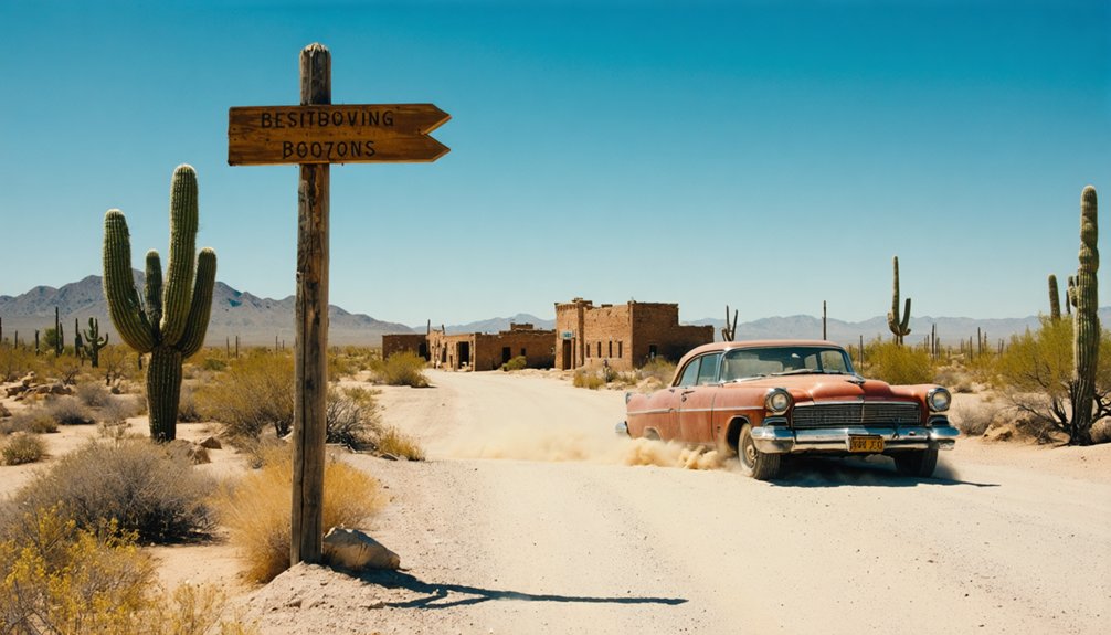
You’ll find Brigham City Fort about 100 miles northeast of Phoenix in Navajo County, accessible via LaPrade Lane from Winslow—but this remote high-desert destination demands serious preparation. Pack at least one gallon of water per person, detailed maps, emergency vehicle gear, and fuel for the journey through areas with limited cell signal. The weathered sandstone walls rising 8 feet from the desert floor tell stories of Mormon pioneers who built this 1876 outpost, while nearby Canyon Diablo’s Boot Hill graves add another layer to your ghost town adventure through Arizona’s frontier past.
Key Takeaways
- Access Brigham City Fort from Winslow via LaPrade Lane and North Road; bring detailed maps, fuel, and supplies for remote desert conditions.
- Visit weathered sandstone walls and building foundations from the 1876-1881 Mormon settlement at nearly 4,900 feet elevation in Navajo County.
- Explore nearby Canyon Diablo and Two Guns ghost towns within 5 miles off I-40 for a multi-site historical road trip.
- Pack one gallon of water per person daily, first aid supplies, navigation tools, and vehicle emergency gear for desert safety.
- Check seasonal weather impacts, drone restrictions, and private property permissions before exploring unstable historic structures and capturing photographs.
Location and Access Routes to Brigham City Fort
Perched at nearly 4,900 feet in the high country of northeastern Arizona, Brigham City Fort occupies a windswept plateau where red earth meets endless sky. You’ll find this historical outpost in Navajo County, roughly 100 miles northeast of Phoenix’s urban sprawl. Winslow serves as your jumping-off point—take LaPrade Lane and North Road to navigate this remote landscape where cell signals fade and self-reliance matters.
The fort’s elevation demands seasonal weather considerations. Winter snows can close access roads without warning, while summer monsoons transform desert washes into rushing torrents. You’ll spot the cemetery northwest of the main structures, confirming you’ve reached Arizona’s forgotten frontier. Come prepared with supplies, detailed maps, and enough fuel—this isn’t suburbia, and that’s precisely the point. Unlike its Utah namesake in Box Elder County, this Arizona outpost never developed into a thriving county seat. The Utah Brigham City sits at 4,436 feet elevation, considerably lower than its Arizona counterpart’s position in the high country.
The History Behind This 1876 Military Outpost
When Brigham Young dispatched roughly 300 Mormon settlers from Utah in February 1876, he wasn’t just founding another desert outpost—he was playing strategic chess across the Arizona Territory. This military colonization strategy aimed to block a Boston-backed settlement scheme that threatened Mormon emigration routes along the Little Colorado River. Young handpicked captains like Lot Smith to lead four separate companies into the frontier, establishing what they’d initially call Ballenger’s Camp before renaming it Brigham City that April.
The Mormon settlement expansion served dual purposes: spreading their faith while securing territorial control. After crossing Sunset Crossing on April 7, these pioneers reached their destination two days later, immediately beginning construction. By August, they’d laid eleven house foundations—physical markers of Young’s calculated push into Arizona’s untamed landscape. The settlers constructed a fortified wall around their community, creating a defensive perimeter that would characterize the site for the brief period of its occupation. Drawing from their earlier experience with the Mormon Battalion’s 2,000-mile march to California, these Arizona pioneers understood the strategic importance of establishing American settlements across the western frontier.
What Remains at the Brigham City Fort Site Today
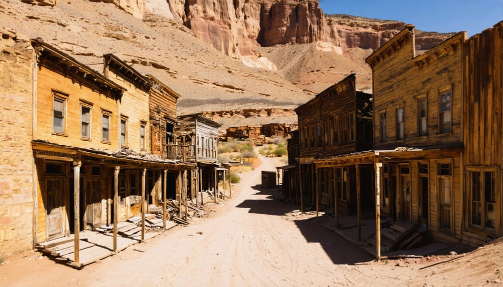
When you arrive at the Brigham City site just north of Winslow, weathered sandstone walls rise eight feet high from the desert floor, their rough-hewn surfaces still bearing the marks of pioneer stonemasons from 1876.
You’ll spot scattered building foundations stretching across the property, silent footprints of a community that once bustled with Mormon settlers and soldiers. The main stone structure stands defiant against time, flanked by crumbling adobe remnants that whisper stories of frontier perseverance and ultimate abandonment.
Among the ruins, you might discover shards of old china and pieces of corroded metal farming tools, tangible remnants of the daily lives once lived within these walls. The settlement was first explored by pioneer William Davis before Mormon colonists established their permanent outpost in the Arizona Territory.
Abandoned Military Outpost Remnants
The skeletal remains of Brigham City rise from the Arizona desert like weathered bones, telling stories of ambitious dreams that couldn’t withstand the harsh realities of frontier life. You’ll find weathered wagon parts scattered across the site—tangible evidence of the 1876 Mormon settlement that lasted just five years before nature won.
The wooden structures that once housed families and schoolchildren now exist as foundation remnants and scattered timbers, their grain exposed to endless sun and wind. Archaeological excavations could reveal the pottery kiln and school foundations beneath your feet, while historical documentation efforts continue mapping what survives. This settlement emerged during a period when the LDS Church’s membership had expanded to tens of thousands of believers spreading throughout the western territories. The establishment of remote settlements like Brigham City contrasted sharply with earlier periods when Church colonies closed during conflicts such as the Utah War of 1857-58.
After the fort’s 1881 abandonment, a ranch house briefly occupied these grounds before falling to decay, leaving you free to explore this layered chronicle to frontier perseverance.
Accessible Ruins and Structures
Standing amid the crumbling adobe walls of Brigham City Fort, you’ll trace your fingers along sandstone blocks that’ve endured 150 Arizona summers. These stabilized ruins rise eight feet high, revealing the fortified perimeter that once protected Mormon pioneers from the unforgiving desert.
The site’s preserved artifacts and foundations tell stories of resilience:
- Stone building foundations scattered across the landscape map the original settlement’s layout
- Dam and irrigation remnants showcase the pioneers’ agricultural ingenuity
- Pottery workshop areas excavated by archaeologists reveal daily life details
- Original doorways and structural supports frame views of endless desert horizons
- Interpretive signage explaining the United Order communal system they practiced
You’re free to wander among these remnants, photographing shadows stretching across adobe bricks while imagining the determined souls who carved civilization from wilderness. The fort stands just north of the park entrance on N Park Dr, easily accessible from downtown Winslow. Founded in 1876, Brigham City Fort was part of a broader network of Mormon communities that stretched along the Little Colorado River. The settlement’s struggle with frequent crop failures ultimately led to its abandonment by 1881, leaving behind these haunting remnants of a failed utopian dream.
Canyon Diablo and Other Nearby Ghost Towns Worth Exploring
While you’re exploring the Brigham City area, don’t miss Canyon Diablo—a settlement so violent it earned a reputation worse than Tombstone and Dodge City combined, where six marshals died within a month trying to tame its fourteen saloons and daily murders.
The crumbling foundations and Boot Hill graves still mark where over 2,000 railroad workers, gamblers, and outlaws turned a bridge construction delay into a decade of chaos.
You’ll find these ruins clustered within five miles of each other off I-40, where Canyon Diablo’s ghost merges with the abandoned tourist traps of Route 66’s Two Guns, creating a concentrated corridor of Arizona’s darkest frontier history.
Canyon Diablo’s Lawless Past
This settlement’s violent escapades made Tombstone look tame:
- Six marshals died enforcing the law—the first lasted five hours, the longest survived one month
- Fourteen saloons and ten gambling houses fueled hourly holdups and constant murders
- Notorious madams “Clabberfoot Annie” and “Bullshit Mary” brawled in legendary wrestling matches
- Boot Hill received 35 violent deaths in under a decade
- The 1889 train robbery netted $150,000, though lawmen recovered only $1,300
Historic Route 66 Sites
Today’s road-trippers race past Canyon Diablo on I-40 without realizing they’re missing one of Route 66’s most authentic ghost towns. You’ll find Arizona Route 66 heritage preserved in the original drivable bridge that spans the 250-foot canyon, a concrete ribbon connecting you to 1920s automobile adventures.
Three miles south, Two Guns ghost town adds another layer to your exploration. This former tourist trap capitalized on Mother Road traffic with its gas station and bizarre attractions. The ruins whisper stories of entrepreneurs chasing highway dreams.
Beyond scattered foundations and a solitary stone wall, you’re standing among abandoned Western railroad relics that birthed chaos in the 1880s. These windswept remnants demand independence—no guided tours, no gift shops, just raw desert history accessible via unmarked gravel roads.
Multi-State Ghost Town Circuit
Venture beyond Canyon Diablo‘s crumbling stone walls, and you’ll discover Arizona’s ghost town corridor stretches across neighboring states like scattered dominoes of forgotten ambition. Your circuit begins five miles out at Apache Death Cave, where 1870s violence echoes through Two Guns tourist trap ruins—Hermann Wolf’s stone trading post melting back into red earth.
Your Multi-State Ghost Town Loop:
- Canyon Diablo’s Hell Street – 14 saloons, 35 violent graves, overnight abandonment in 1882
- Apache Death Cave – Navajo-Apache conflict site, later exploited by roadside attractions
- Two Guns ruins – Failed Route 66 stop, Chief Crazy Thunder’s macabre zoo remnants
- Utah border caches – $150,000 train robbery loot allegedly hidden near state line
- Navajo Reservation edges – Fred Volz’s 1886-1910 trading post territory
You’ll find freedom in desolation, tracing outlaw trails through three states.
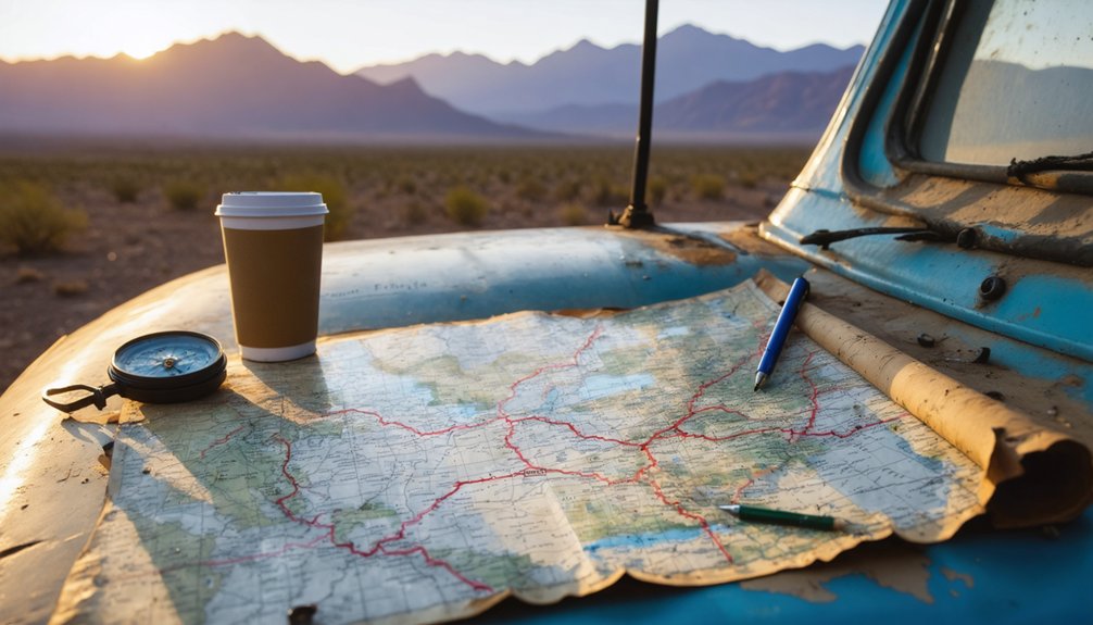
Essential Supplies and Safety Gear for Your Visit
Before you set off down the dusty washboard roads leading to Brigham City’s crumbling adobe walls, you’ll need to pack smart—this isn’t a quick jaunt to a roadside attraction with gift shops and water fountains. Desert heat demands at least one gallon of water per person daily, so packing light doesn’t mean compromising on staying hydrated.
Toss essential first aid supplies into your daypack: bandages, antiseptic wipes, and pain relievers prove invaluable when exploring unstable structures. A headlamp transforms shadowy interiors into explorable spaces, while your multi-tool handles unexpected repairs.
Don’t forget sunscreen, bug spray, and a wide-brimmed hat—Arizona’s sun shows no mercy. Vehicle emergency gear including jumper cables and a basic tool kit guarantees you’ll escape the backcountry if mechanical trouble strikes.
Best Photography Spots and Drone Opportunities
While golden hour transforms Arizona’s ghost towns into photographer’s paradise, knowing where to position yourself separates snapshot-takers from storytellers.
Your best shots emerge when you:
- Capture interior architectural details at Castle Dome’s schoolhouse and hotel, where window light creates dramatic contrasts—bring your tripod for those dark corners
- Frame Goldfield’s saloon patio against Superstition Mountains using wide-angle glass for epic landscape shots
- Isolate weathered textures at Vulture City with telephoto lenses during early morning when shadows emphasize decay
- Document Ghost Town Trail’s Bono Store mural showcasing authentic 1982 townsfolk portraits
- Scout drone flight restrictions before launching—privately owned sites like Ruby require explicit permission, and federal airspace rules apply near all historic structures
Pack light but smart: one body, two lenses, essential batteries.
Combining Your Trip With Route 66 Attractions in Winslow
Since Winslow sits just 90 minutes northeast of most Arizona ghost towns, you’ll discover Route 66’s living history makes the perfect counterpoint to abandoned mining camps. Start at Standin’ on the Corner Park, where bronze statues and that flatbed Ford deliver pure Americana.
The La Posada Hotel houses stunning Navajo rug exhibits, including a 695-square-foot masterpiece that’ll stop you cold. This renovated Harvey House anchors Winslow’s vibrant arts scene—think Marfa-level creativity without the pretension.
Drive the original Route 66 alignment past vintage Phillips 66 stations and neon-signed motels. The 9/11 Memorial Garden, displaying World Trade Center beams, offers unexpected reflection. Cap your day at Old Trails Museum or grab malts at Sipp Shoppe. You’re experiencing America’s open road exactly as intended—unscripted, unrushed, unforgettable.
Multi-State Ghost Town Itinerary Ideas Through Arizona, Nevada, and Utah
The American West’s greatest ghost town corridor stretches across three states in a crescent of abandoned dreams—Arizona’s copper camps climbing mountainsides, Nevada’s gold rush monuments bleaching under desert sun, Utah’s pioneer settlements tucked into red rock canyons.
Chart your own path through these historic districts where tourism growth hasn’t tamed the wilderness:
- Jerome to Rhyolite run: 300 miles through mining districts, 6 hours of switchback freedom
- Central Nevada hub: Tonopah connects AZ-UT routes, 4-6 hours per exploration leg
- Goldfield double-header: Visit both Arizona’s 1892 camp and Nevada’s 20,000-strong boomtown
- Utah’s pioneer triangle: Grafton’s schoolhouse, Harrisburg’s restored home, Silver Reef’s Catholic church
- Digital scouts: GhostTownGallery.com maps 125+ satellite-verified sites across state lines
Pack water. Watch for rattlesnakes. Drive where pavement ends.
Frequently Asked Questions
Are There Any Entrance Fees to Visit Brigham City Fort?
No entrance fees stand between you and frontier history here. You’ll find free access during daylight entrance hours, with parking availability at no cost. Just bring water, wear sturdy shoes, and explore these pioneer ruins freely.
Can I Camp Overnight Near the Ghost Town Ruins?
Camping overnight isn’t permitted at Brigham City’s private ruins. Local regulations prohibit staying on-site, and there’s no campsite availability. You’ll need to explore nearby alternatives along the Little Colorado River or head toward Winslow for accommodations.
Is Cell Phone Service Available in This Remote Area?
Like a tumbleweed rolling beyond civilization’s reach, you’ll find no cell phone coverage range in Arizona’s ghost towns. Cellular data limitations mean you’re truly off-grid here—embrace the digital detox and navigate by stars, not signals.
What Time of Year Offers the Best Weather Conditions?
Summer and fall deliver the best conditions for exploring freely. You’ll find ideal hiking conditions from September through November, avoiding peak tourism season crowds while enjoying comfortable temperatures and clear skies perfect for photographing abandoned structures.
Are Guided Tours Available or Is It Self-Exploration Only?
You’ll find both guided tours and self-guided options available—no reservations needed on this Wild West adventure. Explore dusty streets freely, or join knowledgeable guides through historic mines and haunted ruins. Your journey, your choice, partner.
References
- https://www.youtube.com/watch?v=_A3rpe8eiuI
- https://www.christywanders.com/2024/03/historic-old-west-towns-in-arizona.html
- https://www.youtube.com/watch?v=7NJrd8nDt0g
- https://familytraveller.com/usa/national-parks/american-west-ghost-towns/
- https://www.wanderthewest.com/threads/ghost-town-tour.15966/
- https://latitude.to/map/us/united-states/cities/brigham-city
- https://www.topozone.com/utah/box-elder-ut/city/brigham-city/
- https://ushpo.utah.gov/wp-content/uploads/2023/06/UT_Box-Elder-County_Brigham-City-HD_Form-compressed.pdf
- https://www.topozone.com/arizona/navajo-az/city/brigham-city-historical/
- https://www.findagrave.com/cemetery/1981013/brigham-city-cemetery


