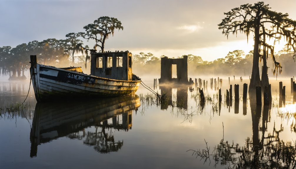
You’ll need to charter a boat from Venice or Pilottown to reach Burrwood’s submerged ruins at the Mississippi’s mouth, where weathered pilings rise like skeletal fingers from Southwest Pass. Navigate to coordinates 28°58′05″N 89°22′39″W during calmer summer months, bringing waterproof cameras to capture the haunting grid of streets beneath the waves and the active pilots station that remains defiantly standing. Pack provisions, GPS equipment, and respect for this watery graveyard where nearly 1,000 souls once thrived before hurricanes and subsidence reclaimed their community.
Key Takeaways
- Burrwood is located at Louisiana’s birdfoot delta in Plaquemines Parish at coordinates 28°58′05″N 89°22′39″W.
- The town was abandoned after Hurricane Betsy in 1965; only weathered pilings and submerged streets remain today.
- An active ship pilots station near Southwest Pass is the last working remnant of the ghost town.
- Access requires boat transportation as the area is mostly submerged with scattered artifacts visible across wetlands.
- Visit nearby vanishing delta communities like Isle de Jean Charles to understand Louisiana’s coastal erosion crisis.
Understanding Burrwood’s Unique Location in the Mississippi River Delta
Where the mighty Mississippi River splays into the Gulf of Mexico like grasping fingers, Burrwood once clung to life on the westernmost prong of Louisiana’s birdfoot delta. You’ll find its remnants at coordinates 28°58′05″N 89°22′39″W in Plaquemines Parish, where Southwest Pass still channels ocean-going vessels toward New Orleans. This location demonstrates delta formation processes in their rawest form—sediment depositing, channels shifting, land emerging and vanishing with the river’s moods.
The ecological significance of the region remains profound despite Burrwood’s abandonment. Here, freshwater meets saltwater across thousands of acres where dredge piles and Burrwood Bayou create indispensable habitat. Burrwood Bayou parallels the main channel on the East Bank of the Southwest Pass, offering paddlers an alternate route with very little flow. During World War II, the Burrwood Naval Section Base was commissioned on December 15, 1941, to monitor Gulf traffic and watch for enemy submarines. But nature’s reclaiming what civilization briefly claimed: subsidence, wave erosion, and hurricanes have submerged this frontier, leaving only a pilot station standing watch over vanishing wilderness.
You’ll find Burrwood’s most dramatic transformation began in 1941, when Roosevelt’s administration rushed to construct a naval garrison at the Mississippi’s mouth—a strategic fortress against German U-boats prowling the Gulf. Within days of Pearl Harbor’s attack, the base was commissioned with a 120-foot water tower, artillery positions, and docks bristling with PT boats, destroyers, and submarine hunters that turned this remote delta outpost into a wartime sentinel.
The population swelled with Coast Artillery detachments and naval personnel, but when the guns fell silent in 1944 and Hurricane Betsy delivered her devastating blow in 1965, Burrwood’s residents abandoned the storm-battered garrison, leaving behind only waterlogged ruins and rusting towers. Today, a ship pilots station rising from the marsh stands as the sole remaining sign of life in what was once a thriving delta community.
As war clouds gathered over Pearl Harbor in December 1941, construction crews were already racing to complete Burrwood’s naval watchtower—a 120-foot sentinel that would officially open on December 15th, just eight days after the attack that thrust America into World War II. The Army Corps of Engineers’ engineering feats didn’t stop there. They erected a secondary 75-foot platform and positioned heavy artillery with 9-mile ranges on both riverbanks.
You’ll discover how three concrete battery positions armed with 155mm guns transformed this remote outpost into a formidable defense network.
Operational challenges proved intense. Thirty ships monthly required major repairs while patrol boats, submarine hunters, and PT boats scrambled to intercept U-boats threatening Gulf shipping lanes. Lieutenant Commander N.J. Ashley commanded this critical checkpoint controlling all Mississippi River traffic. The base maintained replenishment storage facilities for fuel, ammunition, and consumable supplies essential to naval operations. The Coast Guard observation planes based in New Orleans conducted convoy patrols and search operations throughout the region, working alongside surface vessels to counter the submarine menace.
Population Boom and Decline
The naval guns and watchtowers drew people like magnets to steel. By the town’s zenith, you’d find nearly 1,000 souls calling this Mississippi River outpost home. Military families, dredge operators, and commercial workers built a thriving community on the bird’s-foot delta, defying the Gulf’s temperamental moods.
Then nature struck back with fury. Hurricane Rita’s 2005 assault marked the beginning of the end, followed by Ike’s devastating blow in 2008. You’d witness an 80% population exodus as natural disaster impacts overwhelmed every defense. Economic decline accelerated as businesses shuttered and military operations couldn’t justify staying. Subsidence swallowed streets, wave erosion consumed homes, and wetlands vanished beneath rising waters. The soft marsh continued its retreat into the waves, exposing what remained of the community to the Gulf’s relentless assault. Where 1,000 residents once thrived, you’ll now find only silence and submerged memories. This pattern mirrors the broader Louisiana exodus, where residents increasingly abandon communities for better employment opportunities in neighboring states like Texas and Florida.
What Remains of Burrwood Today
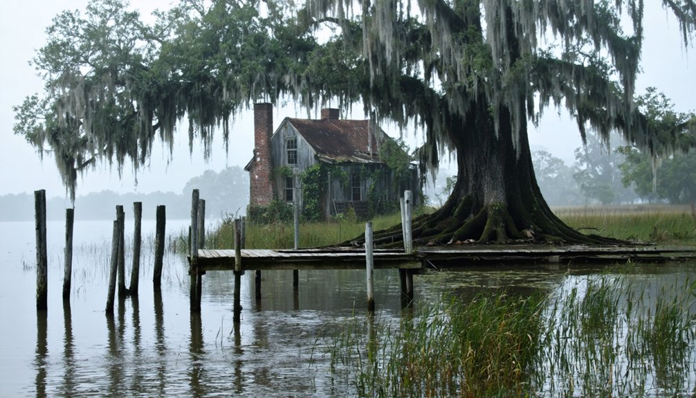
If you squint across the murky waters where Burrwood once thrived, you’ll spot weathered pilings jutting from the Gulf like skeletal fingers—the only physical evidence that a town ever existed here. These rotting posts mark where docks and buildings once anchored a bustling community to solid ground before the sea swallowed it whole.
Surprisingly, ship pilots still maintain an active station nearby, their modern boats traversing the same treacherous river mouth that Burrwood’s residents once called home. Located near the far south end of the Mississippi River delta in Plaquemines Parish, Burrwood once supported an estimated population of 1,000 residents before coastal erosion claimed most of its territory. The community faced gradual erosion of the coastal landscape due to rising sea levels and subsidence, a slow but relentless process that ultimately sealed its fate.
Visible Pilings and Remnants
Wooden pilings jutting from the water stand as grave markers for Burrwood’s drowned streets. You’ll spot skeletal remains protruding through marsh grasses where homes once anchored families to this delta community.
The ship pilots station rises defiantly above the wetlands—Burrwood’s most substantial survivor—while debris and artifacts lie scattered across submerged zones.
If you’re equipped with underwater mapping technology and remote sensing techniques, you’ll discover the ghostly grid of streets beneath the surface. These pilings aren’t just historical curiosities; they’re monuments to the delta’s relentless reclamation.
The Gulf claimed its prize gradually, swallowing buildings and memories alike. What you’ll witness here isn’t preservation—it’s transformation. Nature’s erasing human ambition, one tide at a time, leaving only these wooden bones behind. Located in Plaquemines Parish, Burrwood shares its fate with other Louisiana settlements consumed by coastal erosion.
Active Ship Pilots Station
Rising from the surrounding marsh like a sentinel frozen in time, Burrwood’s ship pilots station commands the watery horizon where Southwest Pass channels Gulf vessels into the Mississippi River. You’ll spot this solitary structure—the town’s sole survivor—still fulfilling its original purpose.
Associated Branch Pilots and Crescent River Port Pilots maintain operations here, guiding captains through treacherous passages where shifting sandbars and powerful downriver currents demand local expertise. These pilots navigate specialized vessel requirements, from cargo ships bound for New Orleans to tankers heading to Baton Rouge’s refineries.
While ongoing restoration efforts preserve this critical navigational outpost, it stands as Burrwood’s last working remnant—a functional ghost defying the subsidence and erosion that swallowed everything else around it.
The history of Burrwood, Louisiana is marked by challenges, as the area has faced significant ecological changes over the decades. Despite these adversities, the community’s resilience shines through, with locals working together to preserve their unique heritage. Each effort tells a story of survival and steadfastness against nature’s relentless forces.
Unlike most ghost towns accessible by dusty dirt roads or forgotten highways, Burrwood demands a boat. You’ll navigate through Louisiana’s disappearing wetlands, following channels that once served destroyers and patrol craft. No daily service runs anymore—this journey requires chartering your own vessel or joining experienced fishermen heading to the delta’s remote reaches.
As you explore the waterways, you might also encounter other ghost towns to explore in Louisiana, each with its own haunting stories and remnants of the past. These abandoned places offer a glimpse into a time when they thrived, now standing silent against the backdrop of thick cypress trees and shimmering bayous. Whether you’re an avid history buff or just seeking adventure, these unique sites promise a thrilling experience off the beaten path.
The boat access requirements mirror those facing modern pilots who still operate the Southwest Pass station. You’ll thread through marsh grass and shifting waterways, watching for sediment bars that reduce depths unpredictably. Navigation challenges intensify as land dissolves into Gulf waters.
Launch from marinas upriver near Pilottown, then venture downstream past oil platforms marking civilization’s edge. The route demands respect—subsidence and wave erosion continue reshaping these channels where Burrwood’s remnants await discovery.
Best Time of Year to Visit the Submerged Ghost Town
You’ll find the ghostly remnants of Burrwood most accessible during late fall through early winter, when receding Gulf waters expose what summer tides conceal and calm seas make the journey safer.
October through February offers the sweet spot—lower rainfall drops water levels enough to reveal submerged foundations, while winter’s reduced humidity sharpens visibility across the marsh to the lone pilots station standing sentinel.
Timing your visit outside June through November’s hurricane season isn’t just strategic; it’s essential, as August through October brings storm surges that can swallow the ruins entirely beneath angry, churning waves.
Seasonal Weather and Tides
When planning your journey to Burrwood’s watery ruins, timing becomes as pivotal as navigation itself. Winter months deliver your best window—temperatures hover between 50-60°F during the day, dropping to 30-40°F at night. You’ll find mostly sunny conditions from late fall through early winter, offering clearer views of what remains above the waterline.
Gulf tides pulse through Southwest Pass continuously, their rhythm dictating access to submerged structures. Tidal variations can expose or conceal remnants within hours, while storm surges during precipitation events—sometimes reaching 70% probability mid-week—transform the landscape entirely. Monitor weather patterns closely; avoid visiting during heavy rainfall when visibility plummets and currents strengthen. Those calm, 5-10 mph wind days represent your golden opportunity to explore Louisiana’s drowning past.
Hurricane Season Considerations
Hurricane season transforms Burrwood’s submerged remains into a genuinely hazardous destination between June 1 and November 30, with the ghost town’s exposed position at the Mississippi’s furthest Gulf reach offering zero protection from tropical systems. You’ll face the same brutal conditions that obliterated the settlement—140 mph gusts recorded in 1915, ten-foot storm surges that swept entire structures into oblivion.
August through September present peak danger, though the 1943 “Surprise” Hurricane proved July brings threats too. Hurricane forecasting accuracy has improved dramatically since Betsy’s 1965 devastation, yet you’re still gambling with rapidly intensifying Gulf storms.
Post storm recovery challenges make access impossible for weeks afterward, with debris fields and altered underwater topography creating navigation nightmares. Plan your exploration for October through May instead.
Safety Considerations for Exploring Coastal Ruins
The crumbling foundations and skeletal remains of Burrwood’s abandoned structures present deceptive dangers beneath their photogenic decay. You’ll navigate unstable floors that sink beneath your weight and encounter dangling debris ready to collapse without warning.
Water-filled basements harbor stingrays in murky shallows—shuffle your feet constantly to avoid their defensive barbs, a vital stingray safety precautions measure. Never swim against rip currents near partially submerged walls; parallel movement offers your only escape.
Before venturing inside, establish clear evacuation planning for storms since these ruins offer zero shelter during sudden coastal weather. Approach deteriorating structures sideways, watching for loose materials overhead. Test every surface before committing your full weight, and always maintain multiple exit routes from partially collapsed rooms.
What to Bring on Your Burrwood Expedition

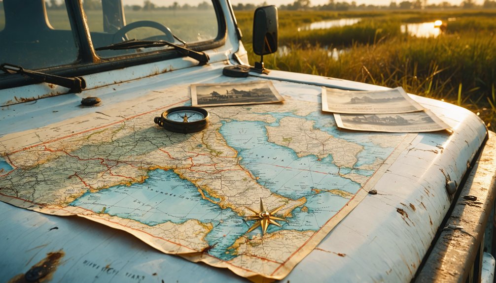
Given Burrwood’s harsh coastal environment where saltwater marsh meets Gulf currents, you’ll need waterproof protection for every essential item. Pack specialized equipment for marsh exploration: sealed dry bags, GPS devices with backup batteries, and maritime charts marking submerged structures.
The importance of proper footwear can’t be overstated—invest in chest waders or amphibious boots that’ll handle shifting mud and hidden debris beneath the water’s surface.
Bring emergency communication gear, first aid supplies, and sun protection for the exposed marshland. You’ll want polarized sunglasses to spot underwater hazards and a waterproof camera to document what remains of this vanishing settlement.
Consider tide charts essential, not optional—they’ll determine whether you’re exploring history or fighting currents. Pack light, but pack smart for this unforgiving coastal frontier.
Photographing the Pilings and Marsh Landscape
Where rotting pilings pierce brackish water and skeletal oaks twist against endless sky, Burrwood offers photographers a haunting tableau of Louisiana’s vanishing coast. You’ll find your best shots during golden hour, when amber light transforms dying oak groves into otherworldly silhouettes.
Golden hour at Burrwood transforms skeletal oaks and rotting pilings into an otherworldly tableau of Louisiana’s vanishing coast.
Wade carefully through shallow marsh channels to frame pilings against mirrored waters where herons stand motionless.
For nighttime photography, the Milky Way arcs dramatically over marsh remnants—set your tripod on stable ground and use long exposures to capture stars wheeling above Plaquemines Parish’s ghost landscape. Though Burrwood lacks the cypress tree reflections found upriver, its stark beauty reveals coastal erosion‘s raw truth.
Bring waterproof boots, wide-angle lenses, and respect for this fragile, disappearing ecosystem.
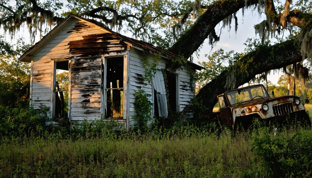
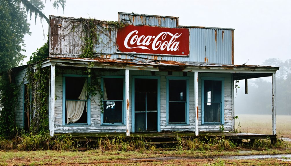
Nearby Gulf Coast Ghost Towns Worth Exploring
Beyond Burrwood’s desolate marsh, Louisiana’s Gulf Coast harbors dozens of settlements erased by hurricanes, floods, and the relentless appetite of rising waters. You’ll find Cheniere Caminada’s ghost near Grand Isle, where the 1893 hurricane killed over 2,000 souls.
Head inland to Ruddock’s cypress ruins in St. John the Baptist Parish, obliterated by 1915’s storm that claimed nearly 700 lives. Bayou Chene’s stilt-house remnants whisper from the Atchafalaya Basin, abandoned when Morganza Spillway construction sealed its fate.
Most urgent is Isle de Jean Charles in Terrebonne Parish, where coastal erosion impacts threaten the Band of Biloxi-Chitimacha-Choctaw Indians—a living record/account/chronicle of indigenous cultural preservation battling disappearing land. Each site demands you witness what happens when nature reclaims its territory.
Preserving Memories of Louisiana’s Vanishing Communities
These crumbling settlements won’t remember themselves. You’re witnessing Louisiana’s delta communities disappearing beneath rising tides, and documenting what remains becomes your responsibility.
Louisiana State University’s historical archives preserve Burrwood’s naval operations and industrial past, but you’ll capture what databases can’t—sun-bleached pilings emerging from marshland, the exact coordinates where a thousand souls once lived.
Modern coastal resilience strategies arrive too late for these ghost towns, though they’ll inform future decisions. Environmental impact assessments now measure what previous generations ignored: subsidence rates, storm surge patterns, wetland loss.
You’re not just exploring ruins; you’re recording evidence of climate’s human cost. Photograph those pilot station remnants. Share coordinates. Interview descendants. These memories survive only through your documentation, preserving testimonies before Gulf waters claim everything.
Frequently Asked Questions
Are There Any Guided Tours Available to Burrwood’s Submerged Remains?
No guided tours exist to Burrwood’s submerged remains. You’ll navigate solo through marsh waters where the history of Burrwood’s settlement vanished beneath waves. The significance of Burrwood’s decline echoes in silent pilots’ stations rising from drowning wetlands.
Can I Dive or Snorkel to Explore Underwater Structures at Burrwood?
No, you can’t dive there—it’s an “access-controlled” industrial zone. Active oil operations, poor underwater visibility, constant dredging, and necessary safety precautions make recreational diving impossible. Commercial divers only work Burrwood’s murky depths under strict protocols protecting shipping channels.
Do I Need Special Permits to Visit Burrwood by Boat?
You don’t need special permits for boat access, but you’ll navigate treacherous waters where navigational hazards lurk beneath murky currents. Boat launch accessibility from refuge areas requires following strict timing rules—arrive between one hour before sunrise through one hour after sunset.
Are There Any Accommodations Near the Launch Points for Burrwood Trips?
You’ll find limited options since Burrwood’s submerged. Venice, the nearest launch point forty miles upriver, offers Airbnb rentals and nearby campsites. You’re venturing into raw delta wilderness where civilization fades and freedom-seekers embrace rustic, off-grid accommodations.
What Wildlife Might I Encounter in the Marsh Around Burrwood?
You’ll spot alligators basking on muddy banks and encounter great blue herons stalking shallow waters. Migratory bird watching reveals snowy egrets, roseate spoonbills, and yellowlegs probing marshlands. Muskrats, nutria, and raccoons roam freely through this untamed wilderness sanctuary.
References
- https://www.abandonedspaces.com/towns/natural-disaster-ghost-towns.html
- https://www.ezhomesearch.com/blog/ghost-towns-in-louisiana/
- https://973thedawg.com/7-louisiana-ghost-towns/
- https://www.eenews.net/articles/5-climate-ghost-towns/
- https://gulfghosttowns.org
- https://en.wikipedia.org/wiki/Burrwood
- https://www.rivergator.org/river-log/birdsfoot-delta/venice-to-gulf/pg/6/
- http://wikimapia.org/6131917/Burrwood-Louisiana
- https://commons.wikimedia.org/wiki/Category:Burrwood
- https://www.lib.lsu.edu/sites/default/files/sc/findaid/5068.pdf