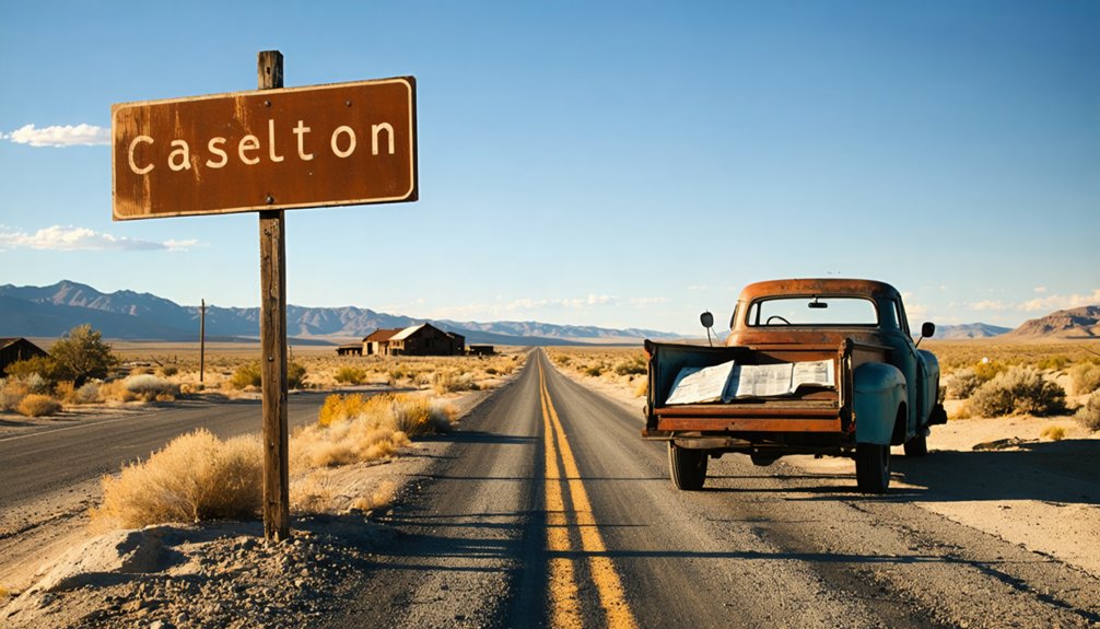
You’ll drive 125 miles north from Las Vegas on U.S. Route 93, watching neon fade into Basin and Range desert as you climb toward Caselton’s 6,211-foot elevation. The 2-3 hour journey ends at State Route 320, where heavy fencing greets you—this ghost town’s off-limits, but don’t turn around yet. From the roadside, you’ll photograph the skeletal 1,000-ton flotation mill and weathered miners’ cabins that haven’t processed ore since 1957, and there’s much more to discover about this restricted slice of Nevada mining history.
Key Takeaways
- Drive 125 miles north from Las Vegas on U.S. Route 93, then take State Route 320 for a 2-3 hour journey.
- Check winter road conditions before departure due to 6,211-foot elevation and prepare for desert Basin and Range terrain.
- Expect heavy fencing and “Keep Out” signs; view the 1940s mill and cabins from roadside only without trespassing.
- Contact caretakers in advance if seeking guided access to shop buildings, tunnel system, or closer structural views.
- Explore nearby mining sites like Golden Eagle and Prince Mine, plus small community of Caselton Heights.
Getting to Caselton: Route Planning and Driving Directions
The drive to Caselton begins where the neon glow of Las Vegas fades into the rearview mirror and U.S. Route 93 stretches north into Nevada’s vast desert expanse. You’ll cover 125 miles in roughly two to three hours, following this well-maintained federal highway through Basin and Range terrain.
Your route planning strategies should account for the site’s 6,211-foot elevation—winter conditions can surprise unprepared travelers. State Route 320, the Caselton Mine Loop, provides your final paved approach directly to the ghost town. Before departing, check current traffic estimates and road conditions to ensure safe passage through Lincoln County.
Peak travel seasons run spring through fall when weather cooperates and roads remain clear. There’s no railroad anymore—it was pulled in 1984—so you’re committed to the asphalt ribbon connecting you to this abandoned mining district southwest of Pioche. The Caselton Mill site is located on private property, so visitors should always respect land boundaries and access restrictions.
What to Expect When You Arrive at This Lincoln County Ghost Town
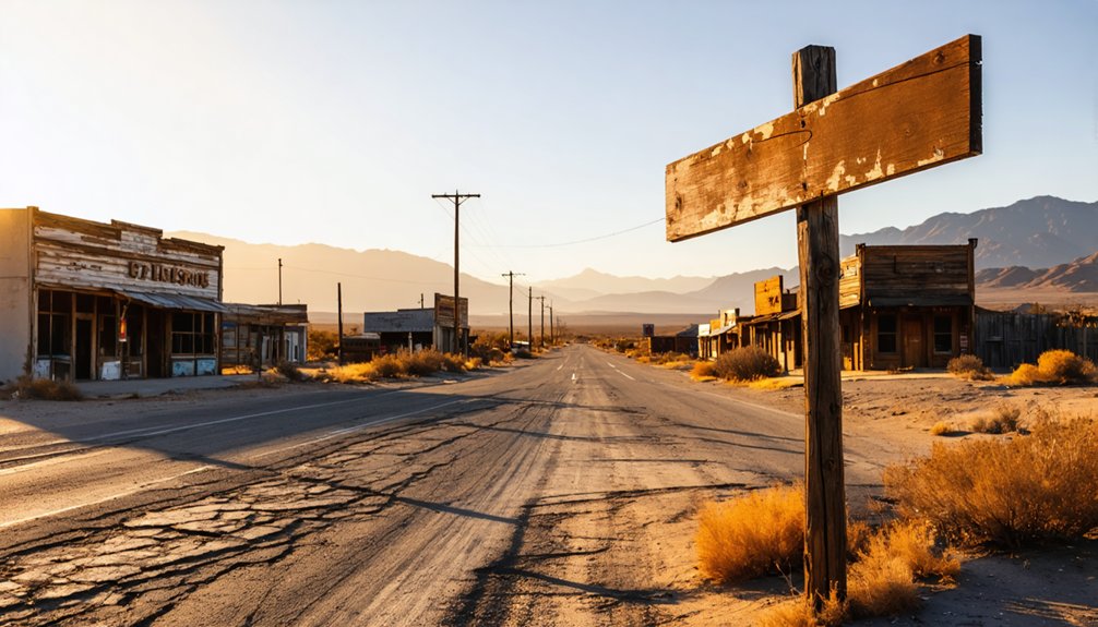
As you round the final bend on State Route 320, Caselton emerges like a monument to Nevada’s stubborn refusal to let the past disappear entirely. The site greets you with heavy fencing and blunt “Keep Out” signs—limited public access enforced by trail cams and volunteers committed to long term preservation efforts.
The remnants of old buildings and rusted artifacts tell the story of a once-thriving community that succumbed to time. Bullionville ghost town highlights the challenges faced by its former residents and serves as a haunting reminder of the harsh realities of mining life in the area. Visitors who dare to explore often leave with a sense of nostalgia and a deeper appreciation for Nevada’s rich history.
You’ll photograph from the roadside: the 1940s Caselton Mill, its massive A-frame companion, and weathered miners’ cabins with rusted chimney pipes jutting skyward. Nevada’s dry climate has arrested decay beautifully here. Don’t cross the fences—federal laws protect every artifact, down to individual nails.
A caretaker occasionally grants guided access, so ask locals before your visit. The surrounding area includes mining communities like the Golden Eagle and Prince Mine operations that once supported this remote settlement. This 1920s company town was once served by the Prince Consolidated Railroad that transported ore from the mines. The 8,000-foot tunnel and abandoned mine cars remain hidden in the hills beyond your permitted view.
The Rise and Fall of a Nevada Mining Community
You’ll find Caselton’s story remarkably compressed—a mining town that sprang up in 1929 around the newly opened Caselton Shaft and thrived for barely three decades before ore depletion killed it in 1957.
During those boom years, the Combined Metals Reduction Company transformed this remote desert site into a bustling community complete with a massive flotation mill that eventually processed over a million tons of ore. The Combined Metals Reduction Company continued operating at the site until 1976, when Kerr-McGee Corporation acquired the mining claims during bankruptcy proceedings.
Walking through the remnants today, you’re seeing what’s left of a place that burned bright and fast, its entire lifespan shorter than most people’s careers. The nearby community of Caselton Heights still maintains a small population, a testament to the area’s enduring legacy.
Boom Years: 1929-1957
When Combined Metals Reduction Company sank the Caselton Shaft into the western slopes of the Pioche Hills in 1929, they weren’t just opening another mine—they were birthing an entire community that would thrive for nearly three decades.
You’d have witnessed impressive expansion efforts throughout the 1940s: a 500-ton flotation mill in 1941 that doubled capacity by 1943, powered by electricity from Boulder Dam. The operation extracted rich ore—5 ounces of silver per ton, 4.5% lead, and 12% zinc—reaching 10,000 tons monthly at its peak.
When primary sulfide reserves depleted around 1953, mineral diversification attempts included unsuccessful manganese mining until 1954. The mine featured a remarkable replacement ore body of unoxidized sphalerite-pyrite-galena, with deposits ranging from 4 to 40 feet thick and averaging 6 feet along a 10,000-foot channel. Despite rehabilitation efforts, collapsing metal prices ultimately forced closure in 1957, ending Caselton’s remarkable run.
Decline and Abandonment Timeline
The year 1957 marked the end of Caselton’s glory days, when the Combined Metals Reduction Company finally admitted what miners had known for months—the rich silver, lead, and zinc veins running through Caselton Shaft No. 2 had given up their last profitable ores.
You’ll find the mill briefly reopened in 1964 to process Pan American Mine‘s ore, but this reprieve only delayed the inevitable. When that mine closed in 1978, Caselton’s fate was sealed. The community dynamics shifted dramatically as families departed, leaving behind arsenic and lead-contaminated tailings across 3,200 acres.
Corporate ownership ping-ponged between Kerr-McGee, Anadarko, and Tronox before bankruptcy left the environmental impacts unaddressed. Today, you’ll discover ruins cordoned off from public access, their toxicity outlasting the prosperity that created them. The abandoned shafts and structures join Nevada’s inventory of nearly 200,000 documented abandoned mines, representing decades of unregulated mineral extraction across the state.
Exploring the Abandoned Mill and Mining Infrastructure
When you arrive at Caselton’s sprawling industrial site along Highway 93, the skeletal remains of the massive flotation mill dominate the landscape—rusted metal frameworks and weathered concrete structures that once processed over a million tons of ore.
If you’re lucky enough to secure permission from the private caretakers, you can walk through accessible shop buildings and glimpse the scale of operations that connected surface facilities to an 8,000-foot tunnel system burrowing deep beneath your feet toward Pioche.
Be aware that a century of silver, lead, and zinc processing left behind dangerous contamination; lead and arsenic leach from legacy waste piles, making this a site where you’ll want to watch where you step and resist the urge to pocket souvenirs. The Multistate Trust has been working since 2011 to investigate and address environmental risks from the historic mining materials scattered across this 3,200-acre site. The Caselton Mill processed ore from the Raymond & Ely Mine, the largest producing mine in the Pioche District according to the USGS.
Historic Flotation Mill Ruins
Rising from the desert floor along Highway 93, the weathered remains of Caselton’s 1,000-ton flotation mill command attention with their industrial-era brickwork and towering concrete structures. You’ll discover a sprawling 3,200-acre site where processing operations ran from 1941 to 1978, transforming over one million tons of silver, lead, and zinc ore.
The mill’s defining features include:
- 1,470-foot main shaft with multiple operational levels still accessible
- 1940s decorative chimneys showcasing Depression-era industrial architecture
- Original piping networks and water infrastructure frozen in time
Mill preservation challenges intersect with modern development proposals—Lincoln County and the EPA are evaluating solar energy retrofit feasibility for this contaminated landmark. You’ll explore genuine industrial ruins where abandoned worker facilities and community buildings tell stories of Nevada’s mining legacy without sanitized interpretation.
8,000-Foot Underground Tunnel System
Beneath Caselton’s crumbling mill foundations, an 8,000-foot tunnel network connects the site’s 1,470-foot shaft to Pioche’s No.1 Shaft through the heart of Treasure Hill. You’re standing above a 1920s engineering marvel where miners blasted through solid rock at the 1,200-foot level, creating passages wide enough to haul ore cars loaded with lead, zinc, and silver.
The tunnel construction methods relied on drilling teams working from both ends, using compressed air equipment and dynamite charges timed to meet underground specifications. This wasn’t just about extraction—it was strategic infrastructure designed for freedom from surface constraints.
The shaft system reached four distinct levels at 660, 840, 1,200, and 1,400 feet, with the deepest passages dropping 1,470 feet into Nevada’s mineralized darkness.
Safety Hazards and Contamination
That 8,000-foot tunnel system you’re admiring from above? It’s a deathtrap waiting to claim another victim. I’ve seen firsthand what happens when adventure-seekers ignore exposure risks at sites like Caselton—collapsed shafts, flooded pits concealing rusted machinery, and soil contaminated with lead and arsenic at levels that’d make an EPA inspector faint.
Before you venture near these ruins, understand the protective equipment needs:
- Respiratory protection against airborne contaminants and toxic dust
- Fall protection gear for traversing unstable ground around concealed winzes
- Water rescue equipment if you’re photographing those deceptively deadly flooded quarries
The timber supports you’ll photograph? They’re rotted through, barely supporting their own weight. Those boarded-over shafts? Hidden traps beneath innocent-looking dirt. Freedom means making informed choices—not reckless ones.
Safety Considerations and Access Restrictions
Visiting Caselton demands careful attention to both legal boundaries and legitimate dangers lurking across this contaminated landscape. Access coordination with EPA and BLM isn’t bureaucratic hassle—it’s survival protocol.
The OU3 site’s secured by Multistate Trust specifically because abandoned shafts and contaminated waste rock create genuine threats. You’ll find lead and arsenic concentrations exceeding safe levels throughout Treasure Hill’s soils, with 29 residential parcels flagged for contamination.
Remote desert placement means you’re far beyond cellphone range—help won’t arrive quickly. Environmental stewardship here means respecting fenced boundaries that protect both you and fragile contaminated areas. Previous visitors’ vandalism triggered access restrictions and bulldozing.
Mining operations from the 1800s left mill site contaminants that still migrate during storms. Bring proper equipment, notify someone of your plans, and honor posted restrictions.
Best Times to Visit and Photography Opportunities
Late spring through fall offers your best window for exploring Caselton, when northern Nevada’s temperamental climate settles into something resembling predictability. You’ll avoid winter storm impacts that render access roads impassable and leave equipment buried under unexpected snowdrifts.
Northern Nevada’s unpredictable weather demands strategic timing—visit Caselton during late spring through fall when access roads remain passable and conditions stabilize.
For photographers chasing authentic ghost town atmospheres, consider these prime conditions:
- Golden hour shots during early morning or late afternoon tours capture weathered structures against dramatic desert landscape features
- Post-blizzard visits transform abandoned buildings into stark contrast studies with snow-covered ruins
- Clear desert light from late spring to fall illuminates vintage artifacts and mining remnants without harsh midday glare
Pack layers regardless of season—mines stay perpetually cold while surface temperatures swing wildly. Nevada’s isolation demands you’re prepared for rapid weather shifts that can transform 98°F sunshine into overnight snow.
Nearby Historic Mining Sites Worth Adding to Your Trip
The Pioche Mining District surrounds Caselton with enough authentic mining history to fill several days of exploration. You’ll discover the legendary Raymond & Ely Mine just west of town—the district’s most productive operation with over $130 million in mineral production since 1864. Its main shaft plunges 1,470 feet through multiple levels of worked-out ore veins.
The Mountain Lion Mine in nearby Highland District offers another glimpse into regional mining history, while the Pan American Mine site reveals how interconnected these ore processing operations were—its material traveled to Caselton Mill until 1978. I’ve spent afternoons wandering these sites, imagining the thousands of miners who carved these tunnels by hand. Each location adds another layer to understanding Nevada’s mineral wealth and the stubborn prospectors who extracted it.
Frequently Asked Questions
Are There Any Hotels or Camping Facilities Near Caselton?
You’ll find excellent accommodations near Caselton, including Best Western Topaz Lake Inn and Carson Valley Inn’s RV park. Nearby bed and breakfasts offer cozy alternatives, while local dining options range from casual cafes to steakhouses for your ghost town adventure.
Exploring ghost towns near Marietta, Nevada can be a thrilling experience for history enthusiasts and adventurers alike. Take the time to uncover the fascinating stories of the past while wandering through the remnants of old mining camps. Don’t forget to bring a camera to capture the stunning landscapes that surround these eerie yet picturesque locations.
Ghost towns near Spruce Mountain offer similar opportunities for exploration, with their crumbling structures and rich histories beckoning visitors. As you navigate these forgotten places, keep an eye out for unique artifacts that provide glimpses into the lives of those who once called them home. Whether you’re trekking alone or joining a guided tour, the haunting beauty of these locations is sure to leave a lasting impression.
What Supplies Should I Bring for a Day Trip?
Think of yourself as a desert explorer—you’ll need survival essentials. Pack extra food, bring sturdy hiking boots, and carry plenty of water. Don’t forget sun protection, navigation tools, and first aid supplies for this remote adventure.
Can I Collect Mineral Specimens or Artifacts From the Site?
No, you can’t collect specimens or artifacts from Caselton. It’s private property access requiring authorization, plus there’re historical preservation concerns and serious contamination hazards. Removing materials violates regulations and constitutes trespassing—better to just photograph memories instead.
Are Guided Tours of Caselton Available?
No guided tour availability exists for Caselton—you’ll explore independently. There aren’t any tour booking options through local operators. You’re free to photograph from outside the fenced boundaries, respecting posted warnings about contaminated grounds and access restrictions.
Is Cell Phone Service Available in the Area?
Cell coverage reliability decreases markedly in Caselton’s remote terrain. You’ll find network connectivity strength varies—Verizon leads nearby Fallon with 80% coverage. Download maps beforehand, as ghost town exploration means embracing disconnection from the digital world you’re escaping.
References
- https://www.nvexpeditions.com/lincoln/caselton.php
- https://en.wikipedia.org/wiki/Caselton
- https://nvtami.com/2025/06/25/lincoln-county-ghost-town-trip/
- https://coloradosghosttowns.com/Caselton NV.html
- https://www.youtube.com/watch?v=auSc3fTx6hA
- https://lincolncountynevada.com/uncovering-the-forgotten-corners-of-lincoln-county/
- https://static1.squarespace.com/static/6434470c6b18f67a587f94b7/t/649a0ab5da297836c768b4e1/1687816886667/Caselton+fact+sheet_layout_June+2023_FINAL.pdf
- https://www.mapquest.com/us/nevada/caselton-nv-282918797
- https://westernmininghistory.com/mine-detail/10198669/
- https://ndep.nv.gov/land/abandoned-mine-lands/caselton-mine


